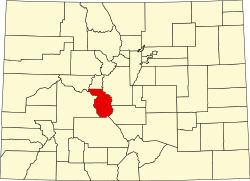
Alpine is a small community, sometimes considered a ghost town, in Chaffee County, Colorado, United States. [1] It was founded as a mining town. The Alpine post office operated from October 26, 1874, until June 30, 1904. [2]
When the mines played out, the Mary Murphy Mine about four miles from St. Elmo was the last to close in 1910, and both Alpine and St. Elmo became ghost towns. There were still a few residents who continued to live in the two towns, but the towns were nearly empty for half a century. Then in the 1950s and 1960s people rediscovered the quiet beauty of Chalk Creek gulch and built summer homes. Some of the salvageable buildings in Alpine and St. Elmo were fixed up and still stand.
The San Isabel National Forest completely surrounds Alpine and St. Elmo and prevents more extensive development. St. Elmo remains a local tourist attraction as a ghost town with a part-time general store and some year-round residents. Alpine is more residential and has no tourist interest. Alpine has about 10 families who live there year-round, and a summer population of several hundred.
Alpine is located at 38°42′40″N106°16′37″W / 38.71111°N 106.27694°W at an elevation 9,269 feet (2,825 m). [1]
Leadville is a statutory city that is the county seat, the most populous community, and the only incorporated municipality in Lake County, Colorado, United States. The city population was 2,633 at the 2020 census. It is situated at an elevation of 10,119 feet (3,084 m). Leadville is the highest incorporated city in the United States and is surrounded by two of the tallest peaks in the state.
Chaffee County is a county located in the U.S. state of Colorado. As of the 2020 census, the population was 19,476. The county seat is Salida.
Georgetown is the territorial charter municipality that is the county seat of Clear Creek County, Colorado, United States. The town population was 1,118 at the 2020 United States Census. The former silver mining camp along Clear Creek in the Front Range of the Rocky Mountains was established in 1859 during the Pike's Peak Gold Rush. The federally designated Georgetown-Silver Plume Historic District comprises Georgetown, the neighboring town of Silver Plume, and the Georgetown Loop Historic Mining & Railroad Park between the two towns. The Georgetown Post Office has the ZIP code 80444.
Ouray is a home rule municipality that is the county seat of Ouray County, Colorado, United States. The city population was 898 as of the 2020 census. The Ouray Post Office has the ZIP Code 81427. Located at an elevation of 7,792 feet (2,375 m), Ouray's climate, natural alpine environment, and scenery have earned it the nickname "Switzerland of America".
Silverton is a statutory town that is the county seat, the most populous community, and the only incorporated municipality in San Juan County, Colorado, United States. The town is located in a remote part of the western San Juan Mountains, a range of the Rocky Mountains. The first mining claims were made in mountains above the Silverton in 1860, near the end of the Colorado Gold Rush and when the land was still controlled by the Utes. Silverton was established shortly after the Utes ceded the region in the 1873 Brunot Agreement, and the town boomed from silver mining until the Panic of 1893 led to a collapse of the silver market, and boomed again from gold mining until the recession caused by the Panic of 1907. The entire town is included as a federally designated National Historic Landmark District, the Silverton Historic District.
Breckenridge is a home rule municipality that is the county seat and most populous municipality of Summit County, Colorado, United States. The town population was 5,078 at the 2020 United States Census. Breckenridge is the principal town of the Breckenridge, CO Micropolitan Statistical Area. The town also has many part-time residents, as many people have vacation homes in the area. The town is located at the base of the Tenmile Range.
Climax is an extinct mining company town, railroad station, and post office located in Lake County, Colorado, United States. The town site is located at an elevation of 11,342 feet (3,457 m) at Fremont Pass on the Continental Divide of the Americas. The Climax station on the Denver, South Park and Pacific Railroad was the highest railroad station in North America from its construction in 1884 until 1904 and again from 1928 until it was removed in 1937. Although the town was razed in 1962 to make room for the expansion of the Climax Molybdenum Mine, the Climax post office continued operation from December 5, 1917 until January 4, 1974. Climax had the highest elevation post office in the United States from April 1, 1919 to January 1, 1974.
Crystal is a ghost town on the upper Crystal River in Gunnison County, Colorado, United States. It is located in the Elk Mountains along a four-wheel-drive road 6 miles (9.7 km) east of Marble and 20 miles (32 km) northwest of Crested Butte. Crystal was a mining camp established in 1881 and after several decades of robust existence, was all but abandoned by 1917. The Crystal post office operated from July 28, 1882, until October 31, 1909. Many buildings still stand in Crystal, but its few residents live there only in the summer.
Animas Forks is an extinct mining town located 12 miles (19 km) northeast of Silverton in San Juan County, Colorado, United States. The area is managed by the Bureau of Land Management. At an elevation of 11,185 feet (3,409 m), Animas Forks is one of the highest mining camps in North America.
Ashcroft is an extinct mining town located in Pitkin County, Colorado, United States. The silver mining camp was founded as Castle Forks City in the spring of 1880. A post office named Ashcroft operated at the site from August 12, 1880, until August 5, 1881, when the name was changed to Chloride. The Chloride post office operated until January 3, 1882 when the name was changed back to Ashcroft. The renamed Ashcroft post office finally closed on November 30, 1912.
Cleator, formerly Turkey Creek or Turkey, is a near ghost town and small community in Yavapai County, Arizona, in the Southwestern United States.
Chalk Creek is a 27.3-mile-long (43.9 km) river flowing east from the Collegiate Peaks mountain range in Chaffee County, Colorado. Mount Antero borders the southern side of the river, while Mount Princeton borders the northern side. The headwaters of the river are located at the Continental Divide. The river empties into the Arkansas River at the town of Nathrop, Colorado.
Carpenter is an extinct coal mining town located in Mesa County, Colorado, United States, twelve miles northeast of Grand Junction at the end of an extension to 27¼ Road. The townsite is located at 39.1944°N 108.4733°W, at an elevation of 5,808 feet (1,770 m). The Carpenter post office operated from June 11, 1890, only until August 3, 1891.
Saint Elmo is a ghost town in Chaffee County, Colorado, United States. Founded in 1880, Saint Elmo lies in the heart of the Sawatch Range, 20 miles (32 km) southwest of Buena Vista and sits at an elevation of 9,961 feet (3,036 m). Nearly 2,000 people settled in this town when mining for gold and silver started. The mining industry started to decline in the early 1920s, and in 1922 the railroad discontinued service. The community is listed on the National Register of Historic Places as the Saint Elmo Historic District. It is one of Colorado's best preserved ghost towns.
The Mary Murphy Mine was the principal gold mine of the Chalk Creek mining district of Chaffee County, Colorado, United States, near St. Elmo, Colorado. The Mary Murphy Mine operated continuously from 1870 to 1925, and produced 220 thousand ounces of gold, worth $4.4 million then, plus considerable silver, lead, and zinc. There were two aerial tramways connecting the mine to Romley, Colorado, and the Denver, South Park and Pacific Railroad.
Buckskin Joe is an extinct gold mining town located in Park County, Colorado, United States. The town was founded in 1860 as Laurette in what was then the Kansas Territory. The Territory of Colorado was created on February 28, 1861, and the Laurette post office opened on November 14, 1861. Laurette was elected the Park County seat on January 7, 1862. The post office name was changed to Buckskin on December 21, 1865, although the town was popularly known as Buckskin Joe. The county seat was moved to Fair Play in 1867, and the Buckskin post office closed on January 24, 1873.
Ironton is an extinct town located in Ouray County, Colorado, United States. It lay south of the present town of Ouray, adjacent to the sites Guston and Red Mountain Town, fellow ghost towns. During the 1880s and 1890s, Ironton formed part of the Red Mountain Pass mining district, the second largest silver mining district in Colorado. The Ironton post office operated from May 2, 1883, until August 2, 1920.
Independence is an extinct town located in Pitkin County, Colorado, United States. It is located at an elevation of 10,913 feet (3,326 m) 2.2 miles (3.6 km) directly west of Independence Pass. It was the first settlement established in the Roaring Fork Valley, after gold was struck in the vicinity on Independence Day, July 4, 1879, hence its name. Independence was served by three differently named post offices: Farwell from July 14, 1881, until July 3, 1882; Sparkill from February 1, 1882, until October 18, 1887; and Chipeta from April 20, 1899, until October 17, 1899. It has also been known historically as Mammoth City, Mount Hope, and Hunter's Pass.
Haybro,, is an extinct town in Routt County, Colorado, United States.