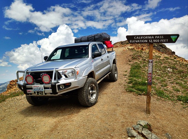
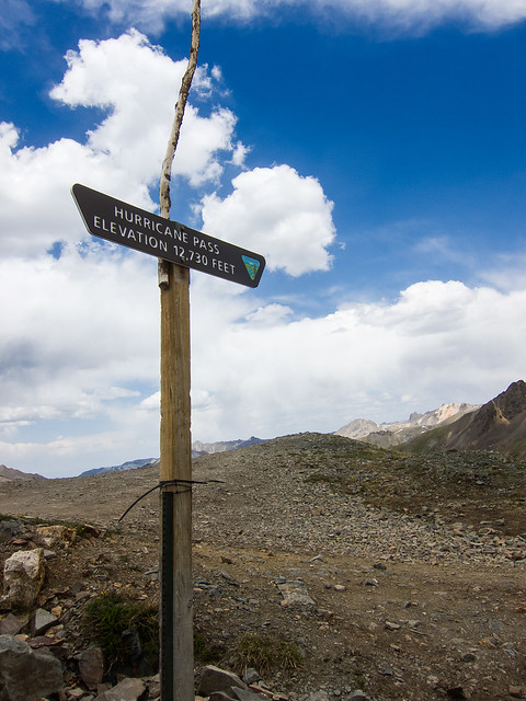
Pass [ a] Maximum elevation [ b] Maximum grade [ c] Road surface [ d] Route [ e] Coordinates [ f] Trail Ridge High Point [ g] 12,183 feet 3,713 m 5.4% WB Asphalt 40°25′42″N 105°45′32″W / 40.42839°N 105.75898°W / 40.42839; -105.75898 (Trail Ridge High Point ) Cottonwood Pass [ h] 12,126 feet 3,696 m [ i] Asphalt Chaffee CR 306 38°49′40″N 106°24′33″W / 38.8277726°N 106.4091921°W / 38.8277726; -106.4091921 (Cottonwood Pass ) Independence Pass [ j] 12,095 feet 3,687 m 6.0% Asphalt 39°06′32″N 106°33′50″W / 39.1088793°N 106.5639194°W / 39.1088793; -106.5639194 (Independence Pass ) Cumberland Pass 12,015 feet 3,662 m Gravel Forest Road 765 38°41′21″N 106°29′03″W / 38.6891616°N 106.4841944°W / 38.6891616; -106.4841944 (Cumberland Pass ) Loveland Pass [ h] 11,992 feet 3,655 m 6.0% Asphalt 39°39′49″N 105°52′45″W / 39.6635979°N 105.8791783°W / 39.6635979; -105.8791783 (Loveland Pass ) Iceberg Pass 11,827 feet 3,605 m [ k] Asphalt 40°25′03″N 105°44′46″W / 40.4174840°N 105.7461187°W / 40.4174840; -105.7461187 (Iceberg Pass ) Fall River Pass 11,796 feet 3,595 m Asphalt west Fall River Road 40°26′29″N 105°45′11″W / 40.44141°N 105.75309°W / 40.44141; -105.75309 (Fall River Pass ) Guanella Pass 11,669 feet 3,557 m [ k] Asphalt Guanella Pass Road 39°35′42″N 105°42′40″W / 39.5949872°N 105.7111165°W / 39.5949872; -105.7111165 (Guanella Pass ) Hoosier Pass [ h] 11,541 feet 3,518 m 8.0% NB Asphalt 39°21′42″N 106°03′45″W / 39.3616552°N 106.0625190°W / 39.3616552; -106.0625190 (Hoosier Pass ) Slumgullion Summit 11,530 feet 3,514 m 9.4% NB Asphalt 37°59′15″N 107°12′48″W / 37.98755°N 107.21342°W / 37.98755; -107.21342 (Slumgullion Summit ) Boreas Pass [ h] 11,481 feet 3,499 m Gravel 39°24′40″N 105°58′10″W / 39.4110990°N 105.9694607°W / 39.4110990; -105.9694607 (Boreas Pass ) Old Monarch Pass [ h] 11,375 feet 3,467 m Gravel former US 50 38°29′48″N 106°20′17″W / 38.4966634°N 106.3380805°W / 38.4966634; -106.3380805 (Old Monarch Pass ) Fremont Pass [ h] 11,318 feet 3,450 m 5.7% Asphalt 39°21′59″N 106°11′12″W / 39.3663772°N 106.1866890°W / 39.3663772; -106.1866890 (Fremont Pass ) Berthoud Pass [ h] 11,315 feet 3,449 m 6.1% NB Asphalt 39°47′54″N 105°46′40″W / 39.7983203°N 105.7777849°W / 39.7983203; -105.7777849 (Berthoud Pass ) Monarch Pass [ h] 11,312 feet 3,448 m 6.4% Asphalt 38°29′48″N 106°19′32″W / 38.4966636°N 106.3255801°W / 38.4966636; -106.3255801 (Monarch Pass ) Cordova Pass 11,248 feet 3,428 m [ k] Gravel 37°20′54″N 105°01′29″W / 37.3483477°N 105.0247231°W / 37.3483477; -105.0247231 (Cordova Pass ) Eisenhower Tunnel [ l] 11,158 feet 3,401 m 7.0% EB Concrete 39°40′44″N 105°55′29″W / 39.67897°N 105.92486°W / 39.67897; -105.92486 (Eisenhower Tunnel ) Shrine Pass 11,089 feet 3,380 m [ k] Gravel former SH 293 39°32′46″N 106°14′27″W / 39.54614°N 106.24083°W / 39.54614; -106.24083 (Shrine Pass ) Juniper Pass 11,020 feet 3,359 m Asphalt 39°40′19″N 105°33′53″W / 39.67196°N 105.56472°W / 39.67196; -105.56472 (Juniper Pass ) Red Mountain Pass 11,018 feet 3,358 m 7.2% Asphalt 37°53′56″N 107°42′43″W / 37.8988840°N 107.7120057°W / 37.8988840; -107.7120057 (Red Mountain Pass ) Molas Pass 10,910 feet 3,325 m 7.0% Asphalt 37°44′16″N 107°41′53″W / 37.7377751°N 107.6981179°W / 37.7377751; -107.6981179 (Molas Pass ) Spring Creek Pass [ h] 10,901 feet 3,323 m 7.5% Asphalt 37°56′27″N 107°09′33″W / 37.9408311°N 107.1592184°W / 37.9408311; -107.1592184 (Spring Creek Pass ) Wolf Creek Pass [ h] 10,857 feet 3,309 m 6.8% Asphalt 37°28′59″N 106°48′07″W / 37.48318°N 106.80207°W / 37.48318; -106.80207 (Wolf Creek Pass ) Marshall Pass [ h] 10,842 feet 3,305 m Gravel Forest Road 200 38°23′29″N 106°14′50″W / 38.3913877°N 106.2472458°W / 38.3913877; -106.2472458 (Marshall Pass ) Grand Mesa Summit [ m] 10,839 feet 3,304 m 6.4% NB Asphalt 39°01′39″N 108°01′54″W / 39.02744°N 108.03163°W / 39.02744; -108.03163 (Grand Mesa Summit ) Milner Pass [ g] [ h] 10,759 feet 3,279 m 5.4% WB Asphalt 40°25′11″N 105°48′41″W / 40.4197060°N 105.8113990°W / 40.4197060; -105.8113990 (Milner Pass ) Vail Pass 10,666 feet 3,251 m 7.0% Asphalt 39°31′50″N 106°13′02″W / 39.5305420°N 106.2172469°W / 39.5305420; -106.2172469 (Vail Pass ) Coal Bank Pass 10,640 feet 3,243 m 6.5% NB Asphalt 37°42′02″N 107°46′37″W / 37.7005528°N 107.7770087°W / 37.7005528; -107.7770087 (Coal Bank Pass ) Los Pinos Pass 10,509 feet 3,203 m Gravel Forest Road 788 38°06′14″N 106°58′20″W / 38.1038842°N 106.9722686°W / 38.1038842; -106.9722686 (Los Pinos Pass ) Tennessee Pass [ h] 10,424 feet 3,177 m 6.0% Asphalt 39°21′44″N 106°18′38″W / 39.36210°N 106.31043°W / 39.36210; -106.31043 (Tennessee Pass ) Ripple Creek Pass 10,343 feet 3,153 m [ k] Gravel former SH 132 40°06′43″N 107°17′44″W / 40.1119248°N 107.2956115°W / 40.1119248; -107.2956115 (Ripple Creek Pass ) Buffalo Pass [ h] 10,300 feet 3,139 m [ k] Gravel 40°32′37″N 106°41′06″W / 40.5435886°N 106.6850437°W / 40.5435886; -106.6850437 (Buffalo Pass ) Cameron Pass 10,276 feet 3,132 m 3.8% EB Asphalt 40°31′15″N 105°53′33″W / 40.5208158°N 105.8925128°W / 40.5208158; -105.8925128 (Cameron Pass ) La Manga Pass 10,230 feet 3,118 m 5.2% Asphalt 37°04′39″N 106°23′10″W / 37.0775096°N 106.3861430°W / 37.0775096; -106.3861430 (La Manga Pass ) Lizard Head Pass 10,222 feet 3,116 m 4.1% Asphalt 37°48′40″N 107°54′22″W / 37.8111060°N 107.9061783°W / 37.8111060; -107.9061783 (Lizard Head Pass ) Tenderfoot Pass 10,200 feet 3,109 m Asphalt 38°45′46″N 105°09′24″W / 38.76284°N 105.156601°W / 38.76284; -105.156601 (Tenderfoot Pass ) Carnero Pass 10,166 feet 3,099 m Gravel Saguache CR 41G 38°00′16″N 106°25′50″W / 38.0044416°N 106.4305896°W / 38.0044416; -106.4305896 (Carnero Pass ) North Pass [ h] 10,149 feet 3,093 m 6.0% Asphalt 38°12′51″N 106°34′21″W / 38.21425°N 106.57239°W / 38.21425; -106.57239 (North Pass ) Ohio Pass 10,065 feet 3,068 m Gravel Gunnison CR 703 38°50′05″N 107°05′30″W / 38.8347153°N 107.0917150°W / 38.8347153; -107.0917150 (Ohio Pass ) Red Hill Pass 10,051 feet 3,064 m [ k] 6.0% Asphalt 39°16′03″N 105°57′40″W / 39.2674141°N 105.9612036°W / 39.2674141; -105.9612036 (Red Hill Pass ) Cochetopa Pass [ h] 10,022 feet 3,055 m 6.0% Gravel former SH 114 38°09′46″N 106°36′00″W / 38.1627°N 106.59996°W / 38.1627; -106.59996 (Cochetopa Pass ) Cumbres Pass 10,022 feet 3,055 m 6.3% Asphalt 37°01′14″N 106°27′00″W / 37.0205662°N 106.4500328°W / 37.0205662; -106.4500328 (Cumbres Pass ) Kebler Pass [ n] 10,007 feet 3,050 m Gravel except asphalt over pass former SH 135 38°50′51″N 107°05′54″W / 38.84759°N 107.09837°W / 38.84759; -107.09837 (Kebler Pass ) Kenosha Pass 10,001 feet 3,048 m 5.3% EB Asphalt 39°24′46″N 105°45′27″W / 39.4127556°N 105.7574844°W / 39.4127556; -105.7574844 (Kenosha Pass ) Cucharas Pass 9,941 feet 3,030 m [ k] 5.9% NB Asphalt 37°19′13″N 105°04′25″W / 37.3202922°N 105.0736148°W / 37.3202922; -105.0736148 (Cucharas Pass ) Dunckley Pass 9,763 feet 2,976 m [ k] Gravel former SH 132 40°12′06″N 107°09′31″W / 40.2016473°N 107.1586644°W / 40.2016473; -107.1586644 (Dunckley Pass ) Willow Creek Pass [ h] 9,621 feet 2,932 m [ k] 6.3% Asphalt 40°21′01″N 106°05′21″W / 40.35021°N 106.08927°W / 40.35021; -106.08927 (Willow Creek Pass ) Old Rabbit Ears Pass [ h] 9,573 feet 2,918 m Asphalt former US 40 40°23′59″N 106°37′03″W / 40.39971°N 106.61749°W / 40.39971; -106.61749 (Old Rabbit Ears Pass ) Gore Pass 9,527 feet 2,904 m 6.3% Asphalt 40°04′33″N 106°33′39″W / 40.0758190°N 106.5608697°W / 40.0758190; -106.5608697 (Gore Pass ) Wilkerson Pass 9,507 feet 2,898 m 5.8% Asphalt 39°02′17″N 105°31′32″W / 39.0380473°N 105.5255561°W / 39.0380473; -105.5255561 (Wilkerson Pass ) Currant Creek Pass 9,482 feet 2,890 m Asphalt 38°50′13″N 105°38′10″W / 38.8369378°N 105.6361114°W / 38.8369378; -105.6361114 (Currant Creek Pass ) Rabbit Ears Pass [ h] 9,426 feet 2,873 m 6.8% Asphalt 40°23′05″N 106°36′42″W / 40.38470°N 106.61171°W / 40.38470; -106.61171 (Rabbit Ears Pass ) North La Veta Pass 9,413 feet 2,869 m 6.0% Asphalt 37°36′48″N 105°11′27″W / 37.6133412°N 105.1908351°W / 37.6133412; -105.1908351 (North La Veta Pass ) Bigelow Divide 9,403 feet 2,866 m Asphalt 38°05′55″N 105°07′40″W / 38.0986154°N 105.1277701°W / 38.0986154; -105.1277701 (Bigelow Divide ) Pass Creek Pass 9,400 feet 2,865 m Gravel former SH 305 37°37′14″N 105°13′46″W / 37.6205628°N 105.2294475°W / 37.6205628; -105.2294475 (Pass Creek Pass ) La Veta Pass 9,380 feet 2,859 m [ k] Gravel former US 160 37°35′35″N 105°12′12″W / 37.59306°N 105.20334°W / 37.59306; -105.20334 (La Veta Pass ) Trout Creek Pass 9,346 feet 2,849 m 5.2% Asphalt 38°54′36″N 105°58′30″W / 38.9099949°N 105.9750131°W / 38.9099949; -105.9750131 (Trout Creek Pass ) Battle Mountain Summit 9,267 feet 2,825 m Asphalt 39°31′23″N 106°23′23″W / 39.52302°N 106.38966°W / 39.52302; -106.38966 (Battle Mountain Summit ) Ute Pass 9,165 feet 2,793 m 5.6% Asphalt 38°56′30″N 105°09′27″W / 38.9416578°N 105.1574868°W / 38.9416578; -105.1574868 (Ute Pass ) Wind River Pass 9,130 feet 2,783 m [ k] Asphalt 40°17′45″N 105°32′38″W / 40.2958176°N 105.5438888°W / 40.2958176; -105.5438888 (Wind River Pass ) Black Mesa Summit 9,121 feet 2,780 m Asphalt 38°28′33″N 107°32′52″W / 38.47575°N 107.54780°W / 38.47575; -107.54780 (Black Mesa Summit ) Hardscrabble Pass 9,085 feet 2,769 m Asphalt 38°09′32″N 105°17′58″W / 38.15897°N 105.29943°W / 38.15897; -105.29943 (Hardscrabble Pass ) Poncha Pass 9,010 feet 2,746 m 2.9% Asphalt 38°25′20″N 106°05′13″W / 38.4222204°N 106.0869615°W / 38.4222204; -106.0869615 (Poncha Pass ) Dallas Divide 8,970 feet 2,734 m 6.4% EB Asphalt 38°05′40″N 107°53′18″W / 38.0944357°N 107.8883971°W / 38.0944357; -107.8883971 (Dallas Divide ) McClure Pass 8,755 feet 2,669 m 8.0% Asphalt 39°07′44″N 107°17′02″W / 39.1288754°N 107.2839398°W / 39.1288754; -107.2839398 (McClure Pass ) Muddy Pass [ h] 8,710 feet 2,655 m [ k] 5.6% Asphalt 40°22′45″N 106°34′44″W / 40.37904°N 106.57901°W / 40.37904; -106.57901 (Muddy Pass ) Blue Mesa Summit 8,704 feet 2,653 m Asphalt 38°23′10″N 107°25′58″W / 38.38604°N 107.43284°W / 38.38604; -107.43284 (Blue Mesa Summit ) Wondervu Hill 8,660 feet 2,640 m Asphalt 39°55′28″N 105°23′48″W / 39.92435°N 105.39677°W / 39.92435; -105.39677 (Wondervu Hill ) Promontory Divide 8,579 feet 2,615 m [ k] Asphalt 37°56′16″N 105°19′37″W / 37.93785°N 105.327015°W / 37.93785; -105.327015 (Promontory Divide ) Baxter Pass 8,400 feet 2,560 m [ k] Gravel 39°34′55″N 108°57′09″W / 39.5819192°N 108.9526058°W / 39.5819192; -108.9526058 (Baxter Pass ) Gunsight Pass 8,332 feet 2,540 m [ k] Gravel former SH 289 40°12′33″N 106°19′54″W / 40.2091512°N 106.3316971°W / 40.2091512; -106.3316971 (Gunsight Pass ) Douglas Pass 8,268 feet 2,520 m 7.0% Asphalt 39°35′51″N 108°48′11″W / 39.5974761°N 108.8031572°W / 39.5974761; -108.8031572 (Douglas Pass ) Cerro Summit 7,958 feet 2,426 m Asphalt 38°26′38″N 107°38′29″W / 38.44400°N 107.64144°W / 38.44400; -107.64144 (Cerro Summit ) Raton Pass [ o] 7,834 feet 2,388 m [ o] Asphalt 36°59′26″N 104°28′54″W / 36.99064°N 104.48180°W / 36.99064; -104.48180 (Raton Pass ) Floyd Hill 7,820 feet 2,384 m Asphalt 39°43′22″N 105°24′49″W / 39.72269°N 105.41372°W / 39.72269; -105.41372 (Floyd Hill ) Yellowjacket Pass 7,783 feet 2,372 m Asphalt 37°15′45″N 107°26′55″W / 37.2625034°N 107.4486630°W / 37.2625034; -107.4486630 (Yellowjacket Pass ) Golden Gate Pass 7,754 feet 2,363 m [ k] Asphalt 39°48′57″N 105°23′49″W / 39.81579°N 105.39697°W / 39.81579; -105.39697 (Golden Gate Pass ) Yellow Jacket Pass 7,420 feet 2,262 m [ k] Asphalt Routt CR 14 40°18′11″N 106°52′13″W / 40.3030364°N 106.8703255°W / 40.3030364; -106.8703255 (Yellow Jacket Pass ) Monument Hill 7,352 feet 2,241 m Asphalt 39°07′26″N 104°51′51″W / 39.12398°N 104.86428°W / 39.12398; -104.86428 (Monument Hill ) Palmer Saddle 7,230 feet 2,204 m Asphalt 39°07′22″N 104°54′46″W / 39.12289°N 104.91290°W / 39.12289; -104.91290 (Palmer Saddle ) Unaweep Divide 7,048 feet 2,148 m Asphalt 38°47′26″N 108°39′18″W / 38.7905393°N 108.6550963°W / 38.7905393; -108.6550963 (Unaweep Divide ) Gypsum Gap 6,100 feet 1,859 m Asphalt 38°01′20″N 108°42′33″W / 38.0222144°N 108.7092640°W / 38.0222144; -108.7092640 (Gypsum Gap ) 
