
Golden is a home rule city that is the county seat of Jefferson County, Colorado, United States. The city population was 20,399 at the 2020 United States Census. Golden lies along Clear Creek at the base of the Front Range of the Rocky Mountains. Founded during the Pike's Peak Gold Rush on June 16, 1859, the mining camp was originally named Golden City in honor of Thomas L. Golden. Golden City served as the capital of the provisional Territory of Jefferson from 1860 to 1861, and capital of the official Territory of Colorado from 1862 to 1867. In 1867, the territorial capital was moved about 12 miles (19 km) east to Denver City. Golden is now a part of the Denver–Aurora–Lakewood, CO Metropolitan Statistical Area and the Front Range Urban Corridor.

State Highway 14 in the U.S. state of Colorado is an east–west state highway approximately 237 miles (381 km) long, making it the longest state highway in Colorado. It traverses four counties along the northern edge of the state, spanning a geography from the continental divide in the Rocky Mountains to the Great Plains, and including North Park, the Poudre Canyon, and the Pawnee National Grassland. It provides the most direct route from Fort Collins westward via Cameron Pass to Walden and Steamboat Springs, and eastward across the plains to Sterling.

State Highway 7 (SH 7) is an 81.64-mile (131.39 km) state highway in Colorado, United States. It is located in the north-central portion of the state, traversing the mountains on the east of the continental divide south of Estes Park as well as portions of the Colorado Piedmont north of Denver. The northwestern segment of the highway is part of the Peak to Peak Scenic Byway and furnishes an access route to Estes Park, Colorado and Rocky Mountain National Park. In its southeast portion it skirts the northern end of the Denver Metropolitan Area, providing an access route connecting Boulder, Lafayette and Brighton with Interstate 25 (I-25) and Interstate 76 (I-76).

State Highway 470 is a freeway located in the southwestern portion of the Denver Metro Area. It is also the southwestern portion of the Denver Metro area's beltway. SH 470 begins at US 6 in Golden and heads south interchanging Interstate 70 and then US 285 outside Morrison. After leaving Morrison, it then heads east passing by Littleton and through Highlands Ranch before interchanging Interstate 25 in Lone Tree, where the freeway continues as a tollway and where the state highway designation ends.
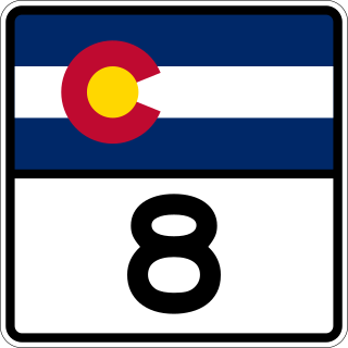
State Highway 8 (SH 8) is an 8.68-mile (13.97 km) long state highway in the U.S. state of Colorado. SH 8's western terminus is at U.S. Route 285 (US 285) in Morrison, and the eastern terminus is at SH 121 in Lakewood.
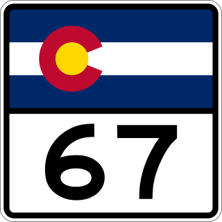
State Highway 67 (SH 67) is a 71-mile-long (114 km) state highway encompassing five distinct segments in south-central Colorado. SH 67's southern terminus is at SH 96 in Wetmore, and the northern terminus is at U.S. Route 85 in Sedalia. It traverses the former route of the Florence and Cripple Creek Railroad through Phantom Canyon as a county road and carrying part of the Gold Belt Byway.

State Highway 103 in the U.S. state of Colorado runs from Interstate 70 (I-70), U.S. Route 6 and US 40 at Idaho Springs to county roads 151 and 103 at Mestaa'ėhehe Pass. The 13 miles (19 km) from Idaho Springs to SH 5 forms about half of the Mount Blue Sky Scenic Byway.
In the US state of Colorado, Interstate 25 (I-25) follows the north–south corridor through Colorado Springs and Denver. The highway enters the state from the north near Carr and exits the state near Starkville. The highway also runs through the cities of Fort Collins, Broomfield, Loveland, and Pueblo. The route is concurrent with U.S. Route 87 (US 87), which is unsigned, through the entire length of the state. I-25 replaced US 87 and most of US 85 for through traffic.

State Highway 347 (SH 347) is a 5.2 mi (8.4 km) long state highway in western Colorado. SH 347's southern terminus is at U.S. Route 50 (US 50) east of Montrose, and the northern terminus is at Black Canyon of the Gunnison National Park.
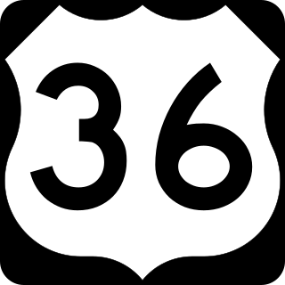
U.S. Route 36 is a United States highway that travels from Rocky Mountain National Park, Colorado to Uhrichsville, Ohio. In Colorado, the highway traverses an east–west route mostly in the northern portion of the Great Plains. At its west end, the road connects several small mountain towns such as Estes Park and Lyons to the larger metropolitan areas of Boulder and Denver. As it continues eastward, it connects to several other small towns and rural highways on the plains before crossing the state line into Kansas.

U.S. Highway 385 (US 385), also known as the High Plains Highway north of Cheyenne Wells, is the easternmost significant north–south state highway in the U.S. state of Colorado, and many of the state's major east–west routes intersect with US 385 before crossing into neighboring Kansas and Nebraska. It enters the state from Oklahoma while overlapped with US 287, but splits at Lamar to follow its own route through the Eastern Plains to Nebraska.

State Highway 66 is a 22.7 mi (36.5 km) long east-west state highway in Boulder and Weld counties in Colorado. The highway extends from the foothills of the Rocky Mountains at a junction with U.S. Route 36 and SH 7 southeast of Lyons, proceeding east through the northern edge of Longmont, to Platteville where it ends at US 85. Although a number of western states retain their "state highway 66" as the decommissioned US 66, the "Mother Road" did not run through Colorado, and SH 66 has no connection to the famed Historic Route 66.

State Highway 72 is a 51-mile-long (82 km) state highway passing through the foothills and the eastern edge of the Front Range. Its southern terminus is at Interstate 70 (I-70) in Wheat Ridge, and its northern terminus is at SH 7 east of Allenspark.

State Highway 30 (SH 30), alternatively known as Hampden Avenue, Havana Street, 6th Avenue, and Gun Club Road is a state route in the independent city and county of Denver and the city of Aurora in Arapahoe County. Its west end is at Interstate 25 (I-25) and U.S. Route 285 in Denver and its east end is at Quincy Avenue east of Aurora.

State Highway 58 (SH 58) is a 5.627 mi (9.056 km) state highway in Jefferson County, Colorado. It begins at an at-grade intersection with US 6 and SH 93 in Golden and ends in Wheat Ridge. It is a freeway for its entire length except for its west junction, which is a signal light. The entire route is known as the Golden Freeway.

State Highway 74 (SH 74) is a state highway in the U.S. state of Colorado. Running 18 miles (29 km) from Interstate 70 (I-70) in El Rancho to SH 8 in Morrison, the highway roughly follows a hook-shaped path running northwest–southeast. The section of the route north of the town of Evergreen is known as Evergreen Parkway and is a segment with a four- to six-lane roadway, with the section east of Evergreen mostly two lanes. The other section is known as the Bear Creek Canyon Scenic Mountain Drive, or just Bear Creek Road, and primarily parallels Bear Creek, passing through the towns of Kittredge and Idledale. The route, which is on the outskirts of Denver, passes through several of the city's mountain parks, including Bergen, Dedisse and Red Rocks parks.

State Highway 170 is a state highway in Colorado that connects Eldorado Springs and Superior. SH 170's western terminus is at Eldorado Canyon State Park, and the eastern terminus is at U.S. Route 36 (US 36) in Superior.

State Highway 119 is a 63.7-mile-long (102.5 km) state highway in north central Colorado. It extends in a southwest to northeast direction, from a junction with U.S. Route 6 in Clear Creek Canyon between Golden and Idaho Springs to a junction with Interstate 25 (I-25) east of Longmont. The southwest portion of the road is a scenic mountain drive providing dramatic vistas of the Front Range, while the northeast portion is a busy interurban thoroughfare. The city of Boulder separates these two vastly different sections of SH 119.

State Highway 88 (SH 88) is a state highway located within the Denver Metropolitan Area in the U.S. state of Colorado. Spanning 19.171 miles (30.853 km), the highway travels through the City and County of Denver and Arapahoe County. SH 88 begins at Colfax Avenue in Denver and heads south along Federal Boulevard until it reaches Belleview Avenue, where it continues east until it reaches Interstate 25 in the Denver Tech Center. It then continues along Arapahoe Road until it reaches eastern terminus at SH 83 in Aurora.

U.S. Highway 287 is the portion of a north-south highway in Colorado that travels from the Oklahoma state line just south of Campo to the Wyoming state line north of Fort Collins.


