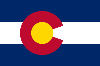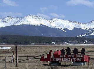
Colorado is a state of the Western United States encompassing most of the southern Rocky Mountains as well as the northeastern portion of the Colorado Plateau and the western edge of the Great Plains. It is the 8th most extensive and 21st most populous U.S. state. The estimated population of Colorado was 5,695,564 on July 1, 2018, an increase of 13.25% since the 2010 United States Census.

Rocky Mountain National Park is an American national park located approximately 76 mi (122 km) northwest of Denver International Airport in north-central Colorado, within the Front Range of the Rocky Mountains. The park is situated between the towns of Estes Park to the east and Grand Lake to the west. The eastern and westerns slopes of the Continental Divide run directly through the center of the park with the headwaters of the Colorado River located in the park's northwestern region. The main features of the park include mountains, alpine lakes and a wide variety of wildlife within various climates and environments, from wooded forests to mountain tundra.

The Wind River Range, is a mountain range of the Rocky Mountains in western Wyoming in the United States. The range runs roughly NW–SE for approximately 100 miles (161 km). The Continental Divide follows the crest of the range and includes Gannett Peak, which at 13,804 feet (4,207 m), is the highest peak in Wyoming. There are more than 40 other named peaks in excess of 13,000 feet (3,962 m). With the exception of the Grand Teton in the Teton Range, the next 19 highest peaks in Wyoming after Gannett are also in the Winds. Two large National Forests including three wilderness areas encompass most of the mountain range. Shoshone National Forest is on the eastern side of the continental divide while Bridger-Teton National Forest is on the west. Both National Forests and the entire mountain range are an integral part of the Greater Yellowstone Ecosystem. Portions of the range are also inside the Wind River Indian Reservation.

Trail Ridge Road is the name for a stretch of U.S. Highway 34 that traverses Rocky Mountain National Park from Estes Park, Colorado in the east to Grand Lake, Colorado in the west. The road is also known as Trail Ridge Road/Beaver Meadow National Scenic Byway.

The Sawatch Range is a high and extensive mountain range in central Colorado which includes eight of the twenty highest peaks in the Rocky Mountains, including Mount Elbert, at 14,440 feet (4,401 m) elevation, the highest peak in the Rockies.

The Sangre de Cristo Mountains are the southernmost subrange of the Rocky Mountains. They are located in southern Colorado and northern New Mexico in the United States. The mountains run from Poncha Pass in South-Central Colorado, trending southeast and south, ending at Glorieta Pass, southeast of Santa Fe, New Mexico. The mountains contain a number of fourteen thousand foot peaks in the Colorado portion, as well as all the peaks in New Mexico which are over thirteen thousand feet.
The Colorado Trail is a long-distance trail running for 486 miles (782 km) from the mouth of Waterton Canyon southwest of Denver to Durango in Colorado, United States. Its highest point is 13,271 feet (4,045 m) above sea level, and most of the trail is above 10,000 feet (3,000 m). Despite its high elevation, the trail often dips below the alpine timberline to provide refuge from the exposed, storm-prone regions above.

Middle Park is a high basin in the Rocky Mountains of north-central Colorado in the United States. It is located in Grand County, on the southwest slope of Rocky Mountain National Park, approximately 50 miles (80 km) west of Boulder.

A gap is a land form that is a low point or opening between hills or mountains or in a ridge or mountain range. It may be called a col, notch, pass, saddle, water gap, or wind gap, and geomorphologically are most often carved by water erosion from a freshet, stream or a river. Gaps created by freshets are often, if not normally, devoid of water through much of the year, their streams being dependent upon the meltwaters of a snow pack. Gaps sourced by small springs will generally have a small stream excepting perhaps during the most arid parts of the year.

The Elk Mountains are a high, rugged mountain range in the Rocky Mountains of west-central Colorado in the United States. The mountains sit on the western side of the Continental Divide, largely in southern Pitkin and northern Gunnison counties, in the area southwest of Aspen, south of the Roaring Fork River valley, and east of the Crystal River. The range sits west of the Sawatch Range and northeast of the West Elk Mountains. Much of the range is located within the White River National Forest and the Gunnison National Forest, as well as the Maroon Bells-Snowmass Wilderness and Raggeds Wilderness. The Elk Mountains rise nearly 9,000 ft. above the Roaring Fork Valley to the north.

Monarch Pass, elevation 11,312 feet (3,448 m), is a high mountain pass in the Rocky Mountains of south-central Colorado in the United States.

Ratón Pass is a 7,834 ft (2,388 m) elevation mountain pass on the Colorado-New Mexico border in the western United States. Ratón is Spanish for "mouse". It is located on the eastern side of the Sangre de Cristo Mountains between Trinidad, Colorado and Raton, New Mexico, approximately 100 miles (160 km) northeast of Santa Fe. The pass crosses the line of volcanic mesas that extends east from the Sangre de Cristo Mountains along the state line, and furnishes the most direct land route between the valley of the Arkansas River to the north and the upper valley of the Canadian River, leading to Santa Fe, to the south. The pass now carries Interstate 25 and railroad tracks.

The Chemehuevi Mountains are found at the southeast border of San Bernardino County in southeastern California adjacent the Colorado River. Located south of Needles, California and northwest of the Whipple Mountains, the mountains lie in a north-south direction in general, and are approximately 15 miles in length.
Union Pass is a high mountain pass in the Wind River Range in Fremont County of western Wyoming in the United States. The pass is located on the Continental Divide between the Gros Ventre mountains on the west and the Wind River Range on the east. A triple divide exists nearby, where water may flow to the Mississippi River, Columbia River, or Colorado River. The pass was historically used by Native Americans and early mountain men including the Astor Expedition in 1811 on its way west. On the return trip, fearing hostile Indian activity near Union Pass, the Astorians chose a southern route and discovered South Pass.

State Highway 149 (SH 149) is a 117.522-mile-long (189.133 km) state highway in southwestern Colorado, United States. SH 149's southern terminus is at U.S. Highway 160 (US 160) in South Fork, and the northern terminus is at US 50 west of Gunnison.

The Indian Pass Wilderness is 32,418-acre (13,119 ha) wilderness area under the administered by the Bureau of Land Management. The reserve is located in the very southeastern part of the Chocolate Mountains, in the southeastern part of California, just to the west of the Colorado River in the Lower Colorado River Valley. It adjoins the Picacho Peak Wilderness to the south, and the Imperial National Wildlife Refuge to the east.

The Colorado River is a major river of the western United States and northwest Mexico in North America. Its headwaters are in the Rocky Mountains where La Poudre Pass Lake is its source. Located in north central Colorado it flows southwest through the Colorado Plateau country of western Colorado, southeastern Utah and northwestern Arizona where it flows through the Grand Canyon. It turns south near Las Vegas, Nevada, forming the Arizona–Nevada border in Lake Mead and the Arizona–California border a few miles below Davis Dam between Laughlin, Nevada and Needles, California California before entering Mexico in the Colorado Desert. Most of its waters are diverted into the Imperial Valley of Southern California. In Mexico its course forms the boundary between Sonora and Baja California before entering the Gulf of California. This article describes most of the major features along the river.


