Weston, Colorado

Last updated

Weston, Colorado
Weston Supply in Weston, Colorado.JPG
Weston Supply and U.S. Post Office in Weston.
Las Animas County Colorado Incorporated and Unincorporated areas Weston Highlighted 0884000.svg
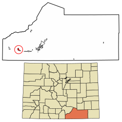
Location of the Weston CDP in Las Animas County, Colorado.
Usa edcp location map.svg
Red pog.svg
Weston
Location of the Weston CDP in the United States.
Coordinates: 37°08′45″N104°52′06″W / 37.1459233°N 104.8682835°W / 37.1459233; -104.8682835 (Weston CDP, Colorado) [1]
Country Flag of the United States.svg  United States
State Flag of Colorado.svg  Colorado
County Las Animas County
Government
[2]
  Type unincorporated town
Area
[1]
  Total3.099 sq mi (8.026 km2)
  Land3.099 sq mi (8.026 km2)
  Water0.000 sq mi (0.000 km2)
Elevation
[2]
7,054 ft (2,150 m)
Population
 (2020) [3]
  Total53
  Density17/sq mi (6.6/km2)
Time zone UTC-7 (MST)
  Summer (DST) UTC-6 (MDT)
ZIP Code [4]
81091
Area code 719
GNIS feature [2] Weston CDP

Weston is an unincorporated town, a post office, and a census-designated place (CDP) located in and governed by Las Animas County, Colorado, United States. The Weston post office has the ZIP Code 81091. [4] At the United States Census 2020, the population of the Weston CDP was 53. [3]

Contents

History

The Weston Post Office has been in operation since 1889. [5] The community was named after A. J. Weston, a local pioneer. [6]

There is an old church at Vigil Plaza, near Weston.

There is a different old church dating from 1866 or 1867, and a cemetery, about three miles east, at Medina Plaza. These were listed on the National Register of Historic Places in 2019 as Our Lady of Guadalupe Church and Medina Cemetery.

Geography

Weston sits in the valley of the Purgatoire River, on the north side of the river, near where the South Fork joins the main stem. Colorado State Highway 12 passes through the community, leading east (downriver) 22 miles (35 km) to Trinidad, the county seat, and west 11 miles (18 km) to Stonewall Gap.

The Weston CDP has an area of 1,983 acres (8.026 km2), all land. [1]

Demographics

The United States Census Bureau initially defined the Weston CDP for the United States Census 2010.

Weston CDP, Colorado
YearPop.±%
2010 55    
2020 53−3.6%
Source: United States Census Bureau

See also

Related Research Articles

<span class="mw-page-title-main">Louviers, Colorado</span> Census Designated Place in Colorado, United States

Louviers is an unincorporated town, a post office, and a census-designated place (CDP) located in and governed by Douglas County, Colorado, United States. The CDP is a part of the Denver–Aurora–Lakewood, CO Metropolitan Statistical Area. The Louviers post office has the ZIP Code 80131. At the United States Census 2020, the population of the Louviers CDP was 293.

<span class="mw-page-title-main">Sedalia, Colorado</span> Census Designated Place in Colorado, United States

Sedalia is an unincorporated town, a post office, and a census-designated place (CDP) located in and governed by Douglas County, Colorado, United States. The CDP is a part of the Denver–Aurora–Lakewood, CO Metropolitan Statistical Area. The Sedalia post office has the ZIP Code 80135. At the United States Census 2020, the population of the Sedalia CDP was 177.

<span class="mw-page-title-main">Edwards, Colorado</span> Census Designated Place in Colorado, United States

Edwards is an unincorporated town, a post office, and a census-designated place (CDP) located in and governed by Eagle County, Colorado, United States. Edwards is the principal town of the Edwards, CO Micropolitan Statistical Area. The Edwards post office has the ZIP Code 81632. At the United States Census 2020, the population of the Edwards CDP was 11,246. The Edwards Metropolitan District provides services.

<span class="mw-page-title-main">Kittredge, Colorado</span> Census Designated Place in Colorado, United States

Kittredge is an unincorporated town, a post office, and a census-designated place (CDP) located in and governed by Jefferson County, Colorado, United States. The CDP is a part of the Denver–Aurora–Lakewood, CO Metropolitan Statistical Area. The Kittredge post office has the ZIP code 80457. At the United States Census 2020, the population of the Kittredge CDP was 1,308.

<span class="mw-page-title-main">Atwood, Colorado</span> Census Designated Place in Colorado, United States

Atwood is an unincorporated town, a post office, and a census-designated place (CDP) located in and governed by Logan County, Colorado, United States. The CDP is a part of the Sterling, CO Micropolitan Statistical Area. The Atwood post office has the ZIP Code 80722. At the United States Census 2020, the population of the Atwood CDP was 138.

<span class="mw-page-title-main">Padroni, Colorado</span> Census Designated Place in Colorado, United States

Padroni is an unincorporated town, a census-designated place (CDP), and a post office located in and governed by Logan County, Colorado, United States. The CDP is a part of the Sterling, CO Micropolitan Statistical Area. The Padroni post office has the ZIP Code 80745. At the United States Census 2020, the population of the Padroni CDP was 75.

<span class="mw-page-title-main">Conejos, Colorado</span> Census Designated Place in Colorado, United States

Conejos is an unincorporated town, a post office, a census-designated place (CDP), and the county seat of Conejos County, Colorado, United States. The Conejos post office has the ZIP Code 81129. At the United States Census 2020, the population of the Conejos CDP was 46. Conejos is the only unincorporated county seat in the State of Colorado.

<span class="mw-page-title-main">Hasty, Colorado</span> Census Designated Place in Colorado, United States

Hasty is an unincorporated town in Bent County, Colorado, United States.

<span class="mw-page-title-main">Hoehne, Colorado</span> Census Designated Place in Colorado, United States

Hoehne is an unincorporated town, a post office, and a census-designated place (CDP) located in and governed by Las Animas County, Colorado, United States. The Hoehne post office has the ZIP Code 81046. At the United States Census 2020, the population of the Hoehne CDP was 80.

<span class="mw-page-title-main">Howard, Colorado</span> Census-designated place in Fremont County, Colorado, United States

Howard is a census-designated place (CDP) and post office in and governed by Fremont County, Colorado, United States. The CDP is a part of the Cañon City, CO Micropolitan Statistical Area. The Howard post office has the ZIP Code 81233. At the United States Census 2020, the population of the Howard CDP was 852.

<span class="mw-page-title-main">Kirk, Colorado</span> Unincorporated community in Colorado, United States

Kirk is an unincorporated town, a post office, and a census-designated place (CDP) located in and governed by Yuma County, Colorado, United States. The Kirk post office has the ZIP Code 80824. At the United States Census 2020, the population of the Kirk CDP was 61.

<span class="mw-page-title-main">McCoy, Colorado</span> Census Designated Place in Colorado, United States

McCoy is an unincorporated town, a census-designated place (CDP), and a post office located in and governed by Eagle County, Colorado, United States. The CDP is a part of the Edwards, CO Micropolitan Statistical Area. The McCoy post office has the ZIP Code 80463. At the United States Census 2020, the population of the McCoy CDP was 30.

<span class="mw-page-title-main">Orchard, Colorado</span> Unincorporated community in Colorado, United States

Orchard is an unincorporated town, a post office, and a census-designated place (CDP) located in and governed by Morgan County, Colorado, United States. The CDP is a part of the Fort Morgan, CO Micropolitan Statistical Area. The Orchard post office has the ZIP Code 80649. As of the 2020 census, the population of the Orchard CDP was 76.

<span class="mw-page-title-main">Wolcott, Colorado</span> Census Designated Place in Colorado, United States

Wolcott is an unincorporated town, a post office, and a census-designated place (CDP) located in and governed by Eagle County, Colorado, United States. The CDP is a part of the Edwards, CO Micropolitan Statistical Area. The Wolcott post office has the ZIP Code 81655. At the United States Census 2020, the population of the Wolcott CDP was 20.

<span class="mw-page-title-main">Jansen, Colorado</span> Census Designated Place in Colorado, United States

Jansen is an unincorporated community and a census-designated place (CDP) located in and governed by Las Animas County, Colorado, United States. The population of the Jansen CDP was 101 at the United States Census 2020. The Trinidad post office serves the Jansen postal addresses.

<span class="mw-page-title-main">San Acacio, Colorado</span> Census Designated Place in Colorado, United States

San Acacio is an unincorporated community and a census-designated place (CDP) located in and governed by Costilla County, Colorado, United States. The population of the San Acacio CDP was 56 at the 2020 United States census. The Sanford post office serves San Acacio postal addresses.

<span class="mw-page-title-main">Segundo, Colorado</span> Census Designated Place in Colorado, United States

Segundo is an unincorporated community and a census-designated place (CDP) located in and governed by Las Animas County, Colorado, United States. The population of the Segundo CDP was 100 at the United States Census 2020. The Trinidad post office serves the area.

<span class="mw-page-title-main">El Moro, Colorado</span> Census Designated Place in Colorado, United States

El Moro is an unincorporated community and a census-designated place (CDP) located in and governed by Las Animas County, Colorado, United States. The population of the El Moro CDP was 216 at the United States Census 2020. The Trinidad post office serves the area.

<span class="mw-page-title-main">Stonewall Gap, Colorado</span> Census Designated Place in Colorado, United States

Stonewall Gap is an unincorporated community and a census-designated place (CDP) located in and governed by Las Animas County, Colorado, United States. The population of the Stonewall Gap CDP was 66 at the United States Census 2020. The Weston post office serves the area.

<span class="mw-page-title-main">Lynn, Colorado</span> Census Designated Place in Colorado, United States

Lynn is an unincorporated community and a census-designated place (CDP) located in and governed by Las Animas County, Colorado, United States. The population of the Lynn CDP was 11 at the United States Census 2020. The Aguilar post office serves the area.

References

  1. 1 2 3 "State of Colorado Census Designated Places - BAS20 - Data as of January 1, 2020". United States Census Bureau . Retrieved December 23, 2020.
  2. 1 2 3 "U.S. Board on Geographic Names: Domestic Names". United States Geological Survey . Retrieved December 23, 2020.
  3. 1 2 United States Census Bureau. "Weston CDP, Colorado" . Retrieved April 14, 2023.
  4. 1 2 "Look Up a ZIP Code". United States Postal Service . Retrieved December 23, 2020.
  5. "Post offices". Jim Forte Postal History. Retrieved July 11, 2016.
  6. Dawson, John Frank. Place Names in Colorado: Why 700 Communities Were So Named, 150 of Spanish or Indian Origin. Denver, CO: The J. Frank Dawson Publishing Co. p. 51.