Villegreen, Colorado | |
|---|---|
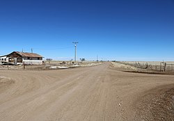 Villegreen in 2019 | |
 Villegreen Location in Colorado  Villegreen Location in the United States | |
| Coordinates: 37°18′21″N103°31′13″W / 37.30583°N 103.52028°W | |
| Country | |
| State | |
| County | Las Animas County |
| Elevation | 5,643 ft (1,720 m) |
| Time zone | UTC-7 (MST) |
| • Summer (DST) | UTC-6 (MDT) |
| ZIP code [2] | 81049 (Kim) |
| Area code | 719 |
| GNIS feature ID | 196201 [1] |
Villegreen is an unincorporated community located in Las Animas County, Colorado, United States. Villegreen is approximately 66 driving miles east of the county seat of Trinidad, Colorado, [3] and almost an equal distance west of Springfield, Colorado, the seat of neighboring Baca County. [4] The U.S. Post Office at Kim (ZIP Code 81049) now serves Villegreen postal addresses. [2]
