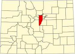
Coal Creek, Jefferson County, Colorado

Last updated

Coal Creek, Colorado
Coal Creek, Boulder County, Colorado.JPG
"Downtown" Coal Creek Canyon.
Boulder County and Gilpin County and Jefferson County Colorado Incorporated and Unincorporated areas Coal Creek Highlighted 0815302.svg
Location of the Coal Creek CDP in Jefferson, Boulder, and Gilpin counties, Colorado.
Usa edcp location map.svg
Red pog.svg
Coal Creek
Location of the Coal Creek CDP in the United States.
Coordinates: 39°54′26″N105°22′48″W / 39.90722°N 105.38000°W / 39.90722; -105.38000 (Coal Creek CDP, Colorado) [1]
Country Flag of the United States.svg  United States
State Flag of Colorado.svg  Colorado
Counties Jefferson County
Boulder County,
Gilpin County
Government
  Type unincorporated community
Area
[2]
  Total24.355 km2 (9.404 sq mi)
  Land24.316 km2 (9.388 sq mi)
  Water0.039 km2 (0.015 sq mi)
Elevation
[1]
2,668 m (8,754 ft)
Population
 (2020) [3]
  Total2,494
  Density100/km2 (270/sq mi)
Time zone UTC-7 (MST)
  Summer (DST) UTC-6 (MDT)
ZIP Code [4]
Golden 80403
Area codes 303 & 720
GNIS feature ID 2407642 [1]

Coal Creek, commonly known as Coal Creek Canyon, is a census-designated place (CDP) located in and governed by Jefferson, Boulder, and Gilpin counties in Colorado, United States, but primarily Jefferson County. The population of the Coal Creek CDP was 2,494 at the United States Census 2020. [3] The Golden post office (Zip code 80403) serves the area. [4]

Contents

Geography

The Coal Creek CDP has an area of 6,018 acres (24.355 km2), including 9.6 acres (0.039 km2) of water. [2]

Climate

According to the Köppen Climate Classification system, Coal Creek has a warm-summer humid continental climate, abbreviated "BSk" on climate maps, but closely borders on an oceanic climate (Cfb).

Climate data for Coal Creek Canyon, Colorado, 19912020 normals, extremes 19842019
MonthJanFebMarAprMayJunJulAugSepOctNovDecYear
Record high °F (°C)60
(16)
58
(14)
66
(19)
73
(23)
81
(27)
88
(31)
89
(32)
87
(31)
84
(29)
75
(24)
67
(19)
60
(16)
89
(32)
Mean maximum °F (°C)51.5
(10.8)
51.4
(10.8)
58.3
(14.6)
63.9
(17.7)
71.7
(22.1)
80.5
(26.9)
83.2
(28.4)
81.0
(27.2)
76.9
(24.9)
68.7
(20.4)
58.3
(14.6)
51.6
(10.9)
84.4
(29.1)
Mean daily maximum °F (°C)33.4
(0.8)
34.2
(1.2)
41.2
(5.1)
45.9
(7.7)
55.3
(12.9)
66.7
(19.3)
73.0
(22.8)
71.2
(21.8)
64.3
(17.9)
51.8
(11.0)
40.9
(4.9)
33.2
(0.7)
50.9
(10.5)
Daily mean °F (°C)24.5
(−4.2)
24.4
(−4.2)
30.7
(−0.7)
35.2
(1.8)
44.0
(6.7)
54.0
(12.2)
60.3
(15.7)
58.6
(14.8)
51.7
(10.9)
40.8
(4.9)
31.0
(−0.6)
24.0
(−4.4)
39.9
(4.4)
Mean daily minimum °F (°C)15.6
(−9.1)
14.7
(−9.6)
20.2
(−6.6)
24.4
(−4.2)
32.6
(0.3)
41.2
(5.1)
47.5
(8.6)
46.1
(7.8)
39.2
(4.0)
29.8
(−1.2)
21.1
(−6.1)
14.8
(−9.6)
28.9
(−1.7)
Mean minimum °F (°C)−6.8
(−21.6)
−8.4
(−22.4)
−0.4
(−18.0)
7.5
(−13.6)
19.3
(−7.1)
31.1
(−0.5)
39.1
(3.9)
36.7
(2.6)
24.8
(−4.0)
12.4
(−10.9)
0.9
(−17.3)
−8.3
(−22.4)
−15.5
(−26.4)
Record low °F (°C)−24
(−31)
−36
(−38)
−18
(−28)
−10
(−23)
4
(−16)
26
(−3)
33
(1)
30
(−1)
3
(−16)
−11
(−24)
−17
(−27)
−30
(−34)
−36
(−38)
Average precipitation inches (mm)1.00
(25)
1.32
(34)
2.68
(68)
3.79
(96)
3.24
(82)
2.19
(56)
2.89
(73)
2.84
(72)
1.86
(47)
1.66
(42)
1.23
(31)
1.13
(29)
25.83
(655)
Average snowfall inches (cm)17.4
(44)
23.2
(59)
35.6
(90)
42.0
(107)
16.6
(42)
0.9
(2.3)
0.0
(0.0)
0.0
(0.0)
2.7
(6.9)
16.1
(41)
18.4
(47)
21.8
(55)
194.7
(494.2)
Average precipitation days (≥ 0.01 in)9.610.411.213.613.612.214.815.49.88.18.19.0135.8
Average snowy days (≥ 0.1 in)10.511.312.112.76.90.90.00.01.26.28.410.080.2
Source 1: NOAA [5]
Source 2: National Weather Service (mean maxima and minima 1984–2019) [6]

Demographics

The United States Census Bureau initially defined the Coal Creek CDP for the United States Census 2000.

Coal Creek CDP, Colorado
YearPop.±%
2000 2,323    
2010 2,400+3.3%
2020 2,494+3.9%
Source: United States Census Bureau

See also

Related Research Articles

<span class="mw-page-title-main">Byers, Colorado</span> Census Designated Place in Colorado, United States

Byers is an unincorporated town, a post office, and a census-designated place (CDP) located in and governed by Arapahoe County, Colorado, United States. The CDP is a part of the Denver–Aurora–Lakewood, CO Metropolitan Statistical Area. The Byers post office has the ZIP Code 80103. At the United States Census 2020, the population of the Byers CDP was 1,322.

<span class="mw-page-title-main">Columbine, Colorado</span> Census-designated place in Jefferson and Arapahoe counties in Colorado, United States

Columbine is a census-designated place (CDP) in and governed by Jefferson and Arapahoe counties in Colorado, United States. The CDP is a part of the Denver metropolitan area. Located primarily in Jefferson County, Columbine lies immediately south of Denver. The population of the Columbine CDP was 25,229 at the 2020 census. The community lies in ZIP code 80123.

<span class="mw-page-title-main">Eldorado Springs, Colorado</span> Census-designated place in Colorado, United States

Eldorado Springs is an unincorporated community, a census-designated place (CDP) and a post office located in and governed by Boulder County, Colorado, United States. The CDP is a part of the Boulder, CO Metropolitan Statistical Area. The Eldorado Springs post office has the ZIP code 80025. At the 2020 United States census, the population of the Eldorado Springs CDP was 559.

<span class="mw-page-title-main">Downieville-Lawson-Dumont, Colorado</span> Census Designated Place in Colorado, United States

Downieville-Lawson-Dumont is a census-designated place (CDP) comprising the unincorporated communities of Downieville, Lawson, and Dumont located in and governed by Clear Creek County, Colorado, United States. The CDP is a part of the Denver–Aurora–Lakewood, CO Metropolitan Statistical Area. The Dumont post office ZIP code 80436 serves the area. At the United States Census 2020, the population of the Downieville-Lawson-Dumont CDP was 527.

<span class="mw-page-title-main">Applewood, Colorado</span> Census Designated Place in Colorado, United States

Applewood is an unincorporated community and a census-designated place (CDP) located in and governed by Jefferson County, Colorado, United States. The CDP is a part of the Denver–Aurora–Lakewood, CO Metropolitan Statistical Area. The population of the Applewood CDP was 7,833 at the 2020 United States Census. The Golden post office serves the area.

<span class="mw-page-title-main">Aspen Park, Colorado</span> Census Designated Place in Colorado, United States

Aspen Park is an unincorporated community and a census-designated place (CDP) located in Jefferson County, Colorado, United States. The CDP is a part of the Denver–Aurora–Lakewood, CO Metropolitan Statistical Area. The population of the Aspen Park CDP was 810 at the United States Census 2020. The Aspen Park Metropolitan District provides services. The Conifer post office serves the area.

<span class="mw-page-title-main">Evergreen, Colorado</span> Census Designated Place in Colorado, United States

Evergreen is an unincorporated town, a post office, and a census-designated place (CDP) located in and governed by Jefferson County, Colorado, U.S. The CDP is a part of the Denver–Aurora–Lakewood, CO Metropolitan Statistical Area. The Evergreen post office has the ZIP Codes 80439 and 80437. At the 2020 census, the population of the Evergreen CDP was 9,307. The Evergreen Metropolitan District provides services.

<span class="mw-page-title-main">Indian Hills, Colorado</span> Census Designated Place in Colorado, United States

Indian Hills is an unincorporated town, a post office, and a census-designated place (CDP) located in and governed by Jefferson County, Colorado, United States. The CDP is a part of the Denver–Aurora–Lakewood, CO Metropolitan Statistical Area. The Indian Hills post office has the ZIP code 80454. At the United States Census 2020, the population of the Indian Hills CDP was 1,474.

<span class="mw-page-title-main">Kittredge, Colorado</span> Census Designated Place in Colorado, United States

Kittredge is an unincorporated town, a post office, and a census-designated place (CDP) located in and governed by Jefferson County, Colorado, United States. The CDP is a part of the Denver–Aurora–Lakewood, CO Metropolitan Statistical Area. The Kittredge post office has the ZIP code 80457. At the United States Census 2020, the population of the Kittredge CDP was 1,308.

<span class="mw-page-title-main">East Pleasant View, Colorado</span> Census Designated Place in Colorado, United States

East Pleasant View is an unincorporated community and a census-designated place (CDP) located in and governed by Jefferson County, Colorado, United States. The CDP is a part of the Denver–Aurora–Lakewood, CO Metropolitan Statistical Area. The population of the East Pleasant View CDP was 333 at the United States Census 2020. The Pleasant View Metropolitan District provides services. The Golden Post Office serves the area.

<span class="mw-page-title-main">Rollinsville, Colorado</span> Census-designated place in Gilpin County, Colorado, United States

Rollinsville is a census-designated place (CDP) and post office in and governed by Gilpin County, Colorado, United States. The CDP is a part of the Denver–Aurora–Lakewood, CO Metropolitan Statistical Area. The Rollinsville post office has the ZIP Code 80474. At the United States Census 2020, the population of the Rollinsville CDP was 194.

<span class="mw-page-title-main">Parshall, Colorado</span> Census Designated Place in Colorado, United States

Parshall is an unincorporated town, a post office, and a census-designated place (CDP) located in and governed by Grand County, Colorado, United States. The Parshall post office has the ZIP Code 80468. At the United States Census 2020, the population of the Parshall CDP was 42.

<span class="mw-page-title-main">No Name, Colorado</span> Census-designated place in Garfield County, Colorado, United States

No Name is a census-designated place (CDP) in and governed by Garfield County, Colorado, United States. The CDP is a part of the Glenwood Springs, CO Micropolitan Statistical Area. The population of the No Name CDP was 117 at the United States Census 2020. The Glenwood Springs post office serves the area.

<span class="mw-page-title-main">Florissant, Colorado</span> Census Designated Place in Colorado, United States

Florissant is an unincorporated town, a post office, and a census-designated place (CDP) located in and governed by Teller County, Colorado, United States. The CDP is a part of the Colorado Springs, CO Metropolitan Statistical Area. The Florissant post office has the ZIP Code 80816. At the United States Census 2020, the population of the Florissant CDP was 128, while the population of the 80816 ZIP Code Tabulation Area was 5,180 including adjacent areas.

<span class="mw-page-title-main">Hartsel, Colorado</span> Census-designated place in Park County, Colorado, United States

Hartsel is a census-designated place (CDP) in and governed by Park County, Colorado United States. The population was 38 at the 2020 census. The Hartsel post office has the ZIP Code 80449. The CDP is a part of the Denver–Aurora–Lakewood, CO Metropolitan Statistical Area.

<span class="mw-page-title-main">Idledale, Colorado</span> Census Designated Place in Colorado, United States

Idledale is an unincorporated town, a post office, and a census-designated place (CDP) located in and governed by Jefferson County, Colorado, United States. The CDP is a part of the Denver–Aurora–Lakewood, CO Metropolitan Statistical Area. The Idledale post office has the ZIP code 80453. At the United States Census 2020, the population of the Idledale CDP was 244.

<span class="mw-page-title-main">Upper Bear Creek, Colorado</span> Census Designated Place in Colorado, United States

Upper Bear Creek is an unincorporated community and a census-designated place (CDP) located in and governed by Clear Creek County, Colorado, United States. The CDP is a part of the Denver–Aurora–Lakewood, CO Metropolitan Statistical Area. The population of the Upper Bear Creek CDP was 984 at the United States Census 2020. The Evergreen post office serves the area.

<span class="mw-page-title-main">Fairmount, Colorado</span> Census Designated Place in Colorado, United States

Fairmount is an unincorporated community and a census-designated place (CDP) in Jefferson County, Colorado, United States. The CDP is a part of the Denver–Aurora–Lakewood, CO Metropolitan Statistical Area. The population of the Fairmount CDP was 9,324 at the United States Census 2010. ZIP code 80403 applies to addresses in Fairmount.

<span class="mw-page-title-main">Glendale, Boulder County, Colorado</span> Census Designated Place in Colorado, United States

Glendale is an unincorporated community and a census-designated place (CDP) located in and governed by Boulder County, Colorado, United States. The CDP is a part of the Boulder, CO Metropolitan Statistical Area. The population of the Glendale CDP was 64 at the United States Census 2020. The Jamestown post office serves the area.

<span class="mw-page-title-main">Brook Forest, Colorado</span> Census Designated Place in Colorado, United States

Brook Forest is an unincorporated community and a census-designated place (CDP) located in and governed by Jefferson and Clear Creek counties, Colorado, United States. The population was 622 at the 2020 census. The CDP is a part of the Denver–Aurora–Lakewood, CO Metropolitan Statistical Area. The Evergreen Post Office serves the area.

References

  1. 1 2 3 U.S. Geological Survey Geographic Names Information System: Coal Creek, Jefferson County, Colorado
  2. 1 2 "State of Colorado Census Designated Places - BAS20 - Data as of January 1, 2020". United States Census Bureau . Retrieved December 17, 2020.
  3. 1 2 United States Census Bureau. "Coal Creek CDP, Colorado" . Retrieved April 10, 2023.
  4. 1 2 "Zip Code 80403 Map and Profile". zipdatamaps.com. 2020. Retrieved December 20, 2020.
  5. "U.S. Climate Normals Quick Access". National Oceanic and Atmospheric Administration. Retrieved August 8, 2022.
  6. "NOAA Online Weather Data". National Weather Service. Retrieved August 8, 2022.