Pine, Colorado | |
|---|---|
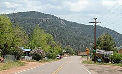 Pine in 2013 | |
 Pine  Pine | |
| Coordinates: 39°24′36″N105°19′19″W / 39.41000°N 105.32194°W | |
| Country | |
| State | |
| County | Jefferson |
| Time zone | UTC-7 (MST) |
| • Summer (DST) | UTC-6 (MDT) |
| ZIP code [1] | 80470 |
| Website | historicpinegrove |
Pine is an unincorporated community and a U.S. Post Office in Jefferson County, Colorado, United States. The Pine Post Office has the ZIP Code 80470. [1]
The historic town is also called Pine Grove. Every summer from 1988 through 2022, the residents held an annual Rhubarb Festival which was sponsored by the Pine-Elk Creek Improvement Association (PECIA). PECIA is a 501(c)(3) charitable organization that was founded in 1947. [2]
