East Pleasant View, Colorado | |
|---|---|
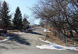 Ellis Street in East Pleasant View. | |
 Location of the East Pleasant View CDP in Jefferson County, Colorado. | |
 East Pleasant View Location of the East Pleasant View CDP, Colorado.  East Pleasant View East Pleasant View (Colorado) | |
| Coordinates: 39°43′40″N105°09′26″W / 39.7277°N 105.1572°W [1] | |
| Country | United States |
| State | Colorado |
| County | Jefferson [2] |
| Government | |
| • Type | unincorporated community |
| • Body | Jefferson County [2] |
| Area | |
• Total | 0.111 sq mi (0.287 km2) |
| • Land | 0.111 sq mi (0.287 km2) |
| • Water | 0 sq mi (0.000 km2) |
| Elevation | 5,837 ft (1,779 m) |
| Population | |
• Total | 333 |
| • Density | 3,010/sq mi (1,160/km2) |
| Time zone | UTC−07:00 (MST) |
| • Summer (DST) | UTC−06:00 (MDT) |
| ZIP code [5] | Golden 80401 |
| Area codes | 303/720/983 |
| GNIS CDP ID | 2408030 |
| FIPS code | 08-22575 |
East Pleasant View is an unincorporated community and a census-designated place (CDP) located in and governed by Jefferson County, Colorado, United States. The CDP is a part of the Denver-Aurora-Centennial, CO Metropolitan Statistical Area. The population of the East Pleasant View CDP was 333 at the United States Census 2020. The Pleasant View Metropolitan District provides services. The Golden Post Office (ZIP Code 80401) serves the area. [5]
