Conifer, Colorado | |
---|---|
Coordinates: 39°31′16″N105°18′19″W / 39.52111°N 105.30528°W [1] | |
Country | United States |
State | Colorado |
County | Jefferson County |
Settled | 1860s |
Government | |
• Type | Unincorporated community |
Elevation | 8,277 ft (2,523 m) |
Population (2009 [2] ) | |
• Total | 19,683 [3] |
Time zone | UTC−7 (MST) |
• Summer (DST) | UTC−6 (MDT) |
ZIP Code | 80433 [4] |
Area code(s) | 303 and 720 |
FIPS code | 08-16770 [1] |
GNIS feature ID | 0204717 [1] |
Website | Conifer CoC |
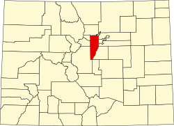
Conifer is an unincorporated community in Jefferson County, Colorado, United States. [1] Conifer is located along U.S. Route 285 in the foothills west of Denver.
A post office called Conifer was established in 1894. [5] Some say the community was named after George Conifer, the proprietor of a local tavern, while others believe conifer trees near the original town site caused the name to be selected. [6]
Conifer is located at 39°31′16″N105°18′19″W / 39.52111°N 105.30528°W (39.5210995,−105.3052708). [1] A magnitude 3.1 tremor centered on Berrian Mountain about 1 mile north of Conifer occurred on November 1, 1981, at 8:03 p.m. MST.[ citation needed ]
Conifer has a humid continental climate (Koppen: Dfb) with a yearly temperature average of 38.6 °F (3.7 °C). Summertime is warm with cool nights, while winter is chilly with nights approaching zero. [7]
Climate data for Conifer, Colorado | |||||||||||||
---|---|---|---|---|---|---|---|---|---|---|---|---|---|
Month | Jan | Feb | Mar | Apr | May | Jun | Jul | Aug | Sep | Oct | Nov | Dec | Year |
Record high °F (°C) | 65 (18) | 70 (21) | 72 (22) | 78 (26) | 86 (30) | 95 (35) | 95 (35) | 93 (34) | 91 (33) | 83 (28) | 72 (22) | 66 (19) | 95 (35) |
Mean daily maximum °F (°C) | 38 (3) | 41 (5) | 46 (8) | 53 (12) | 62 (17) | 73 (23) | 78 (26) | 76 (24) | 69 (21) | 59 (15) | 45 (7) | 38 (3) | 57 (14) |
Mean daily minimum °F (°C) | 7 (−14) | 10 (−12) | 17 (−8) | 23 (−5) | 31 (−1) | 38 (3) | 43 (6) | 42 (6) | 34 (1) | 24 (−4) | 15 (−9) | 9 (−13) | 24 (−4) |
Record low °F (°C) | −46 (−43) | −48 (−44) | −25 (−32) | −15 (−26) | 6 (−14) | 22 (−6) | 28 (−2) | 26 (−3) | 7 (−14) | −9 (−23) | −26 (−32) | −33 (−36) | −48 (−44) |
Average precipitation inches (mm) | 0.40 (10) | 0.54 (14) | 1.28 (33) | 1.92 (49) | 2.10 (53) | 1.76 (45) | 2.55 (65) | 2.68 (68) | 1.25 (32) | 1.15 (29) | 0.89 (23) | 0.58 (15) | 17.1 (436) |
Average snowfall inches (cm) | 14 (36) | 11.3 (29) | 7.2 (18) | 2.5 (6.4) | 0.6 (1.5) | 0.1 (0.25) | 0 (0) | 0 (0) | 0.2 (0.51) | 1.7 (4.3) | 8.3 (21) | 17.6 (45) | 63.5 (161.96) |
Source: Weather Underground [8] |
Students living within Jefferson County attend Jefferson County schools. Those neighborhood schools are Elk Creek Elementary School, West Jefferson Elementary School, Marshdale Elementary School, West Jefferson Middle School, and Conifer High School. In 2011, Conifer High School was ranked 434 in the top 500 schools in the nation by Newsweek. [9]
Conifer residents are served by the Elk Creek Fire Protection District, a mixed career/volunteer fire department with approximately 60 active-duty firefighters. [10]
US Route 285 is alongside The Town
Jefferson County is a county located in the U.S. state of Colorado. As of the 2020 census, the population was 582,910, making it the fourth-most populous county in Colorado. The county seat is Golden, and the most populous city is Lakewood.
Arapahoe County is a county located in the U.S. state of Colorado. As of the 2020 census, its population was 655,070, making it the third-most populous county in Colorado. The county seat is Littleton, and the most populous city is Aurora. The county was named for the Arapaho Native American tribe, who once lived in the region.
Byers is an unincorporated town, a post office, and a census-designated place (CDP) located in and governed by Arapahoe County, Colorado, United States. The CDP is a part of the Denver–Aurora–Lakewood, CO Metropolitan Statistical Area. The Byers post office has the ZIP Code 80103. At the United States Census 2020, the population of the Byers CDP was 1,322.
The City of Englewood is a home rule municipality located in Arapahoe County, Colorado, United States. The town population was 33,659 at the 2020 United States Census. Englewood is a part of the Denver–Aurora–Lakewood, CO Metropolitan Statistical Area and the Front Range Urban Corridor. Englewood is located immediately south of Denver in the South Platte River Valley.
Cañon City is a home rule municipality that is the county seat and the most populous municipality of Fremont County, Colorado, United States. The city population was 17,141 at the 2020 United States Census. Cañon City is the principal city of the Cañon City, CO Micropolitan Statistical Area and is a part of the Front Range Urban Corridor. Cañon City straddles the easterly flowing Arkansas River and is a popular tourist destination for sightseeing, whitewater rafting, and rock climbing. The city is known for its many public parks, fossil discoveries, Skyline Drive, The Royal Gorge railroad, the Royal Gorge, and extensive natural hiking paths. In 1994, the United States Board on Geographic Names approved adding the tilde to the official name of Cañon City, a change from Canon City as the official name in its decisions of 1906 and 1975. It is one of the few U.S. cities to have the Spanish Ñ in its name, others being La Cañada Flintridge, California; Española, New Mexico; Peñasco, New Mexico; and Peñitas, Texas.
Aspen Park is an unincorporated community and a census-designated place (CDP) located in Jefferson County, Colorado, United States. The CDP is a part of the Denver–Aurora–Lakewood, CO Metropolitan Statistical Area. The population of the Aspen Park CDP was 810 at the United States Census 2020. The Aspen Park Metropolitan District provides services. The Conifer post office serves the area.
The City of Edgewater is a home rule municipality located in Jefferson County, Colorado, United States. The city population was 5,005 at the 2020 United States Census. Edgewater is surrounded by Denver to the east, Lakewood to the south and west, and Wheat Ridge to the north. The city is a part of the Denver–Aurora–Lakewood, CO Metropolitan Statistical Area and the Front Range Urban Corridor.
Evergreen is an unincorporated town, a post office, and a census-designated place (CDP) located in and governed by Jefferson County, Colorado, U.S. The CDP is a part of the Denver–Aurora–Lakewood, CO Metropolitan Statistical Area. The Evergreen post office has the ZIP Codes 80439 and 80437. At the 2020 census, the population of the Evergreen CDP was 9,307. The Evergreen Metropolitan District provides services.
Indian Hills is an unincorporated town, a post office, and a census-designated place (CDP) located in and governed by Jefferson County, Colorado, United States. The CDP is a part of the Denver–Aurora–Lakewood, CO Metropolitan Statistical Area. The Indian Hills post office has the ZIP code 80454. At the United States Census 2020, the population of the Indian Hills CDP was 1,474.
Kittredge is an unincorporated town, a post office, and a census-designated place (CDP) located in and governed by Jefferson County, Colorado, United States. The CDP is a part of the Denver–Aurora–Lakewood, CO Metropolitan Statistical Area. The Kittredge post office has the ZIP code 80457. At the United States Census 2020, the population of the Kittredge CDP was 1,308.
Jefferson County School District R-1 is a school district in Jefferson County, Colorado. The district is headquartered at the Jeffco Public Schools Education Center in an unincorporated area of the county near Golden in the Denver metropolitan area. Jeffco Public Schools serves almost 81,000 students in 166 schools. It is the second-largest school district in Colorado, having been surpassed in 2013 by Denver Public Schools, which has an enrollment of approximately 81,000.
Hartsel is a census-designated place (CDP) in and governed by Park County, Colorado United States. The population was 38 at the 2020 census. The Hartsel post office has the ZIP Code 80449. The CDP is a part of the Denver–Aurora–Lakewood, CO Metropolitan Statistical Area.
Buffalo Creek is an unincorporated community and U.S. Post Office in Jefferson County, Colorado, United States. The ZIP Code of the Buffalo Creek Post Office is 80425.
The Lariat Loop National Scenic and Historic Byway is a National Scenic Byway and a Colorado Scenic and Historic Byway located in Jefferson County, Colorado, USA. The byway is a 40-mile (64 km) loop in the Front Range foothills west of Denver through Golden, Lookout Mountain Park, Genesee Park, Evergreen, Morrison, Red Rocks Park, and Dinosaur Ridge. The Lariat Loop connects to the Mount Blue Sky Scenic Byway at Bergen Park.
Lawson is a small unincorporated community situated along Clear Creek in Clear Creek County, Colorado, United States. Lawson is a part of the Downieville-Lawson-Dumont census-designated place.
The following outline is provided as an overview of and topical guide to the U.S. state of Colorado:
Lakewood is the home rule municipality that is the most populous municipality in Jefferson County, Colorado, United States. The city population was 155,984 at the 2020 U.S. Census, making Lakewood the fifth most populous city in Colorado and the 167th most populous city in the United States. Lakewood is a suburb of Denver and is a principal city of the Denver–Aurora–Lakewood, CO Metropolitan Statistical Area and a major city of the Front Range Urban Corridor.
John James Huddart, known usually as John J. Huddart, was a British born and trained architect who practised out of Denver, Colorado in the United States. At the end of the Nineteenth century he was one of Denver's leading architects, known for his work on public buildings and as a courthouse architect.
Harvey Park is a neighborhood in Denver, Colorado. As of the 2020 U.S. Census, the population of the neighborhood was 11,496.