List of lakes of Colorado

Last updated
The location of the State of Colorado in the United States of America. Colorado in United States.svg
The location of the State of Colorado in the United States of America .
An enlargeable map of the State of Colorado. Map of Colorado NA.png
An enlargeable map of the State of Colorado.

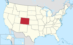
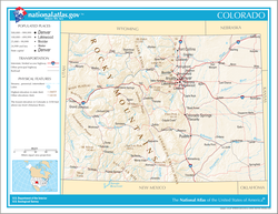
This is an alphabetical list of some notable lakes and reservoirs in the U.S. State of Colorado . Most of the larger lakes in Colorado are either reservoirs or dam-enhanced natural lakes.

Contents

A

B

C

D

E

F

G

H

I

J

K

L

M

N

O

P

Q

R

S

T

U

V

W

X

Y

Z

See also

Related Research Articles

<span class="mw-page-title-main">Grand County, Colorado</span> County in Colorado, United States

Grand County is a county located in the U.S. state of Colorado. As of the 2020 census, the population was 15,717. The county seat is Hot Sulphur Springs.

<span class="mw-page-title-main">Curecanti National Recreation Area</span> National Park Service in Colorado, US

Curecanti National Recreation Area is a National Park Service unit located on the Gunnison River in western Colorado. Established in 1965, Curecanti National Recreation Area is responsible for developing and managing recreational facilities on three reservoirs, Blue Mesa Reservoir, Morrow Point Reservoir and Crystal Reservoir, constructed on the upper Gunnison River in the 1960s by the U.S. Bureau of Reclamation to better utilize the vital waters of the Colorado River and its major tributaries. A popular destination for boating and fishing, Curecanti offers visitors two marinas, traditional and group campgrounds, hiking trails, boat launches, and boat-in campsites. The state's premiere lake trout and Kokanee salmon fisheries, Curecanti is a popular destination for boating and fishing, and is also a popular area for ice-fishing in the winter months.

<span class="mw-page-title-main">White River National Forest</span> National forest in northwest Colorado

White River National Forest is a National Forest in northwest Colorado. It is named after the White River that passes through its northern section. It is the most visited National Forest in the United States, primarily from users of the twelve ski areas within its boundaries.

<span class="mw-page-title-main">Blue Mesa Reservoir</span> Lake on the Gunnison River in Colorado, United States

Blue Mesa Reservoir is an artificial reservoir located on the upper reaches of the Gunnison River in Gunnison County, Colorado. The largest lake located entirely within the state, Blue Mesa Reservoir was created by the construction of Blue Mesa Dam, a 390 feet (120 m) tall earthen fill dam constructed on the Gunnison by the U.S. Bureau of Reclamation in 1966 for the generation of hydroelectric power. Managed as part of the Curecanti National Recreation Area, a unit of the National Park Service, Blue Mesa Reservoir is the largest lake trout and Kokanee salmon fishery in Colorado.

<span class="mw-page-title-main">San Isabel National Forest</span> Forest in Colorado, US

San Isabel National Forest is located in central Colorado. The forest contains 19 of the state's 53 fourteeners, peaks over 14,000 feet (4,267 m) high, including Mount Elbert, the highest point in Colorado.

<span class="mw-page-title-main">Arapaho National Recreation Area</span>

The Arapaho National Recreation Area (ANRA) is a United States national recreation area located near the headwaters of the Colorado River in north central Colorado adjacent to Rocky Mountain National Park. ANRA is under the jurisdiction of the Arapaho-Roosevelt National Forest. ANRA contains five lakes in the upper Colorado River Valley:

The High Rockies, or high country, is a term for a region of the U.S. state of Colorado. It commonly includes Larimer County, Jackson County, Routt County, Grand County, Summit County, Eagle County, Lake County, and Pitkin County. Some notable towns there include Estes Park, Walden, Steamboat Springs, Grand Lake, Winter Park, Breckenridge, Dillon, Vail, Leadville, and Aspen. The geography of the High Rockies has some of the most rugged parts of the Rocky Mountains and consists of the Front Range and mountainous topography to the west, much of which is on or near the Continental Divide. Known for pine forests and winding roads, the former mining towns there have been reinvented by wilderness tourism such as hiking, cycling, fishing, and most especially both cross-country and alpine skiing. Notable ski resorts include Copper Mountain, Keystone Resort, Steamboat Ski Resort, Beaver Creek Resort, Buttermilk, Aspen Highlands, Snowmass, and Aspen Mountain. The High Rockies are also the location of Rocky Mountain National Park and Arapaho National Forest.

<span class="mw-page-title-main">U.S. Route 50 in Colorado</span> Section of U.S. Highway in Colorado, United States

U.S. Route 50 (US 50) is a part of the U.S. Highway System that travels from West Sacramento, California, to Ocean City, Maryland. In the U.S. state of Colorado, US 50 is a major highway crossing through the lower midsection of the state. It connects the Western Slope with the lower Front Range and the Arkansas Valley. The highway serves the areas of Pueblo and Grand Junction as well as many other smaller areas along its corridor. The long-term project to widen the highway from two lanes to a four lane expressway between Grand Junction and Montrose was completed in January 2005. Only about 25% of the remainder of highway 50 in Colorado is four lane highway.

<span class="mw-page-title-main">Index of Colorado-related articles</span>

This is an alphabetical list of articles related to the U.S. State of Colorado.

<span class="mw-page-title-main">Curecanti Needle</span> Granite spire in Colorado, USA

The Curecanti Needle is a 700-ft granite spire located on the Gunnison River in western Colorado. A notable landmark to generations of natives and pioneers, the Needle is located on the southern bank of Morrow Point Reservoir, an impoundment of the Gunnison river between Gunnison and Montrose, Colorado. Used for many years as an advertising symbol for the Denver and Rio Grande Western Railroad, whose narrow-gauge railway famously ran along the northern bank of the river and passed near the Needle, the spire is today part of the Curecanti National Recreation Area, a National Park Service facility that encompasses three impoundments of the Gunnison river, including Morrow Point Reservoir.

<span class="mw-page-title-main">Outline of Colorado</span> Overview of and topical guide to Colorado

The following outline is provided as an overview of and topical guide to the U.S. state of Colorado:

<span class="mw-page-title-main">Morrow Point Reservoir</span> Reservoir on the Gunnison River in Colorado

Morrow Point Reservoir is an 817-acre (331 ha) artificial reservoir on the Gunnison River in western Colorado. Located in the upper Black Canyon of the Gunnison, the lake was created in 1968 by the U.S. Bureau of Reclamation as part of a larger plan to impound the upper section of the Gunnison and create opportunities for hydroelectric power generation, water conservation, and recreation. Morrow Point Reservoir is managed by the National Park Service as a unit within the Curecanti National Recreation Area, and is the location of the Curecanti Needle, a striking 700-foot (210 m) granite spire on the reservoir's southern bank whose unique shape was for decades a recognized symbol of the Denver and Rio Grande Western Railroad.

Crystal Reservoir is a 340-acre artificial reservoir on the Gunnison River in western Colorado. Located in the upper Black Canyon of the Gunnison, the lake was created in 1976 by the U.S. Bureau of Reclamation as part of a larger plan to impound the upper section of the Gunnison for the generation of hydroelectric power, water storage, and public recreation. Crystal Reservoir is managed by the National Park Service as an element of the Curecanti National Recreation Area. Located at the far western end of Curecanti, Crystal Reservoir is the smallest, least developed, and least accessible of the three reservoirs within the park.

<span class="mw-page-title-main">Blue Creek (Gunnison River tributary)</span> River

Blue Creek is a tributary of the Gunnison River in Gunnison County, Colorado. It forms at the confluence of Little Blue Creek and Big Blue Creek adjacent to the intersection of U.S. Highway 50 and Alpine Plateau Road in Blue Creek Canyon.

References

    38°59′50″N105°32′52″W / 38.9972°N 105.5478°W / 38.9972; -105.5478 (State of Colorado)