Williams Fork Reservoir

Last updated
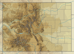
Williams Fork Reservoir
Williams Fork Reservoir.JPG
The reservoir in 2016.
USA Colorado relief location map.svg
Red pog.svg
Williams Fork Reservoir
Usa edcp relief location map.png
Red pog.svg
Williams Fork Reservoir
Location Grand County, Colorado,
United States
Coordinates 40°00′55″N106°12′37″W / 40.01528°N 106.21028°W / 40.01528; -106.21028
Type reservoir
Primary inflows Williams Fork of the Colorado River
Primary outflows Williams Fork of the Colorado River
Basin  countries United States
Surface area1,860 acres (750 ha)
Water volume97,000 acre⋅ft (120,000,000 m3)
Surface elevation7,811 ft (2,381 m)

Williams Fork Reservoir, located near the town of Parshall in Grand County, Colorado, is owned and operated by Denver Water. The reservoir impounds the Williams Fork of the Colorado River.

Contents

Geography

When the reservoir is full, its elevation is 7,811 feet (2,381 m). With a 15.8 miles (25.4 km) shoreline, the reservoir's surface area is 1,860 acres (750 ha). [1]

Williams Fork Dam and Power Plant

The Williams Fork Dam and Power Plant, completed in 1938 and expanded in 1959, [2] provides electricity and water to the Western Slope or Denver metropolitan area in Colorado. It's a concrete dam, 217 feet (66 m) high and with a length of 600 feet (180 m) at its crest. The reservoir impounds about 97,000 acre-feet (120,000,000 m3) of water (one acre foot=325,851 gallons), and the power plant contains a 3,158-kilowatt generator. [1]

Recreactional Activities

Water based activities include motor boating, fishing, ice fishing and wind surfing. The lake is stocked for fishing by Colorado Parks and Wildlife. Tent, trailer and recreational vehicle (RV) camping and picnic sites are available. [1]

See also

Related Research Articles

Lake Kickapoo is a reservoir located on the North Fork Little Wichita River in the Red River Basin of Archer County, Texas. It is neighbored by Archer City, Texas and Wichita Falls, Texas which reside within the Central Great Plains ecoregion.

<span class="mw-page-title-main">South Platte River</span> River in Colorado and Nebraska, United States

The South Platte River is one of the two principal tributaries of the Platte River. Flowing through the U.S. states of Colorado and Nebraska, it is itself a major river of the American Midwest and the American Southwest/Mountain West. Its drainage basin includes much of the eastern flank of the Rocky Mountains in Colorado, much of the populated region known as the Colorado Front Range and Eastern Plains, and a portion of southeastern Wyoming in the vicinity of the city of Cheyenne. It joins the North Platte River in western Nebraska to form the Platte, which then flows across Nebraska to the Missouri. The river serves as the principal source of water for eastern Colorado. In its valley along the foothills in Colorado, it has permitted agriculture in an area of the Colorado Piedmont and Great Plains that is otherwise arid.

<span class="mw-page-title-main">Lake Oroville</span> Reservoir in Butte County, California, U.S.

Lake Oroville is a reservoir formed by the Oroville Dam impounding the Feather River, located in Butte County, northern California. The lake is situated 5 miles (8 km) northeast of the city of Oroville, within the Lake Oroville State Recreation Area, in the western foothills of the Sierra Nevada. Known as the second-largest reservoir in California, Lake Oroville is treated as a keystone facility within the California State Water Project by storing water, providing flood control, recreation, freshwater releases to assist in controlling the salinity intrusion into the Sacramento-San Joaquin Delta and protecting fish and wildlife.

<span class="mw-page-title-main">Dworshak Dam</span> Dam in Idaho

Dworshak Dam is a concrete gravity dam in the western United States, on the North Fork of the Clearwater River in north central Idaho. In Clearwater County, the dam is located approximately four miles (6 km) northwest of Orofino and impounds the Dworshak Reservoir for flood control and hydroelectricity generation.

<span class="mw-page-title-main">Dillon Reservoir</span> Fresh water reservoir in Summit County, Col., US

Dillon Reservoir, sometimes referred to as Lake Dillon, is a large fresh water reservoir located in Summit County, Colorado, United States, south of I-70 and bordered by the towns of Frisco, Silverthorne, and Dillon. It is a reservoir for the city of Denver, and its waters are under the control of Denver Water. Popular ski areas are close to the reservoir, including Copper Mountain, Keystone, Arapahoe Basin, and Breckenridge.

<span class="mw-page-title-main">Flaming Gorge Dam</span> Dam on the Green River in Utah, United States

Flaming Gorge Dam is a concrete thin-arch dam on the Green River, a major tributary of the Colorado River, in northern Utah in the United States. Flaming Gorge Dam forms the Flaming Gorge Reservoir, which extends 91 miles (146 km) into southern Wyoming, submerging four distinct gorges of the Green River. The dam is a major component of the Colorado River Storage Project, which stores and distributes upper Colorado River Basin water.

<span class="mw-page-title-main">Great Falls Dam (Tennessee)</span> Hydroelectric dam in Tennessee

Great Falls Dam is a hydroelectric dam on the Caney Fork, straddling the county line between White County and Warren County in the U.S. state of Tennessee. It is the only dam outside the Tennessee River watershed owned and operated by the Tennessee Valley Authority. The dam impounds the 1,830-acre (740 ha) Great Falls Lake, and its tailwaters feed into Center Hill Lake. The completion of Great Falls Dam in late 1916 was an engineering triumph, marking the first successful attempt to impound the volatile and flood-prone Caney Fork. The dam is also notable for its design, utilizing a mostly underground conduit to carry water from the reservoir via a tributary to the Power House 0.75 miles (1.21 km) downstream from the dam.

<span class="mw-page-title-main">Crooked River (Oregon)</span> River in Oregon, United States

The Crooked River is a tributary, 125 miles (201 km) long, of the Deschutes River in the U.S. state of Oregon. The river begins at the confluence of the South Fork Crooked River and Beaver Creek. Of the two tributaries, the South Fork Crooked River is the larger and is sometimes considered part of the Crooked River proper. A variant name of the South Fork Crooked River is simply "Crooked River". The Deschutes River flows north into the Columbia River.

The Central Utah Project is a US federal water project that was authorized for construction under the Colorado River Storage Project Act of April 11, 1956, as a participating project. In general, the Central Utah Project develops a portion of Utah's share of the yield of the Colorado River, as set out in the Colorado River Compact of 1922.

<span class="mw-page-title-main">Colorado River Storage Project</span> US Bureau of Reclamation project

The Colorado River Storage Project is a United States Bureau of Reclamation project designed to oversee the development of the upper basin of the Colorado River. The project provides hydroelectric power, flood control and water storage for participating states along the upper portion of the Colorado River and its major tributaries.

<span class="mw-page-title-main">South Holston Dam</span> Dam in Tennessee, United States

South Holston Dam is a hydroelectric and flood control dam on the South Fork Holston River in Sullivan County, in the U.S. state of Tennessee. It is the uppermost of three dams on the South Fork Holston owned and operated by the Tennessee Valley Authority, which built the dam in the 1940s as part of efforts to control flooding in the Tennessee River watershed. On October 21, 1950 the valve gate closed and water began backing up to create South Holston Reservoir. Work began on the dam in December 1941, but in November 1942, the War Production Board requested that the operation be suspended because of a shortage of critical materials. Work did not resume until July 1, 1947. The dam now impounds the South Holston Lake of 7,550 acres (3,060 ha), which extends northeastward across the Tennessee-Virginia state line.

<span class="mw-page-title-main">Fort Patrick Henry Dam</span> Dam in Tennessee, United States

Fort Patrick Henry Dam is a hydroelectric dam on the South Fork Holston River within the city of Kingsport, in Sullivan County in the U.S. state of Tennessee. It is the lowermost of three dams on the South Fork Holston owned and operated by the Tennessee Valley Authority, which built the dam in the early 1950s to take advantage of the hydroelectric potential created by the regulation of river flow with the completion of Watauga Dam, South Holston Dam, and Boone Dam further upstream in preceding years. The dam impounds the 872-acre (353 ha) Fort Patrick Henry Lake. While originally built for hydroelectric generation, the dam now plays an important role in the regulation of water flow and water temperature for the John Sevier Fossil Plant and other industrial plants downstream. The dam and associated infrastructure were listed on the National Register of Historic Places in 2017.

<span class="mw-page-title-main">Lake Pueblo State Park</span> State park in Colorado, United States

Lake Pueblo State Park is a state park located in Pueblo County, Colorado. It includes 60 miles (97 km) of shoreline and 10,000 acres (40 km2) of land. Activities it offers include two full-service marinas, recreational fishing, hiking, camping and swimming at a special swim beach.

<span class="mw-page-title-main">Minidoka Project</span>

The Minidoka Project is a series of public works by the U.S. Bureau of Reclamation to control the flow of the Snake River in Wyoming and Idaho, supplying irrigation water to farmlands in Idaho. One of the oldest Bureau of Reclamation projects in the United States, the project involves a series of dams and canals intended to store, regulate and distribute the waters of the Snake, with electric power generation as a byproduct. The water irrigates more than a million acres (4,000 km²) of otherwise arid land, producing much of Idaho's potato crop. Other crops include alfalfa, fruit and sugar beets. The primary irrigation district lies between Ashton in eastern Idaho and Bliss in the southwestern corner of the state. Five main reservoirs collect water, distributing it through 1,600 miles (2,600 km) of canals and 4,000 miles (6,400 km) of lateral distribution ditches.

<span class="mw-page-title-main">San Gabriel Dam</span> Dam in Los Angeles County, California

San Gabriel Dam is a rock-fill dam on the San Gabriel River in Los Angeles County, California, within the Angeles National Forest. Completed in 1939, the dam impounds the main stem of the San Gabriel River about 2.5 miles (4.0 km) downstream from the confluence of the river's East and West Forks, which drain a large portion of the San Gabriel Mountains. It is located directly upstream from the Morris Dam. The dam provides flood control, groundwater recharge flows and hydroelectricity for the heavily populated San Gabriel Valley in the Greater Los Angeles metropolitan area.

<span class="mw-page-title-main">Sugar Loaf Dam</span>

Sugar Loaf Dam is a dam in Lake County of mid-Colorado, 4 miles (6.4 km) west of Leadville.

Wishon Dam is a dam in Fresno County, California in the Sierra National Forest, in the Sierra Nevada Mountain Range. It impounds the North Fork Kings River to form Wishon Reservoir.

<span class="mw-page-title-main">Beardsley Dam</span> Dam in Tuolumne County, California.

Beardsley Dam is a dam on the Middle Fork Stanislaus River in Tuolumne County, California. The site is surrounded by the Stanislaus National Forest.

<span class="mw-page-title-main">Upper North Fork Feather River Project</span>

The Upper North Fork Feather River Project is a hydroelectric scheme in the Sierra Nevada of California, within Lassen and Plumas Counties. The project consists of three dams, five power plants, and multiple conduits and tunnels in the headwaters of the North Fork Feather River, a major tributary of the Feather—Sacramento River systems. The total installed capacity is 362.3 megawatts (MW), producing an annual average of 1,171.9 gigawatt hours (GWh). The project is also contracted for the delivery of irrigation water between March 31 and October 31 of each year. The project is owned and operated by Pacific Gas and Electric Company.

<span class="mw-page-title-main">Gross Reservoir</span> Reservoir in Boulder County, Colorado

Gross Reservoir, located in Boulder County, Colorado, is owned and operated by Denver Water. Completed in 1954, the reservoir has a surface area of 440 acres (180 ha), and the spillway sits at 7,225 feet (2,202 m) elevation. The reservoir is undergoing an expansion project.

References

  1. 1 2 3 Williams Fork Reservoir. Archived 2011-10-06 at the Wayback Machine Denver Water. 2011. Retrieved 10-4-2011.
  2. Limerick, Patricia Nelson; Hanson, Jason L. (2012). A Ditch in Time : The City, the West, and Water. Golden, Cololorado: Fulcrum Publishing. p. 152. ISBN   978-1-55591-366-3 . Retrieved 7 May 2024.