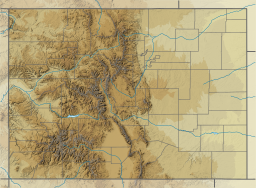
The South Platte River is one of the two principal tributaries of the Platte River. Flowing through the U.S. states of Colorado and Nebraska, it is itself a major river of the American Midwest and the American Southwest/Mountain West. Its drainage basin includes much of the eastern flank of the Rocky Mountains in Colorado, much of the populated region known as the Colorado Front Range and Eastern Plains, and a portion of southeastern Wyoming in the vicinity of the city of Cheyenne. It joins the North Platte River in western Nebraska to form the Platte, which then flows across Nebraska to the Missouri. The river serves as the principal source of water for eastern Colorado. In its valley along the foothills in Colorado, it has permitted agriculture in an area of the Colorado Piedmont and Great Plains that is otherwise arid.

The Deschutes River in central Oregon is a major tributary of the Columbia River. The river provides much of the drainage on the eastern side of the Cascade Range in Oregon, gathering many of the tributaries that descend from the drier, eastern flank of the mountains. The Deschutes provided an important route to and from the Columbia for Native Americans for thousands of years, and then in the 19th century for pioneers on the Oregon Trail. The river flows mostly through rugged and arid country, and its valley provides a cultural heart for central Oregon. Today the river supplies water for irrigation and is popular in the summer for whitewater rafting and fishing.

Lake Mead is a reservoir formed by the Hoover Dam on the Colorado River in the Southwestern United States. It is located in the states of Nevada and Arizona, 24 mi (39 km) east of Las Vegas. It is the largest reservoir in the US in terms of water capacity. Lake Mead provides water to the states of Arizona, California, and Nevada as well as some of Mexico, providing sustenance to nearly 20 million people and large areas of farmland.
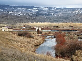
Muddy Creek is a tributary of the Colorado River, approximately 60.5 miles (97.4 km) long, in north central Colorado in the United States.

Flaming Gorge Reservoir is the largest reservoir in Wyoming, on the Green River, impounded behind the Flaming Gorge Dam. Construction on the dam began in 1958 and was completed in 1964. The reservoir stores 3,788,900 acre-feet (4.6735×10⁹ m3) of water when measured at an elevation of 6,040 feet (1,841 m) above sea-level (maximum).

Lake Oroville is a reservoir formed by the Oroville Dam impounding the Feather River, located in Butte County, northern California. The lake is situated 5 miles (8 km) northeast of the city of Oroville, within the Lake Oroville State Recreation Area, in the western foothills of the Sierra Nevada. Known as the second-largest reservoir in California, Lake Oroville is treated as a keystone facility within the California State Water Project by storing water, providing flood control, recreation, freshwater releases to assist in controlling the salinity intrusion into the Sacramento-San Joaquin Delta and protecting fish and wildlife.

Curecanti National Recreation Area is a National Park Service unit located on the Gunnison River in western Colorado. Established in 1965, Curecanti National Recreation Area is responsible for developing and managing recreational facilities on three reservoirs, Blue Mesa Reservoir, Morrow Point Reservoir and Crystal Reservoir, constructed on the upper Gunnison River in the 1960s by the U.S. Bureau of Reclamation to better utilize the vital waters of the Colorado River and its major tributaries. A popular destination for boating and fishing, Curecanti offers visitors two marinas, traditional and group campgrounds, hiking trails, boat launches, and boat-in campsites. The state's premiere lake trout and Kokanee salmon fisheries, Curecanti is a popular destination for boating and fishing, and is also a popular area for ice-fishing in the winter months.

Stevens Creek Reservoir is an artificial lake located in the foothills of the Santa Cruz Mountains near Cupertino, California. A 1,063-acre (430 ha) county park surrounds the reservoir and provides limited fishing, picnicking, hiking, and horseback riding activities. Although swimming is not allowed, non-power boating is allowed for certain parts of the year. No powered boats or jet skis are allowed. All vessels must be inspected for invasive Quagga mussels prior to launch.

Isabella Dam is an embankment dam located in the Kern River Valley, about halfway down the Kern River course, between the towns of Kernville and Lake Isabella in Kern County, California.

The Whiskeytown–Shasta–Trinity National Recreation Area is a United States National Recreation Area in northern California. The recreation area was authorized in 1965 by the United States Congress. Recreational activities available include swimming, fishing, boating, camping, and hiking.

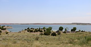
Blue Mesa Reservoir is an artificial reservoir located on the upper reaches of the Gunnison River in Gunnison County, Colorado. The largest lake located entirely within the state, Blue Mesa Reservoir was created by the construction of Blue Mesa Dam, a 390 feet (120 m) tall earthen fill dam constructed on the Gunnison by the U.S. Bureau of Reclamation in 1966 for the generation of hydroelectric power. Managed as part of the Curecanti National Recreation Area, a unit of the National Park Service, Blue Mesa Reservoir is the largest lake trout and Kokanee salmon fishery in Colorado.

Spruce Run Recreation Area is a 1,290-acre (5.2 km2) New Jersey state recreation area located in Union Township and Clinton Township in Hunterdon County, New Jersey, United States. It encompasses the Spruce Run Reservoir that is used as a backup reservoir to protect the state from prolonged droughts. The reservoir is the third largest in the state, after Round Valley and Wanaque Reservoir. The reservoir is used for recreation purposes, including hunting, fishing, boating and swimming.

Englebright Lake is an 815 acre reservoir on the Yuba River, impounded by Englebright Dam, in the Sierra Nevada, Northern California, United States. The reservoir stores 45,000 acre feet of water with nearly 24 miles of shoreline.
The Central Utah Project is a US federal water project that was authorized for construction under the Colorado River Storage Project Act of April 11, 1956, as a participating project. In general, the Central Utah Project develops a portion of Utah's share of the yield of the Colorado River, as set out in the Colorado River Compact of 1922.

The Prineville Reservoir is in the high desert hills of Central Oregon, Oregon, United States. The reservoir is on the Crooked River 14 miles (22.5 km) southeast of Prineville, and 29 miles (46.7 km) east of Bend. This reservoir is a popular retreat for most of Central Oregon. It is near the geographic center of Oregon. Prineville Reservoir State Park is managed by the Oregon Parks and Recreation Department.

Scofield Reservoir is a 2,815-acre (11.39 km2) reservoir impounded by Scofield Dam, in Carbon County, Utah. Located on the Price River, a tributary of the Green River, Scofield Reservoir is adjacent to the northernmost boundary of the Manti–La Sal National Forest. The reservoir sits at an elevation of 7,618 feet (2,322 m), on the northern edge of the Wasatch Plateau. Utah State Route 96 runs along the western shoreline.

Anderson Lake, also known as Anderson Reservoir, is an artificial lake in Morgan Hill, located in southern Santa Clara County, California. The reservoir is formed by the damming of Coyote Creek just below its confluence with Las Animas Creek. A 4,275-acre (1,730 ha) county park surrounds the reservoir and provides limited fishing, picnicking, and hiking activities. Although swimming is prohibited, boating, water-skiing, and jet-skiing are permitted in the reservoir.
Lake Pueblo State Park is a state park located in Pueblo County, Colorado. It includes 60 miles (97 km) of shoreline and 10,000 acres (40 km2) of land. Activities it offers include two full-service marinas, recreational fishing, hiking, camping and swimming at a special swim beach.

Camanche Reservoir is an artificial lake in the San Joaquin Valley in California in the United States, at the juncture of Amador, Calaveras, and San Joaquin counties. Its waters are impounded by Camanche Dam, which was completed in 1963. Camanche Reservoir is a source of water for industrial and municipal purposes and also provides flood control.

Rollins Dam is a dam on the border of Nevada and Placer counties in northern California, in the United States.