Related Research Articles

Clinton County is a county in the north-easternmost corner of the state of New York, in the United States and bordered by the Canadian province of Quebec. It is the northeastern most county in New York. As of the 2020 United States Census, the population was 79,843. Its county seat is the city of Plattsburgh. The county lies just south of the border with the Canadian province of Quebec and to the west of the State of Vermont. The county is named for George Clinton, the first Governor of New York, who later was elected as Vice President. He had been a Founding Father who represented New York in the Continental Congress. Clinton County comprises the Plattsburgh, New York Micropolitan statistical area. The county is part of the North Country region of the state.
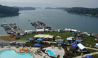
Smith Mountain Lake is a large reservoir in the Roanoke Region of Virginia, United States, located southeast of the City of Roanoke and southwest of Lynchburg. The lake was created in 1963 by the Smith Mountain Dam impounding the Roanoke River. The majority of the south shore of the lake lies in Franklin County while a small portion, including access to the dam, lies in Pittsylvania County. Bedford County makes up the northern half of the lake with the Roanoke River as the dividing line. The lake has become a popular recreation spot and has also experienced significant development in the last decade. It is the largest lake contained entirely within the Commonwealth of Virginia.

The Missisquoi River is a transboundary river of the east shore of Lake Champlain, approximately 80 miles (130 km) long, in northern Vermont in the United States and southern Quebec in Canada.
The Hanging Hills of south central Connecticut, United States, are a range of mountainous trap rock ridges overlooking the city of Meriden and the Quinnipiac River Valley 900 feet (274 m) below. They are a subrange of the narrow, linear Metacomet Ridge that extends from Long Island Sound near New Haven, Connecticut, north through the Connecticut River Valley of Massachusetts to the Vermont border. The range is also a subrange of the Appalachian Mountains. A popular outdoor recreation resource, the range is known for its microclimate ecosystems, rare plant communities, and expansive views from cliffs that rise abruptly over 700 feet (213 m) above the surrounding landscape. The Hanging Hills encompass the 1,800-acre (7.3 km2) Hubbard Park, designed with the help of landscape architect Frederick Law Olmsted. The 51 mile (80k) Metacomet Trail traverses the range.
Ragged Mountain, est. 761 feet (232 m), is a traprock mountain ridge located 3 miles (5 km) west of New Britain, Connecticut, in the towns of Southington and Berlin, Connecticut. It is part of the narrow, linear Metacomet Ridge that extends from Long Island Sound near New Haven, Connecticut, north through the Connecticut River Valley of Massachusetts to the Vermont border. The mountain, a popular hiking and rock climbing attraction located between metropolitan Hartford and Meriden, is known for expansive vistas, vertical cliff faces, mountain ridge reservoirs, unique microclimate ecosystems, and rare plant communities. Ragged Mountain is traversed by the 51-mile (82 km) Metacomet Trail.

Jericho Mountain State Park is located in the White Mountains in Berlin, New Hampshire, United States. The park offers trail riding for ATV, UTV, trail bike, and snowmobile enthusiasts, as well as camping, swimming, fishing, canoeing, and picnicking at Jericho Lake.

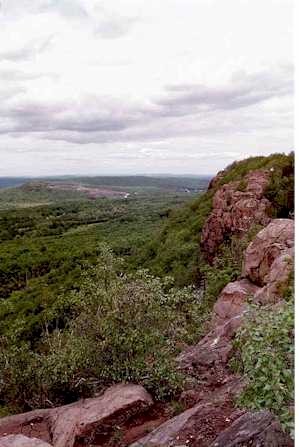
Haystack Mountain is located in Wilmington, Vermont, and is part of the Green Mountains mountain range. It has a summit of 3,445 feet and shares a ridgeline with neighboring Mt. Snow to the north. Haystack is “[a] mountain with a sharp summit cone and a broad, deep lake just under the precipitous peak. The view is a wide and complete panorama.” According to the 2015 Wilmington Municipal Plan, “Haystack Mountain and the ridgeline which forms the spine of the Green Mountain National Forest are prominent landforms. They provide a dramatic scenic impact from many viewpoints in Wilmington. Haystack Mountain boasts numerous hiking trails to the summit, capturing a broad vista of the valley below.” In his 1861 report, Edward Hitchcock described Haystack Mountain as, “one of the wildest, most rugged, and imposing peaks in Southern Vermont.”
Talcott Mountain of central Connecticut, with a high point of 950 feet (290 m), is a 13-mile (21 km) long trap rock mountain ridge located 6 miles (10 km) west of the city of Hartford. The ridge, a prominent landscape feature, forms a continuous line of exposed western cliffs visible across the Farmington River valley from Farmington to Simsbury. Talcott Mountain is part of the narrow, linear Metacomet Ridge that extends from Long Island Sound near New Haven, Connecticut, north through the Connecticut River Valley of Massachusetts to the Vermont border.

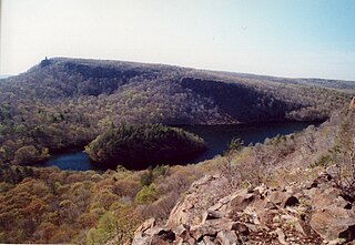
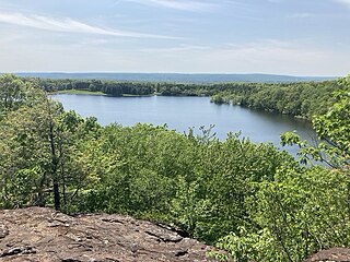
Totoket Mountain, with a high point of (est.) 720 ft (220 m) above sea level, is a traprock massif with several distinct summits, located 7 mi (11 km) northeast of New Haven, Connecticut. It is part of the Metacomet Ridge that extends from the Long Island Sound near New Haven, north through the Connecticut River Valley of Massachusetts to the Vermont border. Totoket Mountain is known for its 500 ft-high (150 m) scenic cliffs, microclimate ecosystems, rare plant communities, and for Lake Gaillard, a 2.5 mi-wide (4.0 km) public reservoir nearly enclosed by the mountain. The north ridge of Totoket Mountain is traversed by the 50 mi (80 km) Mattabesett Trail and a significant network of shorter trails. The name "Totoket Mountain" applies to both the entire mountain and to a subordinate northwestern peak.
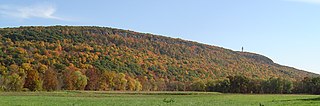
Higby Mountain or Mount Higby 892 feet (272 m), is a traprock mountain ridge located 3.75 miles (6.04 km) east of Meriden, Connecticut. It is part of the narrow, linear Metacomet Ridge that extends from Long Island Sound near New Haven, Connecticut, north through the Connecticut River Valley of Massachusetts to the Vermont border. Higby Mountain is known for its high cliff faces, unique microclimate ecosystems, and rare plant communities. It rises steeply 600 feet (180 m) above the Quinnipiac River valley and the city of Meriden to the west as a continuous 2-mile (3 km) long ledge. The mountain is traversed by the 50-mile (80 km) Mattabesett Trail.

Saltonstall Mountain, also known as Saltonstall Ridge, with a high point of (est.) 320 feet (98 m) above sea level, is a traprock mountain ridge located 3 miles (5 km) east of New Haven, Connecticut and 1.75 miles (2.8 km) north of Long Island Sound. It is part of the Metacomet Ridge that extends from Long Island Sound near New Haven, Connecticut, north through the Connecticut River Valley of Massachusetts to the Vermont border. Saltonstall Mountain is known for its 100 foot (30 m) scenic cliff faces and sharp ridgeline, unique microclimate ecosystems, rare plant communities, and for Lake Saltonstall, a 3 miles (5 km) long by 0.3 miles (400 m) wide municipal reservoir nearly enclosed by the mountain. Saltonstall Mountain is traversed by a number of hiking trails managed by the South Central Connecticut Regional Water Authority (SCCRWA) and Branford Land Trust.

Lake Rescue is located in Windsor County of south central Vermont, in the northeastern United States. Occupying 180 acres (73 ha) and reaching depths of 95 feet (29 m), it is the tenth-deepest and 23rd-largest lake in the state. Lake Rescue is located along VT Route 100 about three miles north of Ludlow and Okemo Mountain, and it is surrounded by the town of Ludlow. The lake is fed by the Black River and is the third of four lakes extending from Plymouth, Vermont through Ludlow, with Lake Amherst and Echo Lake to the north and Lake Pauline to the south. The northern section of the lake, connected to the main body via a shallow channel, is referred to as Round Pond.
References
- ↑ Gresser, Joseph (July 11, 2018). "Swimming at Chrystal Lake resumes after E. coli scare". The Chronicle. Barton, Vermont. pp. 11A.