
South Burlington is a city in Chittenden County, Vermont, United States. As of the 2010 U.S. Census, the population of the city was 17,904. It is home to the headquarters of Ben & Jerry's and Vermont's largest mall, the University Mall. It is also one of the principal municipalities of the Burlington, Vermont metropolitan area.

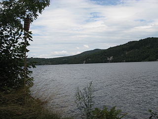
Elmore is a town in Lamoille County, Vermont, United States. The town was named for Colonel Samuel Elmore, a landowner. The population was 849 at the 2000 census. Elmore contains East Elmore, Lake Elmore, and Elmore State Park, a 700-acre (2.8 km2) recreational area surrounding the 219-acre (0.9 km2) lake.
Lake St. Catherine State Park is a 117-acre (0.5 km2) state park located in Poultney, Vermont on the northern end of Lake Saint Catherine.
Northwood Lake is a 653-acre (2.64 km2) water body located in Rockingham and Merrimack counties in central New Hampshire, United States, in the towns of Northwood and Epsom. The town of Deerfield occupies part of the southern shore. The outlet of the lake is the Little Suncook River, flowing west to the Suncook River, a tributary of the Merrimack River.
Crystal Lake is near the village of Barton in Orleans County, Vermont. It is a glacial lake 3 by 1 mile and 100 feet (30 m) deep in places. Route 5 runs along the lake's western shore. Crystal Lake is in the northeast section of the state of Vermont. The lake is owned by the state and managed by the Department of Environmental Conservation.
Elmore State Park is a state park located in Elmore, Vermont, United States. It includes Lake Elmore and Elmore Mountain, and has day-use facilities for picnicking, hiking, and water-based activities, and a 59-site campground. Some of its facilities were developed in the 1930s by the Civilian Conservation Corps; for these, it was listed on the National Register of Historic Places in 2002. The park is open seasonally between Memorial Day and Columbus Day; fees are charged for day use and camping.

Silver Lake State Park is a 35-acre state park located near Barnard, Vermont. It is situated on the northern shoreline of 84-acre Silver Lake and offers swimming, picnic areas and camping. Other activities include fishing, paddling and winter sports.

Lake Rescue is located in Windsor County of south central Vermont, in the northeastern United States. Occupying 180 acres (73 ha) and reaching depths of 95 feet (29 m), it is the tenth-deepest and 23rd-largest lake in the state. Lake Rescue is located along VT Route 100 about three miles north of Ludlow and Okemo Mountain, and it is surrounded by the town of Ludlow. The lake is fed by the Black River and is the third of four lakes extending from Plymouth, Vermont through Ludlow, with Lake Amherst and Echo Lake to the north and Lake Pauline to the south. The northern section of the lake, connected to the main body via a shallow channel, is referred to as Round Pond.

Townshend Dam is a dam in Townshend, Windham County, Vermont.
Woods Island State Park is a state park on Lake Champlain in Vermont. The park comprises the 125-acre Woods Island, and is located off St. Albans Point in Franklin County, Vermont. It is administered by the Vermont Department of Forests, Parks, and Recreation, as part of the Vermont State Park system. The park can only be reached by boat, and visitors must make their own arrangements to get there. There is no dock.
Groton State Forest covers 26,164 acres (105.88 km2) in Danville, Groton, Marshfield, Orange, Peacham, Plainfield, Topsham, Vermont. The forest covers areas in Caledonia, Orange, and Washington Counties. Major roads through the forest are U.S. Route 302 and Vermont Route 232.

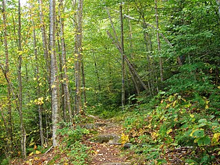
New Discovery State Park is a state park near Marshfield, Vermont in the United States. It is one of seven state parks located in Groton State Forest. The park is on Vermont Route 232, offering camping, picnicking, and access to forest trails. The park was developed in the 1930s by the Civilian Conservation Corps; its major CCC-built facilities, located mainly in western Peacham, were listed on the National Register of Historic Places in 2002.
Bomoseen State Park is a 3,576-acre state park in the towns of Castleton, Fair Haven, Hubbarton and Benson, Vermont. The park is located in the Taconic Mountains on the western shore of Lake Bomoseen.
Mount Ascutney State Park is a state park in the U.S. state of Vermont. The park entrance is located along Vermont Route 44-A near the town of Windsor in Windsor County. Operated by the Vermont Department of Forests, Parks and Recreation, the park is listed on the National Register of Historic Places.
Putnam State Forest, officially known as C.C. Putnam State Forest, covers 13,633 acres (55.17 km2) in Lamoille and Washington County in Vermont. The forest is managed by the Vermont Department of Forests, Parks, and Recreation in parts of Stowe, Elmore, Waterbury, Worcester and Middlesex.

Willoughby State Forest covers 7,682 acres (31.09 km2) in Newark, Sutton and Westmore in Caledonia and Orleans counties in Vermont. The forest is managed by the Vermont Department of Forests, Parks, and Recreation. Activities include hiking, primitive camping, cross country skiing, snowshoeing, hunting and fishing.
Rupert State Forest covers 363 acres (1.47 km2) in Rupert, Vermont in Bennington County. The forest is managed by the Vermont Department of Forests, Parks, and Recreation. It consists of two parcels located on the Rupert-Dorset town line that were a gift to the state in 1959, along with another 27 acres from the state in 2013.
Okemo State Forest covers 7,466 acres (30.21 km2) in Andover, Ludlow, Mount Holly and Weston, Vermont in Windsor and Rutland Counties. Okemo Mountain Resort is located in the forest. The forest is managed by the Vermont Department of Forests, Parks, and Recreation.

Mount Mansfield State Forest covers 44,444 acres (179.86 km2) in seven towns in Chittenden, Lamoille and Washington counties in Vermont. The towns are Bolton and Underhill in Chittenden County, Cambridge, Johnson, Morristown and Stowe in Lamoille County, and Waterbury in Washington County. Mt. Mansfield State Forest is the largest contiguous landholding owned by the Vermont Department of Forests, Parks and Recreation.

