Clifton, Colorado

Last updated

Clifton, Colorado
Clifton, Colorado.JPG
F Road (U.S. Route 6) in Clifton looking toward Grand Mesa
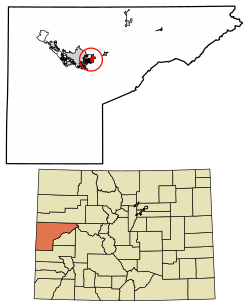
Mesa County Colorado Incorporated and Unincorporated areas Clifton Highlighted 0815165.svg
Usa edcp location map.svg
Red pog.svg
Clifton
Location in the United States
Coordinates: 39°04′35″N108°27′38″W / 39.07639°N 108.46056°W / 39.07639; -108.46056 (Clifton CDP, Colorado) [1]
Country Flag of the United States.svg  United States
State Flag of Colorado.svg  Colorado
County Mesa County
Government
[1]
  Type unincorporated town
Area
[2]
  Total6.061 sq mi (15.70 km2)
  Land5.988 sq mi (15.51 km2)
  Water0.073 sq mi (0.19 km2)
Elevation
[1] /
4,724 ft (1,440 m)
Population
 (2020) [3]
  Total20,413
  Density3,409.0/sq mi (1,316.2/km2)
Time zone UTC-7 (MST)
  Summer (DST) UTC-6 (MDT)
ZIP Codes [4]
81520 (Clifton)
81504 (Grand Junction)
Area code 970
GNIS feature 2407634 [1]

Clifton is a census-designated place (CDP) and post office in and governed by Mesa County, Colorado, United States. It is part of the Grand Junction, CO Metropolitan Statistical Area. [5] The Clifton post office has the ZIP Code 81520. [4] As of the 2020 census, the population of the Clifton CDP was 20,413. [3]

Contents

History

The Clifton Post Office has been in operation since 1900. [6] The community was named for cliffs near the town site. [7]

Geography

Clifton is in central Mesa County, bordered to the west by the city of Grand Junction and to the northwest by unincorporated Fruitvale. The Colorado River forms the southern edge of the community. U.S. Route 6 passes through the center of Clifton, leading west 6 miles (10 km) to the center of Grand Junction and east the same distance to Palisade. Interstate 70 passes along the northern edge of Clifton, with access from Exit 37 (I-70 Business). Colorado State Highway 141 leads south from US 6, 5 miles (8 km) to U.S. Route 50. The Clifton CDP has an area of 6.1 square miles (16 km2), of which 0.07 square miles (0.18 km2), or 1.20%, are water. [2]

Demographics

Clifton CDP, Colorado
YearPop.±%
1970 5,223    
1980 6,597+26.3%
1990 12,671+92.1%
2000 12,238−3.4%
2010 19,889+62.5%
2020 20,413+2.6%
Source: United States Census Bureau

The United States Census Bureau initially defined the Clifton CDP for the 1980 United States Census.

See also

Related Research Articles

<span class="mw-page-title-main">Louviers, Colorado</span> Census Designated Place in Colorado, United States

Louviers is an unincorporated town, a post office, and a census-designated place (CDP) located in and governed by Douglas County, Colorado, United States. The CDP is a part of the Denver–Aurora–Lakewood, CO Metropolitan Statistical Area. The Louviers post office has the ZIP Code 80131. At the United States Census 2020, the population of the Louviers CDP was 293.

<span class="mw-page-title-main">Sedalia, Colorado</span> Census Designated Place in Colorado, United States

Sedalia is an unincorporated town, a post office, and a census-designated place (CDP) located in and governed by Douglas County, Colorado, United States. The CDP is a part of the Denver–Aurora–Lakewood, CO Metropolitan Statistical Area. The Sedalia post office has the ZIP Code 80135. At the United States Census 2020, the population of the Sedalia CDP was 177.

<span class="mw-page-title-main">Edwards, Colorado</span> Census Designated Place in Colorado, United States

Edwards is an unincorporated town, a post office, and a census-designated place (CDP) located in and governed by Eagle County, Colorado, United States. Edwards is the principal town of the Edwards, CO Micropolitan Statistical Area. The Edwards post office has the ZIP Code 81632. At the United States Census 2020, the population of the Edwards CDP was 11,246. The Edwards Metropolitan District provides services.

<span class="mw-page-title-main">Battlement Mesa, Colorado</span> Ceneus-designated place in Garfield County, Colorado, United States

Battlement Mesa is a census-designated place (CDP) and post office in and governed by Garfield County, Colorado, United States. The CDP is a part of the Glenwood Springs, CO Micropolitan Statistical Area. The Battlement Mesa post office has the ZIP Codes 81635 and 81636. At the United States Census 2020, the population of the Battlement Mesa CDP was 5,438. The Battlement Mesa Metropolitan District provides services.

<span class="mw-page-title-main">Kittredge, Colorado</span> Census Designated Place in Colorado, United States

Kittredge is an unincorporated town, a post office, and a census-designated place (CDP) located in and governed by Jefferson County, Colorado, United States. The CDP is a part of the Denver–Aurora–Lakewood, CO Metropolitan Statistical Area. The Kittredge post office has the ZIP code 80457. At the United States Census 2020, the population of the Kittredge CDP was 1,308.

<span class="mw-page-title-main">Atwood, Colorado</span> Census Designated Place in Colorado, United States

Atwood is an unincorporated town, a post office, and a census-designated place (CDP) located in and governed by Logan County, Colorado, United States. The CDP is a part of the Sterling, CO Micropolitan Statistical Area. The Atwood post office has the ZIP Code 80722. At the United States Census 2020, the population of the Atwood CDP was 138.

<span class="mw-page-title-main">Fruitvale, Colorado</span> Census-designated place in Colorado, United States

Fruitvale is a census-designated place (CDP) in and governed by Mesa County, Colorado, United States. It is part of the Grand Junction, CO Metropolitan Statistical Area. The population was 8,271 at the 2020 census, up from 7,675 in 2010. The Grand Junction post office serves Fruitvale postal addresses.

<span class="mw-page-title-main">Orchard Mesa, Colorado</span> Census-designated places in Mesa County, United States

Orchard Mesa is a census-designated place (CDP) in and governed by Mesa County, Colorado, United States. It is part of the Grand Junction, CO Metropolitan Statistical Area. The population of the Orchard Mesa CDP was 6,688 at the 2020 census. The Grand Junction post office serves the area.

<span class="mw-page-title-main">Redlands, Colorado</span> Census-designated place in Colorado, United States

Redlands is an unincorporated community and census-designated place (CDP) located in and governed by Mesa County, Colorado, United States. It is part of the Grand Junction, CO Metropolitan Statistical Area. The population of the Redlands CDP was 9,061 at the 2020 census. The Grand Junction post office serves the area.

<span class="mw-page-title-main">Loma, Colorado</span> Census-designated place in Colorado, United States

Loma is an unincorporated town, post office, and census-designated place (CDP) located in and governed by Mesa County, Colorado, United States. It is part of the Grand Junction, CO Metropolitan Statistical Area. The Loma post office has the ZIP Code 81524. At the 2020 census, the population of the Loma CDP was 1,314.

<span class="mw-page-title-main">Conejos, Colorado</span> Census Designated Place in Colorado, United States

Conejos is an unincorporated town, a post office, a census-designated place (CDP), and the county seat of Conejos County, Colorado, United States. The Conejos post office has the ZIP Code 81129. At the United States Census 2020, the population of the Conejos CDP was 46. Conejos is the only unincorporated county seat in the State of Colorado.

<span class="mw-page-title-main">Cope, Colorado</span> Census Designated Place in Colorado, United States

Cope is an unincorporated town, a post office, and a census-designated place (CDP) located in and governed by Washington County, Colorado, United States. The population was 53 at the 2020 census. The Cope post office has the ZIP Code 80812.

<span class="mw-page-title-main">Gardner, Colorado</span> Census-designated place in Huerfano County, Colorado, United States

Gardner is a census-designated place (CDP) and post office in and governed by Huerfano County, Colorado, United States. The Gardner post office has the ZIP Code 81040. At the United States Census 2020, the population of the Gardner CDP was 106.

<span class="mw-page-title-main">Howard, Colorado</span> Census-designated place in Fremont County, Colorado, United States

Howard is a census-designated place (CDP) and post office in and governed by Fremont County, Colorado, United States. The CDP is a part of the Cañon City, CO Micropolitan Statistical Area. The Howard post office has the ZIP Code 81233. At the United States Census 2020, the population of the Howard CDP was 852.

<span class="mw-page-title-main">Joes, Colorado</span> Census-designated place in Yuma County, Colorado, United States

Joes is a census-designated place (CDP) and post office in and governed by Yuma County, Colorado, United States. The Joes post office has the ZIP Code 80822. At the United States Census 2020, the population of the Joes CDP was 82.

<span class="mw-page-title-main">McCoy, Colorado</span> Census Designated Place in Colorado, United States

McCoy is an unincorporated town, a census-designated place (CDP), and a post office located in and governed by Eagle County, Colorado, United States. The CDP is a part of the Edwards, CO Micropolitan Statistical Area. The McCoy post office has the ZIP Code 80463. At the United States Census 2020, the population of the McCoy CDP was 30.

<span class="mw-page-title-main">Orchard, Colorado</span> Unincorporated community in Colorado, United States

Orchard is an unincorporated town, a post office, and a census-designated place (CDP) located in and governed by Morgan County, Colorado, United States. The CDP is a part of the Fort Morgan, CO Micropolitan Statistical Area. The Orchard post office has the ZIP Code 80649. As of the 2020 census, the population of the Orchard CDP was 76.

<span class="mw-page-title-main">Weldona, Colorado</span> Census Designated Place in Colorado, United States

Weldona is an unincorporated town, a post office, and a census-designated place (CDP) located in and governed by Morgan County, Colorado, United States. The CDP is a part of the Fort Morgan, CO Micropolitan Statistical Area. The Weldona post office has the ZIP Code 80653. At the United States Census 2020, the population of the Weldona CDP was 113.

<span class="mw-page-title-main">Wolcott, Colorado</span> Census Designated Place in Colorado, United States

Wolcott is an unincorporated town, a post office, and a census-designated place (CDP) located in and governed by Eagle County, Colorado, United States. The CDP is a part of the Edwards, CO Micropolitan Statistical Area. The Wolcott post office has the ZIP Code 81655. At the United States Census 2020, the population of the Wolcott CDP was 20.

<span class="mw-page-title-main">El Moro, Colorado</span> Census Designated Place in Colorado, United States

El Moro is an unincorporated community and a census-designated place (CDP) located in and governed by Las Animas County, Colorado, United States. The population of the El Moro CDP was 216 at the United States Census 2020. The Trinidad post office serves the area.

References

  1. 1 2 3 4 U.S. Geological Survey Geographic Names Information System: Clifton, Colorado
  2. 1 2 "2022 U.S. Gazetteer Files: Colorado". United States Census Bureau. Retrieved November 28, 2022.
  3. 1 2 "P1. Race – Clifton CDP, Colorado: 2020 DEC Redistricting Data (PL 94-171)". U.S. Census Bureau. Retrieved November 28, 2022.
  4. 1 2 "Look Up a ZIP Code". United States Postal Service . Retrieved December 24, 2020.
  5. "Clifton is considered a suburb of Grand Junction" . Retrieved October 20, 2023.
  6. "Post offices". Jim Forte Postal History. Archived from the original on March 6, 2016. Retrieved June 24, 2016.
  7. Dawson, John Frank. Place names in Colorado: why 700 communities were so named, 150 of Spanish or Indian origin. Denver, CO: The J. Frank Dawson Publishing Co. p. 14.