Mesa, Colorado | |
|---|---|
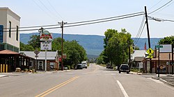 Looking towards the Grand Mesa in Mesa on Highway 65 | |
 Mesa  Mesa | |
| Coordinates: 39°09′59″N108°08′20″W / 39.16639°N 108.13889°W | |
| Country | |
| State | |
| County | Mesa [1] |
| Elevation | 5,643 ft (1,720 m) |
| Time zone | UTC-7 (MST) |
| • Summer (DST) | UTC-6 (MDT) |
| ZIP code [2] | 81643 |
| Area code | 970 |
| GNIS feature ID | 174463 [1] |
Mesa is an unincorporated community in Mesa County, Colorado, United States.
