Cascade-Chipita Park CDP, Colorado | |
|---|---|
 Cascade, Colorado | |
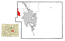 Location of the Cascade-Chipita Park CDP in El Paso County, Colorado | |
 Cascade‑Chipita Park CDP Location of the Cascade‑Chipita Park CDP, Colorado.  Cascade‑Chipita Park CDP Cascade‑Chipita Park CDP (Colorado) | |
| Coordinates: 38°53′48″N104°58′20″W / 38.8967°N 104.9722°W [1] | |
| Country | United States |
| State | Colorado |
| County | El Paso [2] |
| Government | |
| • Type | unincorporated communities |
| • Body | El Paso County [2] |
| Area | |
• Total | 13.461 sq mi (34.864 km2) |
| • Land | 13.452 sq mi (34.841 km2) |
| • Water | 0.0089 sq mi (0.023 km2) |
| Elevation | 7,379 ft (2,249 m) |
| Population | |
• Total | 1,628 |
| • Density | 121.0/sq mi (46.73/km2) |
| Time zone | UTC−07:00 (MST) |
| • Summer (DST) | UTC−06:00 (MDT) |
| ZIP code [5] | Cascade 80809 |
| Area code | 719 |
| GNIS IDs | Cascade 193326 Chipita Park 203531 |
| GNIS CDP ID | 2407982 |
| FIPS code | 08-12325 |
Cascade-Chipita Park is a census-designated place (CDP) comprising the unincorporated communities of Cascade and Chipita Park located in, and governed by, El Paso County, Colorado, United States. The population of the Cascade-Chipita Park CDP was 1,628 at the United States Census 2020. [4] The CDP is a part of the Colorado Springs, CO Metropolitan Statistical Area and the Front Range Urban Corridor. The Cascade, Colorado, post office (Zip Code 80809) serves the area. [5]
