
The Town of Hooper is a Statutory Town located in the San Luis Valley in Alamosa County, Colorado, United States. The population was 81 at the 2020 census.
Alpine is a small community, sometimes considered a ghost town, in Chaffee County, Colorado, United States. It was founded as a mining town. The Alpine post office operated from October 26, 1874, until June 30, 1904.
Altman is an extinct mining town located in Teller County, Colorado, United States. The Altman post office operated from January 18, 1894, until May 30, 1911. Much of the town was destroyed by fire on May 24, 1903.

Howardsville is an unincorporated community in San Juan County, Colorado, United States, along the Animas River at the mouth of Cunningham Creek. Its elevation is 9,748 feet (2,971 m). It is located about two miles from the town of Silverton and 8 miles from the famous ghost town of Animas Forks, and is on the same road as the ghost towns of Middleton and Eureka.

Ironton is an extinct town located in Ouray County, Colorado, United States. It lay south of the present town of Ouray, adjacent to the sites Guston of Red Mountain Town, fellow ghost towns. During the 1880s and 1890s, Ironton formed part of the Red Mountain Pass mining district, the second largest silver mining district in Colorado. The Ironton post office operated from May 2, 1883, until August 2, 1920.
Adelaide is an extinct town located in Fremont County, Colorado, United States. The townsite is located at 38.5600°N 105.0908°W at an elevation of 6,949 feet (2,118 m). Previously known as Robinson, the former mining camp and railroad water is located along the Phantom Canyon Road. The Adelaide Bridge is located just north of the townsite.
Chandler is an extinct coal company town located south of the Lincoln Park area near Cañon City in Fremont County, Colorado, United States. The Chandler post office operated from August 4, 1890, until October 31, 1942.
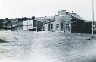
Cameo is an extinct coal mining town located in Mesa County, Colorado, United States. The townsite is located off I-70 Exit 46 at 39.1486°N 108.3209°W at an elevation of 4,787 feet (1,459 m).
Adena is an extinct town located in Morgan County, Colorado, United States. The townsite is located at 40.0083°N 103.8866°W at an elevation of 4,692 feet (1,430 m).
Beshoar is an extinct town located in Las Animas County, Colorado, United States. The townsite is located at 37.2181°N 104.4066°W at an elevation of 5,922 feet (1,805 m).
Bloom is an extinct town located in Otero County, Colorado, United States. The townsite is located at 37.6875°N 103.9566°W at an elevation of 4,800 feet (1,463 m).
Buckingham is an extinct town located in Weld County, Colorado, United States. The townsite is located at 40.6214°N 103.9777°W at an elevation of 4,944 feet (1,507 m).

Franceville was a coal mining town and railroad post office in eastern El Paso County, Colorado, about five miles from the town of Falcon and twelve miles east of Colorado Springs. The Franceville post office operated from November 2, 1881, until May 14, 1894. The town was located on land owned by Matt France. There were 120 people in the town in 1885.
Bijou Basin is an extinct town located in El Paso County, Colorado, United States. The townsite is located at 39.1356°N 104.4569°W at an elevation of 6,398 feet (1,950 m). Travelers could take post road 49 to the settlement. It was located five miles southeast of another early settlement, Sidney.
Edgerton is an extinct town at the confluence of Monument Creek and West Monument Creek eight miles north of present-day Colorado Springs in El Paso County, Colorado, United States. It was across from Black Forest. The Edgerton post office operated from June 16, 1870, until August 28, 1902.
Gwillimsville was a settlement at the head of Cherry Creek and six miles east of Monument in northern El Paso County, Colorado. Its settlers were engaged in dairy, ranching, and timber businesses. The Gwillimsville post office operated from April 18, 1878, until September 25, 1890.
Adelaide is an extinct mining town located in Lake County, Colorado, United States. The site of the former town is located about one mile west of downtown Leadville through Stray Horse Gulch and two-thirds of a mile north of Nugget Gulch.
Baldwin is an extinct coal mining town located in Gunnison County, Colorado, United States. The townsite is located at 38.7639°N 107.0478°W at an elevation of 8,767 feet (2,672 m). The Baldwin post office operated from September 17, 1883, until September 30, 1948.

Holy Cross City is an extinct town located in Eagle County, Colorado, United States. Holy Cross City got its name from Mount of the Holy Cross, located nearby. The Holy Cross post office operated from January 23, 1882, until February 8, 1899, and from December 7, 1904, until August 7, 1905. Presently, the former townsite is located along Holy Cross City Trail within Holy Cross Wilderness, part of White River National Forest. The Mount of the Holy Cross is not visible from the townsite.
Clarkville is an ghost town located in northern Yuma County, Colorado, United States. Founded in 1933, the townsite is located at an intersection where Colorado State Highway 59 curves from East-West to North-South. The Clarkville post office operated from May 18, 1938, until April 30, 1954.

