Chipita Park, Colorado

Last updated
Chipita Park
Unincorporated community

Fountain Creek and Interstate 25 Between Colorado Springs and Pueblo, Colorado (7235133064).jpg

Fountain Creek is a 74.5-mile-long (119.9 km) stream in El Paso and Pueblo counties, in Colorado in the United States. From its source near the city of Woodland Park north of Pikes Peak, the creek flows southeast through the communities of Green Mountain Falls and Chipita Park to the town of Cascade. Locals confusingly refer to it as "Ute Pass", or just "the pass"; but the actual Ute Pass is some 15 miles (24 km) to the west, along US 24.
Etymology: The wife of Chief Ouray
El Paso County Colorado Incorporated and Unincorporated areas Cascade-Chipita Park Highlighted.svg
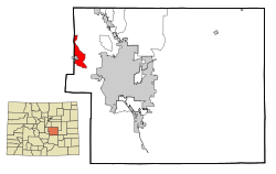
This map shows the incorporated and unincorporated areas in El Paso County, Colorado, highlighting Cascade-Chipita Park in red. It was created with a custom script with US Census Bureau data and modified with Inkscape.
Country United States
State Colorado
Census-designated place Cascade-Chipita Park

Chipita Park is an unincorporated community located in El Paso County, Colorado, named for the wife of Chief Ouray. [1]

Unincorporated area Region of land not governed by own local government

In law, an unincorporated area is a region of land that is not governed by a local municipal corporation; similarly an unincorporated community is a settlement that is not governed by its own local municipal corporation, but rather is administered as part of larger administrative divisions, such as a township, parish, borough, county, city, canton, state, province or country. Occasionally, municipalities dissolve or disincorporate, which may happen if they become fiscally insolvent, and services become the responsibility of a higher administration. Widespread unincorporated communities and areas are a distinguishing feature of the United States and Canada. In most other countries of the world, there are either no unincorporated areas at all, or these are very rare; typically remote, outlying, sparsely populated or uninhabited areas.

El Paso County, Colorado County in the United States

El Paso County is one of the 64 counties of the U.S. state of Colorado. The 2017 census estimate recorded an approximate population of 699,232 for El Paso County. The Census Bureau's 2017 estimate indicates it is the second-most populous county in Colorado, after the City and County of Denver. The county seat is Colorado Springs, the second most populous city in Colorado.

Colorado State of the United States of America

Colorado is a state of the Western United States encompassing most of the southern Rocky Mountains as well as the northeastern portion of the Colorado Plateau and the western edge of the Great Plains. It is the 8th most extensive and 21st most populous U.S. state. The estimated population of Colorado was 5,695,564 on July 1, 2018, an increase of 13.25% since the 2010 United States Census.

Contents

Those who live in the Chipita Park area are also inhabitants of Cascade, Colorado. When receiving mail, they may put Chipita Park or Cascade for the city, as both refer to the Cascade-Chipita Park, Colorado census-designated place.

Cascade, Colorado Unincorporated community in State of Colorado, United States

Cascade is an unincorporated community and U.S. Post Office in El Paso County, Colorado, United States. The ZIP Code of the Cascade Post Office is 80809.

Cascade-Chipita Park, Colorado CDP in State of Colorado, United States

Cascade-Chipita Park is a census-designated place (CDP) in El Paso County, Colorado, United States. The population was 1,655 at the 2010 census.

A census-designated place (CDP) is a concentration of population defined by the United States Census Bureau for statistical purposes only. CDPs have been used in each decennial census since 1980 as the counterparts of incorporated places, such as self-governing cities, towns, and villages, for the purposes of gathering and correlating statistical data. CDPs are populated areas that generally include one officially designated but currently unincorporated small community, for which the CDP is named, plus surrounding inhabited countryside of varying dimensions and, occasionally, other, smaller unincorporated communities as well. CDPs include small rural communities, colonias located along the U.S. border with Mexico, and unincorporated resort and retirement communities and their environs.

Coordinates: 38°55′28″N105°00′24″W / 38.92444°N 105.00667°W / 38.92444; -105.00667

Geographic coordinate system Coordinate system

A geographic coordinate system is a coordinate system that enables every location on Earth to be specified by a set of numbers, letters or symbols. The coordinates are often chosen such that one of the numbers represents a vertical position and two or three of the numbers represent a horizontal position; alternatively, a geographic position may be expressed in a combined three-dimensional Cartesian vector. A common choice of coordinates is latitude, longitude and elevation. To specify a location on a plane requires a map projection.

See also

Front Range Urban Corridor Megaregion of the US in United States ----

The Front Range Urban Corridor is an oblong region of urban population located along the eastern face of the Southern Rocky Mountains, encompassing 18 counties in the US states of Colorado and Wyoming. The corridor derives its name from the Front Range, the mountain range that defines the west central boundary of the corridor. The region comprises the northern portion of the Southern Rocky Mountain Front geographic area, which in turn comprises the southern portion of the Rocky Mountain Front geographic area of Canada and the United States. The Front Range Urban Corridor had an estimated population of 4,833,260 on July 1, 2016, an increase of +11.53% since the 2010 United States Census.

Pikes Peak mountain in the Rocky Mountains, Colorado, United States of America

Pikes Peak is the highest summit of the southern Front Range of the Rocky Mountains, in North America. The ultra-prominent 14,115-foot (4,302.31 m) fourteener is located in Pike National Forest, 12 miles (19 km) west of downtown Colorado Springs, Colorado. The mountain is named in honor of American explorer Zebulon Pike, who was unable to reach the summit. The summit is higher than any point in the United States east of its longitude.

Related Research Articles

Hudspeth County, Texas County in the United States

Hudspeth County is a county located in the U.S. state of Texas. As of the 2010 census, the population was 3,476. Its county seat is Sierra Blanca, and the largest community is Fort Hancock. The county is named for Claude Benton Hudspeth, a state senator and United States Representative from El Paso. It is northeast from the Mexican border.

Teller County, Colorado County in the United States

Teller County is one of the 64 counties in the U.S. state of Colorado. As of the 2010 census, the population was 23,350. The county seat is Cripple Creek, and the most populous city is Woodland Park.

Pueblo County, Colorado County in the United States

Pueblo County is one of the 64 counties in the U.S. state of Colorado. As of the 2010 census, the population was 159,063. The county seat is Pueblo. The county was named for the historic city of Pueblo which took its name from the Spanish language word meaning "town" or "village".

Fremont County, Colorado County in the United States

Fremont County is one of the 64 counties in the U.S. state of Colorado. As of the 2010 census, the population was 46,824. The county seat is Cañon City. The county is named for explorer and presidential candidate John C. Frémont.

Colorados 5th congressional district

Colorado's 5th congressional district is a congressional district in the U.S. state of Colorado. The district lies in the center of the state and comprises Colorado Springs and its suburbs including Cimarron Hills and Fort Carson.

South-Central Colorado is a region of the U.S. state of Colorado. It can be roughly defined by Chaffee County in the northwest, El Paso County in the northeast, Las Animas County in the southeast, and Conejos County in the southwest. Some notable towns and cities there include Colorado Springs, Pueblo, Cripple Creek, Cañon City, Salida, Buena Vista, Monte Vista, Alamosa, Walsenburg, and Trinidad. The landscapes of South-Central Colorado were made known to the Western world by the explorations of Zebulon Pike and Kit Carson, who were later followed by settlers, many of whom came by the Santa Fe Trail. The upper tributaries of the Arkansas River and South Platte River provide ample whitewater rafting and are famous for trout and bass fishing in scenic settings such as Royal Gorge. Much of the local economic system is dependent on mining, forestry, ranching, and tourism related to these endeavors. South-Central Colorado has so far largely escaped urbanization, allowing visitors to experience something of the American Old West.

Colorado Springs metropolitan area human settlement in United States of America

The Colorado Springs, CO Metropolitan Statistical Area is a United States Office of Management and Budget defined Metropolitan Statistical Area (MSA) located in the Colorado Springs region of the State of Colorado. The Census Bureau estimates that the population was 668,353 in 2012, a 3.52% increase since the 2010 United States Census. The Colorado Springs MSA is the 79th most populous MSA in the United States. The Colorado Springs MSA encompasses El Paso County and Teller County, Colorado. Approximately 88.40% percent of the MSA's population live in cities or CDPs. The Colorado Springs Metropolitan Statistical Area is the second most populous component of the Front Range Urban Corridor.

Rush, Colorado Unincorporated community in State of Colorado, United States

Rush is an unincorporated community and a U.S. Post Office located in El Paso County, Colorado, United States. The Rush Post Office has the ZIP Code 80833.

Ellicott, Colorado Census-designated place in Colorado, United States

Ellicott is a census-designated place located in El Paso County, Colorado. The population as of the 2010 Census was 1,131. The U.S. Post Office at Calhan now serves the Ellicott postal address.

Crystola, Colorado Unincorporated community in Colorado, United States

Crystola is an unincorporated community in El Paso and Teller counties, Colorado, United States. ZIP code 80863 serves Crystola, but mail must be addressed to Woodland Park.

Park County was a county of the extralegal United States Territory of Jefferson that existed from November 28, 1859, until February 28, 1861.

Manitou Springs School District 14

Manitou Springs School District 14 is the main school district of Manitou Springs and its nearby communities at the western edge of El Paso County, Colorado.

Colorado State Highway 105 highway in Colorado

State Highway 105 (SH 105) is a state highway that runs partially from I-25 in Monument to SH 67 in Sedalia. The highway serves the communities of Monument and Palmer Lake and the unincorporated areas of Douglas and El Paso counties. Several former sections have been deleted from the state highway system since its inception, thus leading to north and south sections of the current highway.

Boulder Crescent Place Historic District human settlement in United States of America

Boulder Crescent Place Historic District is a historic area in Colorado Springs, Colorado along West Boulder and Cascade Avenue near the intersection of the two streets. It is a National Register of Historic Places listing and is on the Colorado State Register of Historic Properties.

Eastholme place in Colorado listed on National Register of Historic Places

The Eastholme, also known as Eastholme of the Rockies, is a historic building in Cascade, near Colorado Springs, Colorado. It is on the National Register of Historic Places.

Roswell, now annexed into the city of Colorado Springs, Colorado, was a coal mine settlement near the northern bluffs of Colorado Springs and a 19th-century railroad junction. The town was located at roughly the present intersection of Fillmore Street and North Nevada Avenue in Colorado Springs.

Terri Carver American politician

Terri Carver is a state representative from Colorado Springs, Colorado. A Republican, Carver represents Colorado House of Representatives District 20, which encompasses several communities in El Paso County, including Air Force Academy, Cascade, Chipita Park, Colorado Springs, Green Mountain Falls, and Palmer Lake. She was first elected in 2014.

References

  1. "Chipita Park Association: On the threshold of a new era". Chipita Park Association. Retrieved 2012-11-11.