Rush, Colorado

Last updated

Rush, Colorado
Rush, Colorado 2007.jpg
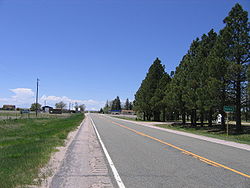
Looking west down Highway 94, Pikes Peak is in the distance
USA Colorado location map.svg
Red pog.svg
Rush
Location in El Paso County and the state of Colorado
Usa edcp location map.svg
Red pog.svg
Rush
Rush (the United States)
Coordinates: 38°50′45″N104°5′32″W / 38.84583°N 104.09222°W / 38.84583; -104.09222
Country Flag of the United States.svg  United States
State Flag of Colorado.svg  State of Colorado
County El Paso County [1]
Elevation
[1]
6,017 ft (1,834 m)
Time zone UTC-7 (MST)
  Summer (DST) UTC-6 (MDT)
ZIP code
80833 [2]
Area code 719
GNIS feature ID 0193570

Rush is an unincorporated community and a U.S. Post Office located in El Paso County, Colorado, United States. The Rush Post Office has the ZIP Code 80833. [2]

Contents

Named for Christopher Rush, a homesteader from Missouri who settled there in 1907. [3]

Education

Miami-Yoder School District 60JT serves Rush.

Geography

Rush is located at 38°50′45″N104°05′32″W / 38.84583°N 104.09222°W / 38.84583; -104.09222 (38.845858,-104.092197), east of Yoder along State Highway 94 about 2 miles (3 km) west of the El Paso, Lincoln County line.

See also

Related Research Articles

<span class="mw-page-title-main">El Paso County, Colorado</span> County in Colorado, United States

El Paso County is a county located in the U.S. state of Colorado. The 2020 Census recorded its population as 730,395. The Census Bureau's 2020 result indicates it is the most populous county in Colorado, surpassing the City and County of Denver. The county seat is Colorado Springs, the second most populous city in Colorado. El Paso County is included in the Colorado Springs, Colorado, Metropolitan Statistical Area and is located in Colorado's 5th congressional district, except for the far eastern extremities, which are located in the 4th.

<span class="mw-page-title-main">Air Force Academy, Colorado</span> Census Designated Place in State of Colorado, United States

The Air Force Academy is a census-designated place (CDP) located in El Paso County, Colorado, United States. The CDP includes the developed portion of the United States Air Force Academy, including the cadet housing facilities. The CDP is a part of the Colorado Springs, CO Metropolitan Statistical Area. The USAF Academy post office (ZIP Codes 80840 and 80841 serves the area. At the United States Census 2020, the population of the Air Force Academy CDP was 6,680.

<span class="mw-page-title-main">Calhan, Colorado</span> Town in Colorado, United States

The Town of Calhan is a statutory town located in El Paso County, Colorado, United States. The town population was 762 at the 2020 United States Census. Calhan is a part of the Colorado Springs, CO Metropolitan Statistical Area and the Front Range Urban Corridor. The town straddles U.S. Highway 24. With Calhan sitting at an elevation of 6,535 feet above sea level, Calhan is the highest non-mountain town in the United States. It is the site of the Calhan Paint Mines Archeological District, a popular natural attraction.

<span class="mw-page-title-main">Woodmoor, Colorado</span> Census Designated Place in Colorado, United States

Woodmoor is an unincorporated community and a census-designated place (CDP) located in and governed by El Paso County, Colorado, United States. The CDP is a part of the Colorado Springs, CO Metropolitan Statistical Area. The population of the Woodmoor CDP was 9,536 at the United States Census 2020. The Monument post office serves the area.

<span class="mw-page-title-main">Williamsburg, Colorado</span> Town in Fremont County, Colorado, United States

Williamsburg is a statutory town located in Fremont County, Colorado, United States. The town population was 731 at the 2020 census. The Florence post office serves Williamsburg.

<span class="mw-page-title-main">Eaton, Colorado</span> Town in Colorado, United States

The Town of Eaton is a Statutory Town located in Weld County, Colorado, United States. The town population was 5,802 at the 2020 United States Census, a +32.92% increase since the 2010 United States Census. Eaton is a part of the Greeley, CO Metropolitan Statistical Area and the Front Range Urban Corridor.

<span class="mw-page-title-main">Hudson, Colorado</span> Town in Colorado, United States

The Town of Hudson is a home rule municipality in Weld County, Colorado, United States. The population was 1,651 at the 2020 census.

<span class="mw-page-title-main">Pierce, Colorado</span> Town in Colorado, United States

Pierce is a Statutory Town in Weld County, Colorado, United States. The population was 1,097 at the 2020 census. The town is a rural agricultural community located on the Colorado Eastern Plains along U.S. Highway 85 north of Greeley.

<span class="mw-page-title-main">Security-Widefield, Colorado</span> Census Designated Place in Colorado, United States

Security-Widefield is a census-designated place (CDP) comprising the unincorporated communities of Security and Widefield located in and governed by El Paso County, Colorado, United States. The CDP is a part of the Colorado Springs, CO Metropolitan Statistical Area. The population of the Security-Widefield CDP was 38,639 at the United States Census 2020. El Paso County governs the unincorporated communities. Both the Colorado Springs post office and the Fountain post office serve the area.

<span class="mw-page-title-main">Cimarron, Colorado</span> Unincorporated community in State of Colorado, United States

Cimarron is an unincorporated rural hamlet in Montrose County, Colorado, United States. It is located on the northern side of U.S. Highway 50, 19 miles from the town of Montrose to its west, and 42 miles from Gunnison, Colorado to its east. There is a store with fuel pumps and a post office at Cimarron. The post office services the rural ZIP Code 81220 area.

Arlington is an unincorporated community and U.S. Post Office in Kiowa County, Colorado, United States. The ZIP Code of the Arlington Post Office is 81021.

<span class="mw-page-title-main">Carr, Colorado</span> Unincorporated community in State of Colorado, United States

Carr is an unincorporated community that used to have a U.S. Post Office in Weld County, Colorado, United States. The ZIP Code of Carr is 80612. Some consider Carr a ghost town. Today, a few old houses remain plus a church and the schoolhouse, but the old store fronts are gone. There are some scattered old foundations throughout the town. There are a growing number of year-round residents, so the town no longer appears abandoned.

<span class="mw-page-title-main">Roggen, Colorado</span> Unincorporated community in Colorado, United States

Roggen is an unincorporated community and a U.S. Post Office in Weld County, Colorado, United States. The Roggen Post Office has the ZIP Code 80652.

<span class="mw-page-title-main">Yoder, Colorado</span> Unincorporated community in Colorado, United States

Yoder is an unincorporated community and a U.S. Post Office located in El Paso County, Colorado, United States. The Yoder Post Office has the ZIP Code 80864.

<span class="mw-page-title-main">Delhi, Colorado</span> Unincorporated community in State of Colorado, United States

Delhi is an unincorporated community in Las Animas County, Colorado, United States. The U.S. Post Office at Model now serves Delhi postal addresses.

North Avondale is an unincorporated community in Pueblo County, Colorado, United States. The U.S. Post Office at Avondale now serves North Avondale postal addresses.

Sopris was an unincorporated community located in Las Animas County, Colorado, United States. The town is now under the surface of Trinidad Lake in Trinidad Lake State Park.

<span class="mw-page-title-main">Ellicott, Colorado</span> Census Designated Place in Colorado, United States

Ellicott is an unincorporated community and a census-designated place (CDP) located in and governed by El Paso County, Colorado, United States. The CDP is a part of the Colorado Springs, CO Metropolitan Statistical Area. The population of the Ellicott CDP was 1,248 at the United States Census 2020. The Calhan post office serves the area.

<span class="mw-page-title-main">Prospect Valley, Colorado</span> Populated Place in Colorado, United States

Prospect Valley is a populated place in Weld County, Colorado, United States. The Post Office at Keenesburg serves the Prospect Valley postal address. SH 52 runs east and west through the community.

<span class="mw-page-title-main">Green Mountain Falls, Colorado</span> Town in Colorado, United States

The Town of Green Mountain Falls is a Statutory Town located in El Paso and Teller counties of the U.S. of State of Colorado. The town population was 646 at the 2020 United States Census with 622 residents in El Paso County and 24 residents in Teller County. Green Mountain Falls is a part of the Colorado Springs, CO Metropolitan Statistical Area and the Front Range Urban Corridor.

References

  1. 1 2 "US Board on Geographic Names". United States Geological Survey. October 25, 2007. Retrieved January 31, 2008.
  2. 1 2 "ZIP Code Lookup" (JavaScript/HTML). United States Postal Service. January 2, 2007. Retrieved January 2, 2007.
  3. Bright, William (2004). Colorado Place Names. Johnson Books. ISBN   9781555663339.