Colorado Springs is a city in and the county seat of El Paso County, Colorado, United States. It is the most populous city in El Paso County, with a population of 478,961 at the 2020 census, a 15.02% increase since 2010. Colorado Springs is the second-most populous city and the most extensive city in the state of Colorado, and the 39th-most-populous city in the United States. It is the principal city of the Colorado Springs metropolitan area and the second-most prominent city of the Front Range Urban Corridor. It is located in east-central Colorado on Fountain Creek, 70 miles (113 km) south of Denver.

El Paso County is the most populous county located in the American state of Colorado. As of the 2020 Census, the population was 730,395, surpassing the City and County of Denver. The county seat is Colorado Springs, the second most populous city in Colorado. El Paso County is included in the Colorado Springs, Colorado, Metropolitan Statistical Area.

Cascade-Chipita Park is a census-designated place (CDP) comprising the unincorporated communities of Cascade and Chipita Park located in and governed by El Paso County, Colorado, United States. The CDP is a part of the Colorado Springs, CO Metropolitan Statistical Area. The population of the Cascade-Chipita Park CDP was 1,628 at the United States Census 2020. The Cascade post office serves the area.
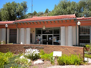
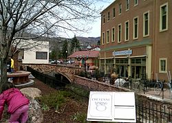
Manitou Springs is a home rule municipality located at the foot of Pikes Peak in western El Paso County, Colorado, United States. The town was founded for its natural mineral springs. The downtown area continues to be of interest to travelers, particularly in the summer, with many shops and restaurants, as well as a creekside city park. The main road through the center of town was one of the direct paths to the base of Pikes Peak. Barr Trail, which winds its way up Pikes Peak, is accessible from town. The subdivision Crystal Hills was added to the municipality in the 1960s.

Woodland Park is a home rule municipality in Teller County, Colorado, United States. Woodland Park is part of the Colorado Springs, CO Metropolitan Statistical Area. Many residents in this bedroom community commute to Colorado Springs. Woodland Park is surrounded by the 1,000,000-acre (400,000 ha) Pike National Forest. The population was 7,920 as of the 2020 Census.

Colorado's 5th congressional district is a congressional district in the U.S. state of Colorado. The district lies in the center of the state and comprises Colorado Springs and its suburbs including Cimarron Hills and Fort Carson.

Cascade is an unincorporated community and U.S. Post Office in El Paso County, Colorado, United States. The ZIP Code of the Cascade Post Office is 80809.

The Widefield School District 3 is a public school district serving parts of western El Paso County, Colorado, United States. It primarily serves Security-Widefield, but it also serves southeastern Colorado Springs, which is where the district office is located.

Chipita Park is an unincorporated community located in El Paso County, Colorado, named for the wife of Chief Ouray.

Before it was founded, the site of modern-day Colorado Springs, Colorado, was part of the American frontier. Old Colorado City, built in 1859 during the Pike's Peak Gold Rush was the Colorado Territory capital. The town of Colorado Springs was founded by General William Jackson Palmer as a resort town. Old Colorado City was annexed into Colorado Springs. Railroads brought tourists and visitors to the area from other parts of the United States and abroad. The city was noted for junctions for seven railways: Denver and Rio Grande (1870), Denver and New Orleans Manitou Branch (1882), Colorado Midland (1886–1918), Colorado Springs and Interurban, Atchison, Topeka, and Santa Fe (1889), Rock Island (1889), and Colorado Springs and Cripple Creek Railways. It was also known for mining exchanges and brokers for the Cripple Creek Gold Rush.

Fountain Creek is a creek that originates in Woodland Park in Teller County and flows through El Paso County to its confluence with the Arkansas River near Pueblo in Pueblo County, Colorado. The 74.5-mile-long (119.9 km) creek, once known as the Fontaine qui Bouille, is a tributary of the Arkansas River.

The Waldo Canyon fire was a forest fire that started approximately 4 miles (6.4 km) northwest of Colorado Springs, Colorado on June 23, 2012, and was declared 100 percent contained on July 10, 2012, after no smoke plumes were visible on a small portion of the containment line on Blodgett Peak. The fire was active in the Pike National Forest and adjoining areas, covering a total of 18,247 acres. The fire had caused the evacuation of over 32,000 residents of Colorado Springs, Manitou Springs and Woodland Park, several small mountain communities along the southwestern side of U.S. Highway 24, and partial evacuation of the United States Air Force Academy. There were 346 homes destroyed by the fire. U.S. Highway 24, a major east–west road, was closed in both directions. The Waldo Canyon Fire resulted in insurance claims totaling more than US $453.7 million. It was the most destructive fire in Colorado state history, as measured by the number of homes destroyed, until the Black Forest Fire surpassed it almost a year later when it consumed 486 homes and damaged 28 others.
Ivywild, Colorado, is a subdivision of Colorado Springs south of the downtown, west of Cascade Avenue and along Cheyenne Creek. As of 2015, the United States Geological Survey defines Ivywild as a Populated Place. It is one of the city's oldest working-class neighborhoods.

Manitou Springs Historic District in Manitou Springs, Colorado is roughly bounded by US 24, Ruxton Avenue, El Paso Boulevard and Iron Mountain Avenue. Listed in the National Register of Historic Places, it is one of the country's largest National Historic Districts.

Cliff House in Manitou Springs, Colorado is a Queen Anne style hotel in the Manitou Springs Historic District. It is a National Register of Historic Places listing. The Cliff House at Pikes Peak is a member of Historic Hotels of America, the official program of the National Trust for Historic Preservation.

Manitou Springs Bridges are historic bridges are located on Park and Canon Avenues over Fountain Creek in Manitou Springs, Colorado. The bridges are on the National Register of Historic Places.

Wheeler Bank is a historic building located on Manitou Avenue in Manitou Springs, Colorado built by Jerome B. Wheeler. It is on the National Register of Historic Places. Over the course of its history, the building has been a financial institution, auditorium and retail business.

Crystal Valley Cemetery is a cemetery located on Plainview Place in Manitou Springs, Colorado. Since its establishment in 1882, it has been the principal cemetery in Manitou Springs. It is listed in the National Register of Historic Places.
Englemann Canyon is a valley along Ruxton Creek, in Manitou Springs, El Paso County, Colorado. It is one of three canyons in Manitou Springs, the others are Ute Pass and Williams Canyon.