Maybell, Colorado

Last updated

Maybell, Colorado
Maybell, Colorado.JPG
The general store in Maybell
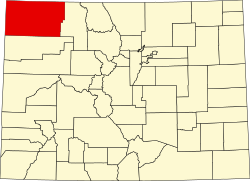
Moffat County Colorado Incorporated and Unincorporated areas Maybell Highlighted 0849325.svg
Usa edcp location map.svg
Red pog.svg
Maybell
Location in the United States
Coordinates: 40°31′08″N108°05′19″W / 40.51889°N 108.08861°W / 40.51889; -108.08861 (Maybell CDP, Colorado) [1]
Country Flag of the United States.svg  United States
State Flag of Colorado.svg  Colorado
County Moffat County
Government
[2]
  Type unincorporated community
Area
[1]
  Total0.525 sq mi (1.36 km2)
  Land0.525 sq mi (1.36 km2)
  Water0.0 sq mi (0 km2)
Elevation
[2]
5,916 ft (1,803 m)
Population
 (2020) [3]
  Total76
  Density144.8/sq mi (55.9/km2)
Time zone UTC-7 (MST)
  Summer (DST) UTC-6 (MDT)
ZIP Code [4]
81640
Area code 970
GNIS feature 2583264 [2]

Maybell is an unincorporated community and census-designated place (CDP) in and governed by Moffat County, Colorado, United States. The CDP is a part of the Craig, CO Micropolitan Statistical Area.

Contents

The Maybell post office has the ZIP Code 81640. [4] At the 2020 census, the population of the Maybell CDP was 76. [3] The coldest ambient air temperature ever recorded in the state of Colorado was −61 °F (−52 °C) at Maybell on February 1, 1985. [5]

History

The village, founded in the 1880s, was named after May Bell, the wife of a local cattleman. It currently consists of a meat processing plant, general store with gas pumps, a garage, an elementary school, a residential hotel, a restaurant, a post office, and housing. The post office, in operation since 1884, serves the ZIP code 81640. [4]

Geography

Maybell is located in central Moffat County, in the valley of the Yampa River along U.S. Highway 40. Craig is 30 miles (48 km) east along US 40, and Dinosaur is 57 miles (92 km) to the west. State Highway 318 leads northwest from Maybell 61 miles (98 km) to the Utah border, passing Browns Park National Wildlife Refuge.

The Maybell CDP has an area of 0.525 square miles (1.360 km2), all land. [1]

Climate

This climatic region is typified by large seasonal temperature differences, with warm to hot (and often humid) summers and cold (sometimes severely cold) winters. The climate of Maybell is a humid continental climate (Dfb).

The coldest ambient air temperature ever recorded in the State of Colorado was −61 °F (−52 °C) at Maybell on February 1, 1985. [5]

Climate data for Maybell, Colorado, 1991–2020 normals: 5944ft (1812m)
MonthJanFebMarAprMayJunJulAugSepOctNovDecYear
Record high °F (°C)56
(13)
66
(19)
75
(24)
82
(28)
91
(33)
96
(36)
102
(39)
98
(37)
94
(34)
87
(31)
70
(21)
61
(16)
102
(39)
Mean maximum °F (°C)46
(8)
51
(11)
65
(18)
75
(24)
83
(28)
91
(33)
94
(34)
93
(34)
86
(30)
77
(25)
63
(17)
50
(10)
94
(34)
Average high °F (°C)31.5
(−0.3)
36.7
(2.6)
48.4
(9.1)
57.6
(14.2)
67.9
(19.9)
79.2
(26.2)
86.2
(30.1)
83.9
(28.8)
75.1
(23.9)
60.8
(16.0)
45.5
(7.5)
33.0
(0.6)
58.8
(14.9)
Daily mean °F (°C)16.2
(−8.8)
21.9
(−5.6)
33.1
(0.6)
41.1
(5.1)
50.3
(10.2)
59.4
(15.2)
66.5
(19.2)
64.5
(18.1)
55.4
(13.0)
42.5
(5.8)
29.6
(−1.3)
18.2
(−7.7)
41.6
(5.3)
Average low °F (°C)0.9
(−17.3)
7.1
(−13.8)
17.7
(−7.9)
24.6
(−4.1)
32.8
(0.4)
39.5
(4.2)
46.7
(8.2)
45.2
(7.3)
35.6
(2.0)
24.2
(−4.3)
13.6
(−10.2)
3.4
(−15.9)
24.3
(−4.3)
Mean minimum °F (°C)−25
(−32)
−18
(−28)
−1
(−18)
12
(−11)
21
(−6)
30
(−1)
37
(3)
35
(2)
23
(−5)
10
(−12)
−6
(−21)
−22
(−30)
−30
(−34)
Record low °F (°C)−50
(−46)
−61
(−52)
−21
(−29)
−11
(−24)
10
(−12)
22
(−6)
26
(−3)
28
(−2)
8
(−13)
−18
(−28)
−26
(−32)
−50
(−46)
−61
(−52)
Average precipitation inches (mm)0.89
(23)
0.93
(24)
1.16
(29)
1.47
(37)
1.27
(32)
0.74
(19)
0.64
(16)
0.97
(25)
1.10
(28)
1.32
(34)
1.11
(28)
1.02
(26)
12.62
(321)
Average snowfall inches (cm)10.90
(27.7)
9.20
(23.4)
8.40
(21.3)
3.60
(9.1)
0.70
(1.8)
0.00
(0.00)
0.00
(0.00)
0.00
(0.00)
0.00
(0.00)
2.60
(6.6)
8.20
(20.8)
11.70
(29.7)
55.3
(140.4)
Source 1: NOAA [6]
Source 2: XMACIS (records & monthly max/mins) [7]

Demographics

Maybell CDP, Colorado
YearPop.±%
2010 72    
2020 76+5.6%
Source: United States Census Bureau

The United States Census Bureau initially defined the Maybell CDP for the United States Census 2010.

See also

Related Research Articles

<span class="mw-page-title-main">Northglenn, Colorado</span> City in Colorado, United States

The City of Northglenn is a home rule municipality located in Adams and Weld counties, Colorado, United States. Northglenn is a part of the Denver–Aurora–Lakewood, CO Metropolitan Statistical Area. As of the 2020 census the city's population was 38,131. It was built as a master planned community in 1959 by Jordon Perlmutter.

<span class="mw-page-title-main">Coal Creek, Jefferson County, Colorado</span> Census-designated place in Boulder, Gilpin, and Jefferson counties in Colorado, United States

Coal Creek, commonly known as Coal Creek Canyon, is a census-designated place (CDP) located in and governed by Jefferson, Boulder, and Gilpin counties in Colorado, United States, but primarily Jefferson County. The population of the Coal Creek CDP was 2,494 at the United States Census 2020. The Golden post office serves the area.

<span class="mw-page-title-main">Battlement Mesa, Colorado</span> Ceneus-designated place in Garfield County, Colorado, United States

Battlement Mesa is a census-designated place (CDP) and post office in and governed by Garfield County, Colorado, United States. The CDP is a part of the Glenwood Springs, CO Micropolitan Statistical Area. The Battlement Mesa post office has the ZIP Codes 81635 and 81636. At the United States Census 2020, the population of the Battlement Mesa CDP was 5,438. The Battlement Mesa Metropolitan District provides services.

<span class="mw-page-title-main">Parachute, Colorado</span> Town in Colorado, United States

The Town of Parachute is a home rule municipality in Garfield County, Colorado, United States. The population was 1,390 at the 2020 census.

<span class="mw-page-title-main">Silt, Colorado</span> Town in Colorado, United States

Silt is a statutory town in Garfield County, Colorado, United States. The population was 3,536 at the 2020 census, up from 2,930 at the 2010 census.

<span class="mw-page-title-main">Craig, Colorado</span> City in Moffat County, Colorado, U.S.

Craig is a home rule municipality that is the county seat and the most populous municipality of Moffat County, Colorado, United States. The city population was 9,060 at the 2020 United States Census. Craig is the principal city of the Craig, CO Micropolitan Statistical Area.

<span class="mw-page-title-main">Hubbell, Michigan</span> Census-designated place & unincorporated community in Michigan, United States

Hubbell is an unincorporated community and census-designated place (CDP) in Houghton County in the U.S. state of Michigan. As of the 2010 census, the CDP population was 946, down from 1,105 at the 2000 census. The community is partially within Torch Lake Township and partially within Osceola Township.

<span class="mw-page-title-main">Big Bay, Michigan</span> Census-designated place & unincorporated community in Michigan, United States

Big Bay is an unincorporated community in Marquette County of the U.S. state of Michigan. It is a census-designated place (CDP) for statistical purposes and does not have any legal status as an incorporated municipality. As of the 2020 census, the CDP had a population of 257, down from 319 in 2010. The community is located within Powell Township near the shore of Big Bay on Lake Superior.

<span class="mw-page-title-main">Palmer, Michigan</span> Census-designated place & unincorporated community in Michigan, United States

Palmer is an unincorporated community in Marquette County in the U.S. state of Michigan. It is a census-designated place (CDP) for statistical purposes and has no legal status as an incorporated municipality. The CDP had a population of 378 at the 2020 census. It is located within Richmond Township along M-35.

<span class="mw-page-title-main">Layton, New Jersey</span> Populated place in Sussex County, New Jersey, US

Layton is an unincorporated community and census-designated place (CDP) located within Sandyston Township in Sussex County, in the U.S. state of New Jersey. The area is served as United States Postal Service ZIP Code 07851.

Genoa is an unincorporated community and census-designated place (CDP) in Miller County, Arkansas, United States. It was first listed as a CDP in the 2020 census with a population of 972. It is located 6 to 12 miles east of Texarkana along Highway 196. Although unincorporated, Genoa has a post office, with the ZIP code of 71840 for a specific post office box. Most of the community is served by ZIP code 71854 (Texarkana). Genoa also has its own school district, Genoa Central School District.

<span class="mw-page-title-main">Placerville, Colorado</span> Census-designated place in San Miguel County, Colorado, United States

Placerville is a census-designated place (CDP) and post office in and governed by San Miguel County, Colorado, United States. The Placerville post office has the ZIP Code 81430. At the United States Census 2020, the population of the Placerville CDP was 362.

<span class="mw-page-title-main">Oak Ridge, New Jersey</span> Populated place in Morris and Passaic counties, New Jersey, US

Oak Ridge is an unincorporated community and census-designated place (CDP) located along the border of West Milford Township in Passaic County and Jefferson Township in Morris County, in the U.S. state of New Jersey. The area is served as United States Postal Service ZIP Code 07438.

University is a census-designated place (CDP) and the official name for an area covering a portion of the University of Mississippi campus, in Lafayette County, Mississippi, United States. The CDP is surrounded by the city of Oxford. Its official United States Postal Service designation is "University, Mississippi", with a ZIP Code of 38677.

<span class="mw-page-title-main">Kenilworth, Utah</span> Census-designated place in Utah, United States

Kenilworth is a census-designated place in northern Carbon County, Utah, United States.

<span class="mw-page-title-main">Loomis, Washington</span> Census-designated place in Washington, United States

Loomis is a census-designated place (CDP) in Okanogan County, Washington, United States. The population was 159 at the 2010 Census. Its area is 0.85 square miles (2.2 km2), which is all land and no water.

Dailey is a census-designated place (CDP) in Randolph County, West Virginia, United States. Dailey is located on U.S. routes 219 and 250, 3 miles (4.8 km) south-southwest of Beverly. Dailey has a post office with ZIP code 26259. As of the 2010 census, its population was 114.

<span class="mw-page-title-main">Banks, Idaho</span> Census-designated place in Idaho, United States

Banks is an unincorporated census-designated place in Boise County, Idaho, United States. Banks is located on Idaho State Highway 55 12 miles (19 km) north-northeast of Horseshoe Bend. Banks has a post office with ZIP code 83602. As of the 2010 census, its population was 17.

Deer is an unincorporated community and census-designated place (CDP) in Newton County, Arkansas, United States. Deer is located on Arkansas Highway 16, 12.5 miles (20.1 km) south of Jasper. Deer has a post office with ZIP code 72628.

Sedan is a census-designated place (CDP) in Gallatin County, Montana, United States. The population was 99 at the 2010 census. It is located on Montana Highway 86, 27 miles from Bozeman. The Zip Code 59086.

References

  1. 1 2 3 "2022 U.S. Gazetteer Files: Colorado". United States Census Bureau. Retrieved November 30, 2022.
  2. 1 2 3 U.S. Geological Survey Geographic Names Information System: Maybell, Colorado
  3. 1 2 "P1. Race – Maybell CDP, Colorado: 2020 DEC Redistricting Data (PL 94-171)". U.S. Census Bureau. Retrieved November 30, 2022.
  4. 1 2 3 "Look Up a ZIP Code". United States Postal Service . Retrieved December 24, 2020.
  5. 1 2 "Record Lowest Temperatures by State" (PDF). National Climatic Data Center. January 1, 2004. Archived from the original (PDF) on November 17, 2001. Retrieved January 11, 2007.
  6. "Maybell, Colorado 1991-2020 Monthly Normals" . Retrieved November 3, 2023.
  7. "xmACIS". National Oceanic and Atmospheric Administration. Retrieved November 3, 2023.