Blue Mountain, Colorado

Last updated
Blue Mountain, Colorado
Usa edcp location map.svg
Red pog.svg
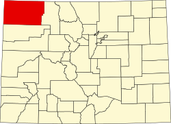
Blue Mountain
Location of Blue Mountain, Colorado.
USA Colorado location map.svg
Red pog.svg
Blue Mountain
Blue Mountain (Colorado)
Coordinates: 40°14′54″N108°51′42″W / 40.2483°N 108.8618°W / 40.2483; -108.8618 [1]
Country United States
State Colorado
County Moffat [2]
Government
  Type unincorporated community
  Body Moffat County [2]
Elevation
[1]
5,824 ft (1,775 m)
Time zone UTC−07:00 (MST)
  Summer (DST) UTC−06:00 (MDT)
GNIS pop ID 201958

Blue Mountain is an unincorporated community in Moffat County, in the U.S. state of Colorado. [1] Blue Mountain is located on U.S. highway route 40.

Contents

History

Blue Mountain was founded sometime after 1910. The Blue Mountain, Colorado, post office operated from September 1, 1949, until January 31, 1957. [3] Blue Mountain is named for a nearby mountain, which is also called Blue Mountain. [4]

The post office in Dinosaur (ZIP code 81610) now serves Blue Mountain addresses. [5]

See also

References

  1. 1 2 3 "Blue Mountain, Colorado". Geographic Names Information System . United States Geological Survey, United States Department of the Interior . Retrieved January 27, 2025.
  2. 1 2 "Colorado Counties". Colorado Department of Local Affairs . Retrieved January 27, 2025.
  3. Bauer, William H.; Ozment, James L.; Willard, John H. (1990). Colorado Post Offices 1859–1989. Golden, Colorado: Colorado Railroad Historical Foundation. ISBN   0-918654-42-4.
  4. "TopoView" . Retrieved September 5, 2021.
  5. "United States Zip Codes" . Retrieved September 5, 2021.