Gloster, Louisiana

Last updated

Gloster, Louisiana
De Soto Parish Louisiana incorporated and unincorporated areas Gloster highlighted.svg
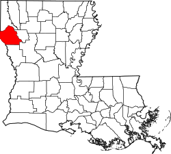
Location in De Soto Parish and the state of Louisiana.
Coordinates: 32°11′28″N93°48′54″W / 32.19111°N 93.81500°W / 32.19111; -93.81500 [1]
Country Flag of the United States.svg  United States
State Flag of Louisiana.svg  Louisiana
Parish DeSoto
Area
[2]
  Total1.27 sq mi (3.30 km2)
  Land1.26 sq mi (3.26 km2)
  Water0.01 sq mi (0.03 km2)
Elevation
241 ft (73 m)
Population
 (2020)
  Total53
  Density42.06/sq mi (16.24/km2)
Time zone UTC-6 (Central (CST))
  Summer (DST) UTC-5 (CDT)
ZIP code
71030
FIPS code 22-29395
GNIS feature ID535251 [1]

Gloster is an unincorporated community and census-designated place (CDP) in DeSoto Parish, Louisiana, United States. As of the 2010 census it had a population of 94. [3]

Gloster is located 1.5 miles (2.4 km) east of U.S. Route 171, 17 miles (27 km) north of Mansfield, the DeSoto Parish seat, and 30 miles (48 km) south of Shreveport.

It is the nearest community to three places listed on the U.S. National Register of Historic Places:

Demographics

Historical population
CensusPop.Note
2020 53
U.S. Decennial Census [4]

Related Research Articles

<span class="mw-page-title-main">DeSoto Parish, Louisiana</span> Parish in Louisiana, United States

DeSoto Parish is a parish located in the U.S. state of Louisiana. The parish was formed in 1843. At the 2020 U.S. census, the population was 26,812. Its parish seat is Mansfield. DeSoto Parish is part of the Shreveport–Bossier City metropolitan statistical area.

<span class="mw-page-title-main">Keachi, Louisiana</span> Town in Louisiana, United States

Keachi is a town in DeSoto Parish, Louisiana, United States. The population was 295 at the 2010 census. It is part of the Shreveport–Bossier City Metropolitan Statistical Area.

<span class="mw-page-title-main">Stonewall, Louisiana</span> Town in Louisiana, United States

Stonewall is a town in northern DeSoto Parish, Louisiana, United States. The population was 1,814 at the 2010 census, increasing to 2,273 in 2020. It is part of the Shreveport–Bossier City metropolitan statistical area.

<span class="mw-page-title-main">Avondale, Louisiana</span> Census-designated place in Louisiana, United States

Avondale is a census-designated place (CDP) in Jefferson Parish, Louisiana, United States, on the west bank of the Mississippi River. The population was 4,582 in 2020. It is part of the New Orleans–Metairie–Kenner metropolitan statistical area.

<span class="mw-page-title-main">Barataria, Louisiana</span> Census-designated place in Louisiana, United States

Barataria is a census-designated place (CDP) in Jefferson Parish, Louisiana, United States. The population was 1,057 in 2020. It is part of the New Orleans–Metairie–Kenner metropolitan statistical area.

Estelle is a census-designated place (CDP) in Jefferson Parish, Louisiana, United States. The population was 17,952 in 2020. It is part of the New Orleans–Metairie–Kenner metropolitan statistical area.

Woodmere is an unincorporated community and census-designated place (CDP) in Jefferson Parish, Louisiana, United States. The population was 12,080 at the 2010 census, and 11,238 at the 2020 census. It is part of the New Orleans–Metairie–Kenner metropolitan statistical area.

Chackbay is a census-designated place (CDP) in northern Lafourche Parish, Louisiana, United States. The population was 5,370 in 2020. It is part of the Houma–Bayou Cane–Thibodaux metropolitan statistical area.

<span class="mw-page-title-main">Violet, Louisiana</span> Census-designated place in Louisiana, US

Violet is a census-designated place (CDP) in St. Bernard Parish, Louisiana, United States. The population was 5,758 at the 2020 census. Violet is located on the east bank of the Mississippi River, approximately 7.5 miles (12.1 km) southeast of New Orleans and is part of the New Orleans–Metairie–Kenner metropolitan statistical area.

Gillis is an unincorporated community and census-designated place (CDP) in northern Calcasieu Parish, Louisiana, United States. As of the 2010 census it had a population of 657.

Ossun is an unincorporated community and census-designated place in Lafayette Parish, Louisiana, United States. In 2020, its population was 2,145. The community is named after the area of Ossun, France, near Lourdes.

<span class="mw-page-title-main">Frierson, Louisiana</span> Census-designated place in Louisiana, United States

Frierson is an unincorporated community and census-designated place (CDP) in DeSoto Parish, Louisiana, United States. It is located approximately 3 miles (5 km) north of Interstate 49 along Louisiana State Highway 175.

Lacassine is an unincorporated community and census-designated place (CDP) in Jefferson Davis Parish in the U.S. state of Louisiana. As of the 2010 census the population was 480.

Bayou Goula is an unincorporated community and census-designated place (CDP) in Iberville Parish, Louisiana, United States. Its population was 514 in 2020.

Starks is an unincorporated community and census-designated place (CDP) in Calcasieu Parish, Louisiana, United States. As of the 2010 census it had a population of 664. It is located approximately 30 miles (48 km) northwest of Lake Charles and about 5 miles (8 km) from the Texas and Louisiana border. Starks is known for its annual Mayhaw Festival to celebrate the fruit that grows in the bayous along the Texas/Louisiana border.

Minorca is an unincorporated community and census-designated place (CDP) in Concordia Parish, Louisiana, United States. As of the 2010 census it had a population of 2,317. It is located in northeastern Concordia Parish, bordered on the east by the city of Vidalia.

Oretta is a census-designated place in Beauregard Parish, Louisiana, United States. As of the 2010 census, it had a population of 418.

Wallace Ridge is an unincorporated community and census-designated place (CDP) in Catahoula Parish, Louisiana, United States. As of the 2010 census it had a population of 710. It is located northeast of the center of Catahoula Parish on the west side of the Ouachita River. Tew Lake, a former channel of the river that is now an oxbow lake, is in the northern part of the CDP, and Wallace Lake, another oxbow, borders the southern part. The original community of Wallace Ridge is on relatively higher ground on the north side of Tew Lake.

Rock Hill is an unincorporated community and census-designated place (CDP) in Grant Parish, Louisiana, United States. As of the 2010 census it had a population of 274.

Crescent is an unincorporated community and census-designated place in Iberville Parish, Louisiana, United States. It was first listed as a CDP in the 2010 Census with a population of 959. In 2020, its population was 811.

References

  1. 1 2 "Gloster". Geographic Names Information System . United States Geological Survey, United States Department of the Interior . Retrieved January 24, 2024.
  2. "2020 U.S. Gazetteer Files". United States Census Bureau. Retrieved March 20, 2022.
  3. "Geographic Identifiers: 2010 Demographic Profile Data (G001): Gloster CDP, Louisiana". U.S. Census Bureau, American Factfinder. Retrieved October 28, 2015.[ dead link ]
  4. "Census of Population and Housing". Census.gov. Retrieved June 4, 2016.