Nocona Hills, Texas | |
|---|---|
 Nocona Hills, Texas  Nocona Hills, Texas | |
| Coordinates: 33°51′09″N97°38′37″W / 33.85250°N 97.64361°W | |
| Country | United States |
| State | Texas |
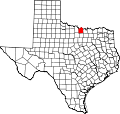
| County | Montague |
| Area | |
• Total | 6.306 sq mi (16.33 km2) |
| • Land | 5.205 sq mi (13.48 km2) |
| • Water | 1.101 sq mi (2.85 km2) |
| Elevation | 856 ft (261 m) |
| Population | |
• Total | 675 |
| • Density | 130/sq mi (50.1/km2) |
| Time zone | UTC-6 (Central (CST)) |
| • Summer (DST) | UTC-5 (CDT) |
| Area code | 940 |
| GNIS feature ID | 2586963 [2] |
Nocona Hills is an unincorporated community and census-designated place in Montague County, Texas, United States. Its population was 675 as of the 2010 census. [1]