Mallard, Texas | |
|---|---|
 Mallard  Mallard | |
| Coordinates: 33°34′59″N97°39′7″W / 33.58306°N 97.65194°W | |
| Country | United States |
| State | Texas |
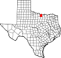
| County | Montague |
| Elevation | 988 ft (301 m) |
| Time zone | UTC-6 (Central (CST)) |
| • Summer (DST) | UTC-5 (CDT) |
| Area code | 940 |
| GNIS feature ID | 2034582 [1] |
Mallard is an unincorporated community in Montague County, Texas, United States. [1] According to the Handbook of Texas, the community had a population of 12 in 2000. [2]