Hardy, Texas | |
|---|---|
 Hardy  Hardy | |
| Coordinates: 33°34′35″N97°31′14″W / 33.57639°N 97.52056°W | |
| Country | United States |
| State | Texas |
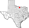
| County | Montague |
| Elevation | 984 ft (300 m) |
| Time zone | UTC-6 (Central (CST)) |
| • Summer (DST) | UTC-5 (CDT) |
| Area code | 940 |
| GNIS feature ID | 1379888 [1] |
Hardy is an unincorporated community in Montague County, Texas, United States. [1] According to the Handbook of Texas, only six people lived in the community in 2000.