Sunset, Montague County, Texas

Last updated
Sunset, Texas
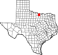
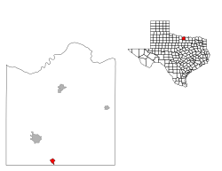
Montague County Sunset.svg
Location of Sunset, Texas
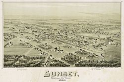
Old map-Sunset-1890.jpg
Map of Sunset in 1890
Coordinates: 33°27′14″N97°46′0″W / 33.45389°N 97.76667°W / 33.45389; -97.76667
Country Flag of the United States.svg  United States
State Flag of Texas.svg  Texas
County Montague
Area
  Total1.1 sq mi (2.8 km2)
  Land1.1 sq mi (2.8 km2)
  Water0.0 sq mi (0.0 km2)
Elevation
991 ft (302 m)
Population
 (2000)
  Total339
  Density318.8/sq mi (123.1/km2)
Time zone UTC-6 (Central (CST))
  Summer (DST) UTC-5 (CDT)
ZIP code
76270
Area code 940
FIPS code 48-71264 [1]
GNIS feature ID1369410 [2]

Sunset is an unincorporated community in Montague County, Texas, United States. Until 1900, a surveying error had placed the community in Wise County. [3] The Fort Worth and Denver Railway runs through Sunset. The population was 339 at the 2000 census. The city disincorporated on April 19, 2007. [4]

Contents

History

2009 wildfires

On April 9, 2009, the community was evacuated in advance of approaching wildfires. The fires ripped through the town in "patchwork fashion", destroying many homes and businesses. [5] [6]

Geography

Sunset is located at 33°27′14″N97°46′0″W / 33.45389°N 97.76667°W / 33.45389; -97.76667 (33.453823, -97.766724). [7] According to the United States Census Bureau, the city has a total area of 1.1 square miles (2.8 km2), all land.

Demographics

Sunset from above Sunset TX.JPG
Sunset from above

As of the census [1] of 2000, Sunset had 339 people, 133 households, and 90 families with a population density of 318.8 people per square mile (123.5/km2). Additionally, Sunset had 151 housing units at an average density of 142.0 per square mile (54.8/km2). The racial makeup was 95.28% White, 1.18% Asian, 1.47% from other races, and 2.06% from two or more races. Hispanics or Latinos of any race were 3.24% of the population.

Of the 133 households noted in the 2000 census, 36.1% had children under the age of 18, 54.1% were married couples living together, 8.3% had a female householder with no husband present, and 31.6% were not families. About 28.6% of all households were made up of individuals, and 14.3% had someone living alone who was 65 years of age or older. The average household size was 2.55 and the average family size was 3.15.

Per the 2000 census, the population of Sunset was distributed as 18 or younger (28.6%), 18-24 (7.7%), 25-44 (28.9%), 45-64 (22.1%), and 65 or older (12.7%). The median age was 35 years.

The median income at the 2000 census was $24,886 for households and $29,643 for families. Males had a median income of $26,875 versus $17,083 for females. The per capita income for the city was $11,304. About 17.3% of families and 16.5% of the population were below the poverty line, including 26.4% of those under the age of 18 and 4.2% of those 65 or over.
Education

Sunset is served by the Bowie Independent School District.

Related Research Articles

<span class="mw-page-title-main">Titus County, Texas</span> County in Texas, United States

Titus County is a county located in the northeastern region of the U.S. state of Texas. As of the 2020 census, its population was 31,247. Its county seat is Mount Pleasant. The county is named for Andrew Jackson Titus, an early settler. Titus County comprises the Mount Pleasant micropolitan statistical area.

<span class="mw-page-title-main">LeRoy, Michigan</span> Village in Michigan, United States

LeRoy is a village in Osceola County of the U.S. state of Michigan. The population was 256 at the 2010 census. The village is located within LeRoy Township.

<span class="mw-page-title-main">Half Moon, North Carolina</span> CDP in North Carolina, United States

Half Moon is a census-designated place (CDP) in Onslow County, North Carolina, United States. The population was 6,645 at the 2000 census. It is part of the Jacksonville, North Carolina Metropolitan Statistical Area.

<span class="mw-page-title-main">Lakeline, Ohio</span> Village in Ohio, United States

Lakeline is a village in Lake County, Ohio, United States. The population was 226 at the 2010 census.

<span class="mw-page-title-main">Megargel, Texas</span> Town in Texas, United States

Megargel is a town in Archer County, Texas, United States. It is part of the Wichita Falls, Texas metropolitan statistical area. Its population was 203 at the 2010 census. The town is named for Roy C. Megargel, the president of the railroad that developed the town.

<span class="mw-page-title-main">Tynan, Texas</span> Census-designated place in Texas, United States

Tynan is a census-designated place (CDP) in Bee County, Texas, United States. The population was 278 at the 2010 census.

<span class="mw-page-title-main">Iredell, Texas</span> City in Texas, United States

Iredell is a city located in Bosque County in central Texas, United States. The population was 339 at the 2010 census.

<span class="mw-page-title-main">El Camino Angosto, Texas</span> Census-designated place in Texas, United States

El Camino Angosto is a census-designated place (CDP) in Cameron County, Texas, United States. The population was 253 at the 2010 census. It is part of the Brownsville–Harlingen Metropolitan Statistical Area.

<span class="mw-page-title-main">Laureles, Texas</span> CDP in Texas, United States

Laureles is a census-designated place (CDP) in Cameron County, Texas, United States. The population was 3,692 at the 2010 census. It is part of the Brownsville–Harlingen Metropolitan Statistical Area. Laureles is an area between Los Fresnos and San Benito, Texas.

<span class="mw-page-title-main">Bartonville, Texas</span> Town in Texas, United States

Bartonville is a town in Denton County, Texas, United States. The population was 1,469 at the 2010 census.

<span class="mw-page-title-main">Eustace, Texas</span> City in Texas, United States

Eustace is a city in Henderson County, Texas, United States. The population was 991 at the 2010 census, up from 798 at the 2000 census.

<span class="mw-page-title-main">Heidelberg, Texas</span> Census-designated place in Texas

Heidelberg is a census-designated place (CDP) in Hidalgo County, Texas. The population was 1,725 at the 2010 United States Census. It is part of the McAllen–Edinburg–Mission Metropolitan Statistical Area.

<span class="mw-page-title-main">Hewitt, Texas</span> City in Texas, United States

Hewitt is a city in McLennan County, Texas, United States. The population was 16,026 at the 2020 census, making it the second largest city in the county. It is part of the Waco Metropolitan Statistical Area.

<span class="mw-page-title-main">Taft Southwest, Texas</span> CDP in Texas, United States

Taft Southwest is a census-designated place (CDP) in San Patricio County, Texas, United States. The population was 1,460 at the 2010 census.

Eagle Mountain is a former census-designated place (CDP) in Tarrant County, Texas, United States. The population was 6,599 at the 2000 census. It is now a part of the city of Saginaw.

<span class="mw-page-title-main">Pelican Bay, Texas</span> City in Texas, United States

Pelican Bay is a city in Tarrant County, Texas, United States. The population was 1,547 at the 2010 census.

<span class="mw-page-title-main">Wellman, Texas</span> City in Texas, United States

Wellman is a city in Terry County, Texas, United States. The city was formed in 1918 as a shipping point on the Santa Fe Railroad and named after Augustus Ogden Wellman, who had been an assistant to the railroad's secretary and treasurer. Its population was 203 at the 2010 census.

<span class="mw-page-title-main">Willamar, Texas</span> Former CDP in Texas, United States

Willamar is a former census-designated place (CDP) in Willacy County, Texas, United States. It was founded in 1921 and named for its founders, Will Harding and Lamar Gill. The population was 15 at the 2000 census. This CDP was deleted prior to the 2010 census.

<span class="mw-page-title-main">Plains, Texas</span> Town in Texas, United States

Plains is a town and the county seat of Yoakum County of western Texas, United States, particularly the south (inner) half of the panhandle's plains. The city's population was 1,481 at the 2010 census. Plains in the Texas High Plains Wine country.

<span class="mw-page-title-main">San Patricio, Texas</span> City in Texas, United States

San Patricio is a city in Nueces and San Patricio counties in the U.S. state of Texas. The population was 384 at the 2020 census.

References

  1. 1 2 "U.S. Census website". United States Census Bureau . Retrieved 2008-01-31.
  2. "US Board on Geographic Names". United States Geological Survey. 2007-10-25. Retrieved 2008-01-31.
  3. Handbook of Texas Online, s.v. "Sunset, TX" https://tshaonline.org/handbook/online/articles/hls89 (accessed July 22, 2009).
  4. Population Estimates Boundary Changes Archived 2006-02-06 at the Wayback Machine , United States Census Bureau, 2007-07-01. Accessed 2008-11-06.
  5. "Wildfires destroy 2 Texas towns, kill 2". Reuters . 2009-04-10.
  6. "3 killed as fires scorch lands, homes in Texas, Oklahoma". Associated Press. 2009-04-11.
  7. "US Gazetteer files: 2010, 2000, and 1990". United States Census Bureau. 2011-02-12. Retrieved 2011-04-23.