In April 1958, an F3 tornado struck Stoneburg, injuring one person.[2] On May 18, 1946, an F4 tornado struck Stoneburg.[3] On April 29, 1906, another tornado hit Stoneburg.[4] On April 9, 2009, Stoneburg was destroyed in a wildfire.[5]
Convicted murderer Henry Lee Lucas was picked up by a Pentecostal minister from the House of Prayer in Stoneburg while hitchhiking.[6]
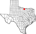
Geography
Stoneburg sits at the intersection of U.S. Route 81 and Farm to Market Road 1806, 15mi (24km) west of Montague and 12mi (19km) north of Bowie in west-central Montague County.[7] Bowie Lake is 2 miles (3.2km) southwest of the town.[8]
↑ "1/1-8/13 U.S. Tornadoes". National Centers for Environmental Information. National Weather Service. Retrieved January 4, 2022.
↑ Grazulis, Thomas P. (1993). Significant tornadoes, 1680–1991: A Chronology and Analysis of Events. St. Johnsbury, Vermont: Environmental Films. pp.922–925. ISBN1-879362-03-1.
This page is based on this Wikipedia article Text is available under the CC BY-SA 4.0 license; additional terms may apply. Images, videos and audio are available under their respective licenses.