Capps Corner, Texas

Last updated

Capps Corner is an unincorporated community in Montague County, Texas, United States.

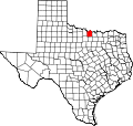
The town is at the intersection of Farm to Market Road 1956, or "Hoosier Highway", and Farm to Market Road 677, 13 miles east of Nocona, eight miles north of Saint Jo, and six miles south of Illinois Bend in far northeastern Montague County. The settlement was established circa 1925 and named for E. G. (Cap) Adams. It was still listed as a community in 1990. Central to this small village was a "filling station" at the corner of the two farm roads, with "Capps Corner" written above the old-fashioned pumps. The store remained in business well into the 1980s; though it has since closed, it can still be seen there. The town also once boasted a small school until it consolidated with the Saint Jo Independent School District in 1961. The school can still be seen about one city block west of the old filling station. The population is less than 100.

33°48′02″N97°30′28″W / 33.80056°N 97.50778°W / 33.80056; -97.50778


Related Research Articles

<span class="mw-page-title-main">Montague County, Texas</span> County in Texas, United States

Montague County is a county located in the U.S. state of Texas, established in 1857. As of the 2020 census, its population was 19,965. The county seat is Montague. The county was created in 1857 and organized the next year. It is named for Daniel Montague, a surveyor and soldier in the Mexican–American War.

<span class="mw-page-title-main">Henrietta, Texas</span> City in Texas, United States

Henrietta is a city in and the county seat of Clay County, Texas, United States. It is part of the Wichita Falls metropolitan statistical area. The population was 3,141 at the 2010 census, a decline of 123 from the 2000 tabulation of 3,264.

<span class="mw-page-title-main">Nocona, Texas</span> City in Texas, United States

Nocona is a city along U.S. Highway 82 and State Highway 175 in Montague County, Texas, United States. The population was 3,033 at the 2010 census. The city, its lake, and its resurgence as a regional travel destination were featured in the June 2012 edition of Texas Highways magazine.

<span class="mw-page-title-main">St. Jo, Texas</span> City in Texas, United States

Saint Jo is a city in Montague County, Texas, United States, along the northern border of the state. The population was 1,043 at the 2010 census.

<span class="mw-page-title-main">Montague, Texas</span> Census-designated place & Unincorporated Community in Texas, United States

Montague is a census-designated place and unincorporated community in Montague County, Texas, United States. It is the county seat of Montague County and had an estimated population of 400 in 2000, according to the Handbook of Texas. Its population was 304 as of the 2010 census.

Ringgold is an unincorporated community in Montague County, Texas, United States, with an estimated population of 100 people. It is approximately 20 miles (32 km) northwest of Montague, the county seat.

Stoneburg is an unincorporated community in Montague County, Texas, United States. It had a population of approximately 51 in 1990.

Saint Jo Independent School District is a public school district based in Saint Jo, Texas (USA).

Lake Nocona or Farmer's Creek Reservoir was begun in 1959 and completed in October 1960. It is formed by a dam on Farmer's Creek about nine miles (14 km) northeast of Nocona, Texas in northeastern Montague County and is owned and operated by North Montague County Water Supply District. The lake was constructed for municipal, industrial, and mining purposes. The elevation of the lake is 827 feet (252 m) above sea level; it has a capacity of 25,400 acre-feet (31,300,000 m3), a maximum depth of 80 feet (24 m), and a surface area of 1,470 acres (595 ha). The drainage area above the dam is 94 square miles (243 km2).

Illinois Bend is an unincorporated community on Farm to Market Road 677 twenty miles northeast of Montague in the extreme northeastern corner of Montague County, Texas, United States. The community, which initially was called Wardville, after local landowner C. M. Ward, was settled in 1862 by a small group of families who moved to Texas from Illinois. The name was changed to Illinois Bend in 1877, when a post office was located there.

<span class="mw-page-title-main">Spanish Fort, Texas</span> United States historic place

Spanish Fort is an unincorporated community in north central Montague County, Texas, United States, at the end of Farm Road 103, one mile south of the Red River.

Belcherville is a city along U.S. Route 82 and Farm to Market Road 1816 in Montague County, Texas, United States. The population is less than 50.

The Gainesville, Henrietta and Western Railway Company (GH&W) was chartered on July 23, 1886, to build a rail line from Gainesville in Cooke County, Texas, to Seymour in Baylor County, Texas, a distance of 130 miles (210 km). The line was to cross Montague, Clay, and Wichita Counties.

<span class="mw-page-title-main">Red River Station, Texas</span> Ghost Town in Texas, United States

Red River Station is a ghost town south of the Red River at Salt Creek in northwestern Montague County, Texas, United States.

Bonita is an unincorporated community in north central Montague County, Texas, United States, north of U.S. Route 82 on Farm to Market Road 1815.

Stanfield is an unincorporated community in far northeastern Clay County, Texas, United States. Located on Farm to Market Road 2332, Stanfield lies 15 miles northeast of Henrietta and approximately one mile south of the Oklahoma border.

Banquete is a census-designated place (CDP) in Nueces County, Texas, United States. Banquete is located at the intersection of State Highway 44 and FM 666, 23 miles west of Corpus Christi. Banquete should not be confused with Rancho Banquete, a census-designated place situated several miles west of the community.

Dundee is an unincorporated community located in Archer County, Texas, United States. According to the Handbook of Texas, the community had a population of 12 in 2010. Dundee is located within the Wichita Falls Metropolitan Statistical Area.

Grassyville is a ghost town located in Bastrop County, Texas, United States. The community was founded in the northeast corner of the county near the intersection of Farm to Market Road 2104 and Farm to Market Road 2239, 6 miles south of Paige, 14 miles east of Bastrop, and 50 miles east of Austin.

Oak Hill is a ghost town in Bastrop County, Texas, United States. It is located 4 miles southwest of McDade, 12 miles southeast of Elgin, 13 miles northeast of Bastrop, and 37 miles southeast of Austin on the old Bastrop-McDade Road.