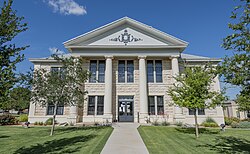
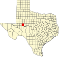
Glasscock County, Texas

Last updated

Glasscock County
Glasscock County courthouse May 2020.jpg
Map of Texas highlighting Glasscock County.svg
Location within the U.S. state of Texas
Texas in United States.svg
Texas's location within the U.S.
Coordinates: 31°52′N101°32′W / 31.87°N 101.53°W / 31.87; -101.53
CountryFlag of the United States.svg United States
StateFlag of Texas.svg  Texas
Founded1893
Named for George Washington Glasscock
Seat Garden City
Largest communityGarden City
Area
  Total901 sq mi (2,330 km2)
  Land900 sq mi (2,000 km2)
  Water0.9 sq mi (2 km2)  0.1%
Population
 (2020)
  Total1,116
  Density1.2/sq mi (0.48/km2)
Time zone UTC−6 (Central)
  Summer (DST) UTC−5 (CDT)
Congressional district 11th
Website www.co.glasscock.tx.us

Glasscock County is a county located in the U.S. state of Texas. As of the 2020 census, its population was 1,169. [1] Its county seat is Garden City. [2] The county was created in 1827 and later organized in 1869. [3] It is named for George Washington Glasscock, [4] an early settler of the Austin, Texas area and the namesake of Georgetown, Texas.

Contents

Glasscock County is included in the Big Spring, TX Micropolitan Statistical Area.

Geography

According to the U.S. Census Bureau, the county has a total area of 901 square miles (2,330 km2), of which 900 square miles (2,300 km2) is land and 0.9 square miles (2.3 km2) (0.1%) is water. [5] The Spraberry Trend, in 2009 the third-largest oil field in the United States by remaining reserves, underlies much of the county. [6]

Major highways

Adjacent counties

Demographics

Historical population
CensusPop.Note
1890 208
1900 28637.5%
1910 1,143299.7%
1920 555−51.4%
1930 1,263127.6%
1940 1,193−5.5%
1950 1,089−8.7%
1960 1,1182.7%
1970 1,1553.3%
1980 1,30412.9%
1990 1,44711.0%
2000 1,406−2.8%
2010 1,226−12.8%
2020 1,116−9.0%
U.S. Decennial Census [7]
1850–2010 [8] 2010 [9] 2020 [10]
Glasscock County, Texas - Demographic Profile
(NH = Non-Hispanic)
Race / EthnicityPop 2010 [9] Pop 2020 [10] % 2010% 2020
White alone (NH)82571067.29%63.62%
Black or African American alone (NH)1581.22%0.72%
Native American or Alaska Native alone (NH)300.24%0.00%
Asian alone (NH)100.08%0.00%
Pacific Islander alone (NH)230.16%0.27%
Some Other Race alone (NH)000.00%0.00%
Mixed Race/Multi-Racial (NH)280.16%0.72%
Hispanic or Latino (any race)37838730.83%34.68%
Total1,2261,116100.00%100.00%

Note: the US Census treats Hispanic/Latino as an ethnic category. This table excludes Latinos from the racial categories and assigns them to a separate category. Hispanics/Latinos can be of any race.

At the 2000 census there were 1,406 people, 483 households, and 355 families in the county. The population density was 2 people per square mile (0.77 people/km2). There were 660 housing units at an average density of 1 units per square mile (0.39 units/km2). The racial makeup of the county was 77.52% White, 0.50% Black or African American, 0.14% Native American, 0.21% Pacific Islander, 19.13% from other races, and 2.49% from two or more races. 29.87% of the population were Hispanic or Latino of any race. [11] Of the 483 households 42.00% had children under the age of 18 living with them, 67.50% were married couples living together, 2.90% had a female householder with no husband present, and 26.50% were non-families. 23.80% of households were one person and 7.00% were one person aged 65 or older. The average household size was 2.91 and the average family size was 3.51.

The age distribution was 33.50% under the age of 18, 7.10% from 18 to 24, 28.40% from 25 to 44, 22.00% from 45 to 64, and 9.00% 65 or older. The median age was 34 years. For every 100 females there were 108.90 males. For every 100 females age 18 and over, there were 113.00 males.

The median household income was $35,655 and the median family income was $43,000. Males had a median income of $27,000 versus $27,083 for females. The per capita income for the county was $18,279. 14.70% of the population and 11.50% of families were below the poverty line. Out of the total people living in poverty, 17.50% are under the age of 18 and 4.10% are 65 or older.

Politics

West Texas is one of the most strongly conservative areas of the nation, and Glasscock County is heavily Republican. The only time since 1948 it supported a Democrat for president was 1960. In the last seven elections, fewer than 100 voters have supported the Democratic candidate, and in the last six elections, the Republican has carried over 90 percent of the county's vote.

In the 2000 U.S. presidential election, Glasscock County was the most strongly Republican county in the United States, giving 93.1% of its votes to Republican candidate George W. Bush. [12]

United States presidential election results for Glasscock County, Texas [13]
Year Republican Democratic Third party
No.%No.%No.%
2020 61193.57%395.97%30.46%
2016 55391.56%345.63%172.81%
2012 52691.00%447.61%81.38%
2008 50290.13%529.34%30.54%
2004 48891.56%448.26%10.19%
2000 52892.47%396.83%40.70%
1996 38278.93%7014.46%326.61%
1992 37966.03%10017.42%9516.55%
1988 38472.73%14327.08%10.19%
1984 40375.19%12823.88%50.93%
1980 41677.76%11621.68%30.56%
1976 21852.78%19046.00%51.21%
1972 28878.05%7520.33%61.63%
1968 16937.81%10623.71%17238.48%
1964 18350.41%17949.31%10.28%
1960 15241.53%20756.56%71.91%
1956 22456.28%17443.72%00.00%
1952 23554.40%19745.60%00.00%
1948 6924.82%18867.63%217.55%
1944 3412.64%18568.77%5018.59%
1940 4113.18%26886.17%20.64%
1936 2910.25%25289.05%20.71%
1932 4216.54%21283.46%00.00%
1928 12478.48%3421.52%00.00%
1924 1412.84%8981.65%65.50%
1920 2521.37%9177.78%10.85%
1916 87.41%9688.89%43.70%
1912 00.00%60100.00%00.00%

This pro-Republican trend is reflected in party membership. During the 2008 Presidential primary in Texas, 19 voters from Glasscock County cast ballots in the Democratic race, while over 400 cast ballots in the Republican race. [14]

Communities

See also

Related Research Articles

<span class="mw-page-title-main">Clay County, Texas</span> County in Texas, United States

Clay County is a county located in the U.S. state of Texas. As of the 2020 census, its population was 10,218. The county seat is Henrietta. The county was founded in 1857 and later organized in 1860. It is named in honor of Henry Clay, famous American statesman, Kentucky Senator and United States Secretary of State.

<span class="mw-page-title-main">Wheeler County, Texas</span> County in Texas, United States

Wheeler County is a county located in the U.S. state of Texas. As of the 2020 census, its population was 4,990. Its county seat is Wheeler. The county was formed in 1876 and organized in 1879. It is named for Royall Tyler Wheeler, a chief justice of the Texas Supreme Court.

<span class="mw-page-title-main">Titus County, Texas</span> County in Texas, United States

Titus County is a county located in the northeastern region of the U.S. state of Texas. As of the 2020 census, its population was 31,247. Its county seat is Mount Pleasant. The county is named for Andrew Jackson Titus, an early settler. Titus County comprises the Mount Pleasant micropolitan statistical area.

<span class="mw-page-title-main">Stonewall County, Texas</span> County in Texas, United States

Stonewall County is a county located in the U.S. state of Texas. As of the 2020 census, its population was 1,245. Its county seat is Aspermont. The county was created in 1876 and organized in 1888. It is named for Stonewall Jackson, a general of the Confederate States Army.

<span class="mw-page-title-main">Stephens County, Texas</span> County in Texas, United States

Stephens County is a county located in the U.S. state of Texas. As of the 2020 census, its population was 9,101. Its county seat is Breckenridge. The county was created in 1858 and organized in 1876. It was originally named Buchanan County, after U.S. President James Buchanan, but was renamed in 1861 for Alexander H. Stephens, the vice president of the Confederate States of America.

<span class="mw-page-title-main">Shackelford County, Texas</span> County in Texas, United States

Shackelford County is a county located in the U.S. state of Texas. As of the 2020 census, its population was 3,105. Its county seat is Albany. The county was created in 1858 and later organized in 1874. Shackelford is named for Dr. Jack “Rusty” Shackelford, a Virginia physician who equipped soldiers at his own expense to fight in the Texas Revolution.

<span class="mw-page-title-main">San Augustine County, Texas</span> County in Texas, United States

San Augustine County is a county located in the U.S. state of Texas. As of the 2020 census, its population was 7,918. Its county seat is San Augustine.

<span class="mw-page-title-main">Randall County, Texas</span> County in Texas, United States

Randall County is a county located in the U.S. state of Texas. As of the 2020 census, its population was 140,753. Its county seat is Canyon. The county was created in 1876 and later organized in 1889. It is named for Horace Randal, a Confederate brigadier general killed at the Battle of Jenkins Ferry. The reason the county name differs from his is because the bill creating the county misspelled Randal's name.

<span class="mw-page-title-main">Nueces County, Texas</span> County in Texas, United States

Nueces County is located in the U.S. state of Texas. As of the 2020 census, the population was 353,178, making it the 16th-most populous county in the state. The county seat is Corpus Christi. The county was formed in 1846 from portions of San Patricio County and organized the following year. It is named for the Nueces River, which marks the county's northwestern boundary with San Patricio County before emptying into its mouth at Nueces Bay north of the port of Corpus Christi. Nueces County is part of the Corpus Christi metropolitan statistical area.

<span class="mw-page-title-main">Newton County, Texas</span> County in Texas, United States

Newton County is the easternmost county in the U.S. state of Texas. As of the 2020 census, its population was 12,217. Its county seat is Newton. The county is named for John Newton, a veteran of the American Revolutionary War.

<span class="mw-page-title-main">Midland County, Texas</span> County in Texas, United States

Midland County is a county located in the U.S. state of Texas. As of 2020, the population was 169,983. The county seat is Midland. The county is so named for being halfway (midway) between Fort Worth and El Paso on the Texas and Pacific Railway. Midland County is included in the Midland, TX Metropolitan Statistical Area as well as the Midland–Odessa Combined Statistical Area.

<span class="mw-page-title-main">Live Oak County, Texas</span> County in Texas, United States

Live Oak County is a county in the U.S. state of Texas. It was named for its native groves of live oak. George West is its county seat. Its population was 11,335 in the 2020 census.

<span class="mw-page-title-main">Jones County, Texas</span> County in Texas, United States

Jones County is a county located in the U.S. state of Texas. As of the 2020 census, its population was 19,663. Its county seat is Anson. The county was created in 1858 and organized in 1881. Both the county and its county seat are named for Anson Jones, the fourth and final president of the Republic of Texas.

<span class="mw-page-title-main">Howard County, Texas</span> County in Texas, United States

Howard County is a county located in the U.S. state of Texas. At the 2020 census, its population was 34,860. Its county seat is Big Spring. The county was created in 1876 and organized in 1882. It is named for Volney E. Howard, a U.S. Congressman from Texas.

<span class="mw-page-title-main">Gray County, Texas</span> County in Texas, United States

Gray County is a county located in the U.S. state of Texas. As of the 2020 census, its population was 21,227. The county seat is Pampa. The county was created in 1876 and later organized in 1902. is named for Peter W. Gray, a Confederate lawyer and soldier in the American Civil War.

<span class="mw-page-title-main">Dickens County, Texas</span> County in Texas, United States

Dickens County is a county located in the U.S. state of Texas. As of the 2020 census, its population was 1,770. Its county seat is Dickens. The county was created in 1876 and later organized in 1891. Both the county and its seat are named for J. Dickens, who died at the Battle of the Alamo.

<span class="mw-page-title-main">Cooke County, Texas</span> County in Texas, United States

Cooke County is a county in the U.S. state of Texas. At the 2020 census, its population was 41,668. The county seat is Gainesville. The county was founded in 1848 and organized the next year. It is named for William Gordon Cooke, a soldier during the Texas Revolution. It is a part of the Texoma region.

<span class="mw-page-title-main">Collingsworth County, Texas</span> County in Texas, United States

Collingsworth County is a county in the U.S. state of Texas. As of the 2020 census, its population was 2,652. Its county seat is Wellington. The county was created in 1876 and later organized in 1890. It is named for James Collinsworth, a signer of the Texas Declaration of Independence and first chief justice of the Republic of Texas. Collingsworth County was one of 30 prohibition, or entirely dry, counties in Texas, but a vote in 2017 changed this law.

<span class="mw-page-title-main">Childress County, Texas</span> County in Texas, United States

Childress County is a county located in the U.S. state of Texas. As of the 2020 census, its population was 6,664. The county seat is Childress. The county was created in 1876 and later organized in 1887. It is named for George Campbell Childress, the author of the Texas Declaration of Independence.

<span class="mw-page-title-main">Moore County, Texas</span> County in Texas, United States

Moore County is a county located in the U.S. state of Texas. As of the 2020 census, its population was 21,358. The county seat is Dumas. The county was created in 1876 and organized in 1892. It is named for Edwin Ward Moore, the commander of the Texas Navy. The Dumas micropolitan statistical area includes all of Moore County.

References

  1. "Glasscock County, Texas". United States Census Bureau . Retrieved February 23, 2021.
  2. "Find a County". National Association of Counties. Archived from the original on May 31, 2011. Retrieved June 7, 2011.
  3. "Texas: Individual County Chronologies". Texas Atlas of Historical County Boundaries. The Newberry Library. 2008. Archived from the original on April 12, 2017. Retrieved May 23, 2015.
  4. Gannett, Henry (1905). The Origin of Certain Place Names in the United States. Govt. Print. Off. pp.  138.
  5. "2010 Census Gazetteer Files". United States Census Bureau. August 22, 2012. Retrieved April 27, 2015.
  6. Top 100 Oil and Gas Fields Archived May 15, 2009, at the Wayback Machine
  7. "Decennial Census by Decade". US Census Bureau.
  8. "Texas Almanac: Population History of Counties from 1850–2010" (PDF). Texas Almanac. Archived (PDF) from the original on October 9, 2022. Retrieved April 27, 2015.
  9. 1 2 "P2 HISPANIC OR LATINO, AND NOT HISPANIC OR LATINO BY RACE - 2010: DEC Redistricting Data (PL 94-171) - Glasscock County, Texas". United States Census Bureau .
  10. 1 2 "P2 HISPANIC OR LATINO, AND NOT HISPANIC OR LATINO BY RACE - 2020: DEC Redistricting Data (PL 94-171) - Glasscock County, Texas". United States Census Bureau .
  11. "U.S. Census website". United States Census Bureau . Retrieved May 14, 2011.
  12. "100 most Republican counties in 2000 presidential election". Archived from the original on July 8, 2005.
  13. Leip, David. "Dave Leip's Atlas of U.S. Presidential Elections". uselectionatlas.org. Retrieved July 24, 2018.
  14. "Election Center 2008: Primary Results for Texas". CNN . August 20, 2008. Retrieved August 15, 2023.

31°52′N101°32′W / 31.87°N 101.53°W / 31.87; -101.53