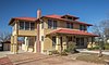
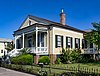
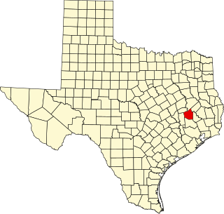
List of Recorded Texas Historic Landmarks (Eastland-Gray)

Last updated

The following is a partial list of Recorded Texas Historic Landmarks (RTHLs) arranged by county as designated by the Texas Historical Commission and local county historical commissions in Texas. This page includes RTHLs in the following counties: Eastland, Ector, Edwards, El Paso, Ellis, Erath, Falls, Fannin, Fayette, Fisher, Floyd, Foard, Fort Bend, Franklin, Freestone, Frio, Gaines, Galveston, Garza, Gillespie, Glasscock, Goliad, Gonzales, and Gray.

Contents

Recorded Texas Historic Landmarks listed by county
Anderson-Callahan Cameron-Duval Eastland-Gray Grayson-Hudspeth Hunt-Martin Mason-Rusk Sabine-Travis Trinity-Zavala

KEY

Map all coordinates using: OpenStreetMap

Landmarks with multiple historic designations are colored according to their highest designation within the following hierarchy.

⁕ Listed individually on the National Register of Historic Places (NRHP) as a National Historic Landmark
⁂ Listed on the NRHP as a contributing property of a National Historic Landmark District
Listed individually on the NRHP
Listed as a contributing property of an NRHP Historic District
§ Listed individually as or as part of a State Historic Site
# Listed individually as or as part of a State Antiquities Landmark

Eastland County

Registered Texas Historic LandmarkImageMarker numberPhysical addressNearest cityYear designatedDescription
Burkett House Burkett House Eastland Wiki (1 of 1).jpg 11852 1301 S. Mulberry St.

32°23′20″N98°49′13″W / 32.38889°N 98.82028°W / 32.38889; -98.82028

Eastland 1998
Carbon City Jail Carbon City Jail Wiki (1 of 1).jpg 17695 Dirt road leading from N. Main St. N of post office to S end of N. Fifth St.

32°16′17″N98°49′41″W / 32.27139°N 98.82806°W / 32.27139; -98.82806

Carbon 2013
Carbon Methodist Church Building Carbon Methodist Church Wiki (1 of 1) 2.jpg 12542 201 W. Anthracite St.

32°16′12″N98°49′51″W / 32.27000°N 98.83083°W / 32.27000; -98.83083

Carbon 1996Avenue D and Anthracite St.
Connellee-Majestic Theatre EastlandTexasMajesticTheater.jpg 1040 108 N. Lamar St.

32°24′8″N98°49′9″W / 32.40222°N 98.81917°W / 32.40222; -98.81917

Eastland 1988
Eastland County Courthouse Eastland County Courthouse Wiki (1 of 1).jpg 16983 100 W. Main St.

32°24′5″N98°49′7″W / 32.40139°N 98.81861°W / 32.40139; -98.81861

Eastland 2007
First National Bank Downtown Cisco 1.jpg 1782 708 Conrad Hilton Blvd.

32°23′18″N98°58′47″W / 32.38833°N 98.97972°W / 32.38833; -98.97972

Cisco 1967
Old Mobley Hotel Mobley Hotel Cisco Wiki.jpg
Commons-logo.svg More images
3430 104 E. Fourth St.

32°23′30″N98°58′51″W / 32.39167°N 98.98083°W / 32.39167; -98.98083

Cisco 1970
Penn House 3981 0.8 mi. N of FM 2945 past railroad bridge 2.5 mi. W of Cisco

32°23′50″N99°1′57″W / 32.39722°N 99.03250°W / 32.39722; -99.03250

Cisco vicinity1988On private property, from Cisco take FM 2945 west about 2.5 miles; go over bridge over railroad tracks. Then turn north on dirt road, about .8 mile to house.
Ranger Post Office Ranger Post Office.jpg 3792 205 Main St.

32°28′14″N98°40′52″W / 32.47056°N 98.68111°W / 32.47056; -98.68111

Ranger 1962Medallion is inside Greer's Western Store
Stubblefield Building Stubblefield Building Eastland Wiki (1 of 1).jpg 5143 101 S. Lamar St.

32°24′6″N98°49′10″W / 32.40167°N 98.81944°W / 32.40167; -98.81944

Eastland 1962Lamar and Main on the courthouse square
The Connellee House ConnelleHouseEastlandTexas.jpg 1038 515 S. Lamar St.

32°23′50″N98°49′11″W / 32.39722°N 98.81972°W / 32.39722; -98.81972

Eastland 1972
The Kean Home Kean House Cisco Wiki (1 of 1).jpg 2908 309 W. Sixth St.

32°23′18″N98°58′58″W / 32.38833°N 98.98278°W / 32.38833; -98.98278

Cisco 1985

Ector County

Registered Texas Historic LandmarkImageMarker numberPhysical addressNearest cityYear designatedDescription
Barrow Ranch House 311 8900 N. County Rd. West (FM 1882)

31°57′9″N102°25′2″W / 31.95250°N 102.41722°W / 31.95250; -102.41722

Odessa 1962From Ector County Courthouse, take US 385 North about 7.6 mile, go West on FM 1882 & continue 1/10 mile to Dirt Road going North,(marker on private property on east wall of two houses).
Ector County Discovery Well 1381 I-20 south service road 2.5 mi. W of Penwell

31°43′15″N102°37′34″W / 31.72083°N 102.62611°W / 31.72083; -102.62611

Penwell 1967US 80 about 2.5 mile West of Penwell on east access road
Site of Old Livery Stable and Wagon Yard 4853 205 N. Grant St.

31°50′46″N102°22′7″W / 31.84611°N 102.36861°W / 31.84611; -102.36861

Odessa 1967205 N. Grant St., Odessa (near Odessa Police Dept.)
White-Pool House # White-Pool House in Odessa, TX Picture 1849.jpg
Commons-logo.svg More images
5786 112 E. Murphy St.

31°50′32″N102°21′51″W / 31.84222°N 102.36417°W / 31.84222; -102.36417

Odessa 1980112 E Murphy, Odessa

Edwards County

Registered Texas Historic LandmarkImageMarker numberPhysical addressNearest cityYear designatedDescription
Edwards County Courthouse # Edwards county tx courthouse.jpg
Commons-logo.svg More images
1402 100 W. Main St.

30°0′57″N100°12′28″W / 30.01583°N 100.20778°W / 30.01583; -100.20778

Rocksprings 1973Courthouse Square; Rocksprings
First Baptist Church of Barksdale Barksdale-tx2016-36(first-baptist).jpg
Commons-logo.svg More images
14896 200 Church St.

29°43′31″N100°2′13″W / 29.72528°N 100.03694°W / 29.72528; -100.03694

Barksdale 2008118 CR 380
Headquarters, American Angora Goat Breeders' Assn. 2418 200 blk W. Austin St.

30°0′59″N100°12′32″W / 30.01639°N 100.20889°W / 30.01639; -100.20889

Rocksprings 1965on Austin Street one block west of courthouse square, Rocksprings
Hough-Haven 2578 300 blk N. Sweeten St.

30°1′5″N100°12′32″W / 30.01806°N 100.20889°W / 30.01806; -100.20889

Rocksprings 1966corner of Austin and Sweeten Street; Rocksprings
Old Carson Store 3702 N. Austin St. at SW corner of E. Well St.

30°0′59″N100°12′27″W / 30.01639°N 100.20750°W / 30.01639; -100.20750

Rocksprings 1968corner of Austin and Well Street; Rocksprings

El Paso County

Registered Texas Historic LandmarkImageMarker numberPhysical addressNearest cityYear designatedDescription
Burges House 569 603 W. Yandell Dr.

31°45′46″N106°29′44″W / 31.76278°N 106.49556°W / 31.76278; -106.49556

El Paso 1993
Casa Ortiz 745 10180 Socorro Rd.

31°39′17″N106°18′12″W / 31.65472°N 106.30333°W / 31.65472; -106.30333

Socorro 1973Apodaca Road at FM 258
El Paso First Ward Chapel 1428 3625 Douglas Ave.

31°47′19″N106°27′4″W / 31.78861°N 106.45111°W / 31.78861; -106.45111

El Paso 1984
El Paso High School EP High School.jpg
Commons-logo.svg More images
18420 1600 N. Virginia St.

31°46′21″N106°29′23″W / 31.77250°N 106.48972°W / 31.77250; -106.48972

El Paso 2016
El Paso Union Depot # El Paso Union Depot, September 2014.jpg
Commons-logo.svg More images
1437 700 San Francisco St.

31°45′27″N106°29′45″W / 31.75750°N 106.49583°W / 31.75750; -106.49583

El Paso 1982
Guardian Angel Church 2302 3021 Frutas Ave.

31°46′29″N106°27′32″W / 31.77472°N 106.45889°W / 31.77472; -106.45889

El Paso 1983at corner of San Marcial and Frutas
Hotel Cortez Hotel Cortez, 309 N. Mesa St. El Paso.JPG
Commons-logo.svg More images
12881 310 N. Mesa St.

31°45′35″N106°29′14″W / 31.75972°N 106.48722°W / 31.75972; -106.48722

El Paso 2002310 N. Mesa
La Hacienda 2995 1720 W. Paisano Dr.

31°45′46″N106°30′34″W / 31.76278°N 106.50944°W / 31.76278; -106.50944

El Paso 1962
Los Portales East facade - Gregorio Garcia House, North side of San Elizario Street, San Elizario, El Paso County, TX HABS TEX,71-SANEL,2-3.tif
Commons-logo.svg More images
3129 1587 Church St.

31°35′6″N106°16′24″W / 31.58500°N 106.27333°W / 31.58500; -106.27333

San Elizario 1962South corner of central town plaza
Magoffin Homestead §# Magoffin home 2009.jpg
Commons-logo.svg More images
3183 1110 Magoffin Ave.

31°45′45″N106°28′36″W / 31.76250°N 106.47667°W / 31.76250; -106.47667

El Paso 1962
Martin Building Martin Building El Paso.jpg 3226 215 N. Stanton St.

31°45′35″N106°29′11″W / 31.75972°N 106.48639°W / 31.75972; -106.48639

El Paso 1981
Mesa Water Boosting Station 15822 5001 Fred Wilson Ave.

31°49′35″N106°25′41″W / 31.82639°N 106.42806°W / 31.82639; -106.42806

El Paso 2009
Mission Nuestra Senora de la Purisima Concepcion Del Socorro Socorro mission front.jpg
Commons-logo.svg More images
3407 328 S. Nevarez Rd.

31°39′30″N106°18′9″W / 31.65833°N 106.30250°W / 31.65833; -106.30250

Socorro 1963one block north of Intersection of Nevarez and FM 258
Old B'Nai Zion Synagogue # Old Bnai Zion Synagogue 02.JPG
Commons-logo.svg More images
3688 906 N. El Paso St.

31°45′37″N106°29′22″W / 31.76028°N 106.48944°W / 31.76028; -106.48944

El Paso 1985
Old County Jail South (front) facade and west facade - Old County Jail, San Elizario Plaza, El Paso, El Paso County, TX HABS TEX,71-ELPA,2-1.tif
Commons-logo.svg More images
3715 1551 Main St.

31°35′8″N106°16′27″W / 31.58556°N 106.27417°W / 31.58556; -106.27417

San Elizario 1962One block southeast of Central Plaza; San Elizario
Old County Jail East and north (raar) facade - Old County Jail, San Elizario Plaza, El Paso, El Paso County, TX HABS TEX,71-ELPA,2-2.tif
Commons-logo.svg More images
14760 1551 Main St.

31°35′8″N106°16′27″W / 31.58556°N 106.27417°W / 31.58556; -106.27417

San Elizario 1970
Old Fort Bliss Old Fort Bliss soldier's quarters.JPG 3730 1836 W. Paisano Dr.

31°45′47″N106°30′33″W / 31.76306°N 106.50917°W / 31.76306; -106.50917

El Paso 1965
Old Main 3761 551 Circle Dr.

31°46′19″N106°30′20″W / 31.77194°N 106.50556°W / 31.77194; -106.50556

El Paso 1982Circle Road, University of Texas at El Paso Campus, El Paso
San Elizario Chapel San Elizario Mission.jpg
Commons-logo.svg More images
4533 1556 San Elizario Rd.

31°35′5″N106°16′22″W / 31.58472°N 106.27278°W / 31.58472; -106.27278

San Elizario 1962at southwest corner of the property
Simeon Hart Residence, Site of Hart's Mill (El Molino) 4699 1720 W. Paisano Dr.

31°45′46″N106°30′34″W / 31.76278°N 106.50944°W / 31.76278; -106.50944

El Paso 1981
Singer Building Singer Sewing Company Building El Paso Texas 2023.jpg 4711 211 Texas Ave.

31°45′33″N106°29′12″W / 31.75917°N 106.48667°W / 31.75917; -106.48667

El Paso 1983
Site of Tienda de Carbajal 4904 10245 Socorro Rd.

31°38′37″N106°18′20″W / 31.64361°N 106.30556°W / 31.64361; -106.30556

Socorro 1972corner of below road and FM 258; Socorro
The Woman's Club of El Paso El Paso Women's Club.JPG
Commons-logo.svg More images
5453 1400 N. Mesa St.

31°46′2″N106°29′40″W / 31.76722°N 106.49444°W / 31.76722; -106.49444

El Paso 1980
Turner Home 5572 1301 Montana Ave.

31°46′15″N106°28′52″W / 31.77083°N 106.48111°W / 31.77083; -106.48111

El Paso 1982
Wallace Apartments 5707 1205 Randolph Dr.

31°45′49″N106°29′53″W / 31.76361°N 106.49806°W / 31.76361; -106.49806

El Paso 1985Yandell and Randolph Streets (east wall facing Randolph)
Ysleta Mission Ysleta Del Sur church.jpg
Commons-logo.svg More images
15485 131 S. Zaragoza Rd.

31°41′27″N106°19′38″W / 31.69083°N 106.32722°W / 31.69083; -106.32722

El Paso 1962

Ellis County

Registered Texas Historic LandmarkImageMarker numberPhysical addressNearest cityYear designatedDescription
1889 Masonic Lodge Hall Waxahachie masonic lodge 2013.jpg
Commons-logo.svg More images
7120 201 S. College St.

32°23′5″N96°50′51″W / 32.38472°N 96.84750°W / 32.38472; -96.84750

Waxahachie 1976201 S. College St., Waxahachie
Dunlap - Simpson House Dunlap-Simpson House Waxahachie Texas(1 of 1).jpg 7073 1203 W. Main St.

32°23′44″N96°51′39″W / 32.39556°N 96.86083°W / 32.39556; -96.86083

Waxahachie 19741203 W. Main St., Waxahachie
Eddy O. Hawkins Home Eddy Hawkins House Waxahachie Texas (1 of 1).jpg 7112 200 S. Hawkins St.

32°23′18″N96°51′16″W / 32.38833°N 96.85444°W / 32.38833; -96.85444

Waxahachie 1984200 S. Hawkins St., Waxahachie
Ellis County Courthouse # Ellis County Courthouse, Waxahachie, Texas (6884671962).jpg
Commons-logo.svg More images
7091 101 W. Main St.

32°23′8″N96°50′42″W / 32.38556°N 96.84500°W / 32.38556; -96.84500

Waxahachie 1969Courthouse Square on Main St., Waxahachie
Ellis County Woman's Building (Davis Hall) Davis Hall (1 of 1).jpg 13611 407 W. Jefferson St.

32°23′7″N96°51′4″W / 32.38528°N 96.85111°W / 32.38528; -96.85111

Waxahachie 2006407 W Jefferson St
Ennis City Hall Ennis City Hall Wiki (1 of 1).jpg 7097 119 W. Brown St.

32°19′35″N96°37′38″W / 32.32639°N 96.62722°W / 32.32639; -96.62722

Ennis 1985109 W. Brown, Ennis
Ennis National Bank Ennis National Bank Wiki (1 of 1).jpg 7098 110 W. Ennis Ave.

32°19′40″N96°37′40″W / 32.32778°N 96.62778°W / 32.32778; -96.62778

Ennis 1983110 W. Ennis Ave., Ennis
First Presbyterian Church Building First Presbyterian Church Waxahachie(1 of 1).jpg 11858 501 W. Main St.

32°23′14″N96°51′5″W / 32.38722°N 96.85139°W / 32.38722; -96.85139

Waxahachie 1997
First Presbyterian Church of Ferris FerrisPresbyterianChurchWS.jpg 7104 201 N. Church St.

32°32′9″N96°40′2″W / 32.53583°N 96.66722°W / 32.53583; -96.66722

Ferris 1994201 N. Church St., Ferris
Fry - Butcher House 7064 501 FM 2377

32°30′16″N96°47′17″W / 32.50444°N 96.78806°W / 32.50444; -96.78806

Red Oak 1992
George Rossan Home 7066 S of Mike Rd. near Mill Creek

32°6′48″N96°55′13″W / 32.11333°N 96.92028°W / 32.11333; -96.92028

Milford 19621.5 mi. E of Milford. Take Water St. E to "y" in road, Just off the left branch.
H.P. and Mollie McCartney House HP Mollie McCartney House (1 of 1).jpg 18825 504 Sycamore St.

32°24′1″N96°50′44″W / 32.40028°N 96.84556°W / 32.40028; -96.84556

Waxahachie 2017
Hancock Building Hancock building waxahachie 2013.jpg 7108 203 S. College St.

32°23′5″N96°50′51″W / 32.38472°N 96.84750°W / 32.38472; -96.84750

Waxahachie 1984203 S. College St., Waxahachie
Harkey - Payne House HarkeyPayneHouse (1 of 1).jpg 7110 216 W. Jefferson St.

32°25′50″N96°40′20″W / 32.43056°N 96.67222°W / 32.43056; -96.67222

Palmer 1983216 W. Jefferson St., Palmer
Hawkins House Hawkins House, Waxahachie, Texas (7049706527).jpg
Commons-logo.svg More images
7111 210 S. Hawkins St.

32°23′17″N96°51′18″W / 32.38806°N 96.85500°W / 32.38806; -96.85500

Waxahachie 1990210 S. Hawkins St., Waxahachie
Jefferson Dunaway Home 7065 115 Dunaway Rd.

32°18′23″N96°54′49″W / 32.30639°N 96.91361°W / 32.30639; -96.91361

Waxahachie 1970
Joshua Chapel A.M.E. Church Joshua Chapel (1 of 1).jpg
Commons-logo.svg More images
7070 110 Aiken St.

32°22′59″N96°50′23″W / 32.38306°N 96.83972°W / 32.38306; -96.83972

Waxahachie 1984
McKinney-Aday Farm House McKinney-Aday Farm House Waxahachie Wiki (1 of 1).jpg 17480 130 Cunningham Meadows Rd.

32°21′26″N96°53′53″W / 32.35722°N 96.89806°W / 32.35722; -96.89806

Waxahachie 2013Approximately 5 feet north of the brick walkway leading to the house, centered on the midpoint of the length of the walkway
Moore House Moore House.JPG 12717 400 W. Denton St.

32°19′50″N96°38′0″W / 32.33056°N 96.63333°W / 32.33056; -96.63333

Ennis 2002400 W. Denton
Old Ellis County Jail Ellis County Jail (1 of 1).jpg 7094 200 N. Rogers St.

32°23′12″N96°50′51″W / 32.38667°N 96.84750°W / 32.38667; -96.84750

Waxahachie 1978At the corner of Rogers and Water St., Waxahachie
Presiding Elder's House Presiding Elder's House Waxahachie Wiki (1 of 1).jpg 7140 201 Oldham Ave.

32°23′20″N96°50′39″W / 32.38889°N 96.84417°W / 32.38889; -96.84417

Waxahachie 1988201 Oldham Ave., Waxahachie
Rockett Christian Church RockettChristianChurch (1 of 1).jpg 7143 135 Maple Leaf Dr.

32°28′11″N96°45′48″W / 32.46972°N 96.76333°W / 32.46972; -96.76333

Rockett 1983Intersection of FM 183 and Loma Linda Rd., Rockett
Rogers Street Bridge Rogers Street Bridge Waxahachie Wiki (1 of 1).jpg
Commons-logo.svg More images
7069 Rogers St. over Waxahachie Creek

32°22′55″N96°51′2″W / 32.38194°N 96.85056°W / 32.38194; -96.85056

Waxahachie 1981Rogers Street Bridge over Waxahachie Creek on Hwy. 77
Rosemont RosemontHouse1 (1 of 1).jpg 7068 701 S. Rogers St.

32°22′44″N96°51′14″W / 32.37889°N 96.85389°W / 32.37889; -96.85389

Waxahachie 1981701 S. Rogers Street
Rutherford's Crossing Bridge Rutherford Crossing Bridge (1 of 1).jpg 7144 Over Red Oak Creek W of new Rutherford Rd. bridge

32°26′54″N96°44′28″W / 32.44833°N 96.74111°W / 32.44833; -96.74111

Waxahachie 1990On Rutherford Rd., 3 mi. off FM 878 and 8 mi. S. of Waxahachie
Saint James A.M.E. Church Milford St. James AME Church (1 of 1).jpg 7145 312 Bois D Arc St.

32°7′9″N96°56′44″W / 32.11917°N 96.94556°W / 32.11917; -96.94556

Milford 1992FM 308 and Bois D'arc St., Milford
Shiloh Cumberland Presbyterian Church Shiloh Cumberland Presbyterian Church Ovilla (1 of 1).jpg 7148 7810 Shiloh Rd.

32°31′2″N96°53′45″W / 32.51722°N 96.89583°W / 32.51722; -96.89583

Ovilla 1962intersection of Shiloh Rd. and FM 664, Ovilla
St. Paul's Episcopal Saint Paul's Episcopal Church (1 of 1).jpg
Commons-logo.svg More images
7062 308 N. Monroe St.

32°23′21″N96°50′52″W / 32.38917°N 96.84778°W / 32.38917; -96.84778

Waxahachie 1965Corner of McMillian & Monroe Sts.
Strickland-Sawyer House Strickland-Sawyer House.JPG 7152 500 Oldham Ave.

32°23′15″N96°50′31″W / 32.38750°N 96.84194°W / 32.38750; -96.84194

Waxahachie 1980500 Oldham Ave., Waxahachie
The H.P. Barkley Home Barkley-Floyd House.JPG 7082 709 N. Dallas St.

32°19′57″N96°37′55″W / 32.33250°N 96.63194°W / 32.33250; -96.63194

Ennis 1981709 N. Dallas, Ennis
The Mahoney-Thompson House 7118 604 W. Main St.

32°23′20″N96°51′9″W / 32.38889°N 96.85250°W / 32.38889; -96.85250

Waxahachie 1969604 W. Main St., Waxahachie
The Telico Church Telico Church Wiki (1 of 1).jpg 7156 S end of Telico Cemetery Rd.

32°22′1″N96°30′34″W / 32.36694°N 96.50944°W / 32.36694; -96.50944

Ennis 1988From Ennis go E on SH 34 about 6 mi. then S on FM 1181 to Telico Cemetery Rd.
Trippet-Shive House Trippet House.jpg 7078 209 N. Grand Ave.

32°23′55″N96°51′44″W / 32.39861°N 96.86222°W / 32.39861; -96.86222

Waxahachie 1983209 N. Grand Ave., Waxahachie
Trotter House Trotter House Midlothian Texas(1 of 1).jpg 18604 508 S. Ninth St.

32°28′39″N96°59′35″W / 32.47750°N 96.99306°W / 32.47750; -96.99306

Midlothian 2017
Waxahachie Chautauqua Building # Waxahachie Chautauqua Building 2016.jpg
Commons-logo.svg More images
7077 400 S. Grand Ave.

32°23′46″N96°51′58″W / 32.39611°N 96.86611°W / 32.39611; -96.86611

Waxahachie 1972In Getzendaner Park off Gran Ave. S., Waxahachie
William L. and Emma Hawkins House Hawkins House Midlothian Texas(1 of 1).jpg 7113 803 W. Ave. G

32°28′57″N97°0′5″W / 32.48250°N 97.00139°W / 32.48250; -97.00139

Midlothian 1994Corner of 2nd St. and Ave. G., Midlothian
Williams-Erwin House Williams-Erwin House (1 of 1).jpg
Commons-logo.svg More images
7063 412 W. Marvin Ave.

32°23′40″N96°50′52″W / 32.39444°N 96.84778°W / 32.39444; -96.84778

Waxahachie 1978

Erath County

Registered Texas Historic LandmarkImageMarker numberPhysical addressNearest cityYear designatedDescription
Bluff Dale Tabernacle Bluff Dale Tabernacle (1 of 1).jpg 442 425 Glenn St.

32°20′52″N98°1′15″W / 32.34778°N 98.02083°W / 32.34778; -98.02083

Bluff Dale 1982Corner of Glenn and Dennis streets
Cage Home Cage House (1 of 1).jpg 620 194 E. Long St.

32°13′8″N98°12′0″W / 32.21889°N 98.20000°W / 32.21889; -98.20000

Stephenville 1983
Clairette Schoolhouse Clairette Schoolhouse 2017.jpg
Commons-logo.svg More images
901 3 mi. N of US 281 on SH 6

32°2′27″N98°7′10″W / 32.04083°N 98.11944°W / 32.04083; -98.11944

Clairette 1985From Hico, take SH 6 north about 7 miles; 3 mi. N of intersection with Hwy 281
Crow Home Crow House Stephenville Wiki (1 of 1).jpg 16446 396 E. Long St.

32°13′11″N98°11′55″W / 32.21972°N 98.19861°W / 32.21972; -98.19861

Stephenville 2010Intersection of Long and Vine Street, 3 blocks south of Washington
Crow Opera House Stephenville August 2017 11 (Crow's Opera House).jpg
Commons-logo.svg More images
1122 187 W. Washington St.

32°13′14″N98°12′10″W / 32.22056°N 98.20278°W / 32.22056; -98.20278

Stephenville 1977
D. L. Harris House D.L. Harris House Wiki (1 of 1).jpg 1144 718 N. Patrick St.

32°5′44″N98°20′22″W / 32.09556°N 98.33944°W / 32.09556; -98.33944

Dublin 1982
Dawson Saloon Dawson Saloon Stephenville Wiki (1 of 1).jpg 18519 190 W. College St.

32°13′10″N98°12′8″W / 32.21944°N 98.20222°W / 32.21944; -98.20222

Stephenville 2016
Doublin Inn 1260 701 Cottonwood St.

32°4′32″N98°20′25″W / 32.07556°N 98.34028°W / 32.07556; -98.34028

Dublin 1971SW end of Cottonwood St., old part (dirt road), facing railroad tracks, Dublin; MARKER IS NOT AT STRUCTURE 5/2011
Duffau School Duffauschool (1 of 1).jpg 11868 0.5 mi. S of FM 1824 on FM 2481

32°4′27″N98°11′17″W / 32.07417°N 98.18806°W / 32.07417; -98.18806

Stephenville 199815 mi. S of Stephenville on US 281; 4 mi. E on FM 1824 to Duffau Store; .5 mi. S on FM 2481; at intersection of FM 2481 and FM 1824
Erath Arches Erath Arches Stephenville Texas 2017.jpg
Commons-logo.svg More images
15792 500 W. Washington St.

32°13′8″N98°12′21″W / 32.21889°N 98.20583°W / 32.21889; -98.20583

Stephenville 2009
Erath County Courthouse # Stephenville August 2017 29 (Erath County Courthouse).jpg
Commons-logo.svg More images
1494 100 W. Washington St.

32°13′12″N98°12′7″W / 32.22000°N 98.20194°W / 32.22000; -98.20194

Stephenville 1963Corner of Washington and Graham
First Methodist Church of Stephenville Stephenville August 2017 06 (First United Methodist Church).jpg 1771 328 W. Washington St.

32°13′10″N98°12′14″W / 32.21944°N 98.20389°W / 32.21944; -98.20389

Stephenville 1988
First National Bank Building Stephenville August 2017 10 (First National Bank Building).jpg
Commons-logo.svg More images
1785 198 S. Belknap Ave.

32°13′11″N98°12′10″W / 32.21972°N 98.20278°W / 32.21972; -98.20278

Stephenville 1994
Gentry and Shelton Building Gentry and Shelton Building Stephenville Wiki (1 of 1).jpg 18517 104 E. College St.

32°13′12″N98°12′5″W / 32.22000°N 98.20139°W / 32.22000; -98.20139

Stephenville 2016
Holt House Holt House (1 of 1).jpg 16419 459 Church St.

32°21′3″N98°1′32″W / 32.35083°N 98.02556°W / 32.35083; -98.02556

Bluff Dale 2010459 Church St.
J. F. Warnock Hardware WarnockHardware (1 of 1).jpg 2675 147 N. Greenwood St.

32°21′5″N98°1′16″W / 32.35139°N 98.02111°W / 32.35139; -98.02111

Bluff Dale 1984North Greenwood Street, Bluff Dale
Lingleville Tabernacle Lingleville Tabernacle Wiki (1 of 1).jpg 6255 FM 219, about 0.2 mi. S of FM 8

32°14′32″N98°22′41″W / 32.24222°N 98.37806°W / 32.24222; -98.37806

Lingleville 1983FM 219, about 0.2 miles south of FM 8, Lingleville
Oldest Home in Stephenville Stephenville Historical House Museum August 2017 1 (Berry House).jpg
Commons-logo.svg More images
3841 525 E. Washington St.

32°13′19″N98°11′57″W / 32.22194°N 98.19917°W / 32.22194; -98.19917

Stephenville 1967
Oxford House Stephenville August 2017 38 (Oxford House).jpg
Commons-logo.svg More images
3894 619 E. Washington St.

32°13′23″N98°11′53″W / 32.22306°N 98.19806°W / 32.22306; -98.19806

Stephenville 1994
Pecan Cemetery Tabernacle 3969 Pecan Cemetery Rd. off CR 291

31°59′8″N98°15′11″W / 31.98556°N 98.25306°W / 31.98556; -98.25306

Dublin vicinity19968 miles southeast of Dublin on FM 219; then 1.5 miles south on CR 291 (Pecan Cemetery Road)
President's House# Presidents House (1 of 1).jpg 4115 1500 Military Dr.

32°12′58″N98°12′59″W / 32.21611°N 98.21639°W / 32.21611; -98.21639

Stephenville 1988Tarleton State University campus, Hall of Presidents, corner of Doc Blanchard Blvd. and Military Drive
Stephenville Church of 1900 Stephenville Historical House Museum August 2017 2 (Chapel on the Bosque).jpg
Commons-logo.svg More images
5112 525 E. Washington St.

32°13′23″N98°11′56″W / 32.22306°N 98.19889°W / 32.22306; -98.19889

Stephenville 1977at Stephenville Historical Museum
The Gallagher House Dublin Gallagher House Wiki (1 of 1).jpg 2099 261 N. Grafton St.

32°5′14″N98°20′24″W / 32.08722°N 98.34000°W / 32.08722; -98.34000

Dublin 1980
William T. Miller Grist Mill East side (front) W T Miller Grist mill.jpg
Commons-logo.svg More images
5847 120 S. Park St.

32°5′5″N98°20′39″W / 32.08472°N 98.34417°W / 32.08472; -98.34417

Dublin 1975At Wm. Wright Historical Park
Wyatt-Boyd Ranch Complex 6399 Off US 281 northwest of FM 913

32°8′39″N98°9′8″W / 32.14417°N 98.15222°W / 32.14417; -98.15222

Stephenville vicinity1987from Stephenville, take US 281 south about 5.5 miles

Falls County

Registered Texas Historic LandmarkImageMarker numberPhysical addressNearest cityYear designatedDescription
Allen House Allen House Marlin Wiki (1 of 1).jpg 126 305 Ward St.

31°18′32″N96°53′55″W / 31.30889°N 96.89861°W / 31.30889; -96.89861

Marlin 1991305 Ward St., Marlin
Blue Ridge Baptist Church 440 S 3.5 mi. on FM 1771 from SH 7

31°16′12″N96°44′24″W / 31.27000°N 96.74000°W / 31.27000; -96.74000

Reagan 1970From Marlin take SH 7 about 9.5 mi., then go south on FM 1771 about 3.5 mi.
Boyhood Home of Tom Connally 1037 1.5 mi NW on CR 437 from SH 7

31°17′38″N97°14′9″W / 31.29389°N 97.23583°W / 31.29389; -97.23583

Bruceville-Eddy 1962From Burceville-Eddy, take Sh 7 SE 1 mi then go NW CW co. Rd about 1.5 mi.
Dodson Place 1240 7 mi. NW on FM 935 Lott 1962From Lott, follow FM 935 NW about 7 mi., private
Falconer Home 1560 433 Agnes Ave.

31°18′52″N96°53′27″W / 31.31444°N 96.89083°W / 31.31444; -96.89083

Marlin 1983433 Agnes Ave., Marlin
Falls County Courthouse# Falls county courthouse.jpg
Commons-logo.svg More images
11717 125 Bridge St.

31°18′25″N96°53′55″W / 31.30694°N 96.89861°W / 31.30694; -96.89861

Marlin 2000
Frank and Julia Bockholt Home 13048 W side CR 379 between SH 320 and CR 380

31°6′50″N97°7′19″W / 31.11389°N 97.12194°W / 31.11389; -97.12194

Westphalia 2003CR 379 at SH 320
Henslee House Henslee House Rosebud Wiki (1 of 1).jpg 2454 507 N. Second St.

31°4′41″N96°58′43″W / 31.07806°N 96.97861°W / 31.07806; -96.97861

Rosebud 1985507 N. Second St., Rosebud
Highlands Mansion Highlands Front.jpg 2478 N side FM 147 E of SH 6

31°19′22″N96°52′54″W / 31.32278°N 96.88167°W / 31.32278; -96.88167

Marlin 1967From Marlin take Fm 147 NE about 1 mi (Just past jct. with Sh 6)
James Bayliss Buck Farmstead James Bayliss Buck Farmstead Lott Wiki (1 of 1).jpg 18234 1641 US 77

31°7′48″N96°59′59″W / 31.13000°N 96.99972°W / 31.13000; -96.99972

Rosebud 2015Highway 77, 0.25 miles south of Travis, Falls County, Texas
Mooreville Methodist Church 3464 206 FM 2643

31°18′7″N97°8′30″W / 31.30194°N 97.14167°W / 31.30194; -97.14167

Mooreville 1991FM 2643, Mooreville. Destroyed by fire February 7, 2019 [1]
Perry United Methodist Church Perry United Methodist Church Wiki (1 of 1).jpg 3991 193 CR 127

31°26′5″N96°53′28″W / 31.43472°N 96.89111°W / 31.43472; -96.89111

Perry 1972From Perry, take FM 1240 east about 2 mi.

Fannin County

Registered Texas Historic LandmarkImageMarker numberPhysical addressNearest cityYear designatedDescription
Biard Home Baird Home (1 of 1).jpg 8842 905 N. Main St.

33°34′55″N96°10′46″W / 33.58194°N 96.17944°W / 33.58194; -96.17944

Bonham 1964
Blanton Chapel Methodist Church Blanton Chapel Methodist Church.jpg 8845 1025 FM 981

33°23′50″N96°17′37″W / 33.39722°N 96.29361°W / 33.39722; -96.29361

Trenton 1964from Leonard take SH 78 west 3 miles to FM 981; then north on FM 981 1.5 miles
Bonham High School Auditorium and Gymnasium Bonham High School Auditorium and Gymnasium (1 of 1).jpg 12459 1201 N. Main St.

33°35′5″N96°10′47″W / 33.58472°N 96.17972°W / 33.58472; -96.17972

Bonham 2001N. Main at 12th St.; physical address listed is for entire campus
Church of St. Mark, The Evangelist, Episcopal Church of St. Mark Honey Grove (1 of 1).jpg 8857 401 S. Eighth St.

33°34′56″N95°54′29″W / 33.58222°N 95.90806°W / 33.58222; -95.90806

Honey Grove 19848th & Market
Dial United Presbyterian Church 8865 8491 FM 824

33°29′51″N95°52′13″W / 33.49750°N 95.87028°W / 33.49750; -95.87028

Dial 1969across from Dial Cemetery on FM 824
First National Bank 8880 120 W. Sam Rayburn Dr.

33°34′39″N96°10′48″W / 33.57750°N 96.18000°W / 33.57750; -96.18000

Bonham 1966SH 56
First Presbyterian Church Bonham July 2016 16 (First Presbyterian Church).jpg
Commons-logo.svg More images
8883 818 N. Main St.

33°34′54″N96°10′44″W / 33.58167°N 96.17889°W / 33.58167; -96.17889

Bonham 1965
First United Methodist Church of Leonard First United Methodist Church WS (1 of 1).jpg 8885 206 N. Main St.

33°22′57″N96°14′50″W / 33.38250°N 96.24722°W / 33.38250; -96.24722

Leonard 1981Main & Houston St.
Fry Homestead 8889 395 FM 2456

33°24′55″N95°57′10″W / 33.41528°N 95.95278°W / 33.41528; -95.95278

Ladonia 1964
Galbraith House 8890 506 CR 3425

33°34′19″N95°57′21″W / 33.57194°N 95.95583°W / 33.57194; -95.95583

Honey Grove 1973
Haden House Haden House, Ladonia, Texas.jpg 8896 603 W. Bonham St.

33°25′30″N95°57′10″W / 33.42500°N 95.95278°W / 33.42500; -95.95278

Ladonia 1966Richard & Bonham Sts.
Home of T. H. Sears 8932 6694 FM 151

33°30′49″N96°22′37″W / 33.51361°N 96.37694°W / 33.51361; -96.37694

Whitewright 1967from Whitewright, FM 151 S one mi. to site
Ladonia Presbyterian Church Building Ladonia October 2015 03 (Presbyterian Heritage Hall).jpg
Commons-logo.svg More images
11876 201 Paris St.

33°25′35″N95°56′45″W / 33.42639°N 95.94583°W / 33.42639; -95.94583

Ladonia 1997Church and Paris
McClellan-Cunningham House McClennan-Cunningham House Bonham (1 of 1).jpg 16897 304 W. Seventh St.

33°34′49″N96°10′54″W / 33.58028°N 96.18167°W / 33.58028; -96.18167

Bonham 2011
McKenzie Methodist Church McKenzie Methodist Church (1 of 1).jpg 8912 701 N. Seventh St.

33°35′6″N95°54′31″W / 33.58500°N 95.90861°W / 33.58500; -95.90861

Honey Grove 19947th & Pecan St.
Morrell Boarding House 8915 205 N. Jackson St.

33°25′37″N95°56′29″W / 33.42694°N 95.94139°W / 33.42694; -95.94139

Ladonia 1965on Jackson St. north of Jackson and E. Paris St. intersection
Old Baldwin Home Baldwin House Windom WS (1 of 1).jpg 8837 708 Main St.

33°33′53″N96°0′5″W / 33.56472°N 96.00139°W / 33.56472; -96.00139

Windom 1967
Old Home of Pioneer Banker A. B. Scarborough Scarborough House Bonham (1 of 1).jpg 8931 219 W. Sam Rayburn Dr.

33°34′36″N96°10′53″W / 33.57667°N 96.18139°W / 33.57667; -96.18139

Bonham 1966corner of Star and Sam Rayburn
Old Kirkpatrick Home 8905 1008 FM 151

33°30′46″N96°22′49″W / 33.51278°N 96.38028°W / 33.51278; -96.38028

Whitewright 1967from Whitewright take FM 151 east .5 miles
Old W. W. Brownlee Home W.W. Brownlee House Bonham Texas (1 of 1).jpg 8850 220 W. Sixth St.

33°34′46″N96°10′52″W / 33.57944°N 96.18111°W / 33.57944; -96.18111

Bonham 1967
Rehobeth Cemetery Chapel 8925 1666 CR 3900

33°23′48″N96°1′24″W / 33.39667°N 96.02333°W / 33.39667; -96.02333

Ladonia 1964from Ladonia take FM 34 west 4.7 miles to Rehobeth Cemetery Rd.; then south 1.3 miles
Sam Rayburn House§# Bonham July 2016 34 (Sam Rayburn House Museum).jpg
Commons-logo.svg More images
8923 890 W. SH 56

33°34′10″N96°12′22″W / 33.56944°N 96.20611°W / 33.56944; -96.20611

Bonham 1965from Bonham take US 82 west 1.5 miles
Sam Rayburn Library and Museum Sam Rayburn Library (1 of 1).jpg
Commons-logo.svg More images
15226 800 W. Sam Rayburn Dr.

33°34′42″N96°11′16″W / 33.57833°N 96.18778°W / 33.57833; -96.18778

Bonham 2008
Texas and Pacific Depot BonhamDepot1.jpg
Commons-logo.svg More images
8939 1 N. Main St.

33°34′25″N96°10′45″W / 33.57361°N 96.17917°W / 33.57361; -96.17917

Bonham 1990
Virginia Point Methodist Church 8944 1386 CR 1200

33°39′22″N96°22′32″W / 33.65611°N 96.37556°W / 33.65611; -96.37556

Savoy 1965from FM 1752 & US 82 intersection in Savoy take FM 1752 north 4.3miles to gravel road; then west on gravel road 1.4 miles
Wheeler House 8946 3 mi. W on SH 56

33°34′34″N95°57′36″W / 33.57611°N 95.96000°W / 33.57611; -95.96000

Honey Grove 1965from Honey Grove take SH 56 west 3 miles

Fayette County

Registered Texas Historic LandmarkImageMarker numberPhysical addressNearest cityYear designatedDescription
Beer Office and Bottling Company La-grange-tx(beer-office)2016-3.jpg
Commons-logo.svg More images
353 114 S. Main St.

29°54′15″N96°52′44″W / 29.90417°N 96.87889°W / 29.90417; -96.87889

La Grange 1983114 S Main St., La Grange.
Bethlehem Lutheran Church Bethlehem Lutheran Church front.jpg
Commons-logo.svg More images
396 412 S. White St.

30°3′46″N96°41′58″W / 30.06278°N 96.69944°W / 30.06278; -96.69944

Round Top 1965south end of White Street., Round Top.
Bradshaw-Killough House 486 345 E. Travis St.

29°54′27″N96°52′27″W / 29.90750°N 96.87417°W / 29.90750; -96.87417

La Grange 1991345 E Travis St., La Grange.
Brethren Church 500 1022 Kramr Rd.

29°53′0″N96°40′16″W / 29.88333°N 96.67111°W / 29.88333; -96.67111

Fayetteville 1964From Fayetteville, take Ross Prairie Road south about 1.4 mile to Junction of Ross Prairie & Kramer Rds.
Casino Hall 18722 254 N. Jefferson St.

29°54′28″N96°52′37″W / 29.90778°N 96.87694°W / 29.90778; -96.87694

La Grange 2017
City Library Building 876 159 E. Fannin St.

29°54′32″N96°52′40″W / 29.90889°N 96.87778°W / 29.90889; -96.87778

La Grange 1970159 E. Fannin St., La Grange
Compton-Zapp House 1016 111 W. Market St.

29°54′19″N96°40′39″W / 29.90528°N 96.67750°W / 29.90528; -96.67750

Fayetteville 1985Market & Washington St., Fayetteville.
Earthman Farm 1365 10 mi. N near FM 2145 La Grange 1972N/A - missing
Fayette County Courthouse# Fayette County courthouse - La Grange TX.jpg
Commons-logo.svg More images
12627 151 N. Washington St.

29°54′19″N96°52′43″W / 29.90528°N 96.87861°W / 29.90528; -96.87861

La Grange 2001west lawn of courthouse square
Fayette County Precinct No. 2 Courthouse 1580 112 N. Washington St.

29°54′16″N96°40′33″W / 29.90444°N 96.67583°W / 29.90444; -96.67583

Fayetteville 1977Town square
Flatonia City Hospital and Opera House 1908 109 W. South Main St.

29°41′11″N97°6′32″W / 29.68639°N 97.10889°W / 29.68639; -97.10889

Flatonia 1983Marker reported missing June 2016.
Flatonia Methodist Church Flatonia-tx2016-57(methodist-church).jpg
Commons-logo.svg More images
1909 403 E. North Main St.

29°41′17″N97°6′15″W / 29.68806°N 97.10417°W / 29.68806; -97.10417

Flatonia 1971N.E. Main St. & N. Middle St., Flatonia.
Freyburg Methodist Church 14197 4520 FM 2238

29°44′10″N96°59′58″W / 29.73611°N 96.99944°W / 29.73611; -96.99944

Flatonia 1994From Flatonia, take I-10 about 6 miles E., then go N. about 2 miles cn FM 2238, in Freyburg.
Gus Cranz Mansion 1106 701 West Ave.

29°40′50″N96°54′41″W / 29.68056°N 96.91139°W / 29.68056; -96.91139

Schulenburg 1964710 W. Ave., Schulenburg.
Hamilton Ledbetter House 3061 229 Hackemack Rd.

30°2′53″N96°40′21″W / 30.04806°N 96.67250°W / 30.04806; -96.67250

Round Top 1978From Round Top, travel southeast on E. Mills St. (which becomes Kneip Rd.) 1.9 mi. then north 0.1 mi. on Hackemack Rd. House is on E. side of road.
Hermes House Hermes House La Grange Wiki-1.jpg 13237 541 N. Main St.

29°54′31″N96°52′55″W / 29.90861°N 96.88194°W / 29.90861; -96.88194

La Grange 2004541 N. Main St.
John Vogt Homestead 5659 5 mi. E on FM 609 La Grange 1983from La Grange, take FM 609 west about 5 mile.
Kallus House Kallus House La Grange Wiki-1.jpg 15434 451 N. Franklin St.

29°54′34″N96°52′42″W / 29.90944°N 96.87833°W / 29.90944; -96.87833

La Grange 2004451 N. Franklin
Kaulbach Home 2907 351 E. Colorado St.

29°54′30″N96°52′28″W / 29.90833°N 96.87444°W / 29.90833; -96.87444

La Grange 1968351 E. Colorado St., La Grange.
Konrad Joh Log Cabin 2763 2260 Hartfield Rd.

30°3′2″N96°43′15″W / 30.05056°N 96.72083°W / 30.05056; -96.72083

Round Top 1978From Round Top, take Hwy. 237 South 1 mile then go West on Hartfield Road 1 mile - house is on west side of street.
Lenert House 3070 350 N. Madison St.

29°54′34″N96°52′34″W / 29.90944°N 96.87611°W / 29.90944; -96.87611

La Grange 1987350 N. Madison, La Grange.
Ludwig and Caroline Giese House 12823 1103 S. Nassau Rd.

30°1′8″N96°38′48″W / 30.01889°N 96.64667°W / 30.01889; -96.64667

Round Top 20021103 S. Nassau
Lyons Lodge No.195, A. F.& A. M. 3155 114 College St.

29°41′4″N96°54′0″W / 29.68444°N 96.90000°W / 29.68444; -96.90000

Schulenburg 1965
Meerscheidt House 3319 458 N. Monroe St.

29°54′39″N96°52′32″W / 29.91083°N 96.87556°W / 29.91083; -96.87556

La Grange 1994458 N. Monroe St., La Grange.
Mulberry Creek Bridge# Mulberry Creek Bridge.jpg
Commons-logo.svg More images
3526 Near West Ave. and Kallus St., Wolters Park

29°40′27″N96°54′39″W / 29.67417°N 96.91083°W / 29.67417; -96.91083

Schulenburg 1990From Schulenburg, go South on FM 957 about 2 miles, then go west on Ha..es Rd. 1 mile
Olle Hotel OlleHotel (1 of 1).jpg 15738 218 S. Market St.

29°41′9″N97°6′26″W / 29.68583°N 97.10722°W / 29.68583; -97.10722

Flatonia 2009218 S. Market Ave.
Rocky Creek Farm 4330 1475 Kneip Rd.

30°3′20″N96°40′49″W / 30.05556°N 96.68028°W / 30.05556; -96.68028

Round Top 1970from Round Top, take County Road 102 SE about 1.6 miles (on E. side of rd.)
S.P.J.S.T. Lodge No. 1 17681 507 E. Main St.

29°54′30″N96°40′18″W / 29.90833°N 96.67167°W / 29.90833; -96.67167

Fayetteville 2013507 East Main Street
Schueddemagen Home 4605 SE corner S. Washington St. at E. Wantke St.

30°3′50″N96°41′50″W / 30.06389°N 96.69722°W / 30.06389; -96.69722

Round Top 1964Rock St. and Hwy. 237, Round Top.
Schulenburg Baptist Church 4608 110 N. Upton Ave.

29°41′21″N96°54′19″W / 29.68917°N 96.90528°W / 29.68917; -96.90528

Schulenburg 1972Corner of N. Upton & Nelba Ave., Schulenburg.
Spacek House 4995 103 N. Washington St.

29°54′13″N96°40′34″W / 29.90361°N 96.67611°W / 29.90361; -96.67611

Fayetteville 1983Town Square, one house north of corner of Main & Washington St., Fayetteville.
St. James Episcopal Church St james episcopal church lagrange 2008.jpg 4443 156 N. Monroe St.

29°54′29″N96°52′25″W / 29.90806°N 96.87361°W / 29.90806; -96.87361

La Grange 1964Monroe & Colorado St., La Grange.
The Faison House Faisonhouse2.JPG 1558 822 S. Jefferson St.

29°53′57″N96°52′22″W / 29.89917°N 96.87278°W / 29.89917; -96.87278

La Grange 1962822 S. Jefferson St., La Grange.
The Menn House 3337 FM 1457 at north edge of town

30°4′41″N96°41′4″W / 30.07806°N 96.68444°W / 30.07806; -96.68444

Round Top 1973N. city limits, FM 1457, Round Top.
The Old Masonic Building 3248 138 W. Travis St.

29°54′20″N96°52′39″W / 29.90556°N 96.87750°W / 29.90556; -96.87750

La Grange 1962E. Travis St.
The Sladek-Hillman House 4946 209 N. Rusk St.

29°54′14″N96°40′42″W / 29.90389°N 96.67833°W / 29.90389; -96.67833

Fayetteville 1979SH 159 and FM 955, Fayetteville.
Townsend-Bremer House 5541 1 mi. S on FM 237

30°0′8″N96°44′45″W / 30.00222°N 96.74583°W / 30.00222; -96.74583

Warrenton 1990From Warrenton, take FM 237 South about 1 mile.
Wheeler Building Flatonia-tx2016-22(wheeler-bldg).jpg
Commons-logo.svg More images
5778 101 W. South Main St.

29°41′11″N97°6′31″W / 29.68639°N 97.10861°W / 29.68639; -97.10861

Flatonia 1989101 West South Main, Fatonia.
Winedale Stagecoach Inn# Winedale inn complex 2008.jpg 5863 3738 FM 2714

30°5′15″N96°38′28″W / 30.08750°N 96.64111°W / 30.08750; -96.64111

Round Top 1967from Round Top, take FM 1457 W about 2.5 miles then go NW on FM 2714 1/2 miles.
Zapp Building Zapp building 2008.jpg
Commons-logo.svg More images
5940 201 W. Fayette St.

29°54′15″N96°40′37″W / 29.90417°N 96.67694°W / 29.90417; -96.67694

Fayetteville 1983Corner of Fayette & Washington, Fayetteville.

Fisher County

There are currently no Recorded Texas Historic Landmarks listed within the county.

Floyd County

Registered Texas Historic LandmarkImageMarker numberPhysical addressNearest cityYear designatedDescription
Carr's Chapel 735 FM 378 N of CR 288

33°55′33″N101°30′48″W / 33.92583°N 101.51333°W / 33.92583; -101.51333

Floydada 1962from Floydada, take FM 784 West about 8 miles, then follow FM 378 south about 6.5 miles.
Zimmerman House 5953 516 S. First St.

33°58′49″N101°20′36″W / 33.98028°N 101.34333°W / 33.98028; -101.34333

Floydada 1990516 South First Street, Floydada

Foard County

Registered Texas Historic LandmarkImageMarker numberPhysical addressNearest cityYear designatedDescription
Foard County Courthouse Foard County Texas Courthouse 2015.jpg
Commons-logo.svg More images
12719 100 S. Main St.

33°59′1″N99°43′28″W / 33.98361°N 99.72444°W / 33.98361; -99.72444

Crowell 2001100 Main at Commerce St. (SH 6 at US 70)

Fort Bend County

Registered Texas Historic LandmarkImageMarker numberPhysical addressNearest cityYear designatedDescription
Cartwright-McCrary House 8984 6 mi. W of Clodine off FM 1093 near Fulshear Clodine 1979
Fort Bend County Courthouse# Old Fort Bend Courthouse.jpg
Commons-logo.svg More images
8994 401 Jackson St.

29°34′54″N95°45′42″W / 29.58167°N 95.76167°W / 29.58167; -95.76167

Richmond 1980between 4th & 5th Sts.
Fort Bend County Jail RichmondPoliceDept.jpg 8995 602 Preston St.

29°35′2″N95°45′52″W / 29.58389°N 95.76444°W / 29.58389; -95.76444

Richmond 1985
Home of Thomas Barnett 8968 5 mi. NW off SH 36 near Dyer Switch Rosenberg 19625 mi. northwest off State 36
McNabb House Richmond TX McNabb House.JPG 9009 SE corner N. Sixth St. at Preston St.

29°35′1″N95°45′50″W / 29.58361°N 95.76389°W / 29.58361; -95.76389

Richmond 1979Decker Park, 6th at Preston
Moore Home John lottie moore house 2008.jpg
Commons-logo.svg More images
9011 406 S. Fifth St.

29°34′51″N95°45′44″W / 29.58083°N 95.76222°W / 29.58083; -95.76222

Richmond 1962cornr of 5th and Houston St.
Morton-McCloy House 9051 402 N. Second St.

29°35′12″N95°45′41″W / 29.58667°N 95.76139°W / 29.58667; -95.76139

Richmond 1994
Simonton School 16950 34935 FM 1093

29°40′46″N95°58′21″W / 29.67944°N 95.97250°W / 29.67944; -95.97250

Simonton 2011the north front of the school faces the railroad tract at Hwy 1093
St. John's United Methodist Church Methodist Church of Richmond (1 of 1).jpg 9064 400 Jackson St.

29°34′56″N95°45′42″W / 29.58222°N 95.76167°W / 29.58222; -95.76167

Richmond 1983corner of Jackson & 4th
Sugar Land Auditorium 9070 226 Lakeview Dr.

29°37′27″N95°37′50″W / 29.62417°N 95.63056°W / 29.62417; -95.63056

Sugar Land 1992
Teague-Waddell House 9073 1810 Ave. M

29°33′9″N95°48′29″W / 29.55250°N 95.80806°W / 29.55250; -95.80806

Rosenberg 1979
Texas Prison System Central State Farm Main Building CentralUnitview.jpg 12990 1 Circle Dr.

29°36′53″N95°39′44″W / 29.61472°N 95.66222°W / 29.61472; -95.66222

Sugar Land 2002Sugar Land, 1 Circle Drive
The Darst-Yoder House 8986 300 S. Ninth St.

29°34′49″N95°45′57″W / 29.58028°N 95.76583°W / 29.58028; -95.76583

Richmond 1976corner of 9th and Jackson St.
The John H. Pickens Davis House 8987 10215 FM 762

29°29′51″N95°40′57″W / 29.49750°N 95.68250°W / 29.49750; -95.68250

Richmond 1962on FM 762 east of Richmond in George Ranch Historical Park
The McFarlane House The McFarlane House Richmond Texas DSC 6344 ad.JPG
Commons-logo.svg More images
9007 410 Jackson St.

29°34′56″N95°45′44″W / 29.58222°N 95.76222°W / 29.58222; -95.76222

Richmond 1985corner of 5th and Jackson
The Peareson-Winston House 9055 404 S. Ninth St.

29°34′46″N95°45′55″W / 29.57944°N 95.76528°W / 29.57944; -95.76528

Richmond 1976
Vogelsang Building Vogelsang Building Rosenberg Texas.jpg 9076 1911 Ave. G

29°33′34″N95°48′27″W / 29.55944°N 95.80750°W / 29.55944; -95.80750

Rosenberg 1986

Franklin County

Registered Texas Historic LandmarkImageMarker numberPhysical addressNearest cityYear designatedDescription
J. A. Drummond Farm Home 9838 45 CR SE 4135

33°7′6″N95°9′11″W / 33.11833°N 95.15306°W / 33.11833; -95.15306

Mount Vernon 1963MARKER REPORTED MISSING 3/2011
Killingsworth Home 9847 4932 SE Access Rd.

33°9′37″N95°8′55″W / 33.16028°N 95.14861°W / 33.16028; -95.14861

Mount Vernon 1965
The Wright-Vaughan House WrightVaughnHouse (1 of 2).jpg 9852 311 E. Main St.

33°11′20″N95°13′8″W / 33.18889°N 95.21889°W / 33.18889; -95.21889

Mount Vernon 1974

Freestone County

Registered Texas Historic LandmarkImageMarker numberPhysical addressNearest cityYear designatedDescription
Bradley House 9861 318 Moody St.

31°43′56″N96°9′49″W / 31.73222°N 96.16361°W / 31.73222; -96.16361

Fairfield 1967
Carter Log House 9867 302 E. Main St.

31°43′36″N96°9′28″W / 31.72667°N 96.15778°W / 31.72667; -96.15778

Fairfield 1968Freestone Co. Historical Museum - Main St. and Hall St.
Harmony Church 9882 FM 2547 S of FM 833

31°49′18″N96°12′13″W / 31.82167°N 96.20361°W / 31.82167; -96.20361

Fairfield 1965about 8 mi. north of Fairfield on FM 2547, just before the intersection of FM 2547 and FM 833
John F. Wallace House WS Teague John F. Wallace House (1 of 1).jpg 9910 101 S. Ninth Ave.

31°37′35″N96°16′40″W / 31.62639°N 96.27778°W / 31.62639; -96.27778

Teague 1987corner of 9th and Main
Old Freestone Jail Old Freestone County Jail -- Fairfield, Texas.jpg
Commons-logo.svg More images
9879 302 E. Main St.

31°43′35″N96°9′29″W / 31.72639°N 96.15806°W / 31.72639; -96.15806

Fairfield 1967
Old Judge Allegre House WS Old Judge Allegre House (1 of 1).jpg 9853 109 N. First St.

31°47′19″N96°27′43″W / 31.78861°N 96.46194°W / 31.78861; -96.46194

Wortham 1969corner of N. 1st and Concho St.
Potter-Watson Log Cabin 9899 302 E. Main St.

31°43′36″N96°9′29″W / 31.72667°N 96.15806°W / 31.72667; -96.15806

Fairfield 1969Main and Hall St.
Stewards Mill Store, 1869 9905 FM 2547 at FM 833

31°49′21″N96°12′16″W / 31.82250°N 96.20444°W / 31.82250; -96.20444

Fairfield 1964about 8 mi. north of Fairfield at the intersection of FM 2547 and FM 833. Marker reported missing Feb. 2010.
The Dr. Emmet Headlee House WS Teague Dr. Emmet Headlee House (1 of 1).jpg 9884 420 S. Tenth Ave.

31°37′22″N96°16′39″W / 31.62278°N 96.27750°W / 31.62278; -96.27750

Teague 1965corner of 10th & Pine
The Fridolin (Fred) Fischer Home The Fridolin (Fred) Fischer Home -- Fairfield, Texas.jpg 9877 222 S. Hall St.

31°43′27″N96°9′28″W / 31.72417°N 96.15778°W / 31.72417; -96.15778

Fairfield 1982
The Manahan House The Manahan House -- Fairfield Texas.jpg 9892 127 E. Reunion St.

31°43′22″N96°9′34″W / 31.72278°N 96.15944°W / 31.72278; -96.15944

Fairfield 1972

Frio County

Registered Texas Historic LandmarkImageMarker numberPhysical addressNearest cityYear designatedDescription
Old Frio County Jail# Jail(old-frio-county)(pearsall-tx)2016-3.jpg
Commons-logo.svg More images
3733 500 S. Pecan St.

28°53′16″N99°5′35″W / 28.88778°N 99.09306°W / 28.88778; -99.09306

Pearsall 1970adjacent to courthouse square, Highway 81, Pearsall
Pearsall Presbyterian Church 3965 308 S. Pecan St.

28°53′20″N99°5′34″W / 28.88889°N 99.09278°W / 28.88889; -99.09278

Pearsall 1971Pecan Street and Comal Street, Pearsall

Gaines County

Registered Texas Historic LandmarkImageMarker numberPhysical addressNearest cityYear designatedDescription
Dan Cobb Home 1162 501 NW Third St.

32°43′28″N102°38′54″W / 32.72444°N 102.64833°W / 32.72444; -102.64833

Seminole 1963501 Northwest Third Street, Seminole
Simpson Hotel 4706 302 Main Ave.

32°56′33″N102°33′48″W / 32.94250°N 102.56333°W / 32.94250; -102.56333

Seagraves 1991302 Main Street, Seagraves

Galveston County

Registered Texas Historic LandmarkImageMarker numberPhysical addressNearest cityYear designatedDescription
1871 Thomas Jefferson League Building⁂ PRINCIPAL (NORTH) SIDE - Strand Historic District, Thomas Jefferson League Building, 2301-2307 Strand, Galveston, Galveston County, TX HABS TEX,84-GALV,38F-1.tif 7513 2301-2307 Strand (Ave. B)

29°18′25″N94°47′40″W / 29.30694°N 94.79444°W / 29.30694; -94.79444

Galveston 1979
A. Wilkins Miller Cottage A. Wilkins Miller Cottage.jpg 7531 1707 Winnie St. (Ave. G)

29°18′16″N94°47′11″W / 29.30444°N 94.78639°W / 29.30444; -94.78639

Galveston 1983
Adriance-Springer House⁂ Adriance Springer House.jpg 9917 1703 Broadway St. (Ave. J)

29°18′5″N94°47′7″W / 29.30139°N 94.78528°W / 29.30139; -94.78528

Galveston 1989
Albertson Home Albertson Home -- Galveston.jpg 17947 2017 Ave. N12

29°17′43″N94°47′14″W / 29.29528°N 94.78722°W / 29.29528; -94.78722

Galveston 2014
Ashton Villa, 1859 Ashton Villa.jpg
Commons-logo.svg More images
9924 2328 Broadway St. (Ave. J)

29°17′59″N94°47′33″W / 29.29972°N 94.79250°W / 29.29972; -94.79250

Galveston 1967
Baden-Sproule House Baden-Sproule House.jpg 58 1919 37th St.

29°17′14″N94°48′20″W / 29.28722°N 94.80556°W / 29.28722; -94.80556

Galveston 1989
Best-Lucas House⁂ Best Lucas House - Galveston.jpg 13815 1122 Sealy St. (Ave. I)

29°18′17″N94°46′46″W / 29.30472°N 94.77944°W / 29.30472; -94.77944

Galveston 20051122 Sealy
Boddeker House⁂ Boddeker House - Galveston.jpg 12810 1114 Broadway St. (Ave. J)

29°18′14″N94°46′44″W / 29.30389°N 94.77889°W / 29.30389; -94.77889

Galveston 20011114 Broadway
C. F. Marschner Building C-F-Marschner-Building.jpg 7527 1916 Mechanic St. (Ave. C)

29°18′27″N94°47′25″W / 29.30750°N 94.79028°W / 29.30750; -94.79028

Galveston 1997
Campbell Home⁂ Campbell Home.jpg 14221 1515 Broadway St. (Ave. J)

29°18′7″N94°47′0″W / 29.30194°N 94.78333°W / 29.30194; -94.78333

Galveston 1962
Carl and Hilda Biehl House⁂ Carl and Hilda Biehl House - Galveston 01.jpg
Commons-logo.svg More images
17278 1416 Broadway St. (Ave. J)

29°18′11″N94°46′57″W / 29.30306°N 94.78250°W / 29.30306; -94.78250

Galveston 2012Southeast corner of the lot facing Broadway.
Cecil and Frances Brown House Cecil and Frances Brown House 2.jpg 259 312 S. Friendswood Dr.

29°31′47″N95°12′7″W / 29.52972°N 95.20194°W / 29.52972; -95.20194

Friendswood 1997
Clarke-Jockusch Home⁂ Clarke Jockusch Home.jpg 8234 1728 Sealy St. (Ave. I)

29°18′10″N94°47′11″W / 29.30278°N 94.78639°W / 29.30278; -94.78639

Galveston 19651728 Sealy, Galveston
Congregation B'nai Israel Synagogue Congregation B'nai Israel Synagogue (Galveston).jpg
Commons-logo.svg More images
8237 822 Kempner Ave. (22nd St.)

29°18′6″N94°47′27″W / 29.30167°N 94.79083°W / 29.30167; -94.79083

Galveston 1967822 22nd Street, Galveston
Davidson-Penland House⁂ Davidson Penland House, Galveston.jpg 16848 1207 Postoffice St. (Ave. E)

29°18′27″N94°46′52″W / 29.30750°N 94.78111°W / 29.30750; -94.78111

Galveston 2011
Davison Home# Frank B. Davison House.jpg 15582 109 Third Ave. N

29°23′13″N94°53′42″W / 29.38694°N 94.89500°W / 29.38694; -94.89500

Texas City 1967
Dr. Frederick K. and Lucy Adelaide Fisher House Dr. Frederick K. and Lucy Adelaide Fisher House -- Galveston.jpg 7450 3503 Bernardo de Gálvez St. (Ave. P)

29°17′18″N94°48′12″W / 29.28833°N 94.80333°W / 29.28833; -94.80333

Galveston 1993
E. S. Levy and Company LacyBuilding (1 of 1).jpg 7516 2227 Postoffice St. (Ave. E)

29°18′16″N94°47′36″W / 29.30444°N 94.79333°W / 29.30444; -94.79333

Galveston 1966
Eaton Memorial Chapel Eaton Memorial Chapel 02.jpg
Commons-logo.svg More images
7435 710 Kempner Ave. (22nd St.)

29°18′9″N94°47′31″W / 29.30250°N 94.79194°W / 29.30250; -94.79194

Galveston 1970
First Hutchings-Sealy National Bank⁂ Hutchings, Sealy & CO Buildings -- Galveston.jpg
Commons-logo.svg More images
7441 2326-2328 Strand (Ave. B)

29°18′26″N94°47′43″W / 29.30722°N 94.79528°W / 29.30722; -94.79528

Galveston 1962
First Lutheran Church First Evangelical Lutheran Church, Galveston, Texas.jpg
Commons-logo.svg More images
7442 2415 Winnie St. (Ave. G)

29°18′8″N94°47′40″W / 29.30222°N 94.79444°W / 29.30222; -94.79444

Galveston 1969Marker reported missing Jun 2007.
First Presbyterian Church First Presbyterian Church Galveston.jpg
Commons-logo.svg More images
7444 1903 Church St. (Ave. F)

29°18′17″N94°47′20″W / 29.30472°N 94.78889°W / 29.30472; -94.78889

Galveston 1968
Franklin-Wandless House Franklin-Wandless House.jpg 11889 1920 Ave. M

29°17′55″N94°47′14″W / 29.29861°N 94.78722°W / 29.29861; -94.78722

Galveston 1999
Frederich-Erhard House⁂ Frederich Erhard House.jpg 7454 1320 Ball St. (Ave. H)

29°18′18″N94°46′55″W / 29.30500°N 94.78194°W / 29.30500; -94.78194

Galveston 1990
Frederick William Beissner House⁂ Frederick William Beissner House -- Side, Galveston.jpg
Commons-logo.svg More images
64 1702 Ball St. (Ave. H)

29°18′14″N94°47′10″W / 29.30389°N 94.78611°W / 29.30389; -94.78611

Galveston 1990
Galveston Children's Home Children's-Home-George-Dealey.jpg
Commons-logo.svg More images
7458 1315 Moody Ave. (21st St.)

29°17′50″N94°47′19″W / 29.29722°N 94.78861°W / 29.29722; -94.78861

Galveston 1978
Galveston Garten Verein# Galveston-Garten-Verein.jpg 7468 2702 Ave. O

29°17′34″N94°47′41″W / 29.29278°N 94.79472°W / 29.29278; -94.79472

Galveston 1971Kempee Park, 27th and Ave. O
Galveston Orphans Home Children's-Home-George-Dealey.jpg
Commons-logo.svg More images
18286 1315 Moody Ave. (21st St.)

29°17′50″N94°47′19″W / 29.29722°N 94.78861°W / 29.29722; -94.78861

Galveston 20151315 21st Street (West side of the street)
George Fox House⁂ George Fox House.jpg 7453 1402 Ball St. (Ave. H)

29°18′17″N94°46′57″W / 29.30472°N 94.78250°W / 29.30472; -94.78250

Galveston 1981
George Seeligson Home⁂ George Seeligson Home -- Galveston.jpg 7181 1208 Ball St. (Ave. H)

29°18′19″N94°46′50″W / 29.30528°N 94.78056°W / 29.30528; -94.78056

Galveston 1976
Grace Episcopal Church Grace Episcopal Church, Galveston, Texas.jpg
Commons-logo.svg More images
7477 1115 36th St.

29°17′39″N94°48′23″W / 29.29417°N 94.80639°W / 29.29417; -94.80639

Galveston 196736th and Avenue L
Grand Opera House 1894 Grand 1894 Opera House.jpg
Commons-logo.svg More images
7478 2020 Postoffice St. (Ave. E)

29°17′47″N94°47′26″W / 29.29639°N 94.79056°W / 29.29639; -94.79056

Galveston 1990
Grover-Chambers House Grover-Chambers House -- Galveston.jpg
Commons-logo.svg More images
7479 1520 Market St. (Ave. D)

29°18′28″N94°47′8″W / 29.30778°N 94.78556°W / 29.30778; -94.78556

Galveston 1976
Hagemann-Cobb House Hagemann Cobb House.jpg 7482 3301 Ave. L

29°17′40″N94°48′47″W / 29.29444°N 94.81306°W / 29.29444; -94.81306

Galveston 1982
Hawes Summer Home Hawes Summer Home -- Galveston.jpg 16835 2512 Ave. P12

29°17′27″N94°47′31″W / 29.29083°N 94.79194°W / 29.29083; -94.79194

Galveston 2011
Heidenheimer-Hunter Building⁂ PRINCIPAL (NORTH) AND WEST SIDES - Strand Historic District, Heidenheimer Building, 2127 Mechanic Street, Galveston, Galveston County, TX HABS TEX,84-GALV,38H-1.tif 7485 2127 Mechanic St. (Ave. C)

29°18′23″N94°47′34″W / 29.30639°N 94.79278°W / 29.30639; -94.79278

Galveston 198722nd and Mechanic St.
Hendley's Row⁂ PRINCIPAL (SOUTH) AND EAST SIDES - Hendley Building, 2000-2016 Strand, Galveston, Galveston County, TX HABS TEX,84-GALV,37-1.tif
Commons-logo.svg More images
7487 2000-2016 Strand (Ave. B)

29°18′30″N94°47′29″W / 29.30833°N 94.79139°W / 29.30833; -94.79139

Galveston 1981
Henry C. Henck Jr. House Henry-C. Henck, Jr House -- front.jpg 7488 2008 Ave. N12

29°17′45″N94°47′14″W / 29.29583°N 94.78722°W / 29.29583; -94.78722

Galveston 1991
Henry Rosenberg Home Historic American Buildings Survey, Harry L. Starnes, Photographer January 27, 1937 FRONT AND NORTH SIDE ELEVATION. - Henry Rosenberg House, 1306 Market Street, Galveston, HABS TEX,84-GALV,13-4.tif
Commons-logo.svg More images
7165 1306 Market St. (Ave. D)

29°18′31″N94°46′58″W / 29.30861°N 94.78278°W / 29.30861; -94.78278

Galveston 1962
Hotel Galvez GalvezHotelGalveston.jpg
Commons-logo.svg More images
7494 2024 Seawall Blvd.

29°17′32″N94°47′8″W / 29.29222°N 94.78556°W / 29.29222; -94.78556

Galveston 19802100 block Seawall Blvd.
Hutchings House Hutchings House.jpg 7495 2816 Ave. O

29°17′34″N94°47′47″W / 29.29278°N 94.79639°W / 29.29278; -94.79639

Galveston 1962Marker on south side of the house, facing Avenue O. Another marker for the same property is nearer the street.
Hutchings House Hutchings House.jpg 14875 2816 Ave. O

29°17′34″N94°47′47″W / 29.29278°N 94.79639°W / 29.29278; -94.79639

Galveston 1962Marker near street, facing Avenue O. Another marker for the same property is on the house.
Hutchings, Sealy & Co. Building⁂ Hutchings, Sealy & CO Buildings -- Galveston.jpg
Commons-logo.svg More images
7496 2326-2328 Strand (Ave. B)

29°18′26″N94°47′43″W / 29.30722°N 94.79528°W / 29.30722; -94.79528

Galveston 1993
Isaac H. and Henrietta Kempner House⁂ Isaac H. and Henrietta Kempner House.jpg 7505 1502 Broadway St. (Ave. J)

29°18′10″N94°47′0″W / 29.30278°N 94.78333°W / 29.30278; -94.78333

Galveston 1994
Isaac Heffron House The Isaac Heffron House in 2016.jpg
Commons-logo.svg More images
18528 1509 Postoffice St. (Ave. E)

29°18′24″N94°47′5″W / 29.30667°N 94.78472°W / 29.30667; -94.78472

Galveston 2016
Isabella Offenbach Maas Residence⁂ Isabella Offenbach Maas Residence.jpg 7520 1727 Sealy St. (Ave. I)

29°18′9″N94°47′11″W / 29.30250°N 94.78639°W / 29.30250; -94.78639

Galveston 1986
J. F. Smith & Brothers (STOLEN)⁂ PRINCIPAL (NORTH) SIDE - Strand Historic District, Bolton Estate Building, 2321-2323 Strand, Galveston, Galveston County, TX HABS TEX,84-GALV,38N-1.tif 15085 2321-2323 Strand (Ave. B)

29°18′24″N94°47′43″W / 29.30667°N 94.79528°W / 29.30667; -94.79528

Galveston 1962
J. F. Smith House J. F. Smith House -- Galveston.jpg 7186 2217 Broadway St. (Ave. J)

29°18′0″N94°47′29″W / 29.30000°N 94.79139°W / 29.30000; -94.79139

Galveston 1990
Jackie Andrews Private School Jackie Andrews Private School -- Galveston.jpg 9922 1807 Church St. (Ave. F)

29°18′18″N94°47′16″W / 29.30500°N 94.78778°W / 29.30500; -94.78778

Galveston 1962
James N. Davis House James N. Davis House - Galveston.jpg 7426 1315 Mitchell Ave. (24th St.)

29°17′48″N94°47′32″W / 29.29667°N 94.79222°W / 29.29667; -94.79222

Galveston 1979
James S. Waters House⁂ James S. Waters House -- Galveston.jpg 18526 1116 Church St. (Ave. F)

29°18′27″N94°46′47″W / 29.30750°N 94.77972°W / 29.30750; -94.77972

Galveston 2016
John M. Jones House John M. Jones House -- Galveston.jpg 7498 1725 Ave. M

29°17′56″N94°47′6″W / 29.29889°N 94.78500°W / 29.29889; -94.78500

Galveston 1979
John Smith House John Smith House -- Galveston.jpg 7187 1116 36th St.

29°17′41″N94°48′22″W / 29.29472°N 94.80611°W / 29.29472; -94.80611

Galveston 1987
John and Eliza Hertford House⁂ John and Eliza Hertford House.jpg 7489 1509 Broadway St. (Ave. J)

29°18′8″N94°47′0″W / 29.30222°N 94.78333°W / 29.30222; -94.78333

Galveston 1993
Julius H. Ruhl Residence⁂ Julius-H-Ruhl-Residence.jpg
Commons-logo.svg More images
7168 1428 Sealy St. (Ave. I)

29°18′14″N94°46′59″W / 29.30389°N 94.78306°W / 29.30389; -94.78306

Galveston 1984
Landes-McDonough House⁂ Landes McDonough House Galveston.jpg
Commons-logo.svg More images
7511 1602 Postoffice St. (Ave. E)

29°18′25″N94°47′9″W / 29.30694°N 94.78583°W / 29.30694; -94.78583

Galveston 1973
Lasker Home for Children Lasker Home for Children.jpg 7512 1019 16th St.

29°18′2″N94°47′1″W / 29.30056°N 94.78361°W / 29.30056; -94.78361

Galveston 1980
Lockhart House⁂ Lockhart House house.jpg 7518 1502 Ball St. (Ave. H)

29°18′16″N94°47′2″W / 29.30444°N 94.78389°W / 29.30444; -94.78389

Galveston 1981
Magale Building⁂ Magale Building -- Galveston.jpg 7522 2313-15 Strand (Ave. B)

29°18′24″N94°47′42″W / 29.30667°N 94.79500°W / 29.30667; -94.79500

Galveston 1978
Mallory-Produce Building⁂ Mallory Produce Building.jpg
Commons-logo.svg More images
7526 2110-2114 Strand (Ave. B)

29°18′28″N94°47′34″W / 29.30778°N 94.79278°W / 29.30778; -94.79278

Galveston 1987
Masonic Temple, Old (BURNED) 15112 2027 Postoffice St. (Ave. E)

29°18′18″N94°47′27″W / 29.30500°N 94.79083°W / 29.30500; -94.79083

Galveston 1962
Mathilda Wehmeyer German-American Kindergarten School 1616 Winnie after rehab.jpg
Commons-logo.svg More images
18647 1616 Winnie St. (Ave. G)

29°18′18″N94°47′8″W / 29.30500°N 94.78556°W / 29.30500; -94.78556

Galveston 2017On the lot, facing Winnie
Maud Moller House⁂ Maud Moller House 2.jpg 7533 812 19th St. (Ave. H)

29°18′11″N94°47′17″W / 29.30306°N 94.78806°W / 29.30306; -94.78806

Galveston 1983
Menard-Ganter House⁂ Menard Ganter House, Galveston.jpg 7528 1209 Winnie St. (Ave. G)

29°18′21″N94°46′51″W / 29.30583°N 94.78083°W / 29.30583; -94.78083

Galveston 1992
Miller-Brautigam Home Miller-Brautigam Home -- Santa Fe, Texas.jpg 15345 5518 Main St.

29°21′54″N95°4′55″W / 29.36500°N 95.08194°W / 29.36500; -95.08194

Santa Fe 2002
Jacobs Home⁂ Jacobs Home earlier called Miller-Jacobs Home, Galveston.jpg 7532 1323 Church St. (Ave. F)

29°18′23″N94°46′57″W / 29.30639°N 94.78250°W / 29.30639; -94.78250

Galveston 1977Plate reported missing Jun 2007. Replaced with different title, now titled "Jacobs Home"
Moody Hall Moody Hall -- Galveston.jpg 18817 4015 Ave. Q

29°17′4″N94°48′31″W / 29.28444°N 94.80861°W / 29.28444; -94.80861

Galveston 2017Southwest corner of 41st Street and Avenue Q to Southeast corner of 40th Street and Avenue Q, located at 4015 Avenue Q between Seawall Boulevard and Broadway Boulevard in Galveston, Texas
Old Austin Home⁂ Historic American Buildings Survey, Harry L. Starnes, Photographer June 25, 1936 WEST SIDE ELEVATION. - Edward T. Austin House, 1502 Market Street (Avenue D), Galveston, HABS TEX,84-GALV,14-2.tif
Commons-logo.svg More images
9926 1502 Market St. (Ave. D)

29°18′29″N94°47′6″W / 29.30806°N 94.78500°W / 29.30806; -94.78500

Galveston 1962
Old Ball Home Historic American Buildings Survey, Harry L. Starnes, Photographer April 9, 1936 FRONT AND SOUTH ELEVATION. - George Ball House, 1405 Twenty-fourth Street, Galveston, Galveston HABS TEX,84-GALV,4-2.tif
Commons-logo.svg More images
60 1405 Mitchell Ave. (24th St.)

29°17′45″N94°47′32″W / 29.29583°N 94.79222°W / 29.29583; -94.79222

Galveston 1962
Old H. B. Moore Home Col. Hugh B. and Helen Moore House.jpg 7536 8 Ninth Ave. N

29°23′38″N94°54′10″W / 29.39389°N 94.90278°W / 29.39389; -94.90278

Texas City 19688 Ninth Ave. N at Bay St.; Marker reported missing Aug. 2008.
Old Red, Ashbel Smith Building # Ashbel Smith Building UTMB Galveston.jpg
Commons-logo.svg More images
7539 916 Strand (Ave. B)

29°18′48″N94°46′44″W / 29.31333°N 94.77889°W / 29.31333; -94.77889

Galveston 1969
Open Gates Open-Gates-The George Sealy Mansion.jpg
Commons-logo.svg More images
7541 2424 Broadway St. (Ave. J)

29°17′59″N94°47′37″W / 29.29972°N 94.79361°W / 29.29972; -94.79361

Galveston 1962George and Magnolia Willis Sealy Conference Center, aka George Sealy House.
Poole-Parker House Poole-Parker House -- Galveston.jpg 7545 3419 Ave. L

29°17′40″N94°48′17″W / 29.29444°N 94.80472°W / 29.29444; -94.80472

Galveston 1980
Powhatan House Powhatan House Galveston.jpg
Commons-logo.svg More images
7546 3427 Ave. O

29°17′24″N94°48′11″W / 29.29000°N 94.80306°W / 29.29000; -94.80306

Galveston 1967
Powhatan and Mattie Wren House⁂ Powhatan and Mattie Wren House -- Galveston.jpg 14023 1403 Broadway St. (Ave. J)

29°18′9″N94°46′54″W / 29.30250°N 94.78167°W / 29.30250; -94.78167

Galveston 20071403 Broadway
Produce Building⁂ Mallory Produce Building.jpg
Commons-logo.svg More images
15645 2110-2114 Strand (Ave. B)

29°18′28″N94°47′34″W / 29.30778°N 94.79278°W / 29.30778; -94.79278

Galveston 1962
Quigg-Baulard Cottage Quigg Baulard Cottage -- Galveston.jpg 18525 2628 Broadway St. (Ave. J)

29°17′57″N94°47′48″W / 29.29917°N 94.79667°W / 29.29917; -94.79667

Galveston 2016
Reedy Chapel A. M. E. Church Reedy Chapel A. M. E. Church, Galveston, Texas.jpg 7548 2013 Broadway St. (Ave. J)

29°18′0″N94°47′19″W / 29.30000°N 94.78861°W / 29.30000; -94.78861

Galveston 1975
Sacred Heart Church⁂ Sacred Heart Church -- Galveston.jpg
Commons-logo.svg More images
7170 1302 Broadway St. (Ave. J)

29°18′12″N94°46′53″W / 29.30333°N 94.78139°W / 29.30333; -94.78139

Galveston 1981
Santa Fe Consolidated High School Santa Fe Consolidated High School - Santa Fe, Texas.jpg 17644 13304 SH 6

29°22′43″N95°6′19″W / 29.37861°N 95.10528°W / 29.37861; -95.10528

Santa Fe 2013
Santa Fe Union Station Old Santa Fe Union Station.jpg
Commons-logo.svg More images
7178 123 Rosenberg Ave. (25th St.)

29°18′23″N94°47′50″W / 29.30639°N 94.79722°W / 29.30639; -94.79722

Galveston 1983
Schreiber-Miller Warehouse⁂ PRINCIPAL (NORTH) SIDE - Strand Historic District, Merchants Mutual Insurance Company Building, 2317-2319 Strand, Galveston, Galveston County, TX HABS TEX,84-GALV,38K-1.tif 7179 2317-2319 Strand (Ave. B)

29°18′24″N94°47′42″W / 29.30667°N 94.79500°W / 29.30667; -94.79500

Galveston 1962
Site of Old Saint Mary's Infirmary 7174 715 Market St. (Ave. D)

29°18′35″N94°46′34″W / 29.30972°N 94.77611°W / 29.30972; -94.77611

Galveston 1962
Sonnentheil Home⁂ Sonnentheil Home -- Galveston.jpg 11566 1826 Sealy St. (Ave. I)

29°18′9″N94°47′15″W / 29.30250°N 94.78750°W / 29.30250; -94.78750

Galveston 1962
St. Joseph's Church St. Josephs Church -- Galveston.jpg 14117 2201 Ave. K

29°17′57″N94°47′26″W / 29.29917°N 94.79056°W / 29.29917; -94.79056

Galveston 1978
St. Mary's Cathedral St Mary's Cathedral Basilica, Galveston.jpg
Commons-logo.svg More images
7172 2011 Church St. (Ave. F)

29°18′14″N94°47′24″W / 29.30389°N 94.79000°W / 29.30389; -94.79000

Galveston 1967
Sweeney-Royston House Sweeney-Royston House.jpg 11571 2402 Ave. L

29°17′52″N94°47′32″W / 29.29778°N 94.79222°W / 29.29778; -94.79222

Galveston 1978
T. J. and Mary Lelia Dick House T. J. and Mary Lelia Dick House -- League City, Texas.jpg 7429 720 Second St.

29°30′47″N95°5′25″W / 29.51306°N 95.09028°W / 29.51306; -95.09028

League City 1993720 Second St. at Kansas
The Bishop's Palace Bishop's Palace, Galveston.JPG
Commons-logo.svg More images
139 1402 Broadway St. (Ave. J)

29°18′17″N94°46′55″W / 29.30472°N 94.78194°W / 29.30472; -94.78194

Galveston 1967
The Cottage⁂ The Cottage -- Galveston.jpg 8239 1517 Ball St. (Ave. H)

29°18′14″N94°47′3″W / 29.30389°N 94.78417°W / 29.30389; -94.78417

Galveston 19661517 Avenue H, Galveston
The Cradle The Cradle -- Galveston.jpg 8240 2902 Avenue O12

29°17′29″N94°47′49″W / 29.29139°N 94.79694°W / 29.29139; -94.79694

Galveston 196229th and O 1/2 Street, Galveston
The Heidenheimer Bros. Marine Building⁂ The Heidenheimer Bros. Marine Building.jpg 7486 305 Moody Ave. (21st St.)

29°18′24″N94°47′31″W / 29.30667°N 94.79194°W / 29.30667; -94.79194

Galveston 198621st and Mechanic St.
The Italian Vault The Italian Vault.jpg 7497 2506 65th St.

29°16′21″N94°49′49″W / 29.27250°N 94.83028°W / 29.27250; -94.83028

Galveston 1992Calvary Catholic Cemetery, 2506 65th St.
The Maas House⁂ The Maas House.jpg 7521 1802 Sealy St. (Ave. I)

29°18′10″N94°47′13″W / 29.30278°N 94.78694°W / 29.30278; -94.78694

Galveston 1976
The Moody Home MoodyMansion.JPG
Commons-logo.svg More images
7534 2618 Broadway St. (Ave. J)

29°17′57″N94°47′46″W / 29.29917°N 94.79611°W / 29.29917; -94.79611

Galveston 1967
The Wilbur Cherry House⁂ Historic American Buildings Survey, Harry L. Starnes, Photographer June 25, 1936 FRONT AND SIDE ELEVATION. - Wilbur F. Cherry House, 1602 Church Street, Galveston, Galveston HABS TEX,84-GALV,7-1.tif
Commons-logo.svg More images
270 1602 Church St. (Ave. F)

29°18′21″N94°47′7″W / 29.30583°N 94.78528°W / 29.30583; -94.78528

Galveston 1981
Thomas Chubb House⁂ Thomas Chubb House.jpg 326 1417 Sealy St. (Ave. I)

29°18′12″N94°46′58″W / 29.30333°N 94.78278°W / 29.30333; -94.78278

Galveston 1981
Trinity Protestant Episcopal Church Trinity Protestant Episcopal Church.jpg
Commons-logo.svg More images
11580 708 Kempner Ave. (22nd St.)

29°18′10″N94°47′32″W / 29.30278°N 94.79222°W / 29.30278; -94.79222

Galveston 1965
Trube House⁂ Trube Castle.jpg
Commons-logo.svg More images
11581 1627 Sealy St. (Ave. I)

29°18′10″N94°47′7″W / 29.30278°N 94.78528°W / 29.30278; -94.78528

Galveston 1965
Trueheart-Adriance Building⁂ Trueheart-Adriance Building, Galveston.jpg
Commons-logo.svg More images
11582 212 Kempner Ave. (22nd St.)

29°18′24″N94°47′33″W / 29.30667°N 94.79250°W / 29.30667; -94.79250

Galveston 1973
W. P. Ballinger Law Firm W. P. Ballinger Law Firm entrance.jpg 63 2228 Mechanic St. (Ave. C), Suite 400

29°18′23″N94°47′38″W / 29.30639°N 94.79389°W / 29.30639; -94.79389

Galveston 19672228 Mechanic, Suite 400 in Washington Building, Galveston
Wegner House Wegner House -- Galveston.jpg 17946 1328 Ave. K

29°18′7″N94°46′52″W / 29.30194°N 94.78111°W / 29.30194; -94.78111

Galveston 2014
Wesley Tabernacle United Methodist Church Wesley Tabernacle United Methodist Church -- Galveston.jpg 13986 902 28th St.

29°17′58″N94°47′52″W / 29.29944°N 94.79778°W / 29.29944; -94.79778

Galveston 2007902 28th St.
William J. Killeen House William J. Killeen House.jpg 7506 1808 Ave. K

29°18′3″N94°47′11″W / 29.30083°N 94.78639°W / 29.30083; -94.78639

Galveston 1980
William and Adele Skinner House⁂ William and Adele Skinner House -- Galveston.jpg 18752 1318 Sealy St. (Ave. I)

29°18′15″N94°46′54″W / 29.30417°N 94.78167°W / 29.30417; -94.78167

Galveston 20171318 Sealy lot, facing Sealy
Williams-Tucker House, 1837–40 Samuel May Williams Home.jpg
Commons-logo.svg More images
11596 3601 Bernardo de Gálvez St. (Ave. P)

29°17′16″N94°48′15″W / 29.28778°N 94.80417°W / 29.28778; -94.80417

Galveston 1964

Garza County

Registered Texas Historic LandmarkImageMarker numberPhysical addressNearest cityYear designatedDescription
C. W. Post Home 601 615 W. Main St.

33°11′26″N101°23′9″W / 33.19056°N 101.38583°W / 33.19056; -101.38583

Post 1964615 West Main, Post
Faith Lutheran Church 1559 124 N. Ave. K

33°11′33″N101°22′45″W / 33.19250°N 101.37917°W / 33.19250; -101.37917

Post 1965corner of 10th Street and Avenue K
Garza County Courthouse Garza courthouse.jpg
Commons-logo.svg More images
12456 300 W. Main St.

33°11′27″N101°22′53″W / 33.19083°N 101.38139°W / 33.19083; -101.38139

Post 2000
Garza County's First Oil Well 12661 3.5 mi. E of historical marker along US 84 in Justiceburg

33°2′26″N101°22′7″W / 33.04056°N 101.36861°W / 33.04056; -101.36861

Justiceburg 1967US 84, 450 ft. NW of Post Office
J. M. Boren Home 2681 504 W. 12th St.

33°11′42″N101°23′2″W / 33.19500°N 101.38389°W / 33.19500; -101.38389

Post 1967504 West 12th Street, Post
Mason Memorial Building Revised photo of Garza County Historical Museum IMG 4643.JPG
Commons-logo.svg More images
3239 117 N. Ave. N

33°11′31″N101°23′2″W / 33.19194°N 101.38389°W / 33.19194; -101.38389

Post 1967
OS Ranch 3643 US 84 SE 8 mi. from Post

33°6′11″N101°15′41″W / 33.10306°N 101.26139°W / 33.10306; -101.26139

Post 1966from Post, take Highway 84 about 8 miles Southeast, adjacent to highway-rest area
Old Close City School Close City Texas abandoned school.jpg 3710 NE corner FM 399 and CR 230

33°12′41″N101°29′11″W / 33.21139°N 101.48639°W / 33.21139; -101.48639

Post 1968Close City Community Center, from Post, take US 380 about 5 miles W to FM 399 N, and follow FM 399 about 1 mile North; MARKER REPORTED MISSING 9/09.
Old Post Sanitarium Garza County Historical Museum, Post, TX IMG 4644.JPG
Commons-logo.svg More images
3783 117 N. Ave. N

33°11′31″N101°23′1″W / 33.19194°N 101.38361°W / 33.19194; -101.38361

Post 1964117 Avenue N, Post
Post-Hundley House 5403 111 E. 11th St.

33°11′36″N101°22′39″W / 33.19333°N 101.37750°W / 33.19333; -101.37750

Post 1976111 East 11th Street, Post
Postex Cotton Mill Picker at Postex Cotton Mills, Post, Texas.jpg 4089 300 S. Ave F

33°11′16″N101°22′21″W / 33.18778°N 101.37250°W / 33.18778; -101.37250

Post 1962Corner of South Avenue F and East 7th, Post
Verbena Community Church 5642 Near jct. FM 2008 and CR 186

33°16′35″N101°11′45″W / 33.27639°N 101.19583°W / 33.27639; -101.19583

Post 1965From Post, take Hwy. 380 East about 10 miles, then take Hwy. 2008 about 5 miles north

Gillespie County

Registered Texas Historic LandmarkImageMarker numberPhysical addressNearest cityYear designatedDescription
Adolph Gold House Adolph Gold House, Fredericksburg, Gillespie County, Texas.jpg 10046 212 E. Travis St.

30°16′33″N98°52′0″W / 30.27583°N 98.86667°W / 30.27583; -98.86667

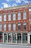
Fredericksburg 1991
Albert Lee Patton Building 10093 232 W. Main St.

30°16′39″N98°52′30″W / 30.27750°N 98.87500°W / 30.27750; -98.87500

Fredericksburg 1981
Albert Nebgen House 10088 613 Lee Roy Behrends Rd.

30°13′20″N98°38′21″W / 30.22222°N 98.63917°W / 30.22222; -98.63917

Stonewall 1988from Stonewall take RR 1623 S approx. 1 mi. to Lee Roy Behrends Rd.; take Behrends east approx. .6 mile to the DE Ranch entrance, take DE Road approx. .4 mile
Cherry Mountain School Complex 10015 5973 RM 2323

30°27′43″N98°56′54″W / 30.46194°N 98.94833°W / 30.46194; -98.94833

Fredericksburg 1992take US 87 NE 7.4 mi., then take Cherry Mountain Loop Rd. 1.8 mi.
Cherry Spring Schoolhouse CherrySpring1.JPG 10017 5973 RM 2323

30°27′50″N98°56′54″W / 30.46389°N 98.94833°W / 30.46389; -98.94833

Fredericksburg 1988take US 87 NW 7.5 miles to RM 2323, then north on RM 2323 six miles
Christian Crenwelge Place 10023 312 W. Schubert St.

30°16′51″N98°52′30″W / 30.28083°N 98.87500°W / 30.28083; -98.87500

Fredericksburg 1979
County Jail of 1885 10021 117 San Antonio St.

30°16′28″N98°52′28″W / 30.27444°N 98.87444°W / 30.27444; -98.87444

Fredericksburg 1980
D. C. Riley House 10101 Itz-Kast Rd. 0.2 mi. N of Lower Crabapple Rd.

30°26′0″N98°57′51″W / 30.43333°N 98.96417°W / 30.43333; -98.96417

Fredericksburg 1972take RR 965 N approx. 17 miles to Lower Crabapple Rd.; then east on Crab Apple 2.6 miles to Itz-Kast Rd.; then north on Itz .2 miles
Dangers Stone House Dangers Stone House, Fredericksburg, Gillespie County, Texas.jpg 10027 213 W. Creek St.

30°16′29″N98°52′38″W / 30.27472°N 98.87722°W / 30.27472; -98.87722

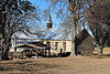
Fredericksburg 1974
Diedrich Rode Complex Historic American Buildings Survey, Richard MacAllister, Photographer May 29, 1936 SOUTH ELEVATION (FRONT). - Rode-Kothe House, East of U.S. 87 at Cherry Spring, Cherry Spring, HABS TEX,86-CHESP,1-2.tif
Commons-logo.svg More images
10104 Cherry Spring Rd. near V-K Rd.

30°28′56″N98°59′6″W / 30.48222°N 98.98500°W / 30.48222; -98.98500

Fredericksburg 1982take US 87 N approx. 17 miles; then east on cherry Spring Rd. 1.2 miles
Domino Parlor 10029 222 E. Main St.

30°16′25″N98°52′12″W / 30.27361°N 98.87000°W / 30.27361; -98.87000

Fredericksburg 1980
Duecker Family Homestead 10031 N. Grape Creek Rd.

30°20′4″N98°38′47″W / 30.33444°N 98.64639°W / 30.33444; -98.64639

Fredericksburg 1993FM 1631 east 6.7 miles, FM 2721 east approx. 8 mi., Grape Creek Road north 3.5 miles
Durst House 10032 2175 Wendell-Ahrens Rd.

30°23′8″N98°55′24″W / 30.38556°N 98.92333°W / 30.38556; -98.92333

Fredericksburg 1991take US 87 NW 8 miles to Cherry Mtn. Loop Rd.; then east on Cherry Mtn. Rd. 1.8 miles to Wandell-Ahrens Rd., then north on Wendell .4 miles to site
Edward and Minnie Stein House 10118 101 E. Hackberry St.

30°16′55″N98°51′54″W / 30.28194°N 98.86500°W / 30.28194; -98.86500

Fredericksburg 1994
Ellebracht-Moritz Homestead 10034 3574 RM 965

30°19′22″N98°51′35″W / 30.32278°N 98.85972°W / 30.32278; -98.85972

Fredericksburg 1987private property
Emil Weber House 10128 110 N. Cherry St.

30°17′5″N98°53′0″W / 30.28472°N 98.88333°W / 30.28472; -98.88333

Fredericksburg 1982
F. W. Arhelger Shop 10008 109 N. Adams St.

30°16′32″N98°52′18″W / 30.27556°N 98.87167°W / 30.27556; -98.87167

Fredericksburg 1980
Felix Van Der Stucken Home 10120 114 W. Austin St.

30°16′38″N98°52′20″W / 30.27722°N 98.87222°W / 30.27722; -98.87222

Fredericksburg 1981
Frank Van Der Stucken Birthplace 14946 123 E. Main St.

30°16′28″N98°52′18″W / 30.27444°N 98.87167°W / 30.27444; -98.87167

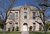
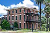
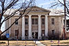
Fredericksburg 1962
Fredericksburg College Building 10040 108 W. Travis St.

30°16′47″N98°52′12″W / 30.27972°N 98.87000°W / 30.27972; -98.87000

Fredericksburg 1971
Gold-Grobe House 10047 413 N. Llano St.

30°16′38″N98°52′2″W / 30.27722°N 98.86722°W / 30.27722; -98.86722

Fredericksburg 1989
Gruen-Doebbler Homestead 16454 1251 Doebbler Rd.

30°8′40″N98°50′21″W / 30.14444°N 98.83917°W / 30.14444; -98.83917

Fredericksburg 2010
H. C. Keese Home 10058 Welgehausen Rd.

30°38′32″N98°52′26″W / 30.64222°N 98.87389°W / 30.64222; -98.87389

Fredericksburg 1981from Crabapple take RR 965 N approx. .75 mi. to Welgehausen Rd.; then west on Welgehausen Rd. 3.4 miles to site on right
Harper Presbyterian Church 10051 147 Oak Ave.

30°18′3″N99°15′11″W / 30.30083°N 99.25306°W / 30.30083; -99.25306

Harper 1976IS Hwy. 280 and FM 783
Heinrich Bierschwale House 10012 209 W. Austin St.

30°16′41″N98°52′27″W / 30.27806°N 98.87417°W / 30.27806; -98.87417

Fredericksburg 1987
Henry Basse House 10010 1004 S. Bowie St.

30°16′46″N98°53′31″W / 30.27944°N 98.89194°W / 30.27944; -98.89194

Fredericksburg 1991at US Hwy. 290 and Basse Ln. take Basse Ln. south .4 mi. to S. Bowie and go east 100 yards
Henry Cordes House 10020 204 W. Schubert St.

30°16′44″N98°52′20″W / 30.27889°N 98.87222°W / 30.27889; -98.87222

Fredericksburg 1981
Hoerster Building 242 E Main Fredericksburg.jpg 10055 242-244 W. Main St.

30°16′40″N98°52′31″W / 30.27778°N 98.87528°W / 30.27778; -98.87528

Fredericksburg 1988
Holy Ghost (Heilige Geist) Evangelical Protestant Church Holy Ghost Lutheran Church.jpg 10056 113 E. San Antonio St.

30°16′22″N98°52′21″W / 30.27278°N 98.87250°W / 30.27278; -98.87250

Fredericksburg 1981
Hugo and Anna Gold Crenwelge House 10024 Gold-Shafer Rd. 1.3 mi. S of Old Willow Rd.

30°22′32″N98°42′31″W / 30.37556°N 98.70861°W / 30.37556; -98.70861
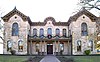
Fredericksburg 1990take SH 16 N 13 mi. to RR 1323; then east on RR 1323 2.7 mi. to Old Willow Rd., then south on Old Willow Rd. .5 mi. to Gold-Schafer Rd., then south on Gold-Schafer Rd. 1.3 miles
J. W. and Ruth Baines House 12975 112 W. College St.

30°16′49″N98°52′7″W / 30.28028°N 98.86861°W / 30.28028; -98.86861

Fredericksburg 2002Fredericksburg, 112 W. College Street
Johann Joseph Knopp House 10066 309 W. Schubert St.

30°16′50″N98°52′30″W / 30.28056°N 98.87500°W / 30.28056; -98.87500

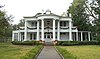
Fredericksburg 1971
John Peter Tatsch Home, 1856 Historic American Buildings Survey, Bartlett Cocke, Photographer March 10, 1934 VIEW FROM EAST. - John Peter Tatsch House, 210 North Bowie Street, Fredericksburg, Gillespie HABS TEX,86-FREBU,3-2.tif
Commons-logo.svg More images
10121 210 N. Bowie St.

30°16′55″N98°51′54″W / 30.28194°N 98.86500°W / 30.28194; -98.86500

Fredericksburg 1965
Kiehne-Hermann Home Historic American Buildings Survey, Richard MacAllister, Photographer May 29, 1936 NORTH ELEVATION (FRONT). - Kiehne-Foerster House, 405 East Main Street, Fredericksburg, HABS TEX,86-FREBU,8-1.tif
Commons-logo.svg More images
10065 405 E. Main St.

30°16′15″N98°52′1″W / 30.27083°N 98.86694°W / 30.27083; -98.86694

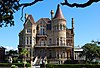
Fredericksburg 1976
Klingelhoeffer House 17349 701 W. Main St.

30°16′57″N98°52′58″W / 30.28250°N 98.88278°W / 30.28250; -98.88278

Fredericksburg 2012Southwest corner of W. Main St. and S. Acorn St.
Kloth-Ludwig Home 10067 414 E. Main St.

30°16′16″N98°51′58″W / 30.27111°N 98.86611°W / 30.27111; -98.86611

Fredericksburg 1980
Kuenemann House 11893 413 W. Creek St.

30°16′39″N98°52′52″W / 30.27750°N 98.88111°W / 30.27750; -98.88111

Fredericksburg 1997
Lehne-Itz House 10069 402 Whitney St.

30°16′27″N98°53′0″W / 30.27417°N 98.88333°W / 30.27417; -98.88333

Fredericksburg 1993
Little Rock House 10103 215B W. Main St.

30°16′36″N98°52′29″W / 30.27667°N 98.87472°W / 30.27667; -98.87472

Fredericksburg 1965
Liveoak Creek Log Cabin 10061 Loudon Rd. 2.5 mi. N of US 290

30°18′33″N98°57′40″W / 30.30917°N 98.96111°W / 30.30917; -98.96111

Fredericksburg 1976private property
Loeffler-Weber House 10072 508 W. Main St.

30°16′50″N98°52′45″W / 30.28056°N 98.87917°W / 30.28056; -98.87917

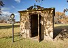
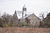
Fredericksburg 1971
Lower South Grape Creek School LowerSouthGrapeSchool1.jpg 10073 10273 E. US 290

30°13′29″N98°43′41″W / 30.22472°N 98.72806°W / 30.22472; -98.72806
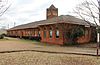
Stonewall 1994from Stonewalll take US 290 E approx. 10 miles, ROW
Luckenbach School Luckenbachschool1.jpg 10075 3566 Luckenbach Rd.

30°11′12″N98°45′16″W / 30.18667°N 98.75444°W / 30.18667; -98.75444

Luckenbach 1982from RR 1376 in Luckenbach take Luckenbach Rd. E approx. .5 miles
Ludwig Doebbler House 16447 542 Doebbler Rd.

30°8′55″N98°49′43″W / 30.14861°N 98.82861°W / 30.14861; -98.82861

Fredericksburg 2010
Lyndon Baines Johnson Lyndon B. Johnson birthplace NPS.jpg
Commons-logo.svg More images
10062 Park Road 49

30°14′27″N98°37′27″W / 30.24083°N 98.62417°W / 30.24083; -98.62417

Stonewall 1967LBJ National Park (near entrance on PR 49)
Maier-Alberthal Building 10078 324 E. Main St.

30°16′20″N98°52′4″W / 30.27222°N 98.86778°W / 30.27222; -98.86778

Fredericksburg 1983
Meckel-Hanus Building 10081 307 W. Main St.

30°16′40″N98°52′35″W / 30.27778°N 98.87639°W / 30.27778; -98.87639

Fredericksburg 1986
Moritz-Hitzfeld-Jacoby House 10085 608 N. Milam St.

30°17′3″N98°52′22″W / 30.28417°N 98.87278°W / 30.28417; -98.87278

Fredericksburg 1994
Morris Ranch Schoolhouse Morris Ranch Schoolhouse.jpg 10086 Morris Ranch Rd.

30°13′7″N99°0′56″W / 30.21861°N 99.01556°W / 30.21861; -99.01556

Fredericksburg 1981from intersection of US 290 and SH 16 in Fredericksburg, take SH 16 S approx. 9 miles to Morris Ranch Rd.; then west on ranch road approx. 2.4 miles
Mosel-Jordan-Duecker Haus 10087 121 E. San Antonio St.

30°16′24″N98°52′22″W / 30.27333°N 98.87278°W / 30.27333; -98.87278

Fredericksburg 1986
Moseley Log Cabin 14225 307 W. Schubert St.

30°16′51″N98°52′29″W / 30.28083°N 98.87472°W / 30.28083; -98.87472

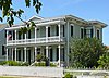
Fredericksburg 1964
Mueller-Petmecky House 10083 201 S. Washington St.

30°16′11″N98°52′8″W / 30.26972°N 98.86889°W / 30.26972; -98.86889

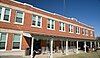
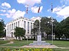
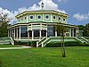
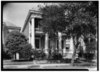
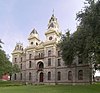
Fredericksburg 1983
Old Gillespie County Courthouse # Fredericksburg memorial library 2008.jpg
Commons-logo.svg More images
10045 101 & 115 W. Main St.

30°16′31″N98°52′24″W / 30.27528°N 98.87333°W / 30.27528; -98.87333

Fredericksburg 1967W. Main and S. Adams
Old Kammlah House Historic American Buildings Survey, Richard MacAllister, Photographer June 16, 1936 NORTH ELEVATION (FRONT). - Heinrich Kammlah House, 309 West Main Street, Fredericksburg, HABS TEX,86-FREBU,6-1.tif
Commons-logo.svg More images
10064 309 - 315 W. Main St.

30°16′40″N98°52′35″W / 30.27778°N 98.87639°W / 30.27778; -98.87639

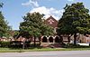
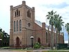
Fredericksburg 1966
Old St. Mary's Church (Die Alte Kirche) St. Mary's Catholic Church July 2017 1 (Marienkirche).jpg
Commons-logo.svg More images
15401 300 W. San Antonio St.

30°16′37″N98°52′36″W / 30.27694°N 98.87667°W / 30.27694; -98.87667

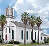
Fredericksburg 1994
Our Lady of Guadalupe Catholic Church 14535 302 E. College St.

30°16′38″N98°51′51″W / 30.27722°N 98.86417°W / 30.27722; -98.86417

Fredericksburg 1994
Pape Log Cabin Pape Log Cabin, Fredericksburg, Gillespie County, Texas.jpg 10092 213 W. Creek St.

30°16′29″N98°52′38″W / 30.27472°N 98.87722°W / 30.27472; -98.87722

Fredericksburg 1974
Pioneer Schandua House 10110 111 E. Austin St.

30°16′31″N98°52′14″W / 30.27528°N 98.87056°W / 30.27528; -98.87056

Fredericksburg 1980
Pioneer Store & Home 14969 309 W. Main St.

30°16′40″N98°52′35″W / 30.27778°N 98.87639°W / 30.27778; -98.87639

Fredericksburg 1966
Rausch Ranch Home 10098 Meusebach Creek Rd. at WM Hahn Rd.

30°11′45″N98°50′33″W / 30.19583°N 98.84250°W / 30.19583; -98.84250

Fredericksburg 1983go south on US 87 approx. 5.5 miles to Meusebach Rd.; then east 1.5 mi. to gate; then 400 ft. to "Y" at creek; then .3 mi. east to gate; then .4 mi. south to site
Ressmann-Boos House 10100 511 E. Main St.

30°16′11″N98°51′54″W / 30.26972°N 98.86500°W / 30.26972; -98.86500

Fredericksburg 1983
Riley-Enderlin House 10102 606 N. Adams St.

30°16′48″N98°52′3″W / 30.28000°N 98.86750°W / 30.28000; -98.86750

Fredericksburg 1987
Schmidt-Dietz Building 10111 218 W. Main St.

30°16′38″N98°52′28″W / 30.27722°N 98.87444°W / 30.27722; -98.87444

Fredericksburg 1981
Schmidt-Gold House 10112 106 S. Lincoln St.

30°16′20″N98°52′11″W / 30.27222°N 98.86972°W / 30.27222; -98.86972

Fredericksburg 1981
Schneider-Klingelhoefer House 10114 714 W. Main St.

30°17′1″N98°53′1″W / 30.28361°N 98.88361°W / 30.28361; -98.88361

Fredericksburg 1988
Schwarz Building 10115 216 W. Main St.

30°16′38″N98°52′28″W / 30.27722°N 98.87444°W / 30.27722; -98.87444

Fredericksburg 1981
Site of The Andreas Lindig Lime Kiln 10071 Rest area between RR 1 and US 290

30°14′13″N98°36′35″W / 30.23694°N 98.60972°W / 30.23694; -98.60972

Stonewall 1970Gillespie County Safety Rest Area, Lower Albert Road
St. Barnabas Episcopal Church 10105 601 W. Creek St.

30°16′45″N98°53′0″W / 30.27917°N 98.88333°W / 30.27917; -98.88333

Fredericksburg 1962W. Creek St. and S. owie St.
St. John's Lutheran Church 10106 14689 Lower Crabapple Rd.

30°26′23″N98°49′57″W / 30.43972°N 98.83250°W / 30.43972; -98.83250
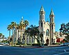
Fredericksburg 1994take RR 965 N approx. 10 miles; take left at "Y" just south of Crab Apple Creek Bridge and go .5 mi.
St. Mary's Catholic Church St. Mary's IMG 0857.JPG
Commons-logo.svg More images
14697 304 W. San Antonio St.

30°16′37″N98°52′37″W / 30.27694°N 98.87694°W / 30.27694; -98.87694

Fredericksburg 1995
St. Paul Lutheran Church 10107 9732 RM 1631

30°11′45″N98°50′33″W / 30.19583°N 98.84250°W / 30.19583; -98.84250

Fredericksburg 1969take RR 1631 NE approx. 10 miles
St. Peter Lutheran Church 10108 806 N. Lindsey Rd.

30°26′42″N99°7′48″W / 30.44500°N 99.13000°W / 30.44500; -99.13000

Doss 1993from Harper take rr 783 approx. 14 miles to intersection of RR 783 and RR 648 in Doss
The August Hennersdorf House 10053 205 W. Austin St.

30°16′40″N98°52′26″W / 30.27778°N 98.87389°W / 30.27778; -98.87389

Fredericksburg 1982
The Burrer Home 10013 Baj Ln. 0.3 mi. E of Lower Crabapple Rd.

30°20′18″N98°49′28″W / 30.33833°N 98.82444°W / 30.33833; -98.82444

Fredericksburg 1981take Lower Crabapple Rd. northeast 4 mi. to Baj Lane, then east on Baj Lane .3 mi.
The Carl Henke Home 10052 116 E. Travis St.

30°16′37″N98°52′5″W / 30.27694°N 98.86806°W / 30.27694; -98.86806

Fredericksburg 1978
The Christian Kraus Homestead 10060 0.75 mi. W of US 87 2 mi. W of town

30°19′12″N98°55′2″W / 30.32000°N 98.91722°W / 30.32000; -98.91722

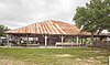
Fredericksburg 1984
The Grapetown School 10048 7325 Old San Antonio Rd.

30°8′53″N98°49′5″W / 30.14806°N 98.81806°W / 30.14806; -98.81806
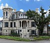
Fredericksburg 1984take US 290 E approx. 3 mi. to the Old San Antonio Rd.; then south approx 7.2 miles to Grapetown
The Meinhardt-Pfeil Home Historic American Buildings Survey, Bartlett Cocke, Photographer March 5, 1934 NORTHEAST ELEVATION (FRONT). - Pfeil House, 125 West San Antonio Street, Fredericksburg, Gillespie HABS TEX,86-FREBU,4-2.tif
Commons-logo.svg More images
10082 125 W. San Antonio St.

30°16′30″N98°52′30″W / 30.27500°N 98.87500°W / 30.27500; -98.87500

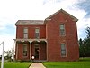
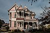
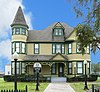
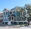
Fredericksburg 1981
The Patton Home 10094 107 N. Orange St.

30°16′42″N98°52′30″W / 30.27833°N 98.87500°W / 30.27833; -98.87500

Fredericksburg 1981
The Schandua Building Fredericksburg 6935.jpg 10109 205 E. Main St.

30°16′25″N98°52′14″W / 30.27361°N 98.87056°W / 30.27361; -98.87056

Fredericksburg 1979
The William Rausch House 10099 107 S. Lincoln St.

30°16′19″N98°52′10″W / 30.27194°N 98.86944°W / 30.27194; -98.86944

Fredericksburg 1985
Trinity Lutheran Church Trinity Lutheran Church, Stonewall, TX IMG 1502.JPG
Commons-logo.svg More images
10122 4270 Ranch Road 1

30°14′13″N98°36′37″W / 30.23694°N 98.61028°W / 30.23694; -98.61028

Stonewall 1989take US 290 E approx. 1 mile to Lower Albert Rd.; take Albert Rd. north approx. .2 miles to intersection with RR 1
Vereins Kirche Fredericksburg Vereins Kirche.JPG
Commons-logo.svg More images
10123 115 Pioneer Plaza

30°16′35″N98°52′21″W / 30.27639°N 98.87250°W / 30.27639; -98.87250

Fredericksburg 1967Market Square
Vogel Sunday House 10124 418 W. Austin St.

30°16′51″N98°52′39″W / 30.28083°N 98.87750°W / 30.28083; -98.87750

Fredericksburg 1982
Wahrmund Millinery, Moellendorf-Dietz Bakery Der LindenBaum.jpg 10126 312 E. Main St.

30°16′21″N98°52′6″W / 30.27250°N 98.86833°W / 30.27250; -98.86833

Fredericksburg 1978
Wahrmund-Priess House 12488 575 Buckeye Rd.

30°11′11″N98°57′0″W / 30.18639°N 98.95000°W / 30.18639; -98.95000

Fredericksburg 2001
Walch Home 10127 412 E. Austin St.

30°16′21″N98°51′57″W / 30.27250°N 98.86583°W / 30.27250; -98.86583

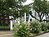
Fredericksburg 1978
Walter-Jenschke Sunday House Fredericksburg-tx2016-233(sunday-house)(jenschke).jpg
Commons-logo.svg More images
15200 406 W. Travis St.

30°16′55″N98°52′31″W / 30.28194°N 98.87528°W / 30.28194; -98.87528

Fredericksburg 1991
Weber "Das Keller Haus" 10129 110 N. Cherry St.

30°17′5″N98°53′1″W / 30.28472°N 98.88361°W / 30.28472; -98.88361

Fredericksburg 1982
Welgenhausen Ranch 10130 12800 RM 965

30°26′35″N98°50′18″W / 30.44306°N 98.83833°W / 30.44306; -98.83833

Fredericksburg 1983from Fredericksburg take RR 965 N approx. 12.6 miles to site just north of Crabapple
William Wahrmund House 10125 206 W. Main St.

30°16′37″N98°52′27″W / 30.27694°N 98.87417°W / 30.27694; -98.87417

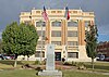
Fredericksburg 1977
Williams Creek School WilliamsCreekSchool2.jpg 15250 5501 S. RM 1623

30°11′45″N98°36′1″W / 30.19583°N 98.60028°W / 30.19583; -98.60028

Stonewall vicinity2002Albert community
Zion Evangelical Lutheran Church Fredericksburg - panoramio.jpg
Commons-logo.svg More images
10132 424 W. Main St.

30°16′49″N98°52′43″W / 30.28028°N 98.87861°W / 30.28028; -98.87861

Fredericksburg 1964

Glasscock County

Registered Texas Historic LandmarkImageMarker numberPhysical addressNearest cityYear designatedDescription
Glasscock County Courthouse and Jail # Glasscock County Courthouse Garden City Texas.jpg 2188 117 E. Currie Ave.

31°51′49″N101°28′49″W / 31.86361°N 101.48028°W / 31.86361; -101.48028

Garden City 1993FM 158, Courthouse grounds, Garden City

Goliad County

Registered Texas Historic LandmarkImageMarker numberPhysical addressNearest cityYear designatedDescription
Brooking-Lipscomb-White House 520 142 W. End St.

28°39′58″N97°23′37″W / 28.66611°N 97.39361°W / 28.66611; -97.39361

Goliad 1986142 W. End St.
Elijah Ray House 1450 8 mi. SW on FM 2442

28°40′17″N97°41′18″W / 28.67139°N 97.68833°W / 28.67139; -97.68833

Charco 1984From Charco, take FM 2442 8 miles SW.
Geraldos B. Smart House 2173 3 mi. E on US 59 Goliad 1962MARKER NOT LOCATED; previously: from Goliad, take US 59 3 miles NE; private—no access.
Goliad County Courthouse# Goliad courthouse.jpg
Commons-logo.svg More images
2204 300 S. Market St.

28°39′57″N97°23′31″W / 28.66583°N 97.39194°W / 28.66583; -97.39194

Goliad 1964Courthouse Square, S. Market Street, Goliad
Goliad Lodge No. 94 A.F. & A.M. Downtown Goliad9 (1 of 1).jpg 2205 202 Commercial St.

28°40′1″N97°23′34″W / 28.66694°N 97.39278°W / 28.66694; -97.39278

Goliad 1967Corner of Commercial and Franklin Streets
Judge Pryor Lea, Home 2883 W. Franklin St. at S. Chilton Ave.

28°40′2″N97°23′37″W / 28.66722°N 97.39361°W / 28.66722; -97.39361

Goliad 1962201 W. Franklin St.
Market House Museum# Old Market House Museum 2012-09-26 16-54-04.jpg 3217 205 S. Market St.

28°40′1″N97°23′31″W / 28.66694°N 97.39194°W / 28.66694; -97.39194

Goliad 1968At intersection of S. Market and Franklin Streets, Goliad.
Mission Nuestra Senora del Espiritu Santo de Zuniga §# The re-created Nuestra Senora del Espiritu Santo De Zuniga Mission, near the famous, oft-captured Presidio La Bahia in Goliad, Texas LCCN2014633552.tif
Commons-logo.svg More images
3408 108 PR 6

28°39′26″N97°23′12″W / 28.65722°N 97.38667°W / 28.65722; -97.38667

Goliad 1969From Goliad, take US 183/77A south about 1 mile to Goliad State Park—on mission wall.
Old Peck House Captain Baron Peck House Goliad Texas.JPG
Commons-logo.svg More images
3686 248 Hill Ave.

28°39′59″N97°24′5″W / 28.66639°N 97.40139°W / 28.66639; -97.40139

Goliad 1962From Goliad, take US 59 west about 1 mile, private property - no access.
Presidio de Nuestra Senora de Loreto de la Bahia Presidio Nuestra Senora de Loreto de la Bahia, commonly known as Presidio La Bahia, Goliad, Texas.jpg
Commons-logo.svg More images
4119 217 US 183 / US 77 Alt.

28°38′51″N97°22′57″W / 28.64750°N 97.38250°W / 28.64750; -97.38250

Goliad 1969From Goliad, take US 183/77A south about 1 mile to Presidio Chapel entrance on Spur 71.
Ramsey Home 4176 205 E. Garden St.

28°40′9″N97°23′26″W / 28.66917°N 97.39056°W / 28.66917; -97.39056

Goliad 1962205 Garden Street, Goliad.
Reed-McCampbell-Wiess Ranch Complex 4223 4 mi. NW on FM 883

28°34′1″N97°38′56″W / 28.56694°N 97.64889°W / 28.56694; -97.64889

Berclair 1991From Berclair, take FM 883 NW about 4 miles.
Site of September 1824 Indian Treaty 4885 4 mi. E on US 59 Goliad 1967MARKER MISSING; concrete base of marker remains, from Goliad, take US 59 east about 4 miles.
Stoddard-Collins House Jessie W- Stoddard House 2012-09-26 16-56-24.jpg 5128 400 E. Fannin St.

28°39′54″N97°23′18″W / 28.66500°N 97.38833°W / 28.66500; -97.38833

Goliad 1993Corner of Fannin and Jefferson Streets, Goliad.
W. J. "Ed" and Mary Elizabeth Lott House 5673 2 mi. W of US 59 on FM 1351 Goliad 19965 miles southwest of Goliad on US 59; 2 miles west on FM 1351

Gonzales County

Registered Texas Historic LandmarkImageMarker numberPhysical addressNearest cityYear designatedDescription
Braches House Gonzales-tx2016-21(braches-house).jpg
Commons-logo.svg More images
482 12 mi. SE of Gonzales off U.S. 90A

29°28′33″N97°18′32″W / 29.47583°N 97.30889°W / 29.47583; -97.30889

Gonzales 1962From Gonzales, take U.S. 90 a E about 10 mile, go .5 miles W. on County Road 361.
Brown House 834 Mitchell St.JPG 532 834 Mitchell St.

29°29′54″N97°26′40″W / 29.49833°N 97.44444°W / 29.49833; -97.44444

Gonzales 1963834 Mitchell St
Charles T. Rather House CT Rather House - 1892.JPG 821 828 St. Louis St.

29°30′7″N97°26′47″W / 29.50194°N 97.44639°W / 29.50194; -97.44639

Gonzales 1975
Chenault House (DEMOLISHED) 15304 324 St. Paul St.

29°30′2″N97°27′3″W / 29.50056°N 97.45083°W / 29.50056; -97.45083

Gonzales 1962
Episcopal Church of the Messiah Episcopal Chuch of the Messiah Gonzales.jpg 1491 711 St. Louis St.

29°30′7″N97°26′56″W / 29.50194°N 97.44889°W / 29.50194; -97.44889

Gonzales 1981
Gonzales College College - 1851.JPG 2217 820 St. Louis St.

29°30′7″N97°26′49″W / 29.50194°N 97.44694°W / 29.50194; -97.44694

Gonzales 1962
Gonzales County Jail# Gonzales-county-jail2016-2.jpg
Commons-logo.svg More images
2218 414 St. Lawrence St.

29°30′5″N97°27′7″W / 29.50139°N 97.45194°W / 29.50139; -97.45194

Gonzales 1966
Gonzales Courthouse # Gonzales-courthouse2016-3.jpg
Commons-logo.svg More images
2219 414 St. Joseph St.

29°30′4″N97°27′8″W / 29.50111°N 97.45222°W / 29.50111; -97.45222

Gonzales 1966
Gonzales Memorial Museum and Amphitheatre# Gonzales Museum - Dec 2012.JPG
Commons-logo.svg More images
2220 414 Smith St.

29°30′14″N97°26′37″W / 29.50389°N 97.44361°W / 29.50389; -97.44361

Gonzales 2003at St. Louis St.
Harwood Methodist Church and Masonic Lodge Harwood-methodist-church&masonic-lodge2016-2.jpg
Commons-logo.svg More images
2402 N. Second St. by Harwood Cemetery

29°40′9″N97°30′9″W / 29.66917°N 97.50250°W / 29.66917; -97.50250

Harwood 1979Stelle St. at N. Second St., Harwood.
Holmes Hospital 1118 Saint Louis St.JPG
Commons-logo.svg More images
2513 1118 St. Louis St.

29°30′11″N97°26′36″W / 29.50306°N 97.44333°W / 29.50306; -97.44333

Gonzales 1984
J. W. and Nannie C. Bailey House 623 Saint Michael St.JPG 277 623 St. Michael St.

29°29′59″N97°26′54″W / 29.49972°N 97.44833°W / 29.49972; -97.44833

Gonzales 1996
John Fauth House 521 Saint Peter St.JPG 1578 521 St. Peter St.

29°30′11″N97°27′4″W / 29.50306°N 97.45111°W / 29.50306; -97.45111

Gonzales 1965
Kennard House Kennard House, Gonzales, Texas.JPG 2924 621 St. Louis St.

29°30′6″N97°26′57″W / 29.50167°N 97.44917°W / 29.50167; -97.44917

Gonzales 1967
Leesville Baptist Church 3066 6055 FM 1682

29°24′26″N97°44′9″W / 29.40722°N 97.73583°W / 29.40722; -97.73583

Leesville 1976FM 1682, 3/4 mile E of Intersection of SA 80 & FM 1682, Leesville
Market Square 3219 Block bounded by St. Lawrence St., St. John St., St. Louis St., and Water St.

29°30′0″N97°27′20″W / 29.50000°N 97.45556°W / 29.50000; -97.45556

Gonzales 1966St. John St. between St Louis and St. Lawrence, Gonzales
Miller's Store 3381 N. Railroad St. at N. Main St.

29°41′35″N97°17′53″W / 29.69306°N 97.29806°W / 29.69306; -97.29806

Waelder 1968Hwy. 90 W, Waelder.
Remschel House 524 Saint Peter St.JPG 11900 524 St. Peter St.

29°30′12″N97°27′2″W / 29.50333°N 97.45056°W / 29.50333; -97.45056

Gonzales 1997
The Eggleston House Eggleston-house2015-2(gonzales-tx).jpg
Commons-logo.svg More images
1405 1303 St. Louis St.

29°30′15″N97°26′31″W / 29.50417°N 97.44194°W / 29.50417; -97.44194

Gonzales 1962in park, 1300 block St. Louis St.
The Pilgrim Home 707 Saint George St.JPG 5400 707 St. George St.

29°30′14″N97°26′58″W / 29.50389°N 97.44944°W / 29.50389; -97.44944

Gonzales 1965
Wells Home Wells House Gonzales Texas.jpg 5751 833 Mitchell St.

29°29′55″N97°26′41″W / 29.49861°N 97.44472°W / 29.49861; -97.44472

Gonzales 1964
William B. and Sue J. Houston House Houston House - Dec 26 2012.JPG 13016 621 St. George St.

29°30′13″N97°27′1″W / 29.50361°N 97.45028°W / 29.50361; -97.45028

Gonzales 2003621 East Saint George Street

Gray County

Registered Texas Historic LandmarkImageMarker numberPhysical addressNearest cityYear designatedDescription
1934 Pampa Post Office Building US Post Office-Pampa Main.JPG 36 120 E. Foster Ave.

35°32′10″N100°57′36″W / 35.53611°N 100.96000°W / 35.53611; -100.96000

Pampa 1992
1931 Combs-Worley Building Combs-Worley Building.JPG 11901 120 W. Kingsmill Ave.

35°32′12″N100°57′46″W / 35.53667°N 100.96278°W / 35.53667; -100.96278

Pampa 1998
Gray County Courthouse Gray County Courthouse (Pampa, Texas).JPG 11902 205 N. Russell St.

35°32′12″N100°57′50″W / 35.53667°N 100.96389°W / 35.53667; -100.96389

Pampa 1997Kingsmill & Russell
Pampa City Hall Pampa City Hall.JPG 3923 200 W. Foster Ave.

35°32′8″N100°57′46″W / 35.53556°N 100.96278°W / 35.53556; -100.96278

Pampa 19871 Albert Square, Pampa (faces Courthouse Square on Kingsmill).
Pioneer Cottage 4027 100 E. Atchison Ave.

35°32′6″N100°57′37″W / 35.53500°N 100.96028°W / 35.53500; -100.96028

Pampa 1970corner of Yeager Street and Starkweather in City Park area, Pampa.

See also

Recorded Texas Historic Landmarks listed by county
Anderson-CallahanCameron-Duval • Eastland-Gray • Grayson-HudspethHunt-MartinMason-RuskSabine-TravisTrinity-Zavala

Related Research Articles

<span class="mw-page-title-main">Anderson, Texas</span> City in Texas, United States

Anderson is a city and county seat of Grimes County, Texas, United States. The population was 193 as of the 2020 census. The town and its surroundings are listed on the National Register of Historic Places as the Anderson Historic District.

<span class="mw-page-title-main">Texas Historical Commission</span> Agency of the State of Texas, United States

The Texas Historical Commission is an agency dedicated to historic preservation within the U.S. state of Texas. It administers the National Register of Historic Places for sites in Texas.

<span class="mw-page-title-main">Sam Bell Maxey House</span> Historic house in Texas, United States

The Sam Bell Maxey House is a historic house in Paris, Lamar County, Texas. Samuel Bell Maxey, a prominent local attorney and later two-term U.S. senator, built the large two-story house after serving as a major general in the Confederate Army. It is built in the High Victorian Italianate style.

<span class="mw-page-title-main">James Riely Gordon</span> American architect

James Riely Gordon was an architect who practiced in San Antonio until 1902 and then in New York City, where he gained national recognition. J. Riely Gordon is best known for his landmark county courthouses, in particular those in Texas. Working during the state's "Golden Age" (1883–1898) of courthouse construction, Gordon saw 18 of his designs erected from 1885 to 1901; today, 12 remain.

<span class="mw-page-title-main">National Register of Historic Places listings in Tom Green County, Texas</span>

The following properties are listed on the National Register of Historic Places in Tom Green County, Texas.

<span class="mw-page-title-main">National Register of Historic Places listings in Bexar County, Texas</span>

This is a list of the National Register of Historic Places listings in Bexar County, Texas.

Recorded Texas Historic Landmark (RTHL) is a designation awarded by the Texas Historical Commission for historically and architecturally significant properties in the U.S. state of Texas. RTHL is a legal designation and the highest honor the state can bestow on a historic structure. Purchase and display of a historical marker is a required component of the RTHL designation process. Because it is a legal designation, owners of RTHL-designated structures must give 60 days' notice before any alterations are made to the exterior of the structure. Changes that are unsympathetic may result in removal of the designation and historical marker. More than 3,600 RTHL structures are spread throughout the state.

<span class="mw-page-title-main">National Register of Historic Places listings in Robertson County, Texas</span>

This is a list of the National Register of Historic Places listings in Robertson County, Texas.

<span class="mw-page-title-main">National Register of Historic Places listings in Hidalgo County, Texas</span>

This is a list of the National Register of Historic Places listings in Hidalgo County, Texas

<span class="mw-page-title-main">Old McCulloch County Jail</span> United States historic place

The Old McCulloch County Jail is located in Brady, McCulloch County, in the U.S. state of Texas. It was added to the National Register of Historic Places listings in McCulloch County, Texas in 1975, and became a Recorded Texas Historic Landmark in 1976. In 1963, the Texas Historical Commission designated the geographical center of Texas as being located 5 miles (8.0 km) northwest of Brady. The old jail became the Heart of Texas Historical Museum in 1974. A granite monument to the center of Texas can be found on the grounds of the McCulloch County Courthouse.

<span class="mw-page-title-main">National Register of Historic Places listings in Walker County, Texas</span>

This is a list of the National Register of Historic Places listings in Walker County, Texas.

<span class="mw-page-title-main">National Register of Historic Places listings in Parker County, Texas</span>

This is a list of the National Register of Historic Places listings in Parker County, Texas.

References

  1. "Historic Mooreville United Methodist Church Catches Fire". 8 February 2019.

Commons-logo.svg Media related to Recorded Texas Historic Landmarks at Wikimedia Commons