Related Research Articles

Schleicher County is a county located on the Edwards Plateau in the U.S. state of Texas. As of the 2020 census, its population was 2,451. Its county seat is Eldorado. The county was created in 1887 and organized in 1901. It is named for Gustav Schleicher, a German immigrant who became a surveyor and politician.

Grimes County is a county located in southeastern Texas, United States. As of the 2020 census, its population was 29,268. The seat of the county is Anderson. The county was formed from Montgomery County in 1846. It is named for Jesse Grimes, a signer of the Texas Declaration of Independence and early European-American settler of the county.

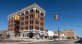
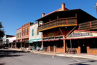
Erath County is a county located in the U.S. state of Texas. According to the United States Census bureau its population was 42,545 in 2020. The county seat is Stephenville. The county is named for George Bernard Erath, an early surveyor and a soldier at the Battle of San Jacinto.

Concho County is a county located on the Edwards Plateau in the U.S. state of Texas. At the 2020 census, the population was 3,303. Its county seat is Paint Rock. The county was founded in 1858 and later organized in 1879. It is named for the Concho River.

Brewster County is a county located in the U.S. state of Texas. It is in West Texas and its county seat is Alpine. It is one of the nine counties that comprise the Trans-Pecos region, and borders Mexico. Brewster County is the largest county by area in the state - at 6,192 square miles (16,040 km2) it is over three times the size of the state of Delaware, and more than 500 square miles (1,300 km2) bigger than Connecticut.

Crawford County is a county located in the central portion of the U.S. state of Georgia. As of the 2020 census, the population was 12,130. The county seat is Knoxville.
Great Valley is a town in Cattaraugus County, New York, United States. The population was 1,991 at the 2020 census. The town is named after its local geographical setting, a relative comparison of two tributaries of the Allegheny River.

Caddo is a town in Bryan County, Oklahoma, United States. The population was 997 at the 2010 census, a 5.6 percent gain over the figure of 944 recorded in 2000. The name is derived from a Caddo word, ka do hada’ cho, meaning "real chief" in English. According to Encyclopedia of Oklahoma History and Culture, the town was named for the nearby Caddo Hills.

De Leon is a city located in Comanche County in the U.S. state of Texas. Its population was 2,258 in the 2020 census. It is commonly associated with being named after the Spanish explorer Ponce de León, but the town is actually named for its location on the Leon River, which flows directly north and east of the community, and drains into nearby Proctor Lake.
Cisco is a city in Eastland County, Texas, United States. The population was 3,883 at the 2020 census, and 3,899 at the time of the 2010 census.

Rising Star is a town in Eastland County, Texas, United States. Its population as of the 2020 census was 756.
Hico is a small city located in Hamilton County in central Texas, United States. The population was 1,335 at the time of the 2020 census, down from 1,341 in the 2010 census. Over the years, it became a cattle and cotton market. Today, ranching and tourism dominate the local economy.

Boyce is a small incorporated town in Clarke County, Virginia, United States. The population was 749 at the 2020 census, up from 589 at the 2010 census.

Elgin is a city in Bastrop County in the U.S. state of Texas. The population was 9,784 at the 2020 census.
The United States Border Patrol operates 71 traffic checkpoints, including 33 permanent traffic checkpoints, near the Mexico–United States border. The stated primary purpose of these inspection stations is to deter illegal immigration and smuggling activities. After the September 11 attacks in 2001, they took on the additional role of terrorism deterrence. These checkpoints are located between 25 and 75 miles of the Mexico–United States border along major U.S. highways; near the southern border of the contiguous United States. Their situation at interior locations allow them to deter illegal activities that may have bypassed official border crossings along the frontier. The checkpoints are divided among nine Border Patrol sectors. There are a number of these checkpoints near the northern border of the contiguous U.S. as well, within 100 miles (160 km) of the Canada–U.S. border.
Alexander is an unincorporated community located in southern Erath County in Central Texas, United States. Alexander is located in the southern part of the county, along Texas State Highway 6 and Fm-914. The town was originally called: "Harper's Mill" when the Post Office was approved for operation around the 1870s. The name was changed in the 1880s, when the Texas Central line, part of the historic Katy Railroad, was built from east to west through the townsite on its way from the Waco area to Stamford, with a branch to Cross Plains from the line at De Leon. In 1907, the Stephenville North and South Texas Railway, part of the Cotton Belt Route, was constructed from north to south and intersected with the Katy's line in Alexander. This made the town an important community for business in the area. The Cotton Belt Route ran from Stephenville through to nearby Carlton. On October 17, 1934, the Cotton Belt Route was abandoned from Stephenville to Hamilton. The Katy Railroad remained through Alexander until its abandonment in the late 1960s. The Alexander post office closed in 1970 and the population remained at a steady 40 from the 1970s through 2000.
Harbin is an unincorporated community located in Erath County in Central Texas, United States. Harbin is in the southwestern part of the county at the intersections of Fm-847 and the Fort Worth and Western Railroad, four miles east-northeast of the City of Dublin.
Comyn is an unincorporated community located in Comanche County in Central Texas, United States. According to the Handbook of Texas, it had a population of 40 in 2000.

Plymouth Township is a township in Russell County, Kansas, United States. As of the 2010 United States Census, it had a population of 280.
Driftwood is a small unincorporated community in northern Alfalfa County, Oklahoma, United States. A formerly prosperous small rural community, at one time it had two churches, a grocery store, barber shop, gas station with repair shop, grain elevator, two-story school, a telephone office, bank, and post office. Currently, it is made up of less than a dozen residences - along with a church and cemetery - grouped along both sides of Oklahoma State Highway 8/State Highway 58.
References
- Texas Escapes Online entry for Clairette
- Katy Railroad Historical Society website
- Handbook of Texas Online entry for Clairette, Texas
Municipalities and communities of Erath County, Texas, United States | ||
|---|---|---|
| Cities |  | |
| CDPs | ||
| Other communities | ||
| Ghost town | ||
| International | |
|---|---|
| National | |
| Other | |