Pawnee is a census-designated place (CDP) in Bee County, Texas, United States. The population was 166 at the 2010 census.

Childress is a city in Childress County, Texas, United States. The population was 6,905 at the 2010 census. It is the county seat of Childress County.
Hico is a small city located in Hamilton and Erath counties in central Texas, United States. The town motto is "Where Everybody Is Somebody!"

Cotulla is a city in and the county seat of La Salle County, Texas, United States. The population was 3,614 at the 2000 census. The whole of La Salle County had 6,886 persons in the 2010 census. In June 2014, Cotulla "self-declared" its population at 7,000, based on utility connections alone.

Floresville is a city in Wilson County, Texas, United States. The population was 6,448 at the 2010 census. It is the county seat of Wilson County. The city is also part of the San Antonio Metropolitan Statistical Area.

Mineola is a city in Wood County, Texas, United States. It lies at the junction of U.S. highways 69 and 80, eighty miles east of Dallas in southwestern Wood County. The population was 4,515 at the 2010 census.
Tilden is a Census-designated place (CDP) and county seat of McMullen County, Texas, United States.

Poolville is an unincorporated community in Parker County, Texas, United States located along Farm Road 920, about seventeen miles northwest of Weatherford, the county seat. It has a population of 2,325 people and a school district with three campuses, a seed company, Snyder and Sons elevator, Williams Barbershop, a post office, a convenience store, a storage facility, and 2L Custom Trucks. There are five churches: Methodist, Southern Baptist, Church of Christ, The Lone Star Church of Poolville Texas, and Oak Tree Baptist Church. The United Methodist and the Church of Christ Church buildings are located just west of the town square behind the seed company.
Cottonwood is an unincorporated community in southeastern Callahan County, Texas, United States, on FM 880, eight miles northwest of Cross Plains. It was first settled by J. W. Love in 1875, under the name Cottonwood Springs. The name was shortened to Cottonwood when a post office was established there. The town has a community center, active church of Christ and Baptist Church congregations, a Methodist Church building, and a volunteer fire department.

Advance is an unincorporated community and census-designated place (CDP) in Davie County, North Carolina, United States. It is seventy-five miles northeast of Charlotte. As of the 2010 census it had a population of 1,138. It is located along North Carolina Highway 801 just south of Bermuda Run. Advance is part of the Piedmont Triad region of North Carolina.
Bluegrove is an unincorporated community on Farm to Market Road 172 11 miles southeast of Henrietta in central Clay County, Texas, United States.

Spicewood is an unincorporated community in Burnet County, Texas, United States. According to the Texas Almanac, the community had an estimated population of 2,000 in 2000. But in the 2011 census, the community had a population of 7,666. The community also extends towards Travis County off of Highway 71.
McKinley is an unincorporated community in Marengo County, Alabama, United States. McKinley had a post office at one time, but it no longer exists. Although a thriving community in its earliest years, it has since dwindled into obscurity.
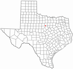
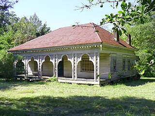
Hampton was a town in Palo Pinto County, Texas, United States. The town was moved south one mile to a nearby railroad and renamed Gordon in 1881.

Brashear is an unincorporated community located on Interstate Highway 30 and Farm to Market Road 2653 in west central Hopkins County, Texas, United States. Although it is unincorporated, Brashear has a post office, church, farm buildings, a radio building, and other buildings.
Purves is an unincorporated community in Erath County, Texas, United States. Purves is located in the southwestern part of the county, along Fm-219 South, seven miles south of the City of Dublin.
Harbin is an unincorporated community located in Erath County in Central Texas. Harbin is in the southwestern part of the county at the intersections of Fm-847 and the Fort Worth and Western Railroad 4 miles east-northeast of the City of Dublin.
Speegleville is an unincorporated community located in McLennan County in Central Texas. Speegleville is a Suburb in the Waco Metropolitan Statistical Area. The community is located along Texas State Highway 6 around 8 miles to the west of the City of Waco on the western edge of Lake Waco. The population of Speegleville was 111 at the time of the 2000 Census. As of 2010 Speegleville continued to maintain a volunteer fire department, elementary school, and 3 churches. Speegleville Park is a US Army Corps of Engineers maintained recreational area with a public beach and campgrounds located on Lake Waco. Speegleville was named for Israel Washington Speegle, a blacksmith and farmer who came to the area from Jasper County, Missouri, in 1849. A Baptist congregation, which was organized in 1859 as the Pleasant Grove Church, shared a building with the local school. The Speegleville post office operated from 1879 until 1929. Speegle was the first postmaster. Speegleville had a population of twenty-five in the mid-1880s and fifty by the early 1890s. In 1896 the community had two general stores, and the principal occupation of area residents was stock raising. That year the Speegleville school district had seventy-seven students and one teacher. Construction of Waco Dam in the late 1920s forced several residents to move their homes or businesses. Residents were forced to move again in the late 1950s and early 1960s because of the construction of the new Lake Waco dam. The original townsite was destroyed, and Speegleville became a scattered collection of houses instead of an organized town. The Speegleville Independent School District was consolidated with the Midway Independent School District in 1980. Population estimates for the community remained at 111 from 1900 through 2000. Notable people that have lived in Speegleville. Congressman Joe Barton worked for his uncle Calvin Buice at the Speegleville Store when he was a teenager during the summers. Johnny Watkins hosted a farm and ranch show on channel 6 KCEN and was a local celebrity.
Joppa is an unincorporated community located in Burnet County, Texas, United States. Joppa is located on the North Fork of the San Gabriel River seven miles northeast of the City of Bertram. First settlers of this farming and ranching community included the William Alexander Faires family who moved to the area in 1874 and the Martin Luther Ater family who moved from nearby Mahomet in 1875.
Bowser is an unincorporated community in northwestern San Saba County in western Central Texas. It lies about 9 miles north of Richland Springs.