Hale County | |
---|---|
Coordinates: 34°04′N101°50′W / 34.07°N 101.83°W | |
Country | United States |
State | Texas |
Founded | 1888 |
Seat | Plainview |
Largest city | Plainview |
Area | |
• Total | 1,005 sq mi (2,600 km2) |
• Land | 1,005 sq mi (2,600 km2) |
• Water | 0.1 sq mi (0.3 km2) 0.01% |
Population (2020) | |
• Total | 32,522 |
• Density | 32/sq mi (12/km2) |
Time zone | UTC−6 (Central) |
• Summer (DST) | UTC−5 (CDT) |
Congressional district | 19th |
Website | www |
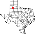
Hale County is a county located in the U.S. state of Texas. As of the 2020 census, its population was 32,522. [1] Its county seat is Plainview. [2] The county was created in 1876 and organized in 1888. [3] It is named for Lt. John C. Hale, [4] a hero of the Battle of San Jacinto. Hale County comprises the Plainview, Texas micropolitan statistical area.
In 7000 BC, Paleo-Indians were the first county inhabitants. Later Native American inhabitants included the Comanche. [5] The Texas Legislature formed Hale County from Bexar County in 1876. [5] A few years later (1881), brothers T.W. and T.N. Morrison, and W.D. Johnson, established the Cross L Ranch and the XIT to raise cattle. [6] In 1883, New York Methodist minister Horatio Graves became the first white permanent settler in the county. [6]
The city of Plainview has its beginnings in 1886 when rancher Zachery Taylor Maxwell moved his family and 2,000 sheep from Floyd County to the site of two hackberry groves [7] on the old military trail established by Col. Ranald S. Mackenzie. The city's name comes from the area's vista. [8] The county was organized in 1888, with Plainview as the county seat. [9] By 1900, the county had 259 farms and ranches, with a population of 1,680. [5]
The Santa Fe Railway came to Plainview in 1906, [10] and Wayland Baptist College was founded the same year. [11] In 1909, businessman Levi Schick opened the Schick Opera House. [12] The county's first motor-driven irrigation well was drilled five years later. [5] The Texas Land and Development Company was organized in Plainview in 1912. Its purpose was to entice settlers by dividing a large tract of land into individual farms, and preparing each farm for occupancy. [13]
The Plainview Site was discovered in 1944. In addition to bone and man-made artifacts, archeologists found the remains of 100 extinct bison about twice the size of modern "buffalo". [14]
Oil was discovered in 1946 in the Anton-Irish field of Lamb and Hale Counties. [15]
Country artist Jimmy Dean, his brother Don Dean, and cousin-in-law Troy Pritchard founded the Jimmy Dean Sausage Company and opened the Jimmy Dean Meat Company in 1969. [16] As of 2010, Hale County was one of 62 counties in Texas still legally barring the sale of alcohol. [17] As of March 7, 2008, Plainview has allowed the sale of packaged alcohol within the city limits. [18]
According to the U.S. Census Bureau, the county has a total area of 1,005 square miles (2,600 km2), of which 0.1 square miles (0.26 km2) (0.01%) is covered by water. [19]
Census | Pop. | Note | %± |
---|---|---|---|
1890 | 721 | — | |
1900 | 1,680 | 133.0% | |
1910 | 7,566 | 350.4% | |
1920 | 10,104 | 33.5% | |
1930 | 20,189 | 99.8% | |
1940 | 18,813 | −6.8% | |
1950 | 28,211 | 50.0% | |
1960 | 36,798 | 30.4% | |
1970 | 34,137 | −7.2% | |
1980 | 37,592 | 10.1% | |
1990 | 34,671 | −7.8% | |
2000 | 36,602 | 5.6% | |
2010 | 36,227 | −1.0% | |
2020 | 32,522 | −10.2% | |
U.S. Decennial Census [20] 1850–2010 [21] 2010 [22] 2020 [23] |
Race / Ethnicity (NH = Non-Hispanic) | Pop 2000 [24] | Pop 2010 [22] | Pop 2020 [23] | % 2000 | % 2010 | % 2020 |
---|---|---|---|---|---|---|
White alone (NH) | 16,526 | 13,647 | 10,693 | 45.15% | 37.62% | 32.88% |
Black or African American alone (NH) | 2,044 | 1,803 | 1,381 | 5.58% | 4.97% | 4.25% |
Native American or Alaska Native alone (NH) | 139 | 103 | 99 | 0.38% | 0.28% | 0.30% |
Asian alone (NH) | 107 | 133 | 149 | 0.29% | 0.37% | 0.46% |
Pacific Islander alone (NH) | 7 | 19 | 30 | 0.02% | 0.05% | 0.09% |
Other race alone (NH) | 18 | 32 | 69 | 0.05% | 0.09% | 0.21% |
Mixed race or Multiracial (NH) | 229 | 267 | 612 | 0.63% | 0.74% | 1.88% |
Hispanic or Latino (any race) | 17,532 | 20,269 | 19,489 | 47.90% | 55.88% | 59.93% |
Total | 36,602 | 36,273 | 32,522 | 100.00% | 100.00% | 100.00% |
As of the census [25] of 2000, 36,602 people, 11,975 households, and 9,136 families resided in the county. The population density was 36 people/sq mi (14 people/km2). The 13,526 housing units averaged 14 units per square mile (5.4/km2). The racial makeup of the county was 66.77% White, 5.79% African American, 0.92% Native American, 0.30% Asian, 23.80% from other races, and 2.42% from two or more races. About 47.90% of the population was Hispanic or Latino of any race.
Of the 11,975 households, 40.40% had children under the age of 18 living with them, 60.30% were married couples living together, 11.60% had a female householder with no husband present, and 23.70% were not families. About 21% of all households were made up of individuals, and 10.7% had someone living alone who was 65 years of age or older. The average household size was 2.86 and the average family size was 3.32.
In the county, the population was distributed as 30.20% under the age of 18, 11.40% from 18 to 24, 27.20% from 25 to 44, 18.30% from 45 to 64, and 12.90% who were 65 years of age or older. The median age was 31 years. For every 100 females there were 102.40 males. For every 100 females age 18 and over, there were 101.30 males.
The median income for a household in the county was $31,280, and for a family was $35,250. Males had a median income of $26,007 versus $20,057 for females. The per capita income for the county was $13,655. About 14.30% of families and 18.00% of the population were below the poverty line, including 23.30% of those under age 18 and 14.80% of those age 65 or over.
Year | Republican | Democratic | Third party(ies) | |||
---|---|---|---|---|---|---|
No. | % | No. | % | No. | % | |
2020 | 7,177 | 74.87% | 2,279 | 23.77% | 130 | 1.36% |
2016 | 6,366 | 71.87% | 2,101 | 23.72% | 391 | 4.41% |
2012 | 6,490 | 73.30% | 2,243 | 25.33% | 121 | 1.37% |
2008 | 7,171 | 72.12% | 2,708 | 27.24% | 64 | 0.64% |
2004 | 8,025 | 79.03% | 2,078 | 20.46% | 51 | 0.50% |
2000 | 6,868 | 75.39% | 2,158 | 23.69% | 84 | 0.92% |
1996 | 5,905 | 60.59% | 3,204 | 32.88% | 637 | 6.54% |
1992 | 6,098 | 59.59% | 2,761 | 26.98% | 1,375 | 13.44% |
1988 | 6,284 | 64.05% | 3,502 | 35.69% | 25 | 0.25% |
1984 | 7,670 | 70.43% | 3,202 | 29.40% | 19 | 0.17% |
1980 | 7,277 | 65.86% | 3,610 | 32.67% | 163 | 1.48% |
1976 | 5,390 | 48.97% | 5,580 | 50.70% | 37 | 0.34% |
1972 | 7,051 | 76.04% | 2,135 | 23.02% | 87 | 0.94% |
1968 | 4,696 | 45.60% | 3,293 | 31.98% | 2,309 | 22.42% |
1964 | 3,666 | 38.21% | 5,910 | 61.60% | 18 | 0.19% |
1960 | 4,784 | 56.07% | 3,695 | 43.31% | 53 | 0.62% |
1956 | 3,804 | 49.64% | 3,848 | 50.22% | 11 | 0.14% |
1952 | 4,858 | 59.06% | 3,351 | 40.74% | 17 | 0.21% |
1948 | 1,013 | 19.08% | 3,995 | 75.24% | 302 | 5.69% |
1944 | 712 | 16.26% | 3,066 | 70.02% | 601 | 13.72% |
1940 | 906 | 20.96% | 3,405 | 78.76% | 12 | 0.28% |
1936 | 451 | 12.59% | 3,109 | 86.80% | 22 | 0.61% |
1932 | 369 | 10.74% | 3,029 | 88.13% | 39 | 1.13% |
1928 | 2,143 | 65.98% | 1,098 | 33.81% | 7 | 0.22% |
1924 | 507 | 24.84% | 1,446 | 70.85% | 88 | 4.31% |
1920 | 352 | 20.96% | 1,279 | 76.18% | 48 | 2.86% |
1916 | 80 | 7.71% | 908 | 87.48% | 50 | 4.82% |
1912 | 26 | 3.74% | 554 | 79.71% | 115 | 16.55% |
School districts serving the county include: [27]
The county is in the service area of South Plains College. [28]
Zavala County is a county located in the U.S. state of Texas. As of the 2020 census, the population was 11,677. Its county seat is Crystal City. The county was created in 1858 and later organized in 1884. Zavala is named for Lorenzo de Zavala, Mexican politician, signer of the Texas Declaration of Independence, and first vice president of the Republic of Texas.
Swisher County is a county in the U.S. state of Texas. As of the 2020 census, its population was 6,971. Its county seat is Tulia. The county was created in 1876 and later organized in 1890. It is named for James G. Swisher, a soldier of the Texas Revolution and signer of the Texas Declaration of Independence.
Nacogdoches County is a county located in the U.S. state of Texas. As of the 2020 census, its population was 64,653. Its county seat is Nacogdoches.
Mitchell County is a county in the U.S. state of Texas. As of the 2020 census, its population was 8,990. Its county seat is Colorado City. The county was created in 1876 and organized in 1881. It is named for Asa and Eli Mitchell, two early settlers and soldiers in the Texas Revolution.
Madison County is a county located in the U.S. state of Texas. As of the 2020 census, its population was 13,455. Its seat is Madisonville. The county was created in 1853 and organized the next year. It is named for James Madison, the fourth President of the United States. In 1852, Hillary Mercer Crabb was elected to serve the unexpired term of State Representative F. L. Hatch. Among Crabb's accomplishments as a legislator was the introduction of a bill to create Madison County.
Lynn County is a county in the U.S. state of Texas. As of the 2020 census, its population was 5,596. Its county seat is Tahoka. The county was created in 1876 and organized in 1903.
Lubbock County is a county located in the U.S. state of Texas. The 2020 census placed the population at 310,639. Its county seat and largest city is Lubbock. The county was created in 1876 and organized in 1891. It is named for Thomas Saltus Lubbock, a Confederate colonel and Texas Ranger.
Live Oak County is a county in the U.S. state of Texas. It was named for its native groves of live oak. George West is its county seat. Its population was 11,335 in the 2020 census.
Floyd County is a county in the U.S. state of Texas. As of the 2020 census, its population was 5,402. The seat of the county is Floydada. The county was created in 1876 and later organized in 1890. It is named for Dolphin Ward Floyd, who died on his 32nd birthday, March 6, 1836, defending the Alamo.
Dawson County is a county in the U.S. state of Texas. As of the 2020 census, its population was 12,456. The county seat is Lamesa. The county was created in 1876 and later organized in 1905. It is named for Nicholas Mosby Dawson, a soldier of the Texas Revolution. Dawson County comprises the Lamesa, TX Micropolitan Statistical Area (μSA), and it is, by population, the smallest Micropolitan Statistical Area in the United States.
Cherokee County is a county located in the U.S. state of Texas. As of the 2020 census, its population was 50,412. The county seat is Rusk, which lies 130 miles southeast of Dallas and 160 miles north of Houston. The county was named for the Cherokee, who lived in the area before being expelled in 1839. Cherokee County comprises the Jacksonville micropolitan statistical area, which is also included in the Tyler–Jacksonville combined statistical area.
Borden County is a rural county located in the U.S. state of Texas. It is in West Texas and its county seat is Gail.
Bailey County is a county located in the U.S. state of Texas. It is in West Texas and its county seat is Muleshoe. As of the 2020 census, its population was 6,904.
Edmonson is a town in Hale County, Texas, United States. The population was 86 at the 2020 census.
Hale Center is a city in Hale County, Texas. The population was 2,062 at the 2020 census, down from 2,252 in 2010.
Petersburg is a city in Hale County, Texas, United States. As of the 2020 census, it had a population of 1,014.
Plainview is a city in and the county seat of Hale County, Texas, United States. As of the 2020 census, its population was 20,187.
Seth Ward is an unincorporated community and census-designated place (CDP) in Hale County, Texas, United States. The population was 2,025 at the 2010 census.
Abernathy is a city in Hale and Lubbock counties in the U.S. state of Texas. The population was 2,805 at the 2010 census.
Moore County is a county located in the U.S. state of Texas. As of the 2020 census, its population was 21,358. The county seat is Dumas. The county was created in 1876 and organized in 1892. It is named for Edwin Ward Moore, the commander of the Texas Navy. The Dumas micropolitan statistical area includes all of Moore County.