Denton County is located in the U.S. state of Texas. As of the 2020 census, its population was 906,422, making it the seventh-most populous county in Texas.[1] The county seat is Denton.[2] The county, which was named for John B. Denton, was established in 1846. Denton County constitutes part of the Dallas–Fort Worth metroplex. In 2007, it was one of the fastest-growing counties in the United States.[3]
Before the arrival of settlers, various Native American peoples, including the Kichai and the Lenape, infrequently populated the area.[4] The area was settled by Peters Colony landowners in the early 1840s.[5] Until the annexation of Texas, the area was considered part of Fannin County.[6] On April11, 1846, the First Texas Legislature established Denton County.[7] The county was named for John B. Denton, who was killed while raiding a Native American village in Tarrant County in 1841.[8] Originally, the county seat was set at Pinckneyville. This was later changed to Alton, where the Old Alton Bridge currently stands, and then moved finally to Denton.
By 1860, the population of the county had increased to 5,031.[9] On March 4, 1861, residents of the county narrowly voted for secession from the Union, with 331 votes cast for and 264 against.[10] The Missouri–Kansas–Texas Railroad reached Lewisville, located in the southern portion of the county, by the early 1880s.[5] The Denton County Courthouse-on-the-Square was built in 1896, and currently houses various government offices, as well as a museum.[11]
According to the U.S. Census Bureau, the county has a total area of 953 square miles (2,470km2), of which 878 square miles (2,270km2) are land and 75 square miles (190km2) (7.8%) are covered by water.[13] Denton County is located in the northern part of the Dallas–Fort Worth metroplex, about 35 miles south of the border between Texas and Oklahoma.[14] It is drained by two forks of the Trinity River.[15] The largest body of water in Denton County is Lewisville Lake, which was formed in 1954 when the Garza–Little Elm Reservoir was merged with Lake Dallas. The county is on the western edge of the eastern Cross Timbers and also encompasses parts of the Grand Prairie portion of the Texas blackland prairies. Portions of Denton County sit atop the Barnett Shale, a geological formation believed to contain large quantities of natural shale gas. Between 1995 and 2007, the number of natural gas wells in the county increased from 156 to 1,820, which has led to some controversy over the pollution associated with hydraulic fracturing.[16]
Denton County, Texas – Racial and ethnic composition Note: the US Census treats Hispanic/Latino as an ethnic category. This table excludes Latinos from the racial categories and assigns them to a separate category. Hispanics/Latinos may be of any race.
According to the 2010 United States census,[23] there were 662,614 people, 224,840 households and 256,139 housing units in the county. The population density was 754.3 peopleper square mile (291.2 people/km2). By the 2020 census, its population increased to 906,422,[22] representing continued population growth among suburban communities outside of the principal metropolitan cities of Dallas and Fort Worth. Denton County ranked 29th on the U.S. Census Bureau's list of fastest-growing counties between 2000 and 2007, with a 41.4% increase in population.[3]
In 2010, the racial makeup of the county was 75% White, 8.4% African American, 0.7% Native American, 6.6% Asian, and 3.0% from two or more races. About 18.2% of the population was Hispanic or Latino of any race.[24] The 2020 census determined the racial and ethnic makeup was 53.58% non-Hispanic white, 10.52% Black or African American, 0.40% Native American, 10.23% Asian, 0.07% Pacific Islander, 0.43% some other race, 4.60% multiracial, and 20.16% Hispanic or Latino American of any race,[22] reflecting state and national demographic trends of greater diversification.[25][26]
Denton County, like all counties in Texas, is governed by a commissioner's court, which consists of the county judge (the chairperson of the court), who is elected county-wide, and four commissioners who are elected by the voters in each of four districts.
Justices of the peace are county officials with jurisdiction over landlord/tenant issues, small civil claims, certain misdemeanors involving fines only (no jail time), and other matters.[28]
County judge and commissioners
Office
Name
Party
County judge
Andy Eads
Republican
Commissioner, Precinct 1
Ryan Williams
Republican
Commissioner, Precinct 2
Kevin Falconer
Republican
Commissioner, Precinct 3
Bobbie Mitchell
Republican
Commissioner, Precinct 4
Dianne Edmondson
Republican
County officials
Office
Name
Party
District attorney
Paul Johnson
Republican
County clerk
Juli Luke
Republican
District clerk
David Trantham
Republican
Sheriff
Tracy Murphree
Republican
Tax assessor
Michelle French
Republican
Treasurer
Cindy Yeatts Brown
Republican
Justices of the peace
Office
Name
Party
Precinct 1
Alan Wheeler
Republican
Precinct 2
James R. DePiazza
Republican
Precinct 3
James Kerbow
Republican
Precinct 4
Harris Hughey
Republican
Precinct 5
Mike Oglesby
Republican
Precinct 6
Blanca Oliver
Republican
Law enforcement
The Denton Sheriff's Office employs more than 600 people, for the Denton County Sheriff's Office, most in the Detention Bureau.[29] The office operates a county jail that houses up to 1,400 prisoners. The office is co-located with the jail at 127 North Woodrow Lane in the city of Denton.[30]
As of 2021, the current sheriff is Tracy Murphree, who was first elected in 2016.[31] That election was particularly contentious, with previous sheriff William B. Travis dogged by scandal,[32] and new candidate Murphree making headlines for saying he would beat up a man who entered a women's public bathroom his daughter was using.[33]
Politics
Denton County, like most suburban counties in Texas, is reliably Republican in statewide and national elections, although becoming less so since the 2018 election, when Beto O'Rourke earned 45.52% of the county's votes and two Democrats were elected.[34] The last Democratic presidential candidate to win the county was native Texan Lyndon B. Johnson in 1964,[35] the only time since 1952 that the county has been carried by a Democrat. Denton swung rapidly into the Republican column at the federal level in the 1950s and 1960s as Dallas and Fort Worth's suburbs spilled into the county.
In 2018, former State Representative Michelle Beckley became the first Democrat elected to the state legislature from Denton County since 1984.[36] Her district at the time, the former 65th, was located entirely within Denton County, and included significant portions of Carrollton, Highland Village and Lewisville. Beckley stepped down from the seat in 2022 to run for Lieutenant Governor, and ultimately it was won back by the Republican nominee.[37] Also in 2018, Christopher Lopez was elected to Justice of the Peace, Precinct 6, and became the first Democrat elected at the county level since 2004; Lopez held the JP6 position until a Republican challenger unseated him in 2022.[36]
Despite a Republican advantage, Denton County has trended leftward, as Joe Biden managed to win 45.2% of the vote share (compared to Donald Trump's 53.3%) in the 2020 presidential election, the best result for a Democrat since 1976. Many other suburban Texas counties, including its immediate neighbors in Collin and Tarrant Counties, as well as those around Houston and Austin, showed similar swings between 2016 and 2020. However, in 2024 many of these swung back toward Trump, though Trump carried Denton County by a smaller margin than in 2016. This election also marked the first time since 1972 that Denton County voted to the left of Texas as a whole.
United States presidential election results for Denton County, Texas[38]
From around 1997 to 2015, the number of non-Hispanic white children in K-12 schools in the county increased by 20,000 as part of a trend of white flight and suburbanization by non-Hispanic white families.[43]
Colleges and universities
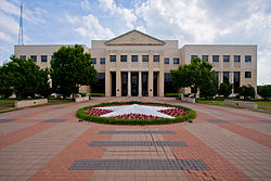
Hurley Administration Building of UNT.
According to the Texas Education Code, most of Denton County is assigned to North Central Texas College for community college. However, portions within Celina ISD, Prosper ISD, and the municipalities of Frisco and The Colony are instead assigned to Collin College (formerly Collin County Community College), and portions zoned to Carrollton-Farmers Branch ISD are assigned to Dallas College (formerly Dallas County Community College District).[44]
These four year higher-education institutions serve Denton County:
The Denton County Transportation Authority (DCTA) operates fixed-route bus services,[45] on-demand GoZone service,[46] and ACCESS paratransit service[47] in the county that includes Denton, Lewisville, and Highland Village. SPAN Transit covers areas outside of Denton and Lewisville.
DCTA also operates the A-train, a commuter rail service that runs from Denton to Carrollton, at which station passengers can switch to the Green Line train owned and operated by Dallas Area Rapid Transit (DART). Passengers can transfer to other DART lines (denominated by different colors) at the downtown Dallas DART station.
Phyllis George, 1971 Miss America, sportscaster and former First Lady of Kentucky
Joe Greene, defensive tackle for the Pittsburgh Steelers, 1969–1981; 1969 defensive rookie of the year; 1972 and 1974 defensive player of the year; NFL 1970s all-decade team; Hall of Fame
Jim Hightower, former Texas Agriculture Commissioner
↑ Leonhardt, David; Quealy, Kevin (June 26, 2015). "Where Same-Sex Couples Live". The New York Times. Archived from the original on June 29, 2015. Retrieved July 6, 2015.
This page is based on this Wikipedia article Text is available under the CC BY-SA 4.0 license; additional terms may apply. Images, videos and audio are available under their respective licenses.