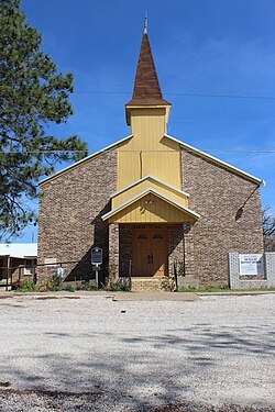
Green Valley Farms is a census-designated place (CDP) in Cameron County, Texas, United States. The population was 655 at the 2020 census, down from 1,272 at the 2010 census. It is part of the Brownsville–Harlingen Metropolitan Statistical Area.
Leming is a census-designated place (CDP) in Atascosa County, Texas, United States. As of the 2010 census, it had a population of 946. This was a new CDP for the 2010 census. The community is part of the San Antonio Metropolitan Statistical Area. Leming has a post office, with the ZIP code 78050.
Boling is a census-designated place (CDP) in Wharton County, Texas, United States. This was a new CDP formed from parts of the Boling-Iago CDP prior to the 2010 census with a population of 1122.
Lake Medina Shores is a census-designated place in Bandera and Medina counties, Texas, United States. Its population was 1,235 as of the 2010 census. This was a new CDP for the 2010 census.
McKinney Acres is a census-designated place (CDP) in Andrews County, Texas, United States. The population was 852 at the 2010 census. This was a new CDP for the 2010 census.

Redland is an unincorporated town and census-designated place (CDP) in Angelina County, Texas, United States. The population was 1,047 at the 2010 census. This was a new CDP for the 2010 census.
Travis Ranch is a census-designated place (CDP) in Kaufman County, Texas, United States. Its population was 2,556 at the 2010 census. It is part of the Dallas–Fort Worth–Arlington metropolitan area.
Bluetown is a census-designated place (CDP) in Cameron County, in the U.S. state of Texas. The population was 356 at the 2010 census. It is part of the Brownsville–Harlingen Metropolitan Statistical Area.
Arroyo Gardens is a census-designated place (CDP) in Cameron County, in the U.S. state of Texas. The population was 456 at the 2010 census. Prior to the 2010 census, the community was part of the Arroyo Gardens-La Tina Ranch CDP. It is part of the Brownsville–Harlingen Metropolitan Statistical Area.
La Tina Ranch is a census-designated place (CDP) in Cameron County, in the U.S. state of Texas. The population was 618 at the 2010 census. Prior to the 2010 census, the community was part of the Arroyo Gardens-La Tina Ranch CDP. It is part of the Brownsville–Harlingen Metropolitan Statistical Area.
Iglesia Antigua is a census-designated place (CDP) in Cameron County, in the U.S. state of Texas. The population was 413 at the 2010 census. Prior to the 2010 census, the community was part of the Bluetown-Iglesia Antigua CDP. It is part of the Brownsville–Harlingen Metropolitan Statistical Area.
Chula Vista is a census-designated place (CDP) in Cameron County, in the U.S. state of Texas. Prior to the 2010 census, the community was part of the Chula Vista-Orason CDP. It is part of the Brownsville–Harlingen Metropolitan Statistical Area.
Orason is a census-designated place (CDP) in Cameron County, in the U.S. state of Texas. The population was 129 at the 2010 census. Prior to the 2010 census, the community was part of the Chula Vista-Orason CDP. It is part of the Brownsville–Harlingen Metropolitan Statistical Area.
Las Palmas II is a census-designated place (CDP) in Cameron County, in the U.S. state of Texas. The population was 1,605 at the 2010 census. Prior to the 2010 census, the community was part of the Las Palmas-Juarez CDP. It is part of the Brownsville–Harlingen Metropolitan Statistical Area.
Juarez is a census-designated place (CDP) in Cameron County, in the U.S. state of Texas. The population was 1,017 at the 2010 census. Prior to the 2010 census, the community was part of the Las Palmas-Juarez CDP. It is part of the Brownsville–Harlingen Metropolitan Statistical Area.
Las Palmas is a census-designated place (CDP) in Zapata County in the U.S. state of Texas. It was a new CDP from the 2010 census, with a population of 67. It is part of the Zapata Micropolitan Statistical Area.
Shadybrook is a census-designated place (CDP) in Cherokee County, Texas, United States. The population was 1,967 at the 2010 census.
Redfield is a census-designated place (CDP) in Nacogdoches County, Texas, United States. This was a new CDP for the 2010 census with a population of 441.
Rafael Pena is a census-designated place (CDP) in Starr County, Texas, United States. This was a new CDP for the 2010 census, with a population of 17.
Los Arrieros is an unincorporated community and census-designated place in Starr County, Texas, United States. Its population was 91 as of the 2010 census. U.S. Route 83 passes through the community.


