Related Research Articles
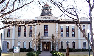
Bastrop County is located in the U.S. state of Texas. It is in Central Texas and its county seat is Bastrop.
The Metropolitan Church Association, also known as the Metropolitan Methodist Mission and Metropolitan Evangelistic Church, is a Methodist denomination in the holiness movement. The Metropolitan Church Association has congregations throughout the world, and in the 20th century, it possessed intentional communities in Wisconsin, Virginia, West Virginia, Louisiana, and Texas, among other locations.
Driftwood is a census-designated place and unincorporated community in northern Hays County, Texas, United States. Per the 2020 census, the population was 106.

Cedar Creek is an unincorporated community in Bastrop County, Texas, United States, located 11 miles (18 km) west of Bastrop at the intersection of State Highway 21 and Farm to Market Road 535. Cedar Creek has a post office with a ZIP code 78612. The community takes its name from Cedar Creek, a tributary of the Colorado River.
Walburg, originally called Concordia, is an unincorporated area located at the crossroads of Farm to Market Road 972 and Farm to Market Road 1105 in Williamson County, Texas, United States, thirty-three miles northeast of Austin. Walburg is a German American settlement. With its heritage of buildings from the late 1890s, Walburg is a popular site for films, including Michael and The Texas Chain Saw Massacre 2.

Deadwood is an unincorporated community in Panola County, Texas, United States. The community is located at the intersection of Farm to Market Road 31 and Farm to Market Road 2517, about 10 miles (16 km) east of Carthage.

Brashear is an unincorporated community located on Interstate Highway 30 and Farm to Market Road 2653 in west central Hopkins County, Texas, United States. Brashear has a post office, church, farm buildings, a radio building, and other buildings.
Bateman is an unincorporated community in Bastrop County, Texas, United States. It is located within the Greater Austin metropolitan area.
Saint John Colony is an unincorporated community in Caldwell County, Texas, United States. According to the Handbook of Texas, the community had a population of 150 in 2000. It is located within the Greater Austin metropolitan area.

Travis County has had two locations named Montopolis. The first was during the Republic of Texas period north of the Colorado River. The second is today's Montopolis neighborhood in Austin, Texas south of the river. Located southeast of the city's urban core, today's neighborhood is in ZIP code 78741. Montopolis is bounded by Lake Lady Bird on the north, by Grove Street and the Pleasant Valley neighborhood on the west, to the south by Texas State Highway 71, and by U.S. Route 183 on the east. The southeast corner abuts Austin-Bergstrom International Airport. Montopolis is in City Council District 3.
San Pedro is a ghost town in Houston County, Texas, United States.

Union is a populated place and CDP in Wilson County, Texas. The area is named for the local ghost town that was originally named "Union Valley." Today, the extant community of Union is located on FM Road 1681, about 56 miles southeast of San Antonio. The cemetery—still visible—used by the town's early inhabitants, contains the grave of Jane Bowen, the wife of outlaw John Wesley Hardin.
William Penn is an unincorporated community in Washington County, Texas, United States. According to the Handbook of Texas, the community had a population of 100 in 2000. It is located within the Greater Houston metropolitan area.
Hills Prairie, or Hill's Prairie, is an unincorporated community in Bastrop County, Texas, United States. According to the Handbook of Texas, the community had a population of 50 in 2000. It is located within the Greater Austin metropolitan area.
Watterson is an unincorporated community in Bastrop County, Texas, United States. It is located within the Greater Austin metropolitan area.

Phelan is a ghost town in Bastrop County, Texas, United States. It is located 2 miles (3.2 km) north of Bastrop near the intersection of Farm to Market Road 157 and Farm to Market Road 36. It is on private property.
McDuff is a ghost town in Bastrop County, Texas, United States. The community was located 8 miles southwest of Elgin, 12 miles northwest of Bastrop, and 25 miles east of Austin. It was on an old stage mail route from Bastrop to Austin. Today, the town site would correspond roughly with the intersection of Farm to Market Road 969 and Upper Elgin River Road.
Oak Hill is a ghost town in Bastrop County, Texas, United States. It is located 4 miles southwest of McDade, 12 miles southeast of Elgin, 13 miles northeast of Bastrop, and 37 miles southeast of Austin on the old Bastrop-McDade Road.
Butler is an unincorporated community in Bastrop County, Texas, United States. It is located within the Greater Austin metropolitan area.
Pin Oak is a ghost town in Bastrop County, Texas, United States. It is located on Farm to Market Road 2104, 6 miles northwest of Winchester, 6 miles northeast of Smithville, 8 miles south of Paige, and 45 miles southeast of Austin.
References
- 1 2 3 "Grassyville, Texas". Texas Escapes. Retrieved August 15, 2018.
- 1 2 Dunk, Tom. "Grassyville". Texas Ghost Towns. Retrieved August 15, 2018.
- ↑ Mitchell Marks, Paula. "Grassyville, Texas". Texas State Historical Association. Retrieved August 15, 2018.
30°8′14″N97°04′45″W / 30.13722°N 97.07917°W
Municipalities and communities of Bastrop County, Texas, United States | ||
|---|---|---|
| Cities |  | |
| CDPs | ||
| Other communities | ||
| Ghost towns | ||
| Footnotes | ‡This populated place also has portions in an adjacent county or counties | |