Related Research Articles

Travis County is located in south central Texas. As of the 2020 census, the population was 1,290,188. It is the fifth-most populous county in Texas. Its county seat and most populous city is Austin, the capital of Texas. The county was established in 1840 and is named in honor of William Barret Travis, the commander of the Republic of Texas forces at the Battle of the Alamo. Travis County is part of the Austin–Round Rock–Georgetown Metropolitan Statistical Area. It is located along the Balcones Fault, the boundary between the Edwards Plateau to the west and the Blackland Prairie to the east.

Caldwell County is a county located in the U.S. state of Texas. As of the 2020 census, its population was 45,883. Its county seat is Lockhart. The county was founded in 1848 and named after Mathew Caldwell, a ranger captain who fought in the Battle of Plum Creek against the Comanches and against Santa Anna's armies during the Texas Revolution. Caldwell was also a signer of the Texas Declaration of Independence.

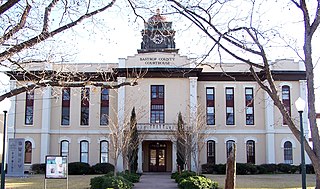
Bastrop County is located in the U.S. state of Texas. It is in Central Texas and its county seat is Bastrop.

Bastrop is a city and the county seat of Bastrop County, Texas, United States. The population was 9,688 according to the 2020 census. It is located about 30 mi (48 km) southeast of Austin and is part of the Greater Austin metropolitan area.

Manor is a city in Travis County, Texas, United States. Manor is located 12 miles northeast of Austin and is part of the Austin-Round Rock metropolitan area. The population was 13,652 at the 2020 census. Manor is one of the faster-growing suburbs of Austin. The city was the seventh fastest growing suburb in America in 2018 by Realtor.com and the 17th best small suburb to live in by U.S. News and World Report in 2019.

Elgin is a city in Bastrop County in the U.S. state of Texas. The population was 9,784 at the 2020 census. Elgin is also known as the Sausage Capital of Texas and the Brick Capital of the Southwest, due to the presence of three operating brickyards in the mid-20th century.

Jollyville is a neighborhood in the northern part of Austin, Texas, United States. In 2010 it was a census-designated place (CDP) in Travis and Williamson counties, but has since been annexed by Austin. The population of the CDP was 16,151 at the 2010 census.

Manchaca is an unincorporated community and census-designated place (CDP) in Travis County, Texas, United States. It is located 10 miles (16 km) southwest of downtown Austin. This was a new CDP for the 2020 census with a population of 2,266.
Elgin Independent School District is a public school district based in Elgin, Texas (USA).

Coupland is a city in southeastern Williamson County, Texas, United States. According to the 2019 population estimate of the United States Census, its population was 317.

The Austin–Round Rock–San Marcos metropolitan statistical area, or Greater Austin, is a five-county metropolitan area in the U.S. state of Texas, as defined by the Office of Management and Budget. The metropolitan area is situated in Central Texas on the western edge of the American South and on the eastern edge of the American Southwest, and borders Greater San Antonio to the south.

Cedar Creek is an unincorporated community in Bastrop County, Texas, United States, located 11 miles (18 km) west of Bastrop at the intersection of State Highway 21 and Farm to Market Road 535. Cedar Creek has a post office with a ZIP code 78612. The community takes its name from Cedar Creek, a tributary of the Colorado River.

Paige is an unincorporated community in Bastrop County, Texas, United States. Paige has a post office with the ZIP code 78659.

Travis County has had two locations named Montopolis. The first was during the Republic of Texas period north of the Colorado River. The second is today's Montopolis neighborhood in Austin, Texas south of the river. Located southeast of the city's urban core, today's neighborhood is in ZIP code 78741. Montopolis is bounded by Lake Lady Bird on the north, by Grove Street and the Pleasant Valley neighborhood on the west, to the south by Texas State Highway 71, and by U.S. Route 183 on the east. The southeast corner abuts Austin-Bergstrom International Airport. Montopolis is in City Council District 3.
Grassyville is a ghost town located in Bastrop County, Texas, United States. The community was founded in the northeastern corner of the county, near the intersection of Farm to Market Road 2104 and Farm to Market Road 2239, six miles south of Paige, 14 miles east of Bastrop, and 50 miles east of Austin.

Phelan is a ghost town in Bastrop County, Texas, United States. It is located 2 miles (3.2 km) north of Bastrop near the intersection of Farm to Market Road 157 and Farm to Market Road 36. It is on private property.
Oak Hill is a ghost town in Bastrop County, Texas, United States. It is located four miles southwest of McDade, 12 miles southeast of Elgin, 13 miles northeast of Bastrop, and 37 miles southeast of Austin on the old Bastrop-McDade Road.
Butler is an unincorporated community in Bastrop County, Texas, United States. It is located within the Greater Austin metropolitan area.
Flower Hill is a ghost town in Bastrop County, Texas, United States. It is located within the Greater Austin metropolitan area.
Pin Oak is a ghost town in Bastrop County, Texas, United States. It is located on Farm to Market Road 2104, six miles northwest of Winchester, six miles northeast of Smithville, eight miles south of Paige and 45 miles southeast of Austin.
References
- ↑ "McDuff, Texas". Texas Escapes. Retrieved August 16, 2018.
- 1 2 3 Smyrl, Vivian Elizabeth. "McDuff, TX". Texas State Historical Association. Retrieved August 16, 2018.
