Driftwood, Texas | |
---|---|
Coordinates: 30°07′38″N98°02′08″W / 30.12722°N 98.03556°W | |
Country | United States |
State | Texas |
County | Hays |
Area | |
• Total | 1.29 sq mi (3.35 km2) |
• Land | 1.29 sq mi (3.35 km2) |
• Water | 0.0 sq mi (0.0 km2) |
Elevation | 1,060 ft (320 m) |
Population (2020) | |
• Total | 106 |
• Density | 82/sq mi (32/km2) |
Time zone | UTC-6 (Central (CST)) |
• Summer (DST) | UTC-5 (CDT) |
ZIP code | 78619 |
FIPS code | 48-21412 |
GNIS feature ID | 2629098 [1] |
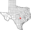
Driftwood is a census-designated place in northern Hays County, Texas, United States. [1] Per the 2020 census, the population was 106. [2]
Driftwood lies along Farm to Market Road 150, 15 miles (24 km) northwest of Kyle and 24 miles (39 km) southwest of downtown Austin. San Marcos, the Hays county seat, is 25 miles (40 km) south of Driftwood via highway. [3] The community has a post office, with the ZIP code of 78619. [4]
Although the earliest settlers arrived in the area now known as Driftwood around 1850, the community was really established in the 1880s. A post office was among the results of the community's significant growth in that decade. Driftwood shrank almost to a ghost town by the early twentieth century; although it grew somewhat by the middle of the century, it returned to its almost-deserted state by the 1970s. [5]
Driftwood is home to The Salt Lick, a relatively well-known barbecue restaurant, Trattoria Lisina, Driftwood Estate Winery, the Wildflower Barn Event Center, Stonehouse Villa Wedding Venue, Vista Brewing, the Ragland Ranch & Organic Herb Farm, and the Lazy 8 Ranch.
Census | Pop. | Note | %± |
---|---|---|---|
2020 | 106 | — | |
U.S. Decennial Census [6] 1850–1900 [7] 1910 [8] 1920 [9] 1930 [10] 1940 [11] 1950 [12] 1960 [13] 1970 [14] 1980 [15] 1990 [16] 2000 [17] 2010 [18] 2020 [19] |
Driftwood first appeared as a census designated place in the 2010 U.S. Census. [18]
Race / Ethnicity (NH = Non-Hispanic) | Pop 2010 [20] | Pop 2020 [19] | % 2010 | % 2020 |
---|---|---|---|---|
White alone (NH) | 133 | 93 | 92.36% | 87.74% |
Black or African American alone (NH) | 0 | 0 | 0.00% | 0.00% |
Native American or Alaska Native alone (NH) | 1 | 0 | 0.69% | 0.00% |
Asian alone (NH) | 0 | 1 | 0.00% | 0.94% |
Pacific Islander alone (NH) | 0 | 0 | 0.00% | 0.00% |
Other race alone (NH) | 0 | 0 | 0.00% | 0.00% |
Mixed race or Multiracial (NH) | 2 | 3 | 1.39% | 2.83% |
Hispanic or Latino (any race) | 8 | 9 | 5.56% | 8.49% |
Total | 144 | 106 | 100.00% | 100.00% |
Cameron Park is a census-designated place (CDP) in Cameron County, Texas, United States. The population was 6,099 at the 2020 census. It is part of the Brownsville–Harlingen Metropolitan Statistical Area.
Agua Dulce is an unincorporated community and census-designated place (CDP) in El Paso County, Texas, United States. The population was 3,218 at the 2020 census. It is part of the El Paso Metropolitan Statistical Area. The ZIP Code encompassing the CDP area is 79928.
Indian Hills is a census-designated place (CDP) in Hidalgo County, Texas, United States. At the 2020 United States Census, the population was 2,694. It is part of the McAllen–Edinburg–Mission Metropolitan Statistical Area.
Relampago is a census-designated place (CDP) in Hidalgo County, Texas, United States. The population was 129 at the 2020 United States Census. It is part of the McAllen–Edinburg–Mission Metropolitan Statistical Area.
Elm Creek is a census-designated place (CDP) in Maverick County, Texas, United States. The population was 2,884 as of the 2020 census.
Alfred is an unincorporated community and census-designated place (CDP) northeast of Alice in Jim Wells County, Texas, United States. Its population was 291 as of the 2010 census. It is known for the outdoor flea markets held on the first whole weekend of the month.
Delmita is a census-designated place in Starr County, Texas, United States. Its elevation is 272 feet (83 m). Although Delmita is unincorporated, it has a post office, with the ZIP code of 78536. This CDP was new for the 2010 census, with a population of 216.
Belterra is a 1,600-acre (650 ha) unincorporated community and census-designated place (CDP) in Hays County, Texas, United States. It is 18 miles (29 km) southwest of downtown Austin. It was first listed as a CDP in the 2020 census with a population of 6,170.
Bluetown is a census-designated place (CDP) in Cameron County, in the U.S. state of Texas. The population was 356 at the 2010 census. It is part of the Brownsville–Harlingen Metropolitan Statistical Area.
Arroyo Gardens is a census-designated place (CDP) in Cameron County, in the U.S. state of Texas. The population was 456 at the 2010 census. Prior to the 2010 census, the community was part of the Arroyo Gardens-La Tina Ranch CDP. It is part of the Brownsville–Harlingen Metropolitan Statistical Area.
La Tina Ranch is a census-designated place (CDP) in Cameron County, in the U.S. state of Texas. The population was 618 at the 2010 census. Prior to the 2010 census, the community was part of the Arroyo Gardens-La Tina Ranch CDP. It is part of the Brownsville–Harlingen Metropolitan Statistical Area.
Iglesia Antigua is a census-designated place (CDP) in Cameron County, in the U.S. state of Texas. The population was 413 at the 2010 census. Prior to the 2010 census, the community was part of the Bluetown-Iglesia Antigua CDP. It is part of the Brownsville–Harlingen Metropolitan Statistical Area.
Chula Vista is a census-designated place (CDP) in Cameron County, in the U.S. state of Texas. Prior to the 2010 census, the community was part of the Chula Vista-Orason CDP. It is part of the Brownsville–Harlingen Metropolitan Statistical Area.
Orason is a census-designated place (CDP) in Cameron County, in the U.S. state of Texas. The population was 129 at the 2010 census. Prior to the 2010 census, the community was part of the Chula Vista-Orason CDP. It is part of the Brownsville–Harlingen Metropolitan Statistical Area.
Las Palmas II is a census-designated place (CDP) in Cameron County, in the U.S. state of Texas. The population was 1,605 at the 2010 census. Prior to the 2010 census, the community was part of the Las Palmas-Juarez CDP. It is part of the Brownsville–Harlingen Metropolitan Statistical Area.
Amargosa is an unincorporated community and census-designated place in Jim Wells County, Texas, United States. Its population was 291 at the 2010 census. Prior to 2010, the community was grouped with nearby Owl Ranch as part of the Owl Ranch-Amargosa census-designated place. The community is named for the Amargosa Creek that runs nearby. The word amargosa means "bitter" in Spanish.
Owl Ranch is an unincorporated community and census-designated place in Jim Wells County, Texas, United States. Its population was 225 as of the 2010 census. Prior to 2010, the community was grouped with nearby Amargosa as part of the Owl Ranch-Amargosa census-designated place.
Los Arrieros is an unincorporated community and census-designated place in Starr County, Texas, United States. Its population was 91 as of the 2010 census. U.S. Route 83 passes through the community.
Perezville is an unincorporated community and census-designated place in Hidalgo County, Texas, United States. Its population was 5,376 as of the 2010 census. Prior to 2010, the community was part of the Abram-Perezville census-designated place along with nearby Abram.
La Moca Ranch is a colonia and census-designated place (CDP) in Webb County, Texas, United States. It was first listed as a CDP prior to the 2020 census.
Media related to Driftwood, Texas at Wikimedia Commons