San Leon, Texas | |
---|---|
Census-designated place (CDP) | |
Coordinates: 29°29′18″N94°55′46″W / 29.48833°N 94.92944°W | |
Country | United States |
State | Texas |
County | Galveston |
Area | |
• Total | 5.2 sq mi (13.4 km2) |
• Land | 4.9 sq mi (12.6 km2) |
• Water | 0.3 sq mi (0.7 km2) |
Elevation | 10 ft (3 m) |
Population (2010) | |
• Total | 4,970 |
• Density | 960/sq mi (370/km2) |
Time zone | UTC-6 (Central (CST)) |
• Summer (DST) | UTC-5 (CDT) |
ZIP code | 77539-2492 |
Area code | 281 |
FIPS code | 48-65564 [1] |
GNIS feature ID | 1346420 [2] |
San Leon is a census-designated place (CDP) in Galveston County, Texas, United States. The population was 6,135 at the 2020 census. [3]
During the early 19th century, the pirate Jean Lafitte, who ruled Galveston Island, established a stronghold at Eagle Point in modern San Leon. [4] Eagle Point went on to become an important shipping and trading post for slaves. A community was established, known as Edward's Point and later North Galveston. When the North Galveston, Houston, and Kansas City Railroad was built through the area in 1893, the town began to develop as a commercial center. However, following the hurricanes in 1900 and 1915, the town was devastated and never able to fully recover. Attempts were made in the early 20th century to establish a resort community in the area, but these efforts met with only modest success. Growth and development since this time have been relatively stagnant. [5]
The San Leon Municipal Utility District (MUD) was created by an Act of the 1965 Texas Legislature with all the powers of a Texas Conservation and Reclamation District, a Municipal Corporation and a Water Control and Improvement District (WCID). [6]
In April 1985, residents of San Leon, Bacliff and Bayview considered an incorporation proposal to become the City of Bayshore. Judge Ray Holbrook signed an order for the election to take place on April 6, 1985, freeing the area, which had a population of 11,000, from the extraterritorial jurisdiction of League City and Texas City. [7] Residents rejected the incorporation proposal. [8] [9] The vote was tallied with 1,268 against and 399 in favor. Proponents wanted a local police force and the ability to pass ordinances. Opponents said that the tax base was too small to support municipal services including police and road and drainage improvements. [9]
San Leon was not in a 1986 proposal to incorporate that included Bacliff and Bayview. Donna Maples, vice president of the Bacliff - Bayview Community Association, said that historically, San Leon had generated most of the opposition to incorporation proposals. She said, "In the past, San Leon has shown it is not interested in incorporation. So this time we decided not to include them. They don't have as much in common as we do." [10]
On April 23, 1991, the community, and other areas of Galveston County, received an enhanced 9-1-1 system which routes calls to proper dispatchers and allows dispatchers to automatically view the address of the caller. [11] On September 13, 2008, San Leon, TX received extensive damage from Hurricane Ike.[ citation needed ]
In 2000, there were 4,365 people organized into 1,815 households. [12] That year, Bacliff and San Leon formed a nine-member board to prepare the communities for incorporation. At that time, Bacliff and San Leon had a combined population of 10,000. [13] The board was to have three members from the Bacliff area, three members from the San Leon area, and three at-large members. It was prompted after the City of Texas City suddenly annexed several commercial parcels along Texas State Highway 146 between Kemah and Dickinson Bayou in 2000. The board hoped to convince Texas City to reverse the annexation. [14]
In 2012, the P.H. Robinson electric generation plant formerly operated by Texas Genco, located in the area, was demolished. [15]
According to the United States Census Bureau, the CDP has a total area of 5.2 sq mi (13 km2), of which 4.9 sq mi (13 km2) is land and 0.3 sq mi (0.78 km2), or 5.61%, is covered by water.
The Bacliff, San Leon, and Bayview communities form the "Bayshore" area. [16]
Shore erosion had affected San Leon. Avenue A was built along the north shore. By 1997, it was no longer contiguous because portions had been destroyed by erosion. [17]
Effective August 15, 2019 Galveston County Commissioners Court approved revised Federal Emergency Management Agency flood plain maps which categorized the vast majority of San Leon as being at high risk from floods. [18] [19] [20]
Race | Number | Percentage |
---|---|---|
White (NH) | 3,504 | 57.11% |
Black or African American (NH) | 109 | 1.78% |
Native American or Alaska Native (NH) | 27 | 0.44% |
Asian (NH) | 164 | 2.67% |
Some Other Race (NH) | 18 | 0.29% |
Mixed/Multi-Racial (NH) | 239 | 3.9% |
Hispanic or Latino | 2,074 | 33.81% |
Total | 6,135 |
As of the 2020 United States census, there were 6,135 people, 2,276 households, and 1,649 families residing in the CDP.
As of the census [24] of 2010, 4,970 people, 1,815 households, and 1,121 families resided in the CDP. The population density was 894.1 inhabitants per square mile (345.2/km2). The 2,293 housing units averaged 469.7 per square mile (181.4/km2). The racial makeup of the CDP was 80.41% White, 0.80% African American, 0.82% Native American, 7.61% Asian, 0.11% Pacific Islander, 8.27% from other races, and 1.97% from two or more races. Hispanics or Latinos of any race were 14.36% of the population.
Of the 1,815 households, 25.1% had children under the age of 18 living with them, 48.6% were married couples living together, 7.3% had a female householder with no husband present, and 38.2% were not families. About 30.0% of all households were made up of individuals, and 8.5% had someone living alone who was 65 years of age or older. The average household size was 2.39 and the average family size was 2.99.
In the CDP, the population was spread out, with 23.0% under the age of 18, 7.4% from 18 to 24, 30.8% from 25 to 44, 28.5% from 45 to 64, and 10.3% who were 65 years of age or older. The median age was 39 years. For every 100 females, there were 110.4 males. For every 100 females age 18 and over, there were 112.8 males.
The median income for a household in the CDP was $31,687, and for a family was $40,656. Males had a median income of $32,574 versus $25,526 for females. The per capita income for the CDP was $19,422. About 14.8% of families and 19.7% of the population were below the poverty line, including 33.5% of those under age 18 and 2.3% of those age 65 or over.
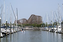
As of 1986, the community is primarily residential. During weekends and summer, many people stayed in their cottages and small houses. [10]
As of 2012, San Leon, Bayview, and Bacliff together make up the largest unincorporated community in the mainland portion of Galveston County by population. [25] As of July 2019 the San Leon CDP included 2632 single family residences, 14 multi-family residences and 2116 vacant lots which provided a tax base of $369,924,758. [26]
In 2008, Phale Cassady Le, an outreach coordinator of Boat People SOS Houston, said that in San Leon and Bacliff, between 150 and 200 Vietnamese families were involved with crab-, oyster-, and shrimp-fishing operations. [27] According to Le, most of the Vietnamese have no house or boat insurance, and even if they did have this insurance, their English is not well developed enough to read the terms of the policies. [27] Many families had hand-made boats that were constructed over several years as the owner made more and more money. Nick Cenegy of The Galveston County Daily News said that the Vietnamese community in San Leon and Bacliff had a "tradition of self-reliance and wariness of outsiders." [27]
In 2017 there were 4,890 people organized into 2,036 households. [12]
The most significant sector of the community's economy is oyster and shrimp fishing. Many homes in the community are second homes used as summer residences. [5] Like Bacliff and Bayview, many residents in San Leon commute to work in Houston. [28]
San Leon CDP is located within Galveston County Precinct 1 and is represented in Galveston County Commissioners Court by the Honorable Darrell A. Apffel who was elected November 8, 2016. [29] [30] San Leon voters reside within Galveston County Voting Precinct 151. [31]
San Leon students are zoned to schools in the Dickinson Independent School District.
San Leon Elementary School opened in the beginning of the 2007–2008 school year, and serves residents from kindergarten through fourth grade.
Barber Middle School in Dickinson serves the fifth and sixth grades. [32] McAdams Junior High School in Dickinson serves grades 7 and 8. Students are zoned to Dickinson High School for grades 9 through 12.
The San Leon Water Control and Improvement District (WCID) provides water services. [33] The political entity San Leon MUD (WCID) was organized in 1965 and is regulated by the state of Texas as a Water Control and Improvement District (WCID). [34]
The San Leon Post Office was damaged and not replaced after Hurricane Ike in 2008.[ citation needed ]
Galveston County is a county in the U.S. state of Texas, located along the Gulf Coast adjacent to Galveston Bay. As of the 2020 census, its population was 350,682. The county was founded in 1838. The county seat is the City of Galveston, founded the following year, and located on Galveston Island. The most-populous municipality in the county is League City, a suburb of Houston at the northern end of the county, which surpassed Galveston in population during the early 2000s.
Bacliff is a census-designated place (CDP) in north-central Galveston County, Texas, United States, 16 miles (26 km) northwest of Galveston. The population was 8,619 at the 2010 census. Bacliff, originally called Clifton-by-the-Sea, began as a seaside resort town. Located on the western shore of Galveston Bay, Bacliff, along with San Leon and Bayview, are the largest unincorporated communities on the Galveston County mainland.
Bolivar Peninsula is a census-designated place (CDP) in Galveston County, Texas, United States. The population was 2,417 at the 2010 census. The communities of Port Bolivar, Crystal Beach, Caplen, Gilchrist, and High Island are located on Bolivar Peninsula.
Dickinson is a city in Galveston County, Texas, United States, within Houston–The Woodlands–Sugar Land metropolitan area. The population was 20,847 at the 2020 census.
Kemah is a city in the U.S. state of Texas, southeast of Houston along west Galveston Bay. The city's population was 1,773 at the 2010 census, down from 2,330 at the 2000 census. Located in Galveston County, Kemah's main industry is shipping. Originally a small fishing town, the city has become a tourist destination for the area's restaurants and attractions, which are contained within the Kemah Entertainment District. In 2012 Kemah was ranked the top tourism spot in the Greater Houston area.
La Marque is a city in Galveston County, Texas, United States, south of Houston. The city population in 2020 was 18,030. La Marque experienced considerable growth in the 1950s, during which the city provided a general administrative and trades and crafts workforce helping to support the petrochemical complex in adjoining Texas City. It is the hometown of U.S. Senator Kay Bailey Hutchison and Norman Bulaich.
Santa Fe is a city in Galveston County, Texas, United States. It is named for the Santa Fe Railroad which runs through the town alongside State Highway 6. The population of Santa Fe at the 2010 census was 12,222.
Atascocita is a census-designated place (CDP) in Harris County, Texas, United States, within the Houston metropolitan area. As of the 2020 census it had a population of 88,174. It is located north and south of Farm to Market Road 1960 about 6 miles (10 km) east of Humble and 18 miles (29 km) northeast of downtown Houston in northeastern Harris County.
Crosby is a census-designated place in Harris County, Texas, United States. The population was 3,417 at the 2020 census.
La Porte is a city in Harris County, Texas, United States, within the Bay Area of the Houston–Sugar Land–Baytown metropolitan area. As of the 2020 census, the city population was 35,124. La Porte is the fourth-largest incorporated city in Harris County.
Seabrook is a city in Harris County in the U.S. state of Texas, with some water surface area located within Chambers County. The population was 11,952 at the 2010 U.S. census, and 14,149 in 2019. Several fish markets line the city's waterfront, while antique shops and bed and breakfast establishments are found in the city's downtown area. The city is home to several miles of trails, which connect multiple city parks to each other.
League City is a city in the U.S. state of Texas, in Galveston County, within the Greater Houston metropolitan area. As of the 2020 census, the city had a population of 112,129.
Galveston Bay is a bay in the western Gulf of Mexico along the upper coast of Texas. It is the seventh-largest estuary in the United States, and the largest of seven major estuaries along the Texas Gulf Coast. It is connected to the Gulf of Mexico and is surrounded by sub-tropical marshes and prairies on the mainland. The water in the bay is a complex mixture of sea water and fresh water, which supports a wide variety of marine life. With a maximum depth of about 10 feet (3 m) and an average depth of only 6 feet (2 m), it is unusually shallow for its size.
Clear Lake, or the Clear Lake Area, is a region in parts of Harris and Galveston County in Texas, United States. It is part of the Galveston Bay Area, which itself is a section of the Houston–The Woodlands–Sugar Land metropolitan area. The area is geographically characterized by the bodies of water in it and around it, including Clear Lake, Taylor Lake, Clear Creek, and Galveston Bay.
Dickinson Independent School District is a school district based in Dickinson, Texas, United States in Greater Houston.
The Galveston Bay Area, also known as Bay Area Houston or simply the Bay Area, is a region that surrounds the Galveston Bay estuary of Southeast Texas in the United States, within Houston–The Woodlands–Sugar Land metropolitan area. Normally the term refers to the mainland communities around the bay and excludes Galveston as well as most of Houston.
Bayview is an area within unincorporated Galveston County, Texas, United States, that was formerly a more distinct community.
For a period of over 7000 years, humans have inhabited the Galveston Bay Area in what is now the United States. Through their history the communities in the region have been influenced by the once competing sister cities of Houston and Galveston, but still have their own distinct history. Though never truly a single, unified community, the histories of the Bay Area communities have had many common threads.
Dickinson High School is located in Dickinson, Texas, United States, in the Dickinson Independent School District. The school serves most of Dickinson, all of San Leon, the majority of Bacliff, and portions of League City and Texas City.