Gilchrist, Texas

Last updated

Houston Galveston area towns roadmap.gif
Red pog.svg
Gilchrist
Gilchrist, Texas (center right) on Bolivar Peninsula, southeast of Houston.

Gilchrist, Texas is an unincorporated residential community and beachfront resort along State Highway 87, located seventeen miles east of Bolivar Point in the Bolivar Peninsula census-designated place, in Galveston County, Texas, United States. [1]

Contents

In 1990 and 2000, Gilchrist's core population was approximately 750, [1] but would see more residents due to seasonal visitors. [1] When the settlement was decimated by Hurricane Ike on September 13, 2008, about 1,000 permanent residents had lived there, [2] but were under evacuation orders. Several businesses in the community had operated to furnish necessities for permanent residents as well as tourists.

History

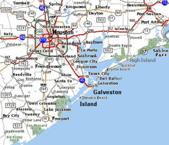
Located in Galveston County, this community was named for Gibb Gilchrist (1887–1972) [3] who relocated and rebuilt the rail line from High Island to Port Bolivar following the 1915 hurricane destruction. [1] This settlement before this event was called Rollover. [1] [4]

In 1950, a post office was opened at Gilchrist.

A notable feature of the community was Rollover Pass (or Rollover Fish Pass), which divided Bolivar Peninsula as well as Gilchrist and carried water between East Bay and the Gulf of Mexico. It was regarded among sportsmen as a very popular fishing location in Texas with some the largest fish in the state. Rollover Pass was a natural high-tide pass that had been dredged wider in 1955 by the Texas Game and Fish Commission as part of its efforts to preserve and improve fish and wildlife resources. [1] In late 2019 contractors hired by the Texas General Land Office installed steel barriers and, months later, dumped dirt into the Pass to close off water flow.

Hurricane Carla caused damage to Gilchrist. [5] On April 23, 1991, the community, and other areas of Galveston County, received an enhanced 9-1-1 system which routes calls to proper dispatchers and allows dispatchers to automatically view the address of the caller. [6]

Hurricane Ike

Aerial photograph of Gilchrist after Hurricane Ike. Gilchrist - east roll-over pass.jpg
Aerial photograph of Gilchrist after Hurricane Ike.

On September 13, 2008, Gilchrist was devastated by Hurricane Ike, [7] which completely destroyed all but a few homes. [2] About 1,000 permanent residents had lived there. The coastline along Gilchrist, once a straight line, became jagged and desolate, permanently altered by Ike's turbulent storm tide. [2]

NOAA aerial photography reveals complete destruction of Gilchrist. The Rollover Pass bridge on Highway 87 was reduced to one lane. Of the 1,000 buildings in Gilchrist, 99.5% of them were knocked off of their foundations. The storm demolished most and washed others into East Bay and swamplands behind Gilchrist. [8] Of all of the houses in one section of Gilchrist, one remained standing. Several houses in another section were still there. Pam Adams, homeowner of the "Last House Standing," stated that many of Gilchrist's homes were built before the latest building codes were enacted. [9] John Lee, Galveston County's emergency management spokesperson, said that Gilchrist had been "wiped clean" by the hurricane. [10]

After Hurricane Ike the United States Postal Service temporarily relocated Gilchrist post office box services to Stowell. Regarding the prospect of returning, John Lee said "It's a very sobering experience that some don't want to go through again. How many will be back? We don't know." [11]

By January 2009, of the communities in the Bolivar Peninsula, Gilchrist received the fewest returnees. [10]

By 2011, Galveston County bought out 434 houses in Gilchrist since the houses were too close to the shore, post-Ike. The land will have limited uses. [12]

As of 2014, homes and businesses have been rebuilt in the area, new residents are settling in, and visitors once again are able to travel through that section of Highway 87. The Rollover Pass bridge has two lanes open instead of the original three. But Texas Historical Marker Number 7166 has yet to be replaced at the Pass.

Government and infrastructure

The Gilchrist Volunteer Fire Department originally served Gilchrist prior to Hurricane Ike. After the Hurricane struck, the Gilchrist Volunteer Fire Department disbanded, and donated all their equipment to other departments many miles away. This upset many residents of the Gilchrist Community and others on the Bolivar Peninsula. Gilchrist is now served by members of the High Island Volunteer Fire Rescue Department [13]

The United States Postal Service once operated the Gilchrist Post Office, which opened on September 16, 1950. The building was destroyed by Hurricane Ike and the post office, in name, was officially discontinued on July 31, 2010. [14]

Education

Gilchrist residents are zoned to schools in the High Island Independent School District. [15]

High Island ISD is assigned to Galveston College in Galveston. [16]

GCA (Gilchrist Community Association)

The purpose of the GCA is to provide civic duties at Rollover Pass on the Bolivar Peninsula in the state of Texas and other civic and community projects to improve and enhance the quality of life for the residents and visitors of Bolivar Peninsula. [17]

The GCA is a 501(c)4 organization whose members are from all over the United States. Their common goal is to save their community from being destroyed by outside interests and keep Rollover Pass open for everyone to enjoy.

Notes and references

  1. 1 2 3 4 5 6 "Handbook of Texas Online". Texas State Historical Association. February 21, 2002. Archived from the original on February 4, 2019. Retrieved September 18, 2008.
  2. 1 2 3 Tim Heller, KTRK Chief Meteorologist (September 15, 2008). "Ike's Aftermath from the Sky". KTRK TV abc13.com. Archived from the original on September 19, 2008. Retrieved September 18, 2008.
  3. "Handbook of Texas Online". Texas State Historical Association. January 17, 2008. Archived from the original on February 4, 2019. Retrieved September 18, 2008.
  4. Rollover, Texas from the Handbook of Texas Online
  5. Gonzalez, J. R. "Then & Now #15 Archived July 7, 2012, at archive.today ." Houston Chronicle . January 2, 2009.
  6. "News briefs Archived January 14, 2009, at the Wayback Machine ." Houston Chronicle . Tuesday April 23, 1991. A14.
  7. Tresaugue, Matthew (September 15, 2008). "For some on coastline, rebuilding may not be an option". Houston Chronicle. Archived from the original on September 18, 2008.
  8. Connelly, Richard. "Goodbye, Gilchrist Archived May 24, 2011, at the Wayback Machine ." Houston Press . September 17, 2008.
  9. Hanna, Jason. "Their house survived Ike, but it's the only one left Archived September 20, 2008, at the Wayback Machine ." CNN . September 19, 2008.
  10. 1 2 Horswell, Cindy. "Holes left in wake of storms: Ike hit before some Texas communities recovered from Rita." McClatchy - Tribune Business News . January 19, 2009. Available at ProQuest, document ID 456273366
  11. "Postal Service Relocates Services, Deploys Portable Buildings Archived May 8, 2009, at the Wayback Machine ." United States Postal Service . September 18, 2008. Retrieved on April 7, 2009.
  12. Aulds, T.J. "Buyout of storm properties one of largest in US Archived April 8, 2011, at the Wayback Machine ." The Galveston Daily News . April 5, 2011. Retrieved on April 6, 2011.
  13. Bech, Melissa. "Gilchrist, someday I will be back. Archived June 19, 2010, at the Wayback Machine " Houston Chronicle . September 2, 2009. Retrieved on February 24, 2010.
  14. "Postmaster Finder Post Offices by Discontinued Date Archived July 21, 2011, at the Wayback Machine ." United States Postal Service. Retrieved on September 23, 2010. "07/31/2010 GILCHRIST TX GALVESTON COUNTY 77617 09/16/1950"
  15. "2020 CENSUS - SCHOOL DISTRICT REFERENCE MAP: Galveston County, TX" (PDF). U.S. Census Bureau. Archived (PDF) from the original on October 9, 2022. Retrieved April 17, 2021.
  16. Texas Education Code, Section 130.179, "Galveston College District Service Area Archived 2009-02-11 at the Wayback Machine ".
  17. http://www.rolloverpasstexas.com/# Archived July 26, 2014, at the Wayback Machine !

29°30′45″N94°29′21″W / 29.51250°N 94.48917°W / 29.51250; -94.48917

Related Research Articles

<span class="mw-page-title-main">Galveston, Texas</span> City in Texas, United States

Galveston is a coastal resort city and port off the Southeast Texas coast on Galveston Island and Pelican Island in the U.S. state of Texas. The community of 211.31 square miles (547.3 km2), with a population of 53,695 at the 2020 census, is the county seat of surrounding Galveston County and second-largest municipality in the county. It is also within the Houston–The Woodlands–Sugar Land metropolitan area at its southern end on the northwestern coast of the Gulf of Mexico.

<span class="mw-page-title-main">Galveston County, Texas</span> County in Texas, United States

Galveston County is a county in the U.S. state of Texas, located along the Gulf Coast adjacent to Galveston Bay. As of the 2020 census, its population was 350,682. The county was founded in 1838. The county seat is the City of Galveston, founded the following year, and located on Galveston Island. The most-populous municipality in the county is League City, a suburb of Houston at the northern end of the county, which surpassed Galveston in population during the early 2000s.

<span class="mw-page-title-main">Bacliff, Texas</span> Census-designated place in Texas, United States

Bacliff is a census-designated place (CDP) in north-central Galveston County, Texas, United States, 16 miles (26 km) northwest of Galveston. The population was 8,619 at the 2010 census. Bacliff, originally called Clifton-by-the-Sea, began as a seaside resort town. Located on the western shore of Galveston Bay, Bacliff, along with San Leon and Bayview, are the largest unincorporated communities on the Galveston County mainland.

<span class="mw-page-title-main">Bolivar Peninsula, Texas</span> CDP in Texas, United States

Bolivar Peninsula is a census-designated place (CDP) in Galveston County, Texas, United States. The population was 2,417 at the 2010 census. The communities of Port Bolivar, Crystal Beach, Caplen, Gilchrist, and High Island are located on Bolivar Peninsula.

Sabine Pass is a neighborhood in Port Arthur, Texas. It had been incorporated in 1861 before being formally annexed by Port Arthur in 1978. However, Sabine Pass retains its own distinct identity with its own school district, post office, water district, and port authority. The Port Arthur Convention and Visitors Bureau stated that Sabine Pass is "often regarded as" being a "self-contained" community.

<span class="mw-page-title-main">Galveston Bay</span> Estuary bay near Houston on the Texas Gulf Coast

Galveston Bay is a bay in the western Gulf of Mexico along the upper coast of Texas. It is the seventh-largest estuary in the United States, and the largest of seven major estuaries along the Texas Gulf Coast. It is connected to the Gulf of Mexico and is surrounded by sub-tropical marshes and prairies on the mainland. The water in the bay is a complex mixture of sea water and fresh water, which supports a wide variety of marine life. With a maximum depth of about 10 feet (3 m) and an average depth of only 6 feet (2 m), it is unusually shallow for its size.

<span class="mw-page-title-main">Galveston Island</span> Barrier island off Galveston Bay, Texas

Galveston Island is a barrier island on the Texas Gulf Coast in the United States, about 50 miles (80.5 km) southeast of Houston. The entire island, with the exception of Jamaica Beach, is within the city limits of the City of Galveston in Galveston County.

Genoa is an area in Houston, Texas, United States located about 15 miles (24 km) southeast of Downtown Houston; it was formerly a distinct unincorporated area in Harris County.

<span class="mw-page-title-main">Port Bolivar, Texas</span> Unincorporated community in Texas, US

Port Bolivar is an unincorporated community located on the northern shore of the western tip of the Bolivar Peninsula, separated from Galveston Island by the entrance to Galveston Bay. The Bolivar Peninsula itself is a census-designated place, in Galveston County, Texas, United States, and part of the Houston–Sugar Land–Baytown metropolitan area. The entire peninsula was severely damaged during Hurricane Ike on September 13, 2008; re-building efforts were still continuing as late as 2013.

<span class="mw-page-title-main">High Island, Texas</span> Unincorporated community in Texas, United States

High Island is an unincorporated community located in the Bolivar Peninsula census-designated place, Galveston County, Texas, United States. The community is located in the extreme eastern part of the county on Bolivar Peninsula, less than one mile from Chambers County and less than two miles from Jefferson County. As of 2000, 500 people resided in High Island. The 2010 census did not record a population for High Island.

Rollover Pass, also called Rollover Fish Pass, was a strait that linked Rollover Bay and East Bay with the Gulf of Mexico in extreme southeastern Galveston County. It has been closed by filling it in with dirt. Rollover Pass was opened in 1955 by the Texas Game and Fish Commission to improve local fishing conditions. Seawater was introduced into East Bay to promote vegetation growth, and to provide access for marine fish to spawn and feed. The name came from the days of Spanish rule, when barrels of merchandise would be rolled over that part of the peninsula to avoid excise tax. The Pass is about 1600 feet long and 200 feet wide.

<span class="mw-page-title-main">Galveston Independent School District</span> School district in Texas, United States

Galveston Independent School District is a school district headquartered in Galveston, Texas, United States.

<span class="mw-page-title-main">Crystal Beach, Texas</span> Unincorporated community in Texas, United States

Crystal Beach is an unincorporated community in the Bolivar Peninsula census-designated place, in Galveston County, Texas, United States. Also known as Patton, Crystal Beach stretches 7 miles (10 km) along Texas State Highway 87 in the middle of Bolivar Peninsula.

High Island Independent School District is a public school district based in unincorporated Galveston County, Texas, United States.

<span class="mw-page-title-main">San Luis Pass (Galveston Island)</span> Natural water inlet in Texas, United States

San Luis Pass is a passage of water on the Texas Gulf Coast of the United States. It connects the sheltered waters of West Bay to the open Gulf of Mexico between Galveston Island and San Luis Island.

Caplen is an unincorporated community that is part of the Bolivar Peninsula census-designated place, in Galveston County, Texas, United States.

<span class="mw-page-title-main">Hurricane Ike</span> Category 4 Atlantic hurricane in 2008

Hurricane Ike was a powerful tropical cyclone that swept through portions of the Greater Antilles and Northern America in September 2008, wreaking havoc on infrastructure and agriculture, particularly in Cuba and Texas. Ike took a similar track to the 1900 Galveston hurricane. The ninth tropical storm, fifth hurricane, and third major hurricane of the 2008 Atlantic hurricane season, Ike developed from a tropical wave west of Cape Verde on September 1 and strengthened to a peak intensity as a Category 4 hurricane over the open waters of the central Atlantic on September 4 as it tracked westward. Several fluctuations in strength occurred before Ike made landfall on eastern Cuba on September 8. The hurricane weakened prior to continuing into the Gulf of Mexico, but increased its intensity by the time of its final landfall in Galveston, Texas, on September 13 before becoming an extratropical storm on September 14. The remnants of Ike continued to track across the United States and into Canada, causing considerable damage inland, before dissipating on the next day.

<span class="mw-page-title-main">Effects of Hurricane Ike in Texas</span>

Hurricane Ike caused major destruction in Texas with crippling and long-lasting effects, including death, widespread damage, and impacts to the price and availability of oil and gas. Hurricane Ike also had a long-term impact on the U.S. economy. Making landfall over Galveston, at 2:10 a.m. CDT on September 13, 2008, Category 2 Hurricane Ike caused extensive damage in Texas, with sustained winds of 110 mph (180 km/h), a 22 ft (6.7 m) storm surge, and widespread coastal flooding.

<span class="mw-page-title-main">Ike Dike</span> Proposed Galveston Bay, Texas storm surge protection project

The Ike Dike is a proposed coastal barrier that, when completed, would protect the Galveston Bay in Texas, United States. The project would be a dramatic enhancement of the existing Galveston Seawall, complete with floodgates, which would protect more of Galveston, the Bolivar Peninsula, the Galveston Bay Area, and Houston. The barrier would extend across Galveston Island and the Bolivar Peninsula and would provide a barrier against all Gulf surges into the bay. The project is primarily the suggestion of Dr. Bill Merrell of Texas A&M University at Galveston. The Ike Dike would be able to withstand a 10000 year storm.

<span class="mw-page-title-main">East Bay (Texas)</span>

East Bay also known as East Galveston Bay, is the eastern extension of Galveston Bay found in Chambers County, Texas. The bay is oriented northeast to southwest, and is approximately five miles wide and twenty miles in length. It covers the area north of the entire Bolivar Peninsula, and south of mainland Texas, including the small community of Smith Point at the western extreme. The bay's one extension is Rollover Bay, which is found to the extreme east near the town of Gilchrist.