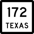
Texas State Highway 172

Last updated

Texas 172.svg

State Highway 172

Texas State Highway 172
SH 172, highlighted in red
Route information
Maintained by TxDOT
Length28.471 mi [1]  (45.820 km)
Existed1932–present
Major junctions
South endLocal road in Olivia
Major intersectionsTexas 35.svg SH 35 in Weedhaven
Texas 111.svg SH 111 in Crossroads
North endTexas Loop 522.svgTexas FM 710.svg Loop 522  / FM 710 in Ganado
Location
Country United States
State Texas
Counties Calhoun, Jackson
Highway system
Texas 171.svg SH 171 Texas 173.svg SH 173

State Highway 172 (SH 172) is a state highway in Texas that connects Ganado to Olivia on the Gulf Coast. [1]
Contents

Route description

State maintenance and the SH 172 designation begin along the shore of Keller Bay in the Calhoun County community of Olivia. [2] The route travels northward along the peninsula and into Jackson County, where it intersects SH 35 in the hamlet of Weedhaven. SH 172 continues to the north and has a brief concurrency FM 616 in La Ward before turning slightly to the northwest. [3] It has a junction with SH 111 before entering Ganado along 3rd Street. The SH 172 designation ends at Loop 522, the former route of US 59 through the city; 3rd Street continues northward as FM 710. [1]

History

SH 172 was originally designated on August 2, 1932 from Ganado to La Ward. [4] On January 9, 1934, the route was extended to Olivia, replacing part of SH 111, which was rerouted further north. [5] [1]

Major intersections

CountyLocationmi [6] kmDestinationsNotes
Calhoun Olivia 0.00.0Local road along Keller BaySouthern terminus, state maintenance ends
1.62.6Texas Spur 159.svg Spur 159  Port Alto
3.65.8Texas FM 2143.svg FM 2143
Jackson Weedhaven 6.09.7Texas 35.svg SH 35  Port Lavaca, Palacios
La Ward 14.323.0East plate.svg
Texas FM 616.svg
FM 616 east Blessing
South end of FM 616 concurrency
La Ward 14.323.0West plate.svg
Texas FM 616.svg
FM 616 west Lolita
North end of FM 616 concurrency
17.327.8Texas FM 3131.svg FM 3131  Red Bluff
19.531.4Texas FM 1823.svg FM 1823
Crossroads 21.835.1Texas 111.svg SH 111  Edna, Midfield
26.242.2Texas FM 1683.svg FM 1683
Ganado 28.345.5Texas FM 1157.svg FM 1157
28.545.9Texas Loop 522.svgTo plate blue.svg
Future plate blue.svg
I-69.svg
To plate.svg
US 59.svg
To plate.svg
Texas FM 710.svg
Loop 522 to Future I-69  / US 59  / FM 710  Houston, Victoria
Exit 46 on I-69/US 59; northern terminus
1.000 mi = 1.609 km; 1.000 km = 0.621 mi

Related Research Articles

<span class="mw-page-title-main">Texas State Highway 51</span> State highway in Texas

State Highway 51 is a short state highway located entirely in Hansford County, Texas, just south of Spearman.

<span class="mw-page-title-main">Texas State Highway 61</span> State highway in Texas

State Highway 61 is a 21.426-mile (34.482 km) state highway in southeast Texas. It connects Anahuac in Chambers County to Devers in Liberty County.

<span class="mw-page-title-main">Texas State Highway 70</span> State highway in Texas

State Highway 70 is a state highway in Texas. The route runs approximately 315 miles (507 km) from US 277 near Blackwell to US 83 south of Perryton.

<span class="mw-page-title-main">Texas State Highway 72</span> State highway in Texas, United States

State Highway 72 is a Texas state highway that runs approximately 111 miles (179 km) from near Fowlerton to Cuero in South Texas.

<span class="mw-page-title-main">Texas State Highway 96</span> State highway in Texas

State Highway 96, also known as League City Parkway, is a state highway in the U.S. state of Texas. The highway runs approximately 6.5 miles (10.5 km) between Interstate 45 and SH 146/future SH 99 in Galveston County, connecting the cities of League City and Kemah.

<span class="mw-page-title-main">Texas State Highway 174</span> State highway in Texas

State Highway 174 is a state highway in Texas that connects Meridian and Burleson.

<span class="mw-page-title-main">Texas State Highway 81</span> State highway in Texas

State Highway 81 is a Texas state highway that runs from Hillsboro to Grandview. It was designated in 1991 to replace U.S. Highway 81, which was decommissioned south of Fort Worth.

<span class="mw-page-title-main">Texas State Highway 124</span> State highway in Texas

State Highway 124 is a state highway in the U.S. state of Texas maintained by the Texas Department of Transportation (TxDOT). The highway begins along the Gulf Coast near the northeast end of the Bolivar Peninsula at SH 87 and extends to the northeast ending at US 69 and US 96. In between, the highway has major intersections with SH 65 and SH 73. The highway is located in Galveston, Chambers, and Jefferson counties and also serves the communities of Hamshire, Fannett, and Cheek. A portion of SH 124 is part of a longer coastal hurricane evacuation route.

<span class="mw-page-title-main">Texas State Highway 125</span> State highway in Texas

State Highway 125 (SH 125) is a state highway in the U.S. state of Texas maintained by the Texas Department of Transportation (TxDOT). The 28-mile (45 km) highway begins at the New Mexico state line southwest of Bledsoe, and passes through Bledsoe where it turns east intersecting SH 214 before terminating at SH 114. The highway is located entirely within Cochran County, and is numerically continuous with New Mexico State Road 125 which it meets at the state line and connects the highway to Tatum, NM. The highway has brief concurrencies with SH 214 in Lehman and Farm to Market Road 1780 in Whiteface.

<span class="mw-page-title-main">Texas State Highway 127</span> State highway in Texas

State Highway 127 is a state highway in Uvalde County in the U.S. state of Texas that connects Sabinal and Concan in south Texas.

<span class="mw-page-title-main">Texas State Highway 58</span> State highway in Texas

State Highway 58 was a state highway in the U.S. state of Texas maintained by the Texas Department of Transportation (TxDOT). The highway was located within the city of Midland in Midland County. The route began at I-20 in south Midland and follows Cotton Flat Rd. and S. Garfield St.) to Spur 268 and Bus. SH 158 in central Midland and intersected BL I-20 in central Midland. The route was designated in 2009, and completed by 2011. The route was decommissioned in 2011 and became a rerouted Business State Highway 158-B. The SH 58 designation was assigned to a highway along the Gulf Coast in the 1920s and 1930s.

<span class="mw-page-title-main">Texas State Highway 131</span> State highway in Texas

State Highway 131 is a Texas state highway that runs from US 277 near Eagle Pass to US 90 in Brackettville.

<span class="mw-page-title-main">Texas State Highway 142</span> State highway in Texas

State Highway 142 is a short Texas state highway that runs from San Marcos to Lockhart.

<span class="mw-page-title-main">Texas State Highway 144</span> State highway in Texas

State Highway 144 is a state highway that runs from Meridian to Granbury in central Texas.

<span class="mw-page-title-main">Texas State Highway 220</span> State highway in Texas

State Highway 220 is a Texas state highway located in Hamilton and Erath Counties.

<span class="mw-page-title-main">Texas State Highway 234</span> Highway in Texas

State Highway 234 is a short state highway connecting Edroy and Odem in San Patricio County, Texas.

<span class="mw-page-title-main">Texas State Highway 240</span> State highway in Texas

State Highway 240 is a Texas state highway that runs from Harrold east to Burkburnett, then south parallel to Interstate 44 to Wichita Falls.

<span class="mw-page-title-main">Texas State Highway 258</span> State highway in Texas

State Highway 258 is a short state highway in northern Texas.

<span class="mw-page-title-main">Texas State Highway 315</span> State highway in Texas

State Highway 315 is a state highway in Texas that runs from Mount Enterprise northeast to Carthage.

<span class="mw-page-title-main">Farm to Market Road 1171</span>

Farm to Market Road 1171 is a farm to market road in Denton County, Texas.

References

Template:Attached KML/Texas State Highway 172
KML is from Wikidata
  1. 1 2 3 4 Transportation Planning and Programming Division (n.d.). "State Highway No. 172". Highway Designation Files. Texas Department of Transportation . Retrieved 2011-09-28.
  2. Transportation Planning and Programming Division (2012). Texas County Mapbook (PDF) (Map) (2012 ed.). 1:120,000. Texas Department of Transportation. p. 523. OCLC   867856197 . Retrieved 2011-09-28.[ dead link ]
  3. Transportation Planning and Programming Division (2012). Texas County Mapbook (PDF) (Map) (2012 ed.). 1:120,000. Texas Department of Transportation. p. 522. OCLC   867856197 . Retrieved 2011-09-28.[ dead link ]
  4. "Minutes" (PDF). publicdocs.txdot.gov. Texas Department of Transportation. November 28, 1932. Archived (PDF) from the original on January 29, 2018. Retrieved 1 May 2023.
  5. "Minutes" (PDF). publicdocs.txdot.gov. Texas Department of Transportation. January 8, 1934. Archived (PDF) from the original on February 4, 2018. Retrieved 1 May 2023.
  6. Google (2011-09-28). "Overview map of Texas State Highway 172 Distances Between Interchanges" (Map). Google Maps . Google. Retrieved 2011-09-28.