Brookland, Arkansas

Last updated

Brookland, Arkansas
Brookland, AR city seal.png
Craighead County Arkansas Incorporated and Unincorporated areas Brookland Highlighted 0509100.svg
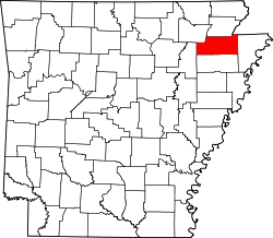
Location of Brookland in Craighead County, Arkansas.
Coordinates: 35°53′12″N90°35′30″W / 35.88667°N 90.59167°W / 35.88667; -90.59167
Country United States
State Arkansas
County Craighead
Area
[1]
  Total7.82 sq mi (20.25 km2)
  Land7.80 sq mi (20.20 km2)
  Water0.02 sq mi (0.04 km2)
Elevation
[2]
259 ft (79 m)
Population
 (2020)
  Total4,064
  Density521.09/sq mi (201.18/km2)
Time zone UTC-6 (Central (CST))
  Summer (DST) UTC-5 (CDT)
ZIP code
72417
Area code 870
FIPS code 05-09100
GNIS feature ID2405329 [2]
Website www.brooklandarkansas.org

Brookland is a city [3] in Craighead County, Arkansas, United States. The population was 1,642 at the 2010 census. [4] It is included in the Jonesboro, Arkansas Metropolitan Statistical Area.

Contents

Geography

Brookland is located in northern Craighead County. Via U.S. Route 49 it is 8 miles (13 km) northeast of downtown Jonesboro. Paragould is 12 miles (19 km) north via US 49.

According to the United States Census Bureau, the city has a total area of 2.0 square miles (5.3 km2), of which 0.008 square miles (0.02 km2), or 0.33%, is water. [4]

List of highways

Demographics

Historical population
CensusPop.Note
1920 326
1930 270−17.2%
1940 2762.2%
1950 33421.0%
1960 301−9.9%
1970 46554.5%
1980 84080.6%
1990 9199.4%
2000 1,33244.9%
2010 1,64223.3%
2020 4,064147.5%
U.S. Decennial Census [5]

2020 census

Brookland racial composition [6]
RaceNumberPercentage
White (non-Hispanic)3,55387.43%
Black or African American (non-Hispanic)1754.31%
Native American 140.34%
Asian 100.25%
Pacific Islander 10.02%
Other/Mixed 1774.36%
Hispanic or Latino 1343.3%

As of the 2020 United States census, there were 4,064 people, 1,337 households, and 945 families residing in the city.

2000 census

As of the census [7] of 2000, there were 1,332 people, 499 households, and 384 families residing in the town. The population density was 1,220.1 inhabitants per square mile (471.1/km2). There were 537 housing units at an average density of 491.9 per square mile (189.9/km2). The racial makeup of the town was 97.52% White, 0.68% Black or African American, 0.38% Native American, 0.68% from other races, and 0.75% from two or more races. 1.05% of the population were Hispanic or Latino of any race.

There were 499 households, out of which 43.7% had children under the age of 18 living with them, 59.3% were married couples living together, 14.4% had a female householder with no husband present, and 23.0% were non-families. 19.6% of all households were made up of individuals, and 11.0% had someone living alone who was 65 years of age or older. The average household size was 2.67 and the average family size was 3.07.

In the town the population was spread out, with 29.7% under the age of 18, 9.2% from 18 to 24, 31.8% from 25 to 44, 17.6% from 45 to 64, and 11.6% who were 65 years of age or older. The median age was 31 years. For every 100 females, there were 95.0 males. For every 100 females age 18 and over, there were 87.2 males.

The median income for a household in the town was $33,125, and the median income for a family was $37,500. Males had a median income of $27,471 versus $18,864 for females. The per capita income for the town was $13,744. About 7.0% of families and 11.1% of the population were below the poverty line, including 17.4% of those under age 18 and 18.7% of those age 65 or over.

Related Research Articles

<span class="mw-page-title-main">Poinsett County, Arkansas</span> County in Arkansas, United States

Poinsett County is a county located in the U.S. state of Arkansas. As of the 2020 census, the population was 22,965. The county seat is Harrisburg. Poinsett County is included in the Jonesboro–Paragould Combined Statistical Area.

<span class="mw-page-title-main">Greene County, Arkansas</span> County in Arkansas, United States

Greene County is a county located in the U.S. state of Arkansas. As of the 2020 census, the population was 45,736. The county seat is Paragould, which sits atop Crowley's Ridge.

<span class="mw-page-title-main">Craighead County, Arkansas</span> County in Arkansas, United States

Craighead County is a county located in the U.S. state of Arkansas. As of the 2020 census, the population was 111,231. The county has two county seats — Jonesboro and Lake City. Craighead County is Arkansas's 58th county, formed on February 19, 1859, and named for state Senator Thomas Craighead. It is one of several dry counties within the state of Arkansas, in which the sale of alcoholic beverages is largely prohibited.

<span class="mw-page-title-main">Norfork, Arkansas</span> City in Arkansas, United States

Norfork is a city in Baxter County, Arkansas, United States. The population was 550 at the 2010 census.

<span class="mw-page-title-main">Bay, Arkansas</span> City in Arkansas, United States

Bay is a city in Craighead County, Arkansas, United States. The population was 1,876 at the 2020 census. It is included in the Jonesboro Metropolitan Statistical Area.

<span class="mw-page-title-main">Black Oak, Arkansas</span> Town in Arkansas, United States

Black Oak is a town in Craighead County, Arkansas, United States. The population was 262 at the 2010 census. It is included in the Jonesboro, Arkansas Metropolitan Statistical Area.

<span class="mw-page-title-main">Bono, Arkansas</span> Bono in Arkansas, United States

Bono is a city in Craighead County, Arkansas, United States. The population was 2,131 at the 2010 census, up from 1,512 in 2000. It is included in the Jonesboro, Arkansas Metropolitan Statistical Area. Bono's most prominent landmarks are the Bono Bridge and the Bono Cemetery.

<span class="mw-page-title-main">Caraway, Arkansas</span> City in Arkansas, United States

Caraway is a city in Craighead County, Arkansas, United States. The population was 1,279 at the 2010 census. It is included in the Jonesboro, Arkansas Metropolitan Statistical Area.

<span class="mw-page-title-main">Cash, Arkansas</span> City in Arkansas, United States

Cash is a city in western Craighead County, Arkansas, United States. The population was 342 at the 2010 census. Cash Arkansas population was of mostly white with 99.8% and partial Puerto Rican ethnicity. It is included in the Jonesboro, Arkansas Metropolitan Statistical Area.

<span class="mw-page-title-main">Egypt, Arkansas</span> Town in Arkansas, United States

Egypt is a town in Craighead County, Arkansas, United States. The population was 112 at the 2010 census. It is included in the Jonesboro, Arkansas Metropolitan Statistical Area.

<span class="mw-page-title-main">Jonesboro, Arkansas</span> City in Northeast Arkansas

Jonesboro is a city located on Crowley's Ridge in the northeastern corner of the U.S. State of Arkansas. Jonesboro is one of two county seats of Craighead County. In 2022, the city had an estimated population of 79,876, making it the fifth-most populous city in Arkansas. In 2020, the Jonesboro metropolitan area had a population of 134,196, and the Jonesboro-Paragould Combined Statistical Area had a population of 179,932.

<span class="mw-page-title-main">Lake City, Arkansas</span> City in Arkansas, United States

Lake City is a city in Craighead County, Arkansas, United States, along the St. Francis River. Lake City is one of two county seats in Craighead County. The population was 2,326 as of the 2020 census. It is included in the Jonesboro, Arkansas Metropolitan Statistical Area.

<span class="mw-page-title-main">Monette, Arkansas</span> City in Arkansas, United States

Monette is a city in Craighead County, Arkansas, United States. The city is located in an area of Northeast Arkansas known as Buffalo Island. The population was 1,506 at the 2020 census.

<span class="mw-page-title-main">Turrell, Arkansas</span> City in Arkansas, United States

Turrell is a city in Crittenden County, Arkansas, United States. Per the 2020 census, the population was 517.

<span class="mw-page-title-main">Paragould, Arkansas</span> City in Arkansas, United States

Paragould is the county seat of Greene County, and the 19th-largest city in Arkansas, in the United States. The city is located in northeastern Arkansas on the eastern edge of Crowley's Ridge, a geologic anomaly contained within the Arkansas delta.

<span class="mw-page-title-main">Fisher, Arkansas</span> City in Arkansas, United States

Fisher is a city in Poinsett County, Arkansas, United States. The population was 223 at the 2010 census. It is included in the Jonesboro, Arkansas Metropolitan Statistical Area.

<span class="mw-page-title-main">Harrisburg, Arkansas</span> City in Arkansas, United States

Harrisburg is a city in Poinsett County, Arkansas, United States. The population was 2,212 at the 2020 census. It is included in the Jonesboro, Arkansas Metropolitan Statistical Area. The city is the county seat of Poinsett County.

<span class="mw-page-title-main">Waldenburg, Arkansas</span> Town in Arkansas, United States

Waldenburg is a town in Poinsett County, Arkansas, United States. The population was 80 at the 2000 census. It is included in the Jonesboro, Arkansas Metropolitan Statistical Area. Waldenburg is home to Zion Lutheran Church. Zion was founded in 1881 and is a member congregation of the Lutheran Church–Missouri Synod.

Jonesboro is a town in Washington County, Maine, United States. The town was named for John Coffin Jones, a landholder. The population was 587 at the 2020 census.

<span class="mw-page-title-main">Jonesboro metropolitan area</span>

The Jonesboro Metropolitan Statistical Area, as defined by the United States Census Bureau, is an area consisting of two counties – Craighead and Poinsett – in northeast Arkansas, anchored by the city of Jonesboro. As of the 2010 census, the MSA had a population of 121,026. It is also part of the larger Jonesboro-Paragould Combined Statistical Area.

References

  1. "2020 U.S. Gazetteer Files". United States Census Bureau. Retrieved October 29, 2021.
  2. 1 2 U.S. Geological Survey Geographic Names Information System: Brookland, Arkansas
  3. Local.Arkansas.gov - Brookland , retrieved September 3, 2012
  4. 1 2 "Geographic Identifiers: 2010 Demographic Profile Data (G001): Brookland city, Arkansas". U.S. Census Bureau, American Factfinder. Archived from the original on February 13, 2020. Retrieved June 18, 2014.
  5. "Census of Population and Housing". Census.gov. Retrieved June 4, 2015.
  6. "Explore Census Data". data.census.gov. Retrieved December 30, 2021.
  7. "U.S. Census website". United States Census Bureau . Retrieved January 31, 2008.