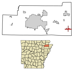
Caraway, Arkansas | |
---|---|
Coordinates: 35°45′33″N90°19′23″W / 35.75917°N 90.32306°W | |
Country | United States |
State | Arkansas |
County | Craighead |
Incorporated | 1923 |
Area | |
• Total | 2.31 sq mi (5.98 km2) |
• Land | 2.30 sq mi (5.97 km2) |
• Water | 0.01 sq mi (0.01 km2) |
Elevation | 226 ft (69 m) |
Population (2020) | |
• Total | 1,133 |
• Density | 491.75/sq mi (189.83/km2) |
Time zone | UTC-6 (Central (CST)) |
• Summer (DST) | UTC-5 (CDT) |
ZIP code | 72419 |
Area code | 870 |
FIPS code | 05-11410 |
GNIS feature ID | 0057508 |
Website | www |
Caraway is a city [2] in Craighead County, Arkansas, United States. The population was 1,279 at the 2010 census. It is included in the Jonesboro, Arkansas Metropolitan Statistical Area.
The town originally began as a lumber camp known as White Switch in 1912. It was incorporated in 1923, taking its name from then-U.S. Senator Thaddeus Caraway. [3]
Caraway is located in the Arkansas Delta region at 35°45′33″N90°19′23″W / 35.75917°N 90.32306°W (35.759143, -90.323051). [4] According to the United States Census Bureau, the town has a total area of 6.0 km2 (2.3 mi2), all land.
Ecologically, Caraway is located within the St. Francis Lowlands ecoregion within the larger Mississippi Alluvial Plain. The St. Francis Lowlands are a flat region mostly covered with row crop agriculture today, though also containing sand blows and sunken lands remaining from the 1811–12 New Madrid earthquakes. Waterways have mostly been channelized, causing loss of aquatic and riparian wildlife habitat. [5] The St. Francis Sunken Lands Wildlife Management Area, which preserves some of the bottomland hardwood forest typical of this ecoregion prior to development for row agriculture lies just west of Caraway along the St. Francis River.
Census | Pop. | Note | %± |
---|---|---|---|
1930 | 425 | — | |
1940 | 477 | 12.2% | |
1950 | 970 | 103.4% | |
1960 | 821 | −15.4% | |
1970 | 952 | 16.0% | |
1980 | 1,165 | 22.4% | |
1990 | 1,178 | 1.1% | |
2000 | 1,349 | 14.5% | |
2010 | 1,279 | −5.2% | |
2020 | 1,133 | −11.4% | |
U.S. Decennial Census [6] |
Race | Number | Percentage |
---|---|---|
White (non-Hispanic) | 1,068 | 94.26% |
Black or African American (non-Hispanic) | 1 | 0.09% |
Native American | 3 | 0.26% |
Other/Mixed | 36 | 3.18% |
Hispanic or Latino | 25 | 2.21% |
As of the 2020 United States census, there were 1,133 people, 422 households, and 231 families residing in the city.
As of the census [8] of 2000, there were 1,349 people, 547 households, and 386 families residing in the town. The population density was 224.5/km2 (581.4/mi2). There were 606 housing units at an average density of 100.9/km2 (261.2/mi2). The racial makeup of the town was 97.63% White, 0.07% Native American, 0.07% Asian, 1.33% from other races, and 0.89% from two or more races. 2.89% of the population were Hispanic or Latino of any race.
There were 547 households, out of which 34.9% had children under the age of 18 living with them, 54.1% were married couples living together, 13.2% had a female householder with no husband present, and 29.4% were non-families. 27.6% of all households were made up of individuals, and 14.6% had someone living alone who was 65 years of age or older. The average household size was 2.41 and the average family size was 2.93.
In the town the population was spread out, with 25.4% under the age of 18, 9.0% from 18 to 24, 25.8% from 25 to 44, 24.9% from 45 to 64, and 14.9% who were 65 years of age or older. The median age was 37 years. For every 100 females, there were 87.9 males. For every 100 females age 18 and over, there were 80.9 males.
The median income for a household in the town was $22,279, and the median income for a family was $26,600. Males had a median income of $25,809 versus $17,000 for females. The per capita income for the town was $11,647. About 21.9% of families and 26.3% of the population were below the poverty line, including 37.1% of those under age 18 and 35.6% of those age 65 or over.
It is a part of the Riverside School District. It was served by the Caraway School District until it consolidated into Riverside on July 1, 1985. [9]
Clay County is a county located in the U.S. state of Arkansas. Originally incorporated as Clayton County, as of the 2020 census, its population was 14,552. The county has two county seats, Corning and Piggott. It is a dry county, in which the sale of alcoholic beverages is restricted or prohibited.
Poinsett County is a county located in the U.S. state of Arkansas. As of the 2020 census, the population was 22,965. The county seat is Harrisburg. Poinsett County is included in the Jonesboro–Paragould Combined Statistical Area.
Greene County is a county located in the U.S. state of Arkansas. As of the 2020 census, the population was 45,736. The county seat is Paragould, which sits atop Crowley's Ridge.
Craighead County is a county located in the U.S. state of Arkansas. As of the 2020 census, the population was 111,231. The county has two county seats — Jonesboro and Lake City. Craighead County is Arkansas's 58th county, formed on February 19, 1859, and named for state Senator Thomas Craighead. It is one of several dry counties within the state of Arkansas, in which the sale of alcoholic beverages is largely prohibited.
Nimmons is a town in Clay County, Arkansas, United States. The population was 69 at the 2010 census, down from 100 in 2000.
Bay is a city in Craighead County, Arkansas, United States. The population was 1,876 at the 2020 census. It is included in the Jonesboro Metropolitan Statistical Area.
Black Oak is a town in Craighead County, Arkansas, United States. The population was 262 at the 2010 census. It is included in the Jonesboro, Arkansas Metropolitan Statistical Area. Black Oak is the namesake of 1970s rock band Black Oak Arkansas and the setting of John Grisham's novel A Painted House.
Bono is a city in Craighead County, Arkansas, United States. The population was 2,131 at the 2010 census, up from 1,512 in 2000. It is included in the Jonesboro, Arkansas Metropolitan Statistical Area. Bono's most prominent landmarks are the Bono Bridge and the Bono Cemetery.
Brookland is a city in Craighead County, Arkansas, United States. The population was 1,642 at the 2010 census. It is included in the Jonesboro, Arkansas Metropolitan Statistical Area.
Cash is a city in western Craighead County, Arkansas, United States. The population was 342 at the 2010 census. Cash Arkansas population was of mostly white with 99.8% and partial Puerto Rican ethnicity. It is included in the Jonesboro, Arkansas Metropolitan Statistical Area.
Egypt is a town in Craighead County, Arkansas, United States. The population was 112 at the 2010 census. It is included in the Jonesboro, Arkansas Metropolitan Statistical Area.
Jonesboro is a city located on Crowley's Ridge in the northeastern corner of the U.S. State of Arkansas. Jonesboro is one of two county seats of Craighead County. In 2023, the city had a population of 81,969 and was the fifth-largest city in Arkansas at the time. In 2023, the Jonesboro metropolitan area had a population of 135,287 and a population of 179,932 in the Jonesboro-Paragould Combined Statistical Area.
Lake City is a city in Craighead County, Arkansas, United States, along the St. Francis River. Lake City is one of two county seats in Craighead County. The population was 2,326 as of the 2020 census. It is included in the Jonesboro, Arkansas Metropolitan Statistical Area.
Monette is a city in Craighead County, Arkansas, United States. The population was 1,506 at the 2020 census.
Crawfordsville, historically Crawfordville, is a town in Crittenden County, Arkansas, United States. The population was 479 at the 2010 census.
Gilmore is a city in Crittenden County, Arkansas, United States. Per the 2020 census, the population was 176.
Manila is a city in Mississippi County, Arkansas, United States. The population was 3,682 at the 2020 census, up from 3,342 in 2010. It was the hometown of World War I sniper Herman Davis. A park in the town honors his memory.
Trumann is a city in Poinsett County, Arkansas, United States. The population was 7,399 at the 2020 census. It is included in the Jonesboro Metropolitan Statistical Area.
The Jonesboro Metropolitan Statistical Area, as defined by the United States Census Bureau, is an area consisting of two counties – Craighead and Poinsett – in northeast Arkansas, anchored by the city of Jonesboro. As of the 2010 census, the MSA had a population of 121,026. It is also part of the larger Jonesboro-Paragould Combined Statistical Area.
The Jonesboro–Paragould Combined Statistical Area is made up of three counties in northeastern Arkansas. The CSA consists of the Jonesboro Metropolitan Statistical Area and the Paragould Micropolitan Statistical Area. As of the 2010 census, the CSA had a population of 163,116.
{{citation}}
: CS1 maint: multiple names: authors list (link) (color poster with map, descriptive text, summary tables, and photographs).