Thornton, Arkansas | |
---|---|
Coordinates: 33°46′36″N92°29′23″W / 33.77667°N 92.48972°W Coordinates: 33°46′36″N92°29′23″W / 33.77667°N 92.48972°W | |
Country | United States |
State | Arkansas |
County | Calhoun |
Area | |
• Total | 1.94 sq mi (5.03 km2) |
• Land | 1.92 sq mi (4.98 km2) |
• Water | 0.02 sq mi (0.04 km2) |
Elevation | 318 ft (97 m) |
Population (2020) | |
• Total | 339 |
• Density | 176.20/sq mi (68.01/km2) |
Time zone | UTC−6 (Central (CST)) |
• Summer (DST) | UTC−5 (CDT) |
ZIP code | 71766 |
Area code | 870 |
FIPS code | 05-69050 |
GNIS feature ID | 0055554 |
Thornton is a city in Calhoun County, Arkansas, United States. The population was 407 as of the 2010 census, [2] down from 517 in 2000. It is part of the Camden, Arkansas micropolitan area.
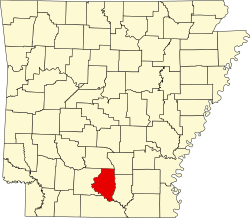
Thornton is located in northern Calhoun County at 33°46′36″N92°29′23″W / 33.77667°N 92.48972°W (33.776794, -92.489711). [3] U.S. Route 79 passes through the city, leading northeast 6 miles (10 km) to Fordyce and southwest 26 miles (42 km) to Camden. U.S. Route 167 cuts across the southeast corner of the city limits, leading north to US 79 and Fordyce and south 16 miles (26 km) to Hampton, the Calhoun County seat.
According to the United States Census Bureau, Thornton has a total area of 1.9 square miles (5.0 km2), of which 0.02 square miles (0.04 km2), or 0.84%, is water. [2]
Census | Pop. | Note | %± |
---|---|---|---|
1880 | 150 | — | |
1890 | 132 | −12.0% | |
1910 | 611 | — | |
1920 | 1,312 | 114.7% | |
1930 | 550 | −58.1% | |
1960 | 658 | — | |
1970 | 746 | 13.4% | |
1980 | 711 | −4.7% | |
1990 | 502 | −29.4% | |
2000 | 517 | 3.0% | |
2010 | 407 | −21.3% | |
2020 | 339 | −16.7% | |
U.S. Decennial Census [4] |
As of the census [5] of 2000, there were 517 people, 206 households, and 142 families residing in the city. The population density was 270.4 inhabitants per square mile (104.4/km2). There were 242 housing units at an average density of 126.6 per square mile (48.9/km2). The racial makeup of the city was 56.48% White, 41.78% Black or African American, 0.19% Native American, and 1.55% from two or more races. 0.97% of the population were Hispanic or Latino of any race.
There were 206 households, out of which 32.5% had children under the age of 18 living with them, 51.9% were married couples living together, 13.1% had a female householder with no husband present, and 30.6% were non-families. 25.2% of all households were made up of individuals, and 14.1% had someone living alone who was 65 years of age or older. The average household size was 2.51 and the average family size was 2.98.
In the city, the age distribution of the population shows 25.5% under the age of 18, 7.2% from 18 to 24, 32.1% from 25 to 44, 22.1% from 45 to 64, and 13.2% who were 65 years of age or older. The median age was 37 years. For every 100 females, there were 86.0 males. For every 100 females age 18 and over, there were 75.8 males.
The median income for a household in the city was $24,375, and the median income for a family was $31,125. Males had a median income of $33,472 versus $16,071 for females. The per capita income for the city was $14,323. About 26.6% of families and 33.9% of the population were below the poverty line, including 45.1% of those under age 18 and 32.8% of those age 65 or over.
The climate in this area is characterized by hot, humid summers and generally mild to cool winters. According to the Köppen climate classification system, Thornton has a humid subtropical climate, abbreviated "Cfa" on climate maps. [6]
The Bearden School District serves residents. [7] On July 1, 1985 the Thornton School District consolidated into the Bearden district. [8]
Ouachita County is a county located in the south central part of the U.S. state of Arkansas. As of the 2020 census, the population was 22,650.
Dallas County is a county located in the U.S. state of Arkansas. As of the 2020 census, the population was 6,482, making it the fourth-least populous county in Arkansas. The county seat is Fordyce. Dallas County is Arkansas's 49th county, formed on January 1, 1845; it was named for George M. Dallas, 11th Vice President of the United States.
Cleveland County is a county located in the U.S. state of Arkansas. Its population was 7,550 at the 2020 U.S. census. The county seat and largest city is Rison.
Calhoun County is a county located in the south central part of the U.S. state of Arkansas. As of the 2020 census, the population was 4,739, making it the least populous county in Arkansas. The county seat is Hampton. Calhoun County is Arkansas's 55th county, formed on December 6, 1850, and named for John C. Calhoun, a Vice President of the United States.
Portland is a town in Ashley County, Arkansas, United States. The population was 430 at the 2010 census. Portland was first settled in the 1830s, and named for its early status as a steamboat port. It was incorporated in 1893.
Hermitage is a city in Bradley County, Arkansas, United States. The United States Census Bureau estimated the population to be 830 as of the 2010 census.
Hampton is a town in Calhoun County, Arkansas, United States. The population was 1,324 at the 2010 census. The town is the county seat of Calhoun County.
Harrell is a town in Calhoun County, Arkansas, United States. The population was 254 at the 2010 census. It is part of the Camden Micropolitan Statistical Area.
Tinsman is a town in Calhoun County, Arkansas, United States. The population was 54 at the 2010 census. It is part of the Camden Micropolitan Statistical Area.
Rison is a city in and the county seat of Cleveland County, Arkansas, United States. Its population was 1,344 at the 2010 U.S. census. It is included in the Pine Bluff, Arkansas Metropolitan Statistical Area. Rison is a bedroom community for people who work in Pine Bluff. The largest employers are the city and county governments, the Cleveland County School District, the Cleveland County Nursing Home. There are two banks, eight churches, and about forty-five businesses within the city limits. Among the local properties listed on the National Register of Historic Places are the Rison Cities Service Station and the Rison Texaco Service Station.
Fordyce is a small town in Dallas County, Arkansas, United States. Its population has been decreasing since the 1980's when the town reached an all time high of 5,175. The population in 2020 was 3,396 down from 4,300 at the 2010 census, and from 4,799 in 2000.
Sparkman is a city in Dallas County, Arkansas, United States. The population was 427 at the 2010 census, down from 586 in 2000.
Leola is a town in Grant County, Arkansas, United States. The population was 501 at the 2010 census. It is the southernmost municipality within the Central Arkansas region.
Calico Rock is a city in Izard County, Arkansas, United States. The population was 1,545 at the 2010 census, up from 991 in 2000.
Keo is a town in southwest Lonoke County, Arkansas, United States. The population was 256 at the 2010 census. It is part of the Little Rock–North Little Rock–Conway Metropolitan Statistical Area.
Bearden is a city in Ouachita County, Arkansas, United States. The population was 966 at the 2010 census. It is part of the Camden Micropolitan Statistical Area.
Lexa is a town in northern Phillips County, Arkansas, United States. The population was 286 at the 2010 census.
Jacksonville is a city in Pulaski County, Arkansas, United States, and a suburb of Little Rock. As of the 2010 census, the population of the city was 28,364. It is part of the Little Rock–North Little Rock–Conway Metropolitan Statistical Area with 729,135 people as of 2014.
Benton is a city in and the county seat of Saline County, Arkansas, United States and a suburb of Little Rock. It was established in 1837. At the 2010 census, the city had a population of 30,681. In 2019 the population was estimated at 36,820. It is part of the Little Rock–North Little Rock–Conway Metropolitan Statistical Area. The city of Benton, first settled in 1833 and named after Missouri Senator Thomas Hart Benton, was formally chartered in 1836 when Arkansas became a state.
Calion is a second-class city in Union County, Arkansas, United States. The population was 494 at the 2010 census.
Media related to Thornton, Arkansas at Wikimedia Commons