Harrison County is located in the far southern part of the U.S. state of Indiana along the Ohio River. The county was officially established in 1808. Its population was 39,654 as of the 2020 United States Census. Its county seat is Corydon, the former capital of Indiana.

The city of Harrison is the county seat of Boone County, Arkansas, United States. It is named after Marcus LaRue Harrison, a surveyor who laid out the city along Crooked Creek at Stifler Springs. According to 2019 Census Bureau estimates, the population of the city was 13,069, up from 12,943 at the 2010 census and it is the 30th largest city in Arkansas based on official 2019 estimates from the U.S. Census Bureau. Harrison is the principal city of the Harrison Micropolitan Statistical Area, which includes all of Boone and Newton counties.

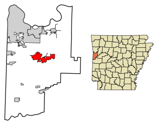
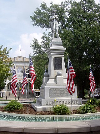
Greenwood is a city in and one of the two county seats of Sebastian County, Arkansas, United States. It is the fifth largest municipality in the Fort Smith, Arkansas-Oklahoma Metropolitan Statistical Area with a population of 8,952 according to the 2010 US Census. According to estimates based on the most recent census, the population of Greenwood in 2018 was 9,397.

Corydon is a town in Harrison Township and the county seat of Harrison County, Indiana, located north of the Ohio River in the extreme southern part of the state. Corydon was founded in 1808 and served as the capital of the Indiana Territory from 1813 to 1816. It was the site of Indiana's first constitutional convention, which was held June 10–29, 1816. Forty-three delegates convened to consider statehood for Indiana and drafted its first state constitution. Under Article XI, Section 11, of the Indiana 1816 constitution, Corydon was designated as the capital of the state, which it remained until 1825, when the seat of state government was moved to Indianapolis. In 1863, during the American Civil War, Corydon was the site of the Battle of Corydon, the only official pitched battle waged in Indiana during the war. More recently, the town's numerous historic sites have helped it become a tourist destination. A portion of its downtown area is listed in the National Register of Historic Places as the Corydon Historic District. As of the 2010 census, Corydon had a population of 3,122.

Davidsonville Historic State Park is a 163-acre (66 ha) Arkansas state park in Randolph County, Arkansas in the United States. Situated on a border between The Ozarks and the Arkansas Delta, the park preserves the remains of the abandoned frontier town of Davidsonville. The town was one of Arkansas Territory's first settlements when founded in 1815, serving as an important river port town on the Black River. The former townsite was made into a state park in 1957 and a monument was added to the National Register of Historic Places in 1974.

The Corydon Historic District is a national historic district located in Corydon, Indiana, United States. The town of Corydon is also known as Indiana's First State Capital and as Historic Corydon. The district was added to the National Register of Historic Places in 1973, but the listing was amended in 1988 to expand the district's geographical boundaries and include additional sites. The district includes numerous historical structures, most notably the Old Capitol, the Old Treasury Building, Governor Hendricks' Headquarters, the Constitution Elm Memorial, the Posey House, the Kintner-McGrain House, and The Kintner House Inn, as well as other residential and commercial sites.

The Woodstock Square Historic District is located in the county seat of McHenry County, Illinois, which is Woodstock. The district is located in downtown Woodstock and has been listed on the National Register of Historic Places since 1982. Within the district two of Woodstock's other Registered Places can be found, Woodstock Opera House and the Old McHenry County Courthouse.

The Ogle County Courthouse is a National Register of Historic Places listing in the Ogle County, Illinois, county seat of Oregon. The building stands on a public square in the city's downtown commercial district. The current structure was completed in 1891 and was preceded by two other buildings, one of which was destroyed by a group of outlaws. Following the destruction of the courthouse, the county was without a judicial building for a period during the 1840s. The Ogle County Courthouse was designed by Chicago architect George O. Garnsey in the Romanesque Revival style of architecture. The ridged roof is dominated by its wooden cupola which stands out at a distance.

Downtown Santa Ana (DTSA), also called Downtown Orange County, is the city center of Santa Ana, the county seat of Orange County, California. It is the institutional center for the city of Santa Ana as well as Orange County, a retail and business hub.

This is a list of the National Register of Historic Places listings in Boone County, Arkansas.

The United States Post Office and Courthouse, also known as Texarkana U.S. Post Office and Federal Building and as Texarkana U.S. Post Office and Courthouse, is located on State Line Avenue in Texarkana, straddling the border between Arkansas and Texas. It is a courthouse of the United States District Court for the Western District of Arkansas and the United States District Court for the Eastern District of Texas.

Charles L. Thompson and associates is an architectural group that was established in Arkansas since the late 1800s. It is now known as Cromwell Architects Engineers, Inc.. This article is about Thompson and associates' work as part of one architectural group, and its predecessor and descendant firms, including under names Charles L. Thompson,Thompson & Harding,Sanders & Ginocchio, and Thompson, Sanders and Ginocchio.

The Fayetteville Historic Square, in Fayetteville, Arkansas, includes the original Fayetteville post office, the Old Bank of Fayetteville Building, the Lewis Brothers Building, the Mrs. Young Building, and the Guisinger Building. These buildings are listed in the National Register of Historic Places. There are several more recent buildings located on the Square.

The Boone County Courthouse is a historic courthouse in Harrison, Arkansas. It is a two-story brick structure, designed by noted Arkansas architect Charles L. Thompson and built in 1907. It is Georgian Revival in style, with a hip roof above a course of dentil molding, and bands of cast stone that mark the floor levels of the building. It has a projecting gabled entry section, three bays wide, with brick pilasters separating the center entrance from the flanking windows. The gable end has a dentillated pediment, and has a bullseye window at the center.
The Boone County Jail is a historic jail building at Central Ave. and Willow St. in Harrison, Arkansas. It is a two-story red brick building, built in 1914. Its design has been attributed to prominent Arkansas architect Charles L. Thompson. Its hip roof is finished in red tile, as is the roof of the single-story porch sheltering the main entrance. The jail was laid out to house the jailer on the first floor, and the prisoners on the second.

Downtown Bentonville is the historic business district of Bentonville, Arkansas. The region is the location of Walmart Home Office; city and county government facilities; and most of Bentonville's tourist attractions for the city and contains many historically and architecturally significant properties. Downtown measures approximately 1.5 square miles (3.9 km2) and is defined as the region between Tiger Boulevard to the north, Highway 102 (AR 102) to the south, Walton Boulevard to the west and J Street to the east. Similar to other central business districts in the US, Downtown has recently undergone a transformation that included the construction of new condos and lofts, renovation of historic buildings, and arrival of new residents and businesses. Upon opening of Crystal Bridges Museum of American Art the increased tourist traffic related to the museum has made Downtown Bentonville one of the state's most popular tourism destinations.

The Magnolia Commercial Historic District encompasses the historic heart of Magnolia, the county seat of Columbia County, Arkansas. It includes the courthouse square and most of the buildings which face it, as well as buildings along Calhoun and Jackson Streets. The centerpiece of the district is the square itself and the Columbia County Courthouse, a Renaissance Revival structure built in 1905 to a design by W. S. Hull. The square is lined with mostly brick-faced buildings built between about 1899 and 1910, and between 1938 and 1958, when the city experienced a second building boom. The oldest known surviving building, then as now housing a pharmacy, is located at 111 S. Court Square. One prominent building from the second building phase is the Cameo Theater Building, an Art Deco design built in 1948.

The Perryville Commercial Historic District encompasses the historic commercial and civic heart of the city of Perryville, Arkansas. It was listed on the National Register of Historic Places in 2012, and it includes two buildings already separately listed. It is centered on the courthouse square, where the 1880 Perry County Courthouse stands. It includes nine contributing buildings, including buildings facing the square, with a few included on adjacent side streets, and six non-contributing ones. This area was developed beginning in the 1840s, when Perryville was founded, and grew through the mid-20th century. Most of the buildings are vernacular commercial buildings, finished in wood, brick, or stone. The most unusual is the Rustic Perryville American Legion Building.

The Newton Downtown Historic District is a nationally recognized historic district located in Newton, Iowa, United States. It was listed on the National Register of Historic Places in 2014. At the time of its nomination it contained 85 resources, which included 60 contributing buildings, one contributing site, and 24 non-contributing buildings. Jasper County was established by the Iowa Territorial Legislature in 1846, and Newton was incorporated the following year as the county seat. The town grew slowly at first around the Jasper County Courthouse. Businesses largely served the needs of the local farmers as well as the town's residents. The Mississippi and Missouri Railroad, later the Chicago, Rock Island and Pacific Railroad, came to Newton in 1867. This changed the town's economy from agricultural-based to manufacturing, and the central business district expanded outward as the community grew. Several washing machine companies established themselves in Newton, most notably Maytag. The emergence of Maytag as a major corporation in the mid-20th century led to the transformation of the downtown area. Between 1951 and 1952, 18 businesses installed new storefronts, transforming them from their original Victorian appearance to a more modern appearance. The modernization continued into the 1960s.


