Springfield, Arkansas

Last updated

Springfield, Arkansas
Country United States
State Arkansas
County Conway
Area
  Total1.8 sq mi (4.6 km2)
Elevation
[1]
472 ft (144 m)
Population
 (2020)
  Total223
Time zone UTC-6 (Central (CST))
  Summer (DST) UTC-5 (CDT)
GNIS feature ID2805686 [1]

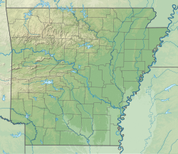
Springfield is an unincorporated community and census-designated place (CDP) located in the north central part of Arkansas in Conway County. [1] It was first listed as a CDP in the 2020 census with a population of 223. [2]
Contents

Demographics

Historical population
CensusPop.Note
2020 223
U.S. Decennial Census [3]
2020 [4]

2020 census

Springfield CDP, Arkansas – Demographic Profile
(NH = Non-Hispanic)
Note: the US Census treats Hispanic/Latino as an ethnic category. This table excludes Latinos from the racial categories and assigns them to a separate category. Hispanics/Latinos may be of any race.
Race / EthnicityPop 2020 [4] % 2020
White alone (NH)19587.44%
Black or African American alone (NH)31.35%
Native American or Alaska Native alone (NH)00.00%
Asian alone (NH)00.00%
Pacific Islander alone (NH)00.00%
Some Other Race alone (NH)00.00%
Mixed Race/Multi-Racial (NH)198.52%
Hispanic or Latino (any race)62.69%
Total223100.00%

Education

It is in the South Conway County School District. [5] [6] It operates Morrilton High School.

Sister Cities

Related Research Articles

<span class="mw-page-title-main">Faulkner County, Arkansas</span> County in Arkansas, United States

Faulkner County is a county located in the Central Arkansas region of the U.S. state of Arkansas. As of the 2020 census, the population was 123,498, making it the fifth most populous of Arkansas's 75 counties. The county seat and largest city is Conway. Faulkner County was created on April 12, 1873, one of nine counties formed during Reconstruction, and is named for Sandford C. Faulkner, better known as Sandy Faulkner, a popular figure in the state at the time.

<span class="mw-page-title-main">Prairie Creek, Arkansas</span> CDP in Arkansas, United States

Prairie Creek is a census-designated place (CDP) in Benton County, Arkansas, United States. Per the 2020 census, the population was 2,217. It is a lakefront community adjacent to Beaver Lake and Rogers within the Northwest Arkansas region.

<span class="mw-page-title-main">Plumerville, Arkansas</span> City in Arkansas, US

Plumerville is a city in Conway County, Arkansas, United States. The population was 734 at the 2020 census.

<span class="mw-page-title-main">Hensley, Arkansas</span> Census-designated place in Arkansas, United States

Hensley is a census-designated place (CDP) in Pulaski County, Arkansas, United States. The population was 139 at the 2010 census. It is part of the Little Rock–North Little Rock–Conway Metropolitan Statistical Area.

<span class="mw-page-title-main">Redan, Georgia</span> Place in Georgia, United States

Redan is an unincorporated community and census-designated place (CDP) in DeKalb County, Georgia, United States. As of the 2020 census, the CDP had a total population of 31,749. It is a predominantly African American community in eastern DeKalb County, and is a suburb of Atlanta.

<span class="mw-page-title-main">Linn, Texas</span> Census-designated place in Hidalgo County, Texas, United States

Linn, formerly San Manuel-Linn, is a census-designated place (CDP) in Hidalgo County, Texas, United States. The population was 801 at the 2010 census, down from 958 at the 2000 census. It is part of the McAllen–Edinburg–Mission Metropolitan Statistical Area.

<span class="mw-page-title-main">Fronton, Texas</span> CDP in Texas, United States

Fronton is a census-designated place (CDP) in Starr County, Texas, United States, bordering the Mexican state of Tamaulipas, close to Ciudad Miguel Alemán. The population was 172 at the 2020 census, a decline from the figure of 180 tabulated in 2010.

<span class="mw-page-title-main">Salineño, Texas</span> CDP in Texas, United States

Salineño is a census-designated place (CDP) in Starr County, Texas, United States. The name was changed in 2008, adding a tilde over the second n. The population was 176 at the 2020 census, down from 201 at the 2010 census.

<span class="mw-page-title-main">Center Ridge, Arkansas</span> Census-designated place in Arkansas, United States

Center Ridge is an unincorporated census-designated place in Conway County, Arkansas, United States. Per the 2020 census, the population was 2,235.

<span class="mw-page-title-main">Cherokee City, Arkansas</span> Census-designated place in Arkansas, United States

Cherokee City is an unincorporated census-designated place (CDP) in Benton County, Arkansas, United States. Per the 2020 census, the population was 73. It is the location of Coon Creek Bridge, which is located on Cty Rd. 24 and is listed on the National Register of Historic Places. The community was named for the Cherokee, since the Trail of Tears crossed the landscape when the Cherokee migrated west to Indian territory, now Oklahoma in the late 1830s. The town is within the Northwest Arkansas region, located about 5 miles east of Oklahoma and 4 miles south of the Missouri state line.

<span class="mw-page-title-main">Maysville, Arkansas</span> Census-designated place in Arkansas, United States

Maysville is an unincorporated community and census-designated place (CDP) in Benton County, Arkansas, United States. It is the westernmost settlement in the state of Arkansas. Per the 2020 census, the population was 117. It is located in the Northwest Arkansas region.

<span class="mw-page-title-main">New Blaine, Arkansas</span> Census-designated place in Arkansas, United States

New Blaine is an unincorporated community and census-designated place (CDP) in Logan County, Arkansas, United States. Per the 2020 census, the population was 173.

<span class="mw-page-title-main">Lost Bridge Village, Arkansas</span> Census-designated place in Arkansas, United States

Lost Bridge Village is a residential subdivision near the town of Garfield in Benton County, Arkansas, United States. Per the 2020 census, the population was 397. It is located in the Northwest Arkansas region.

<span class="mw-page-title-main">Staves, Arkansas</span> Census-designated place in Arkansas, United States

Staves is a census-designated place in Cleveland County, Arkansas, United States. Per the 2020 census, the population was 133.

Jerusalem is an unincorporated community and census-designated place (CDP) in Conway County, Arkansas, United States. It was first listed as a CDP in the 2020 census with a population of 137. Jerusalem is located on Arkansas Highway 124, 18 miles (29 km) north-northwest of Morrilton. Jerusalem has a post office with ZIP code 72080.

Amada Acres is a census-designated place (CDP) in Starr County, Texas, United States. It is a new CDP, formed from part of the former La Casita-Garciasville CDP prior to the 2010 census, with a population of 92.

Longoria is a census-designated place (CDP) in Starr County, Texas, United States. This was a new CDP for the 2010 census, with a population of 92.

Santa Anna is a census-designated place (CDP) in Starr County, Texas, United States. This was a new CDP for the 2010 census, with a population of 13.

Los Corralitos is a census-designated place (CDP) in Webb County, Texas, United States. This was a new CDP for the 2010 census, with a population of 35.

Collins is an unincorporated community and census-designated place (CDP) in Drew County, Arkansas, United States. It is located along Arkansas Highway 35, 7 miles (11 km) west of Dermott and 15 miles (24 km) southeast of Monticello. It was first listed as a CDP in the 2020 census with a population of 149.

References

  1. 1 2 3 U.S. Geological Survey Geographic Names Information System: Springfield, Arkansas
  2. "Springfield CDP, Arkansas". United States Census Bureau . Retrieved April 7, 2022.
  3. "Decennial Census of Population and Housing by Decades". US Census Bureau.
  4. 1 2 "P2 HISPANIC OR LATINO, AND NOT HISPANIC OR LATINO BY RACE – 2020: DEC Redistricting Data (PL 94-171) – Springfield CDP, Arkansas". United States Census Bureau .
  5. "SCHOOL DISTRICT REFERENCE MAP (2010 CENSUS): Conway County, AR" (PDF). U.S. Census Bureau . Retrieved February 27, 2021.
  6. "General Highway Map Conway County, Arkansas" (PDF). Arkansas Department of Transportation . Retrieved March 17, 2021. - See Solgohachia and Springfield on the map.

Further reading

35°16′03″N92°33′28″W / 35.26750°N 92.55778°W / 35.26750; -92.55778