Elkins is a city in Washington County, Arkansas, United States. The community is located in the Boston Mountains, deep in the Ozark Mountains. A combination of the former unincorporated communities of Harris and Hood, Elkins was established in 1964. Located immediately east of Fayetteville in the Northwest Arkansas metropolitan statistical area, Elkins has been experiencing rapid growth in recent years, doubling in population between the 2000 and 2010 censuses.

Farmington is a city in Washington County, Arkansas, United States. The community is nestled in a valley among the Boston Mountains, a subset of the Ozark Mountains. Although the first settlers came from the Deep South in 1828, the community did not incorporate until 1946. Located immediately west of Fayetteville in the Northwest Arkansas metropolitan statistical area, Farmington has been experiencing a population boom in recent years, as indicated by a 66% growth in population between the 2000 and 2010 censuses. It has been characterized as a bedroom community by the University of Arkansas Community Design Center.

Goshen is a city in Washington County, Arkansas, United States. The population was 2,102 at the 2020 census. It is part of the Northwest Arkansas region. According to Business Insider, it is the “most educated” city in the state of Arkansas.

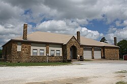
Johnson is a city in Washington County, Arkansas, United States. The community is located in the Ozark Mountains and is surrounded by valleys and natural springs. Early settlers took advantage of these natural features and formed an economy based on mining lime, the Johnson Mill and trout. Although a post office was opened in the community in 1887, Johnson did not incorporate until it required the development of a city government to provide utility services in 1961. Located between Fayetteville and Springdale in the heart of the rapidly growing Northwest Arkansas metropolitan statistical area, Johnson has been experiencing a population and building boom in recent years, as indicated by a 46% growth in population between the 2000 and 2010 censuses.

Lincoln is a city in Washington County, Arkansas, United States. The population was 2,294 at the 2020 census. It is part of the Northwest Arkansas metro area.

Winslow is a city in southern Washington County, Arkansas, United States. The population was 365 as of the 2020 census. It is part of the Northwest Arkansas region.
Summers is an unincorporated community and census-designated place (CDP) in far western Washington County, Arkansas, United States. It was first listed as a CDP in the 2020 census with a population of 166.

Canehill, also known as Cane Hill and Boonsboro, is an unincorporated community and census-designated place (CDP) in Washington County, Arkansas, United States. It was first listed as a CDP in the 2020 census with a population of 74.

Cherokee City is an unincorporated census-designated place (CDP) in Benton County, Arkansas, United States. Per the 2020 census, the population was 73. It is the location of Coon Creek Bridge, which is located on Cty Rd. 24 and is listed on the National Register of Historic Places. The community was named for the Cherokee, since the Trail of Tears crossed the landscape when the Cherokee migrated west to Indian territory, now Oklahoma in the late 1830s. The town is within the Northwest Arkansas region, located about 5 miles east of Oklahoma and 4 miles south of the Missouri state line.
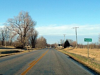
Maysville is an unincorporated community and census-designated place (CDP) in Benton County, Arkansas, United States. It is the westernmost settlement in the state of Arkansas. Per the 2020 census, the population was 117. It is located in the Northwest Arkansas region.
Acorn, Arkansas is an unincorporated community and census-designated place (CDP) in Polk County, Arkansas, United States, approximately 6 miles north of Mena. The town is located at the junction of U.S. Route 59, U.S. Route 71 and U.S. Route 270 in the northern part of the county. Though Acorn is only a three-way junction, it marks the end of three separate U.S. highway concurrencies: U.S. 59 & 71 from Texarkana, U.S. 59 & 270 from Heavener, Oklahoma, and U.S. 71 & 270 from "Y" City.
Cincinnati is an unincorporated community and census-designated place (CDP) in northwestern Washington County, Arkansas, United States. It was first listed as a CDP in the 2020 census with a population of 306.
Board Camp is an unincorporated community and census-designated place (CDP) in Polk County, Arkansas, United States. Board Camp is located on Arkansas Highway 8, 8.5 miles (13.7 km) east-southeast of Mena. Board Camp has a post office with ZIP code 71932.
Morrow is an unincorporated community and census-designated place (CDP) in Washington County, Arkansas, United States. A post office has been in operation at Morrow since 1883; The community had the name of G. W. Morrow, an early postmaster. it was first listed as a CDP in the 2020 census with a population of 263;
Deer is an unincorporated community and census-designated place (CDP) in Newton County, Arkansas, United States. Deer is located on Arkansas Highway 16, 12.5 miles (20.1 km) south of Jasper. Deer has a post office with ZIP code 72628.
Mount Judea is an unincorporated community and census-designated place (CDP) in Newton County, Arkansas, United States. Mount Judea is located at the junction of Arkansas highways 74 and 123, 9.5 miles (15.3 km) southeast of Jasper. Mount Judea has a post office with ZIP code 72655.
Witts Springs is an unincorporated community and census-designated place (CDP) in Searcy County, Arkansas, United States. It was first listed as a CDP in the 2020 census with a population of 33. Witts Springs is located on Arkansas Highway 16, 16.5 miles (26.6 km) southwest of Marshall. Witts Springs has a post office with ZIP code 72686. John Campbell who served in Mexico and the Confederate Army and who was a county surveyor and judge as well as a state senator for two terms had his post office at Witts Springs.
Floral is an unincorporated community and census-designated place (CDP) in Independence County, Arkansas, United States. It was first listed as a CDP in the 2020 census with a population of 109. Floral is located on Arkansas Highway 87, 8 miles (13 km) west-northwest of Pleasant Plains. Floral has a post office with ZIP code 72534.
Violet Hill is an unincorporated community and census-designated place (CDP) in Izard County, Arkansas, United States. Violet Hill is located on Arkansas Highway 56, 4 miles (6.4 km) west-southwest of Franklin. Violet Hill has a post office with ZIP code 72584. It was first listed as a CDP in the 2020 census with a population of 36.
Wilburn is an unincorporated community and census-designated place (CDP) in Cleburne County, Arkansas, United States. Wilburn is located on Arkansas Highway 110, 8 miles (13 km) east of Heber Springs. Wilburn has a post office with ZIP code 72179.